

Time for a fresh look at all the bike infrastructure being delivered across the Tāmaki Makaurau Auckland Central Isthmus. We report on what’s been built, what’s underway, and what’s glimmering on the horizon – because it’s important to count what we’ve won by raising our collective voices.
Our Discovery Map now includes an option to see routes which are under construction. Check it out here and find instructions for how to use it here.
Skip to…
Slinkin’ around the Central City
Walking and cycling across the Auckland Harbour Bridge – unknown
The most glaring gap for our City Centre could be easily solved with a little kiwi ingenuity, but successive Central Governments have tossed around crossing plans like a hot potato, never fully committing. In short, the most recent announcement on a second harbour crossing was a “please give us more time” to phone a friend, to get ideas from overseas. Has the last 80 years not been long enough already?
Well, we can speed things up a bit for Hon Chris Bishop, Transport Minister; lots of large overseas cities allow walking and cycling on their bridges, with great success. In Vancouver, they reallocated one of Burrard Bridge’s motor traffic lanes to cycling and it’s now the single busiest section of cycle lane in the entirety of North America. Undoubtedly, they, too, would say “get on with it and Liberate the Lane”

Keen to help Liberate the Lane?
We would love to share your ‘why’; why cycling access across the Auckland Harbour Bridge matters to you, and how you might use a dedicated walking and cycling crossing. This could be as a guest blog piece, photo blog, or video.
You can also help by sharing the Liberate the Lane website, encouraging more people to sign the petition, and more organisations to add their voice to the open letter. Every little bit helps!
Got another idea for how you can help? Please share it with us. Sign up as a volunteer!
Victoria Street Cycleway Extension – complete, March 2025
Thanks to Bike Auckland advocacy, and all of your awesome support, a two-way protected cycleway has been delivered along two blocks of Victoria Street from Nelson Street to the Sky Tower to ‘un-gap the map’ between existing and in-progress facilities. The Victoria Street Cycleway Extension provides a safe link from the Nelson Street cycleway and the existing Victoria Street west cycleway, to the under-construction Te Hā Noa on the eastern side of Victoria Street. And, importantly, we now have a cycleway directly alongside the Skytower! What a beautiful vision of a clean, green Aotearoa.

When budget is available, these two blocks (Nelson st to Federal st) will be replaced with something similar to Te Hā Noa, progressing The City Centre Masterplan vision for a Linear Park along Victoria Street from Albert Park all the way to Victoria Park!
Te Hā Noa Linear Park – underway, due for completion mid 2026
Sections of Te Hā Noa are complete and look fantastic with beautiful seating areas, cycle parking, and more street trees. The two-way cycleway is complete from Federal Street to Queen street, then there’s a gap of about a block, and then the cycleway is complete again from High/ Lorne Street to Kitchener Street. But the cycleways are not officially open and are blocked by planter boxes. Watercare’s Midtown Wastewater Upgrades are currently being delivered on the missing block between Queen Street and High/ Lorne Street. As such, that will be the last section to be delivered.

Of course, on a two wheeled bike it is fairly easy to sneak around planter boxes simply for the glee of riding an exciting shiny new cycleway … Not that we’d know from personal experience or anything …
It’s understandable that the section of cycleway from High/ Lorne Street to Kitchener Street is fairly short and could be considered to be unsafe for people to use without the adjoining block being completed – and I’m sure there are those who would find it a very useful and safer connection regardless, depending on which direction they are headed. But it’s the section from Federal Street to Queen street, which connects to the aforementioned Victoria Street Cycleway Extension, that is really perplexing. It could provide safety and transport choice to so many more people if it were to be opened now.
It appears that the reason for the cycleways remaining closed is that the Central Rail Link construction crew are using a section of the cycleway (between Federal Street and Elliot Street) for storage of materials while Te Waihorotiu station is being completed. We love the Central Rail Link, and we absolutely support its speedy completion. But surely they could find somewhere else to store those materials? Shouldn’t they be seeking a better solution? The cycleway from Federal Street to Queen Street is practically begging to be opened, providing a safe connection from Nelson Street cycleway to the Queen street shared path. It’s like we almost have an inner city network all set to go but there is the teensiest pile of materials in the way?
Tricky Quay st curb cut – timeline unknown??
On Quay street cycleway there’s a ramp where the cycleway moves from the road to the footpath (near the Tangihua st intersection). The ramp has a sideways camber, and requires a sharp turn. This combination can be dangerous for some bike types, such as trikes, and may cause them to tip over, as highlighted in our Inclusive Cycling Report 2023. After we raised this with Auckland Transport, they changed the paint markings to help highlight the potential hazard. They have it on their list to improve the ramp but the timeline keeps getting extended. Most recently, when they attempted to improve the curb cut, they discovered there were additional engineering challenges that they had not planned for. They’ve gone back to the drawing board to brain up a new solution.

Te Wero Bridge – repairs completed December 2024
The bridge to and from Wynyard Quarter has been repaired! It is once again in frequent use, and is highly busy with people walking, cycling, and scooting. Eke Panuku’s Marian Webb said that the extensive repairs that were completed last year mean the bridge will “continue to safely and reliably serve Auckland’s waterfront for many years to come.”
Te Wero Bridge was originally put in as a temporary crossing measure, and has since been repaired and had its lifetime extended several times. The City Centre Masterplan includes an intention to replace the bridge with a permanent “fit for purpose” walking, cycling, and scooting crossing. But the timeline and funding for achieving that are unclear.

Viaduct Bascule Bridge – essential maintenance underway, due for completion June 2025
Incredibly close by, essential maintenance is being undertaken on the historic Viaduct Bascule Bridge. Rust is being sandblasted off and a new protective membrane being applied, preserving it for many years to come. Eke Panuku says that the 93 year old steel bascule rolling truss bridge “is one of the few bridges of its type in the world.” The train nerd in me is very excited to learn that it used to carry a railway. Though the climate activist in me is less happy to know that it was connected to oil loading facilities. It was manually operated at first, then became electrified, and then stopped being used in 1992, the year I was born.

This bridge provides a bold and dramatic thoroughfare between the City Centre and Wynyard Quarter. To me it is a symbol of a separation of different spaces. To the east of the Bascule Bridge, the Eastern Viaduct is definitely the Central City. To the west of Te Wero Bridge, at Karanga Plaza, where Brownie’s pool is, it’s definitely Wynyard Quarter. But, for me, that middle part, to the west of Bascule Bridge and the east of Te Wero crossing, that’s a kind of unclaimed territory. On the map it’s called Te Wero Island. So perhaps we can consider it a territory all of its own, it’s own Island in the middle of our city.

For the duration of the essential works the Bascule Bridge thoroughfare will be closed to everyone. Temporary pedestrian (and bike?) access has been instead provided through two narrow metal bridges to the southern side. These temporary bridges can be crossed on a two wheeled bike – and I even went through there with a two wheeled bike towing the Bike Valet Trailer (I was very impressed with myself for it) – but it feels really very narrow. It is unlikely that wider bikes like trikes can fit through, and I would expect that some people who use power chairs would also struggle to get through. Come June, the Bascule Bridge with its shiny new coat will be unwrapped, and we’ll reclaim our beautifully wide, accessible thoroughfare to our independent Te Wero Island state once more.

On the City’s edges…
The Strand shared pathway – delivery underway, due for completion August 2025
As part of the Waka Kotahi Auckland Network Optimisation Programme, a shared path is being constructed alongside the Strand! The original design included several signalised crossings across the Strand itself, which were sneakily removed in 2024 (we believe in response to ex-transport minister Simeon Brown’s disdain for safe streets). Not only are safe crossings crucial for people to get to and from the shared path to use it (when coming from the east), there have already been several avoidable deaths of people attempting to walk and cycle along this frequent truck route.

You can help by emailing Transport Minister Chris Bishop and The Strand project team to let them know you want safe pedestrian crossings across the Strand, like were in the original design, so that the shared path is able to be safely accessed for walking, cycling, and wheeling.
Here are their emails for your convenience: Chris.Bishop@parliament.govt.nz, StrandOptimisation@nzta.govt.nz
Karanga-a-hape Station Improvements – under construction, due for completion early 2026
Long-awaited improvements to the Karanga-a-hape neighbourhood (designed to tie in with the opening of the new City Rail Link station) are underway. Enragingly, many of the people-friendly, climate-friendly elements of the planned street design have been quietly disappeared.

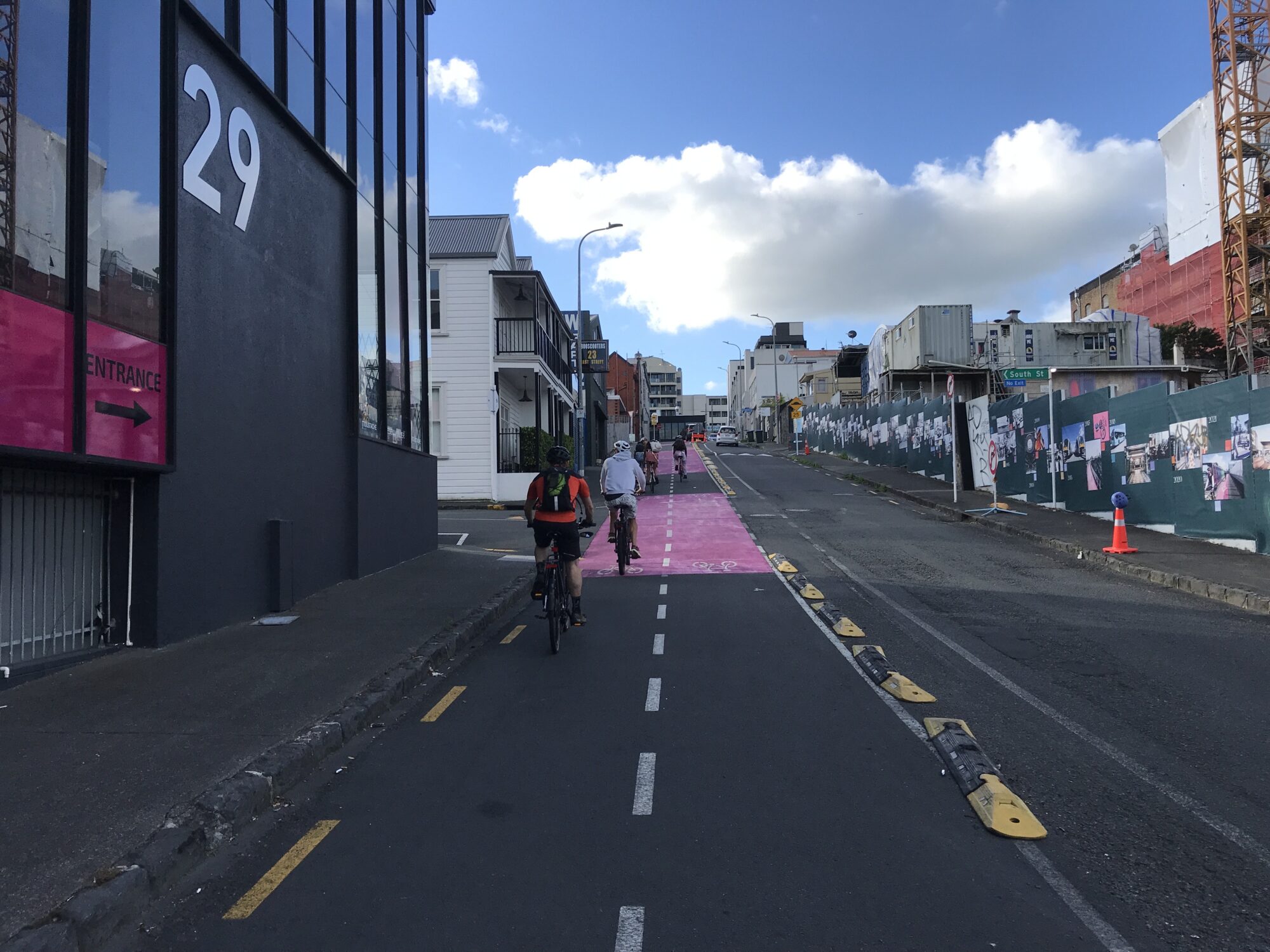
The good news: a short portion of the cycleway on Pitt Street is already open to ride, a new public toilet is available for use, and the design plans still include a protected two-way cycleway along Canada Street to connect with Te Ara I Whiti (Lightpath) – a much more accessible option than the existing shared path with its steep camber connecting to Upper Queen street (a tipping hazard for trikes and wheelchair bikes).

The dreadful news: Auckland Transport has significantly changed the design even though it’s already under construction, including an intention to replace the existing two-way cycleway along East street with motor vehicle lanes and sharrows. Previous plans to widen footpaths on Mercury lane and put in decorative planter boxes have also been removed.
You can help by emailing your thoughts on this to Auckland Transport Chair Richard Leggat, CEO Dean Kimpton, Director Infrastructure & Place Murray Burt, and CEO Auckland Council Phil Wilson. Here are their emails, for your convenience: Richard.leggat@at.govt.nz, dean.kimpton@at.govt.nz, Murray.Burt@at.govt.nz, phil.wilson@aucklandcouncil.govt.nz
Find out more about this absolute kerfuffle here.
Great North Road – under construction!! Due for completion Oct 2025
After years of advocacy, and millions of hours of volunteer time from the local community, all we can say is yippee!

Image: Auckland Transport

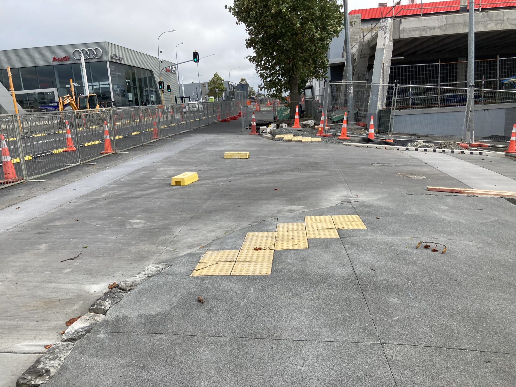
So far a few of the raised bus stop platforms and raised tables on side roads have been completed, and more are in progress. Some of the raised tables on the side roads look a little low to us, so we are following up with the project team. The work on intersections, footpaths, tree pits, and bus stops will be completed in approximately late September. After this, the road will be resurfaced, paint markings added, and the cycleway installed along Great North Road from Ponsonby Road to just past Crummer Road (stopping short of the Grey Lynn shops).
You can follow construction progress here – or stop by in person to have a looksie.
Inner West
Surrey Crescent – underway mid 2025??
Some aspects of the remaining “Grey Lynn gap” (aka Waitematā Safe Routes) will be completed via roading renewals, though this will still leave dodgy intersections and missing gaps. We’re particularly excited for one-way cycleways either side of the road right outside Grey Lynn School!

We continue to push Auckland Transport to upgrade the intersections and to deliver the full safe cycle connection from Meola Road to Great North Road: weaving a network into the Inner West!
Pt Chevalier to Westmere – Complete April 2025
While they have not been officially opened, the cycleways [along Meola Road, Point Chevalier Road (from Great North Road to Meola Road), and a short section of Garnet Road] are complete and ready to ride! There may still be some small fixes to come but overall it’s fantastic! Every time I visit I see kids on bikes using the new cycleways, and it absolutely warms my heart.

Image: Bike Pt Chev Facebook group

Image: Bike Pt Chev Facebook group

Image: Bike Pt Chev Facebook group
Already Bike Pt Chev’s bike train has doubled in participants – with safe speeds on the local residential streets connecting into the cycleways on the busier roads, parents are no longer worried about their kids cycling independently to join the train! And, Bike Pt Chev’s Bike to Football initiative was wildly successful, with kids and their parents taking advantage of the new cycleways. One parent commented that one of the best things about biking to football, aside from the weather, was being able to drop off birthday party invitations along the way.
Keep an eye on Bike Auckland communications for news of an official opening event!

Central East
Te Ara ki Uta ki Tai / Glen Innes to Tāmaki Drive Section 4 – construction in progress, completion end of 2026
Last Friday, the 2nd of May, we had the absolute joy of attending the sod turning for Stage 4 of Te Ara Ki Uta Ki Tai (the beautiful boardwalk section from Ōrākei station to Tāmaki Drive). The project in its entirety provides a route to walk, cycle, and wheel from Glen Innes to Tāmaki Drive through trees and birdsong, alongside the sea.

Image: Auckland Transport
Surprisingly ex-Transport Minister Simeon Brown was at the event. He’s also our Minister for Auckland. He gave an opening speech in which he directly stated that this kind of cycleway is okay because it doesn’t take space away from cars. A news headline flashed through my mind “National backs gold-plated cycleways (only).” Let’s not pretend though – this section only got funding because it practically had to (was already committed to), no doubt helped by the fact that it was originally kicked off by then-Prime Minister John Key.

Image: Auckland Transport

Image: Auckland Transport

Image: Auckland Transport
Deputy Mayor Desley Simpson thanked Simeon for coming and quipped “more importantly, thank you for your funding.” She talked about how amazing it was to have this connection to nature, to hear the birds, to walk and cycle by the sea and the native bush, so close to the Central City. Someone highlighted what an incredible tourism asset the pathway will be for Tāmaki Makaurau Auckland. Waka Kotahi‘s Steve Mutton shared heartwarming memories of teaching his grandchild to ride a bike on the pathway through Meadowbank. It felt like the pathway held a special meaning for everyone.
An Auckland Transport staff member told me that the interim pathway along Ngāpipi Drive was already so well used at peak times that when they had held the dawn karakia for this section, they had to avoid the practical stampede of cyclists using Ngāpipi to head to work. It will be incredible to witness those numbers absolutely balloon once this beautiful boardwalk is complete.
When Gowing Drive was mentioned in the speeches Charmaine (from Bike Eastern Suburbs) and I whooped and cheered in support. It was a joyous affair. We were in high spirits.

Gowing Drive – on hold, timeline unknown
Jokingly dubbed “stage 5” of Te Ara Ki Uta Ki Tai by locals, the missing piece of the puzzle is the long-awaited Gowing Drive connection. The final part of the Meadowbank to Kohimarama connections project links up Gowing Drive with the existing shared path in Meadowbank via a railway underpass. From there people can choose to continue along the pathway to Glen Innes or the Central City or the nearby Meadowbank Train Station – or they can cross to the other side of the valley, exiting the path at the (already completed) John Rhymer Place connection. With schools on either side of the valley, there’s pent up demand for a safe connection for students to walk and wheel using both of these connections.

So what’s the hold up on this highly supported local link? Auckland Council needs to provide Auckland Transport with the funding for it. Unfortunately that means it’s probably going to be paused until after the next Regional Land Transport Plan, in 2027. But there’s hope yet – as a vital local connection which would “un-gap the map” and significantly expand the catchment of the pathway, it has a strong ally in Deputy Mayor Desley Simpson. On behalf of all the children trying to walk or cycle to school in an area whose residential streets are frequented by heavy traffic and large trucks, we’re counting on you Desley!
Links to Glen Innes Cycleways – underway, due for completion in early 2026
Like the Inner West routes, the Glen Innes network has been on the horizon for nearly a decade. This suite of protected bike lanes creates local links to the town centre and train station, as well as to the surrounding existing – and planned – cycleways. Check out the project page here.
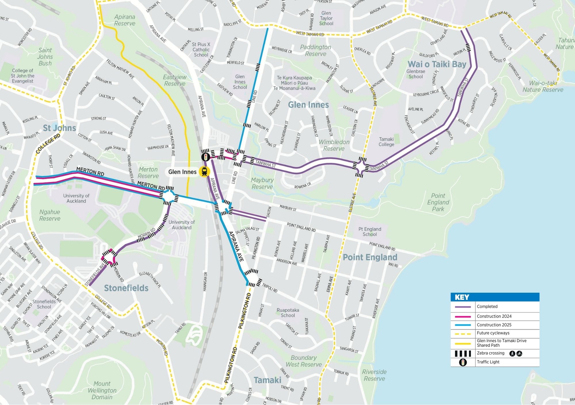
The great news is that this project is being delivered and is currently under construction. The frustrating news is it will take a few months longer than it should because of absolutely needless delay from Auckland Transport. The woefully predictable news is that some additional carparking is being added into the design for Line Road.
For a period of time the Links to Glen Innes Cycleways project stalled while Auckland Transport panicked and decided (for no apparent reason) that it needed to (once again) seek the Maungakiekie-Tāmaki Local Board’s approval to continue this already-under-construction project.
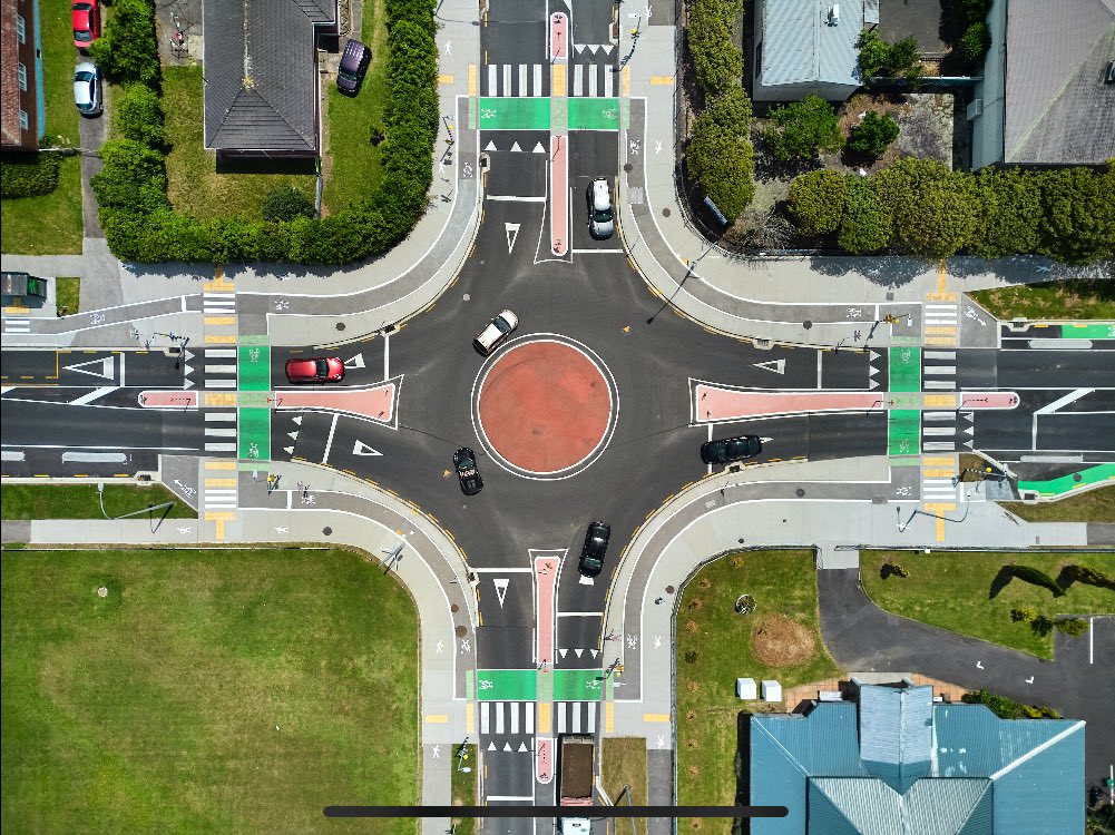
Image: Peter McGlashan’s Twitter
The stunning two-way cycleway along Apirana Avenue disappeared at the two roundabouts that intersect it, with no safe crossing options provided. The beautiful new two-way cycleway along Morrin Avenue spat people out into oncoming traffic instead of connecting them safely onto Merton Road. For a period of time we were truly afraid someone would be hurt. So Bike Eastern Suburbs local Charmaine wrote this awesome guest blog urging the project to proceed, we encouraged people to express their celebration of the Glen Innes cycleways, and, on Tuesday 29 April, the Maungakiekie-Tāmaki Local Board unanimously agreed to the continuation of the (already under construction) Links to Glen Innes Cycleways project. In case it interests you, the minutes from this meeting still aren’t up, but a write up about the project can be seen in the meeting agenda at page 197 which includes this spot-on observation: “There is a risk with not proceeding further. The infrastructure at the roundabout has been built assuming the full scheme is delivered. If we do not complete the scheme, then it will require a rework to ensure the delivered facilities can function safely.” Did we mention it was already under construction?
The outcome of all of this needless back-and-forth is that the timeline for delivery has been extended by several months, and is now forecast to be completed by early 2026. Thanks to Auckland Transport’s need for constant reassurance, Glen Innes businesses and locals will continue to live with the disruption of construction (which could have been over) this Summer.
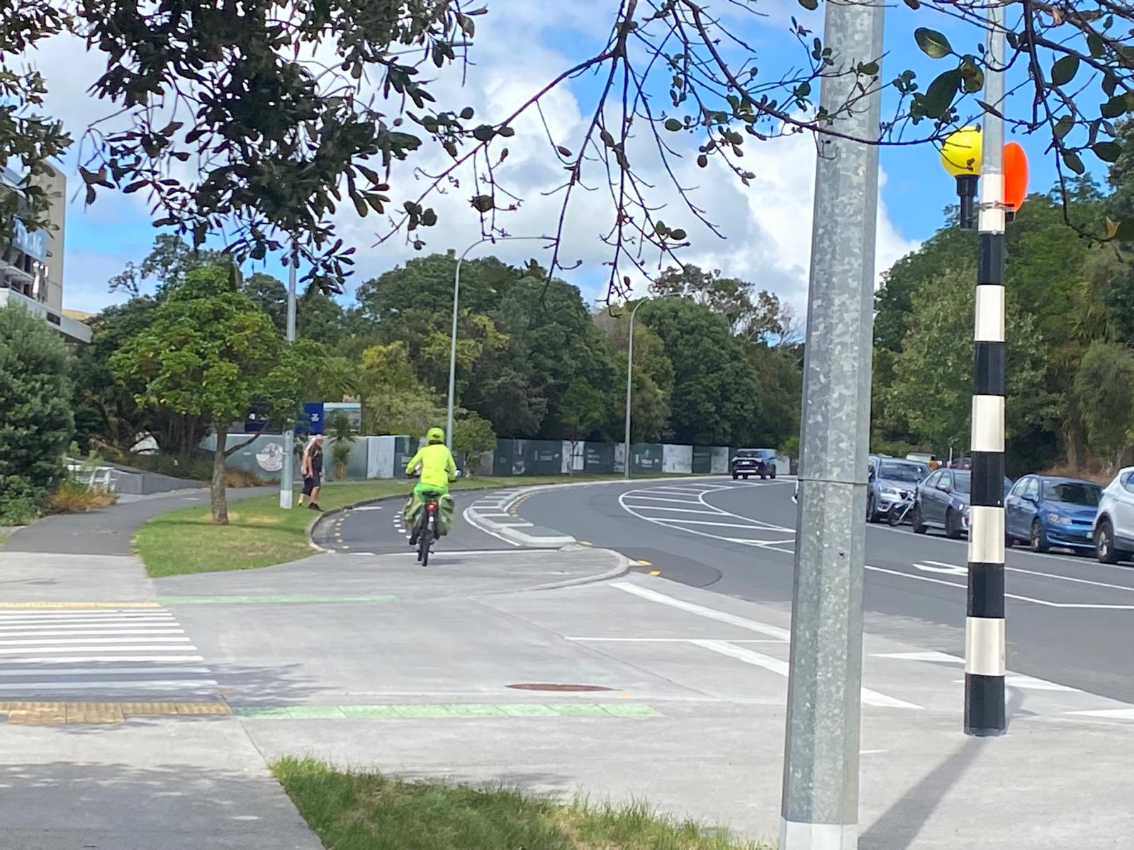
Of course, all of that drama aside, we are truly happy to see this project continuing, and we’re excited to see children already using the cycleways and raised crossings that have already appeared in Glen Innes. The project as a whole provides safe and accessible routes to the Glen Innes train station, to the beautiful Te Ara Ki Uta Ki Tai, and to the City Centre beyond. Combined with the cycleway alongside the Eastern Busway, Eke Panuku’s Panmure pathway, and Auckland Transport’s improvements to Te Horeta Road cycleway, we will have a safe route all the way from Botany to the City Centre – and from there one could continue all the way out west to Massey.
Our very own East-West link.