In 2023, as part of our Inclusive Cycling project funded by Hoe Ki Angitū (Waka Kotahi Innovation Fund), Bike Auckland commissioned Grab Your Wheels, Let’s Travel to compile a report on the accessibility of 50km of Tāmaki Makaurau Auckland’s pathways. With a team of epic auditors, they pulled together this amazing snapshot of the current state of our cycleways, and what needs to be improved to make them more inclusive.
You can read this Report simply by continuing to read this webpage. Alternatively, you can read the original PDF version here!
It’s no small read! If you would prefer a shorter summary check out this blog instead – or use the table of contents to skip to the parts that interest you most!
Table of Contents
1.0 – INTRODUCTION
2.0 – ACCESSING AUCKLAND PATHS
2.1 – Pakuranga Rotary Path
2.2 – Waterview Shared Path
2.3 – Glen Innes to Ōrākei Shared Cycle path
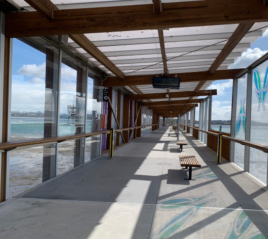
2.4 – City to Bays via Tāmaki Drive
2.5 – Northwestern – Point Chevalier to Westgate
2.6 – Northwestern – City to Point Chevalier via Pink Cycleway
3.0 – WAYFINDING
3.1 – Pakuranga Rotary Path
3.2 – Waterview Shared Path
3.3 – Glen Innes to Ōrākei Shared Cycle path
3.4 – City to Bays via Tāmaki Drive
3.5 – Northwestern – Point Chevalier to Westgate
3.6 – Northwestern – City to Point Chevalier via Pink Cycleway and Grafton Gully
4.0 – INFRASTRUCTURE BARRIERS
4.1 – Pakuranga Rotary Path
4.2 – Waterview Shared Path
4.3 – Glen Innes to Ōrākei Shared Cycle path
4.4 – City to Bays via Tāmaki Drive
4.5 – Northwestern – Point Chevalier to Westgate
4.6 – Northwestern – City to Point Chevalier
5.0 – ACCESS TO RECREATION
5.1 – Pakuranga Rotary Path – Farm Cove
5.2 – Waterview Shared Path – Eric Armishaw Reserve
5.3 – Glen Innes to Ōrākei
5.4 – City to Bays via Tamaki Drive – Ōrākei, Okahu Bay
6.0 – KEY FINDINGS
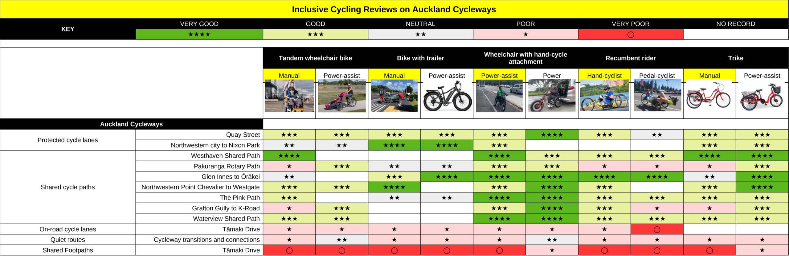
6.0 – Matrix
6.1 – Gradients
6.2 – Inconsistencies
6.3 – Protected Cycleways
6.4 – Summary
7.0 – REFERENCES
1.0 Introduction
Who needs inclusive access?

Bike Auckland contracted Grab Your Wheels, Let’s Travel to find a diverse group of disabled cyclists to undertake an audit of Tāmaki Makaurau Auckland’s cycleways. The audit was to cover a minimum of 50km, with accessibility and inclusion in mind.
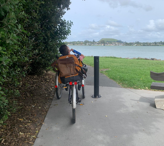
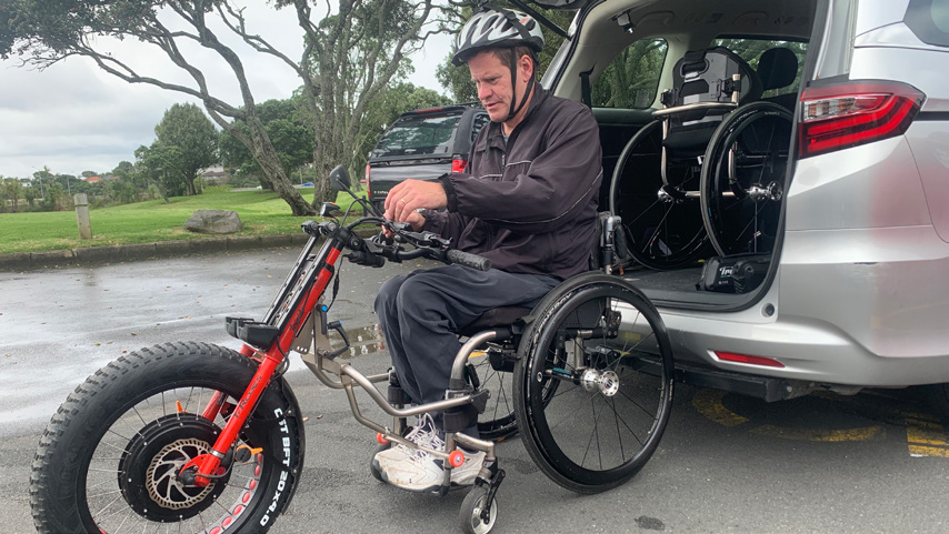
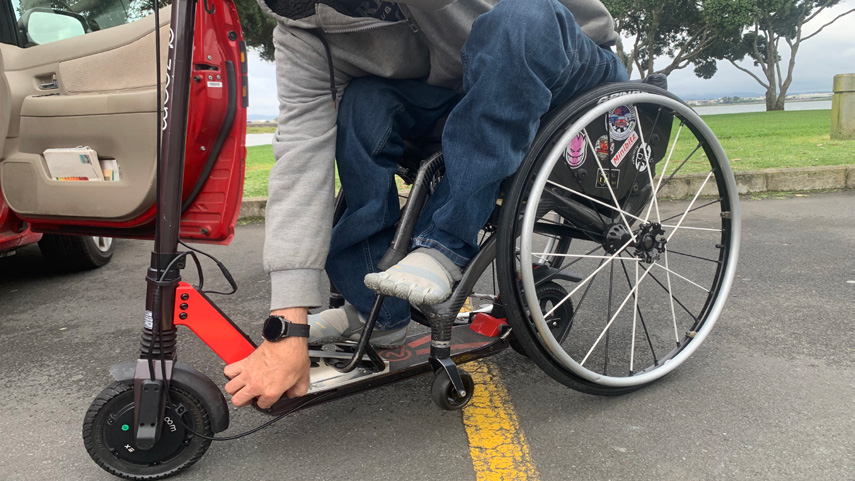
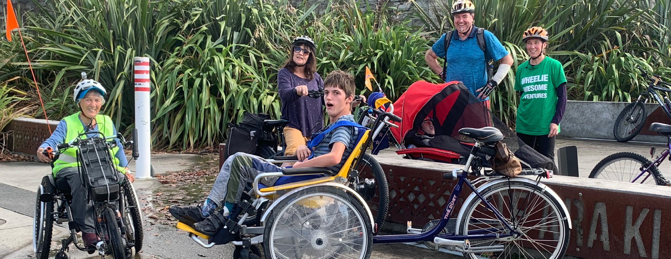
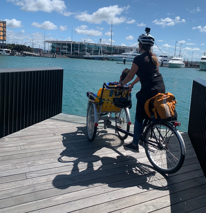
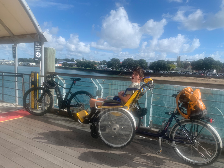
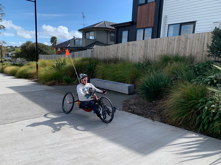
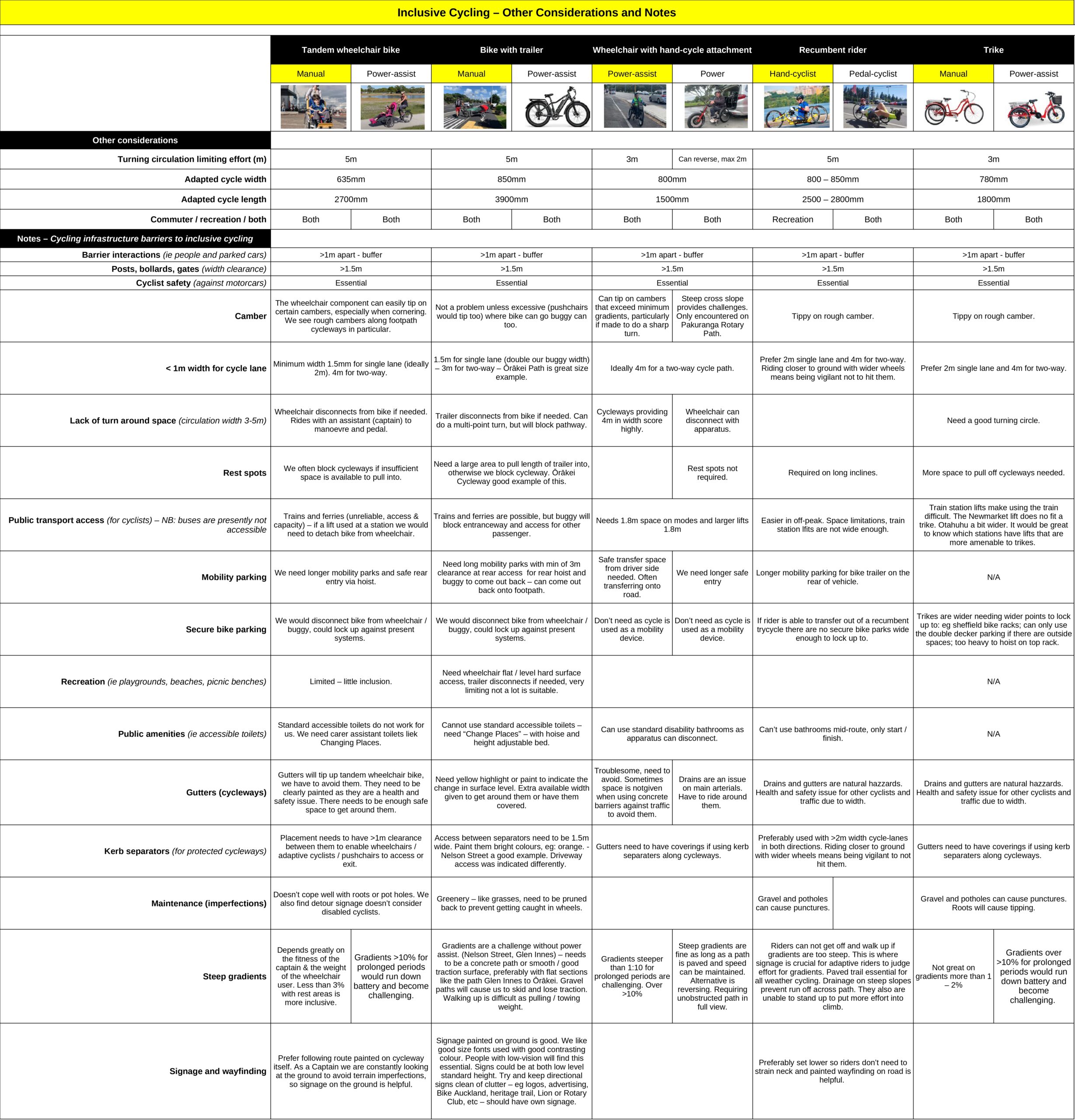
The disabled cyclists involved in the audit rode the following: a tandem wheelchair bike manual, trike hand-cycle assist, recumbent hand-cycle manual, standard bike with trailer and a wheelchair with TriRide attachment.
The cycleways ranged from shared footpaths with painted separations and separate shared cycle paths, to dedicated on-road cycleways with fully integrated cycling crossings. They looked at detailing their individual journey from simply getting to a cycleway via public transport or private vehicle, their inclusion around recreation and what barriers they encountered, what they found challenging and what limited their participation. The team that undertook the audits was made up of representatives from CCS Disability Action, Disability Connect and independent adaptive cycling enthusiasts.
The team concentrated on identifying chosen cycle paths from Auckland Transport’s cycling maps, which are available at all public transport and tourist information venues. Team members all agreed that they would not be cycling along the road without protection from motor vehicles, which is always the main deterrent to all adaptive riders.
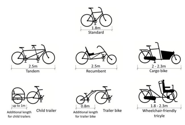
Though large numbers of disabled cyclists use a standard two-wheeled bicycle to get around, it is important to recognise that many others use a variety of non-standard cycles, depending on their needs.
These take many different forms, but when it comes to design criteria, we refer you to Highways England’s Cycle Design Vehicle, an inclusive concept that captures all shapes and sizes of cycles, defined as 2.8m long and 1.2m wide.
This report is set out to focus on certain aspects of getting out and about as an adaptive cyclist. Auckland is geographically hilly, public transport is still underdeveloped and we have a long way to go to bring our infrastructure up to an accessible and inclusive standard. Building a cycling network for everyone is going to be challenging as there are so many variables to take on board. For example, what one adaptive rider thought was too challenging in terms of the steepness of the gradient, another, fitter person decided they liked it as it pushed them.
You will find as you read through this report, that we have created chapters on Accessing Auckland Cycle Paths, Wayfinding, Infrastructure Barriers, Recreation, Public Amenities, and Common Findings. Within these chapters, we have picked out points of interest from each of the cycle paths audited. This is to highlight the main factors that discourage many in the disability community from taking up cycling.
One important barrier to adaptive cycling is affordability. To take on Auckland’s cycleway network, power-assist technology is almost a must. However, every specialised/adapted manual or power-assist cycle comes at a huge cost. If disability was obtained due to an accident, an adaptive cycle will be funded through ACC (Accident Compensation Corporation). But, if the disability is the result of a health condition, funding for an adaptive cycle is not available, and that is when charitable organisations may step in.
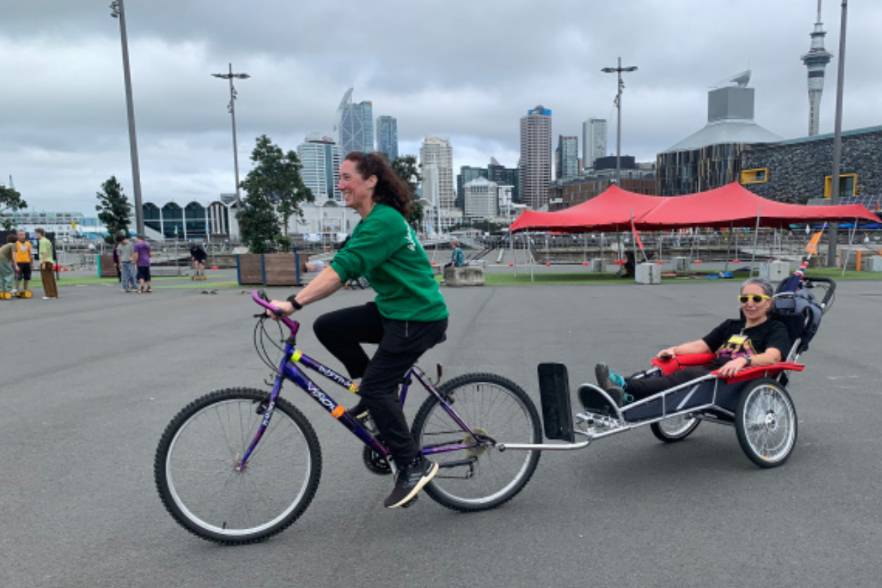
Over April and May 2023, Bike Auckland partnered with Grab Your Wheels to put on a series of TryaCycle events down at Silo Park on the Auckland waterfront. A great cross-section of the disability community came out to try a cycle for the first time. The enthusiasm was overwhelming, but the cost to buy the adaptive cycles dampened a few spirits.
Once an adaptive cycle is purchased, the next challenge is how to access the cycle path. Can we cycle to it safely? Do we use public transport? Or do we take a private car and find somewhere to park? A recumbent rider would not be able to use public transport, simply because the width, length and circulation of a recumbent cycle wouldn’t fit. However, a hand-cyclist with a ‘clip-on’ for the front of their wheelchair could easily use it. This is why, in this report, we look closely at the logistics of ‘getting there’, from cycle path suitability in terms of width, gradient, terrain and level of maintenance, to whether there is access to recreation and our destination is accessible. Once there, can we stay and play for any period of time? Is there an accessible toilet available that meets our needs? These are all basic needs, but surprisingly, adaptive cyclists will often find that these basic needs are not being met. This results in barriers to cycling participation for our disability communities.
When you see the new cycling adaptations on the market, you begin to understand how important it is to build to future demand. These are some of the options from the biggest distributor of adaptive cycles in the world at Van Raam.
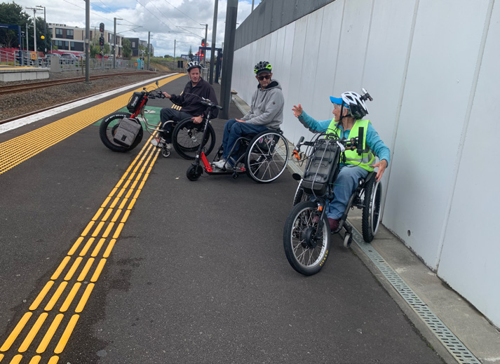
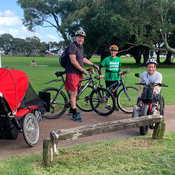
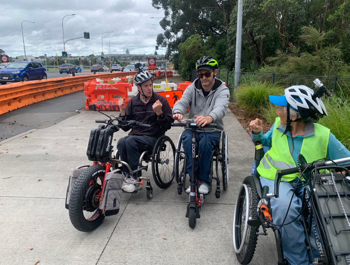
Our Auckland Cycleway Auditing Team
“We love cycling and running as a family, so to enable this to happen we bought a bike trailer so our son could accompany us on rides.”
Sarah and Aaron, Parent cyclist with trailer bike.
“My husband and I love recreational cycling. We enjoy taking our wheelchair dependent son out in the cycle trailer around Auckland.”
Debbie Fong, Parent cyclist with trailer bike.
“Our tandem wheelchair bike can disconnect from the bike to be used as a wheelchair on its own. This type of ride can be used for commutes as well as recreation.”
Kimberly Graham, Founder and writer for Grab Your Wheels, Let’s Travel.
”My handcycle was damaged awaiting parts so I carried on with my enjoyment of cycling with a powered TriRide.”
Mike Potter, CEO Disability Connect recumbent hand-cyclist.
“I am a recumbent hand cyclist who loves speed and a challenge. I joined the crew on some challenging hairpins along the Pakuranga Rotary Path.”
Lee Warn, Paralympian recumbent hand-cyclist.
“I have a power assist handcycle attachment on my wheelchair. I take public transport most of the time.”
Vivian Naylor, CCS Disability Action.
This form was created with the audit team, and used to note observations along the rides.
2.0 Accessing Auckland cycle paths
– using public transport, path lateral access points
One of the first things we did as an adaptive cycling audit team was to identify the best place to drive to, in order to transfer in and out of wheelchairs into adaptive cycles. As it’s important to look at cycling as a commute or emission-free form of transport, we looked at the potential for using the cycle path to or from public transport, as well as the accessibility of the path via neighbourhood connecting points. This is where we discovered many challenges when it comes to the present infrastructure, which is not designed with inclusion in mind for its diverse range of users.
Accessing a particular path or cycleway is as important as the path itself. To be able to do that safely and with minimal effort, will make cycling a more attractive mode of transport to everyone. Tāmaki Makaurau Auckland on the whole, as it exists today, has a challenging cycling infrastructure network and the public transport network seems to be in continual maintenance mode, with a lack of staffing to operate it. It is no wonder the average person falls back on using their private vehicle. However, even driving has become less attractive, with increased fuel prices, congestion and the lack of parking at a destination. We decided to concentrate, in one chapter, on the access around an individual cycle path to illustrate the importance it makes to inclusive cyclists.
Who commutes by cycling or public transport?
- Hand-cycle with a front clip-on attachment for a wheelchair
- Tandem wheelchair bike that disconnects from bike
- Trailer bike or cargo bike
- Trikes (trikes offer someone good stability and exist in tandem and recumbent versions).
- Recumbent – leg pedal.
Who cycles purely for health, wellbeing and the environment?
- Recumbent hand-cyclist
- Everyone above and beyond

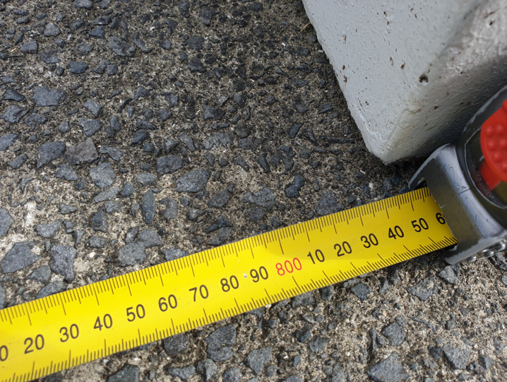
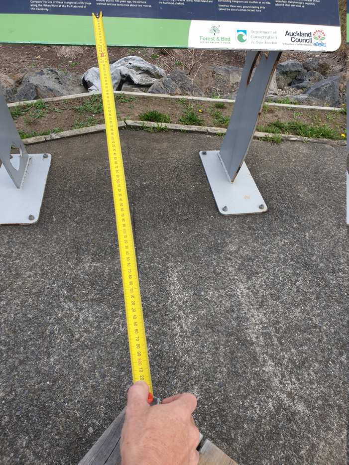
2184mm long, 850mm wide

1500mm long, 800mm wide
3900mm long, 850mm wide

2700mm long, 635mm wide
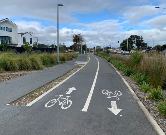
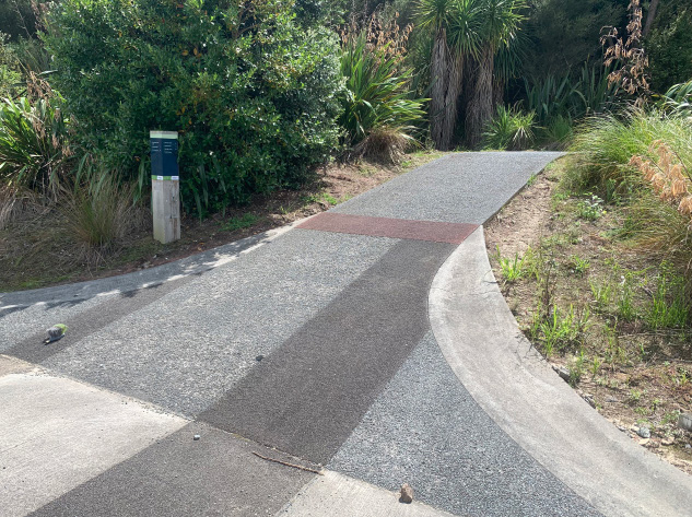
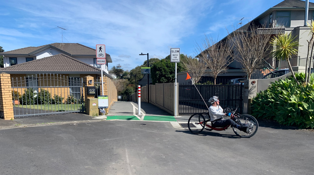
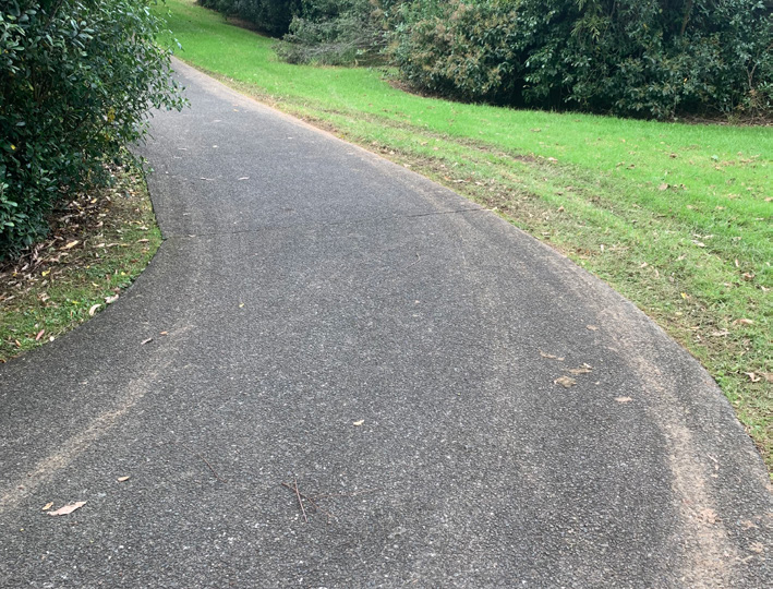
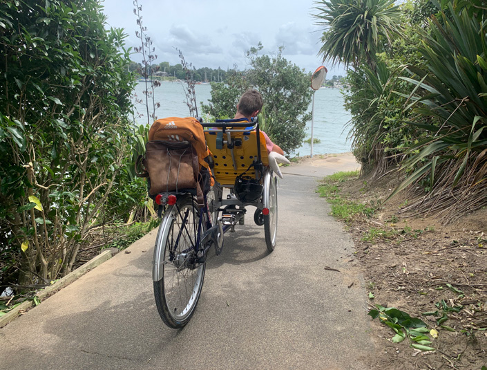
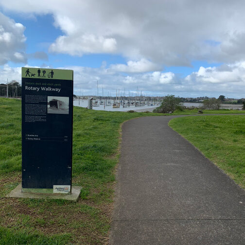
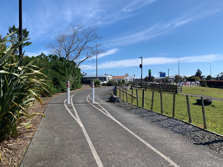
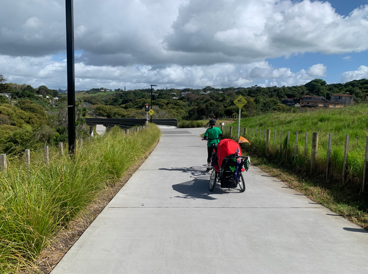
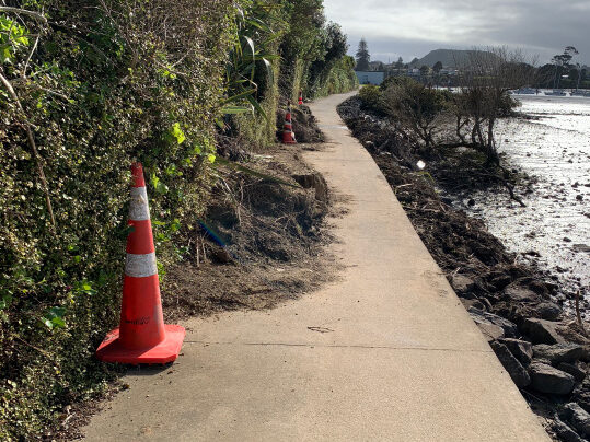
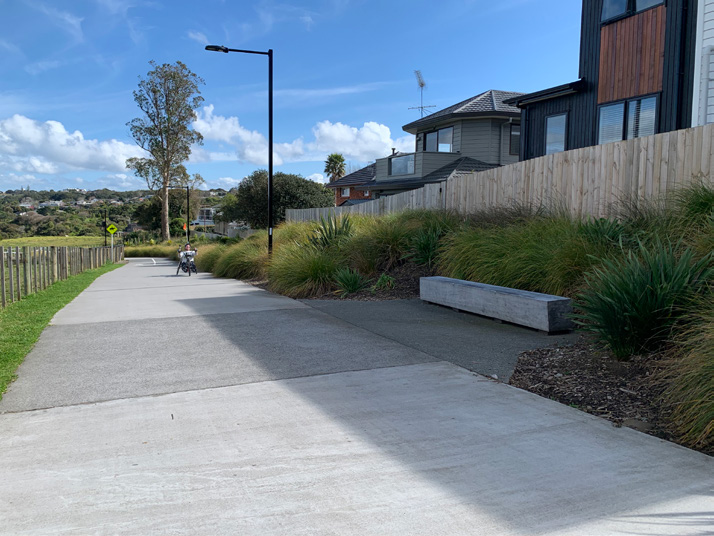
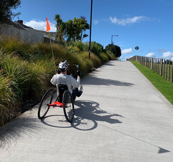
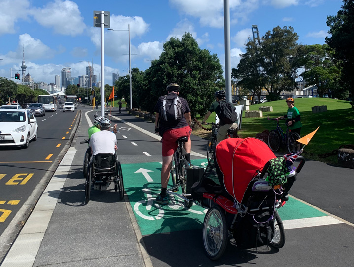
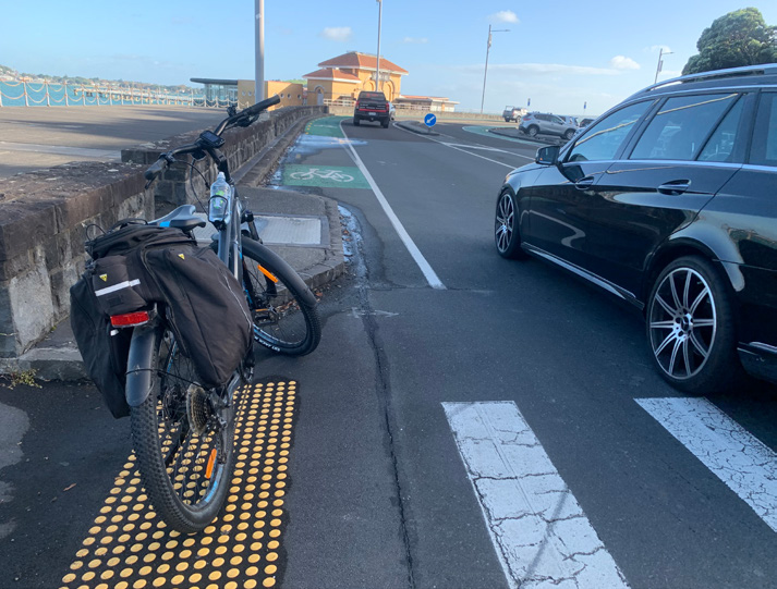
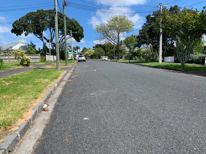
2.1 Pakuranga Rotary Path
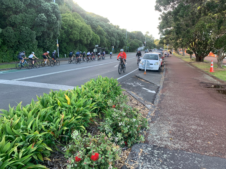
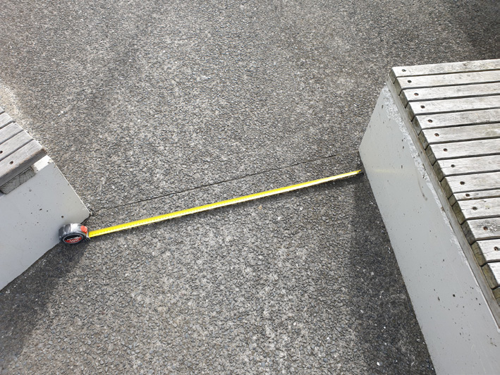
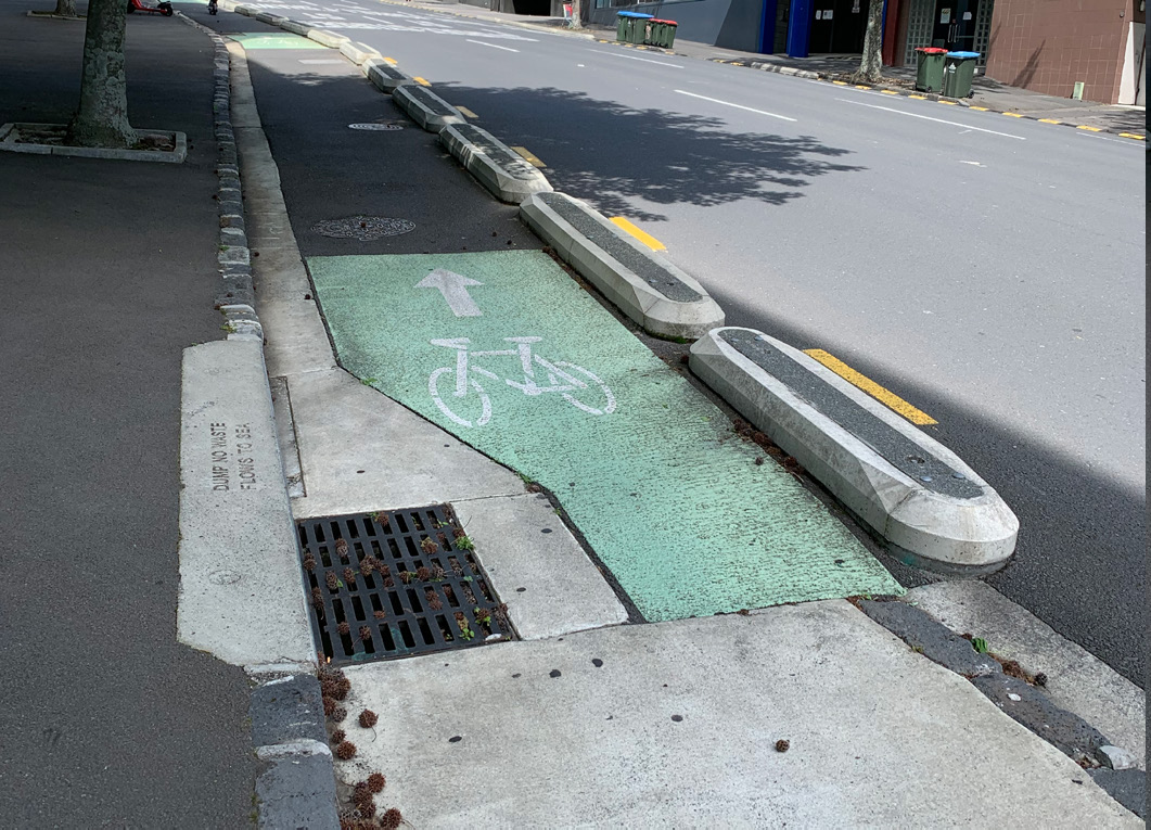
Pakuranga Rotary Path can be accessed via a dedicated cycleway from the Panmure Train Station. This commute is seamless, with the shared path sections wide enough to use alongside the foot traffic. In other sections, the cycleway is separated by subtle divisions, assisting cyclists and foot traffic to flow separately. The two-way cycleway width is approximately 2.6m, the minimum allowable width for a bidirectional (two-way) cycleway according to Auckland Transport’s Engineering Design Code on cycleways. Wheels for Wellbeing, a United Kingdom-based disability advocacy group, recommends a minimum 2.8m width for bidirectional cycleways, with an ideal width of 4m (see A Guide to Inclusive Cycling by Wheels for Wellbeing).

USING PUBLIC TRANSPORT
– via train to access path at Kerswell Place, off Pakuranga Road.


At the beginning of the path, the Kerswell Place end has a steep gradient. Using the Strava App along this first part indicated an 11.8% grade at its peak.

Finding the way via ferry from Half Moon Bay
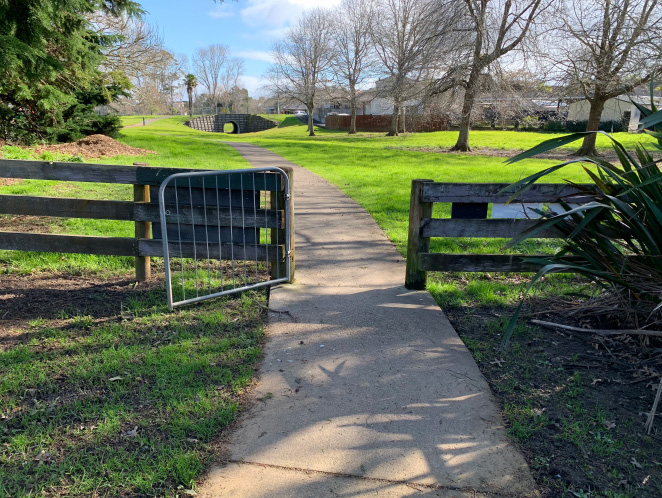
The official Pakuranga Rotary Path comes to an end at the Wakaaranga Creek Reserve. The route then branches off in different directions. One route takes you to the Palmyra Way exit, where you turn left to avoid cycling on main roads. The route is not well signposted, so a map is essential. Local knowledge showed us through a series of safer paths leading through Pigeon Mountain Wetlands, onto a path that follows alongside a creek and various quieter suburban streets. The route can work for standard bike riders, however, is inaccessible due to gates and terrain for adaptive riders.


LATERAL CONNECTION LINKS
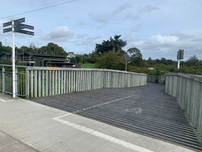
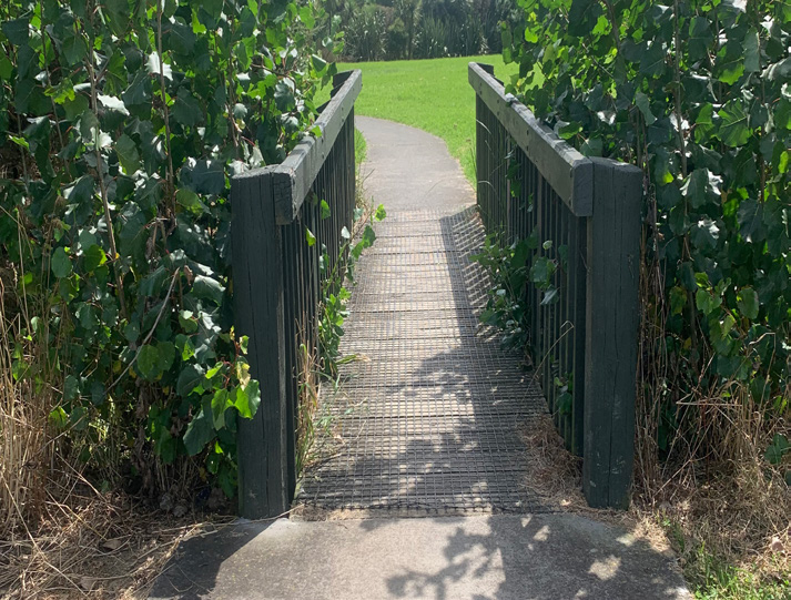
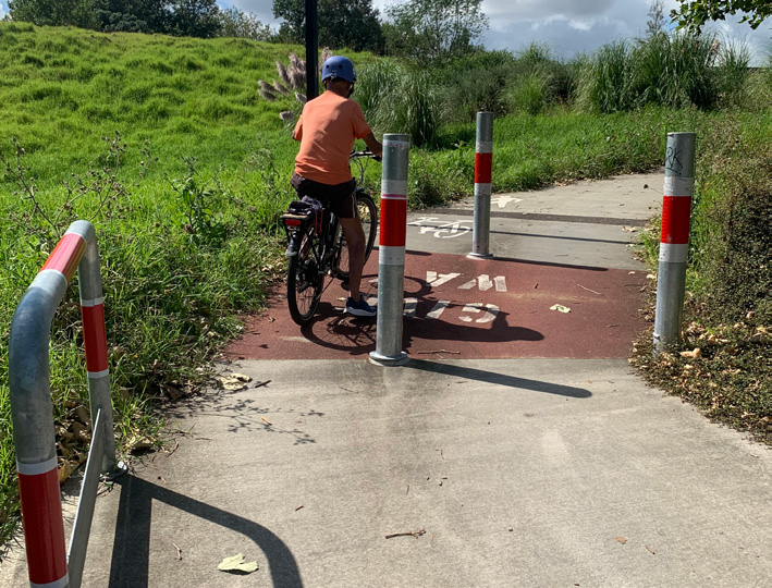
Laterals are the routes and pathways linking cycleways with local neighbourhoods, amenities, services and other safe cycle routes. Many of these routes are challenging to access for non-standard cyclists as they are not always appropriately signposted, gradients are often steep (more than 2%), and a pinch point often lies in the way, with less than 1m in width clearance.
We discovered many inaccessible laterals on the majority of cycleways ridden. Some of the older paths, built originally with foot traffic in mind, even had steps. Gradients, lack of mirrors to see around corners, and signage sometimes leading you the wrong way meant having to turn around. If the path is too narrow, this provides adaptive cyclists with another barrier and it is a huge challenge trying to find a way to turn around in a tight space. Widths of between 3-5m are essential for turning around.

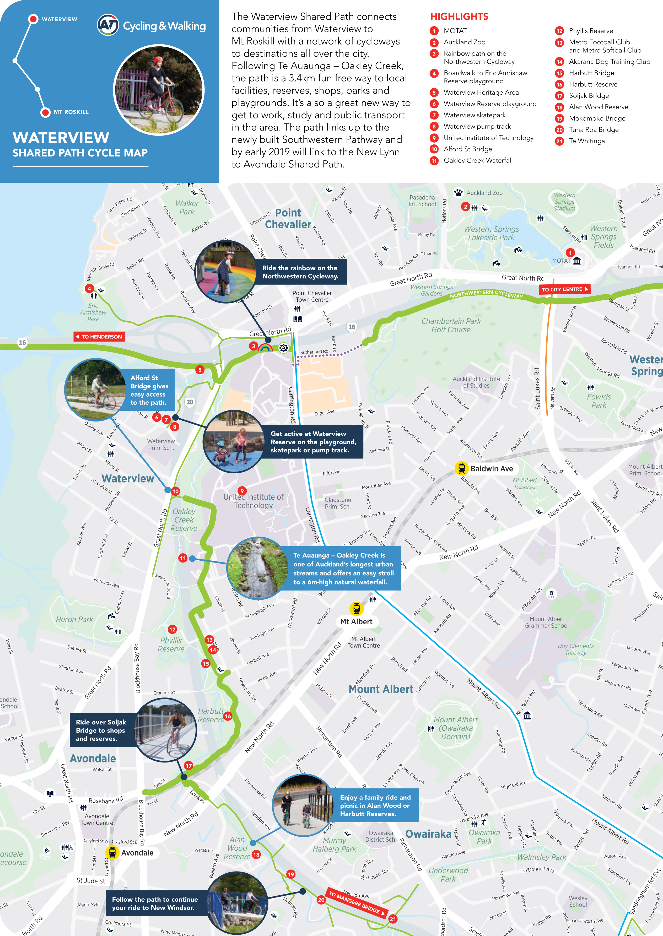
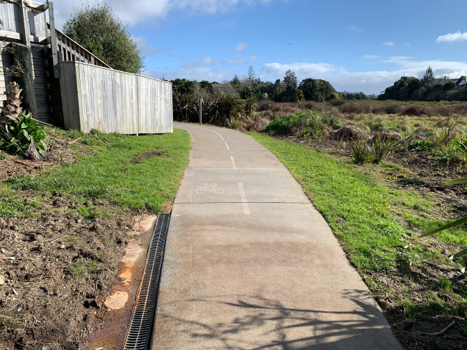
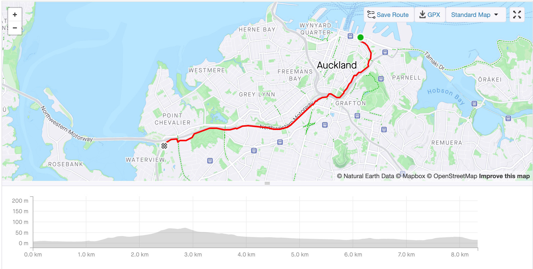
2.2 Waterview Shared Path
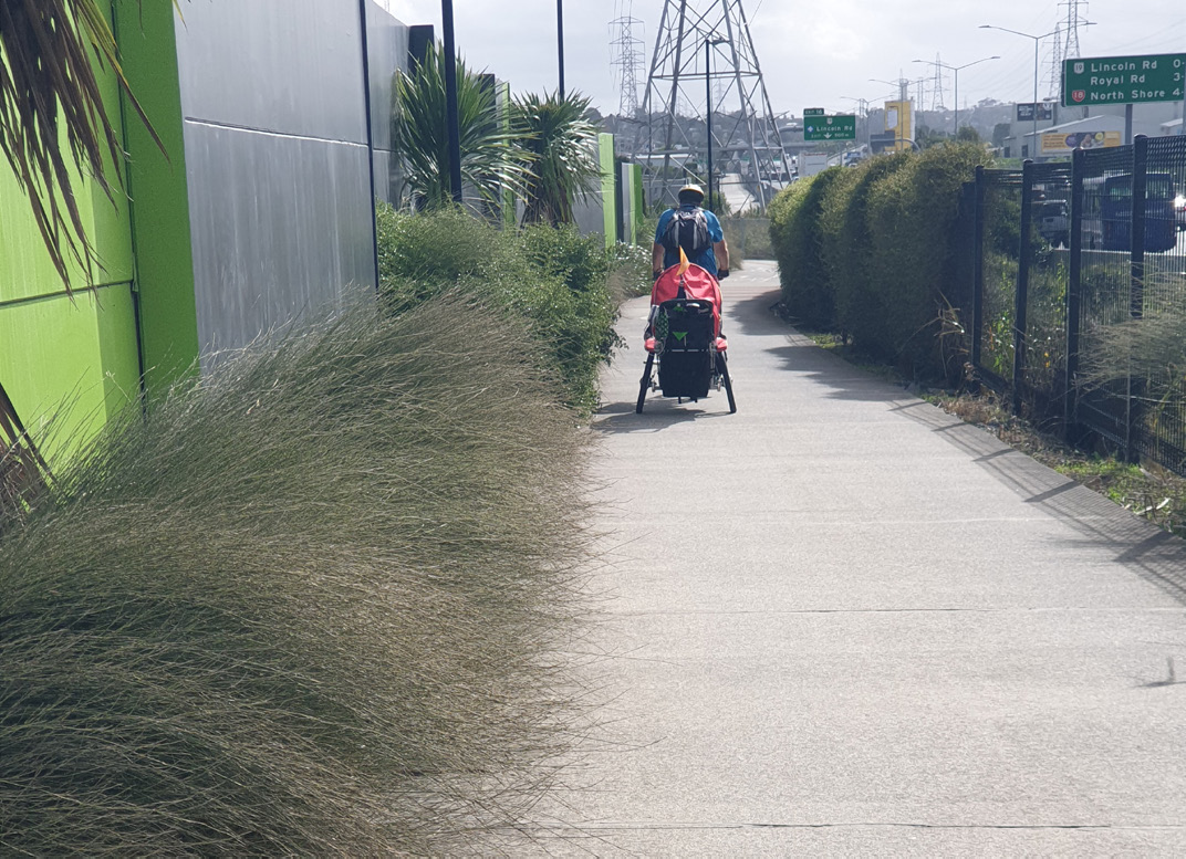
The Waterview Shared Path links communities from Waterview through to Mt Roskill, then connects to a network of cycleways leading all over the city. The team met at Eric Armishaw Reserve, as it had a sealed, flat car park for our wheelchair users to transfer into adapted cycles. The distance covered was 6.2km. Starting from Eric Armishaw Reserve gave the opportunity to try the route linking onto the Waterview Shared Path. This route took in part of the Northwestern through to the Southwestern cycleways.

Images below show the team getting ready to ride the shared path. Both our recumbent riders had swapped their recumbents for clip-on power for this ride

PUBLIC TRANSPORT
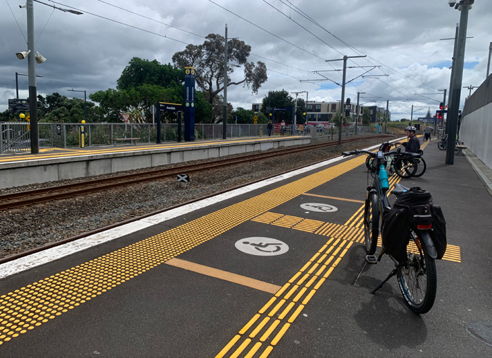
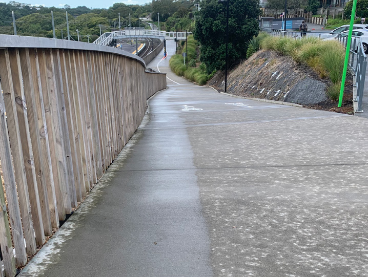
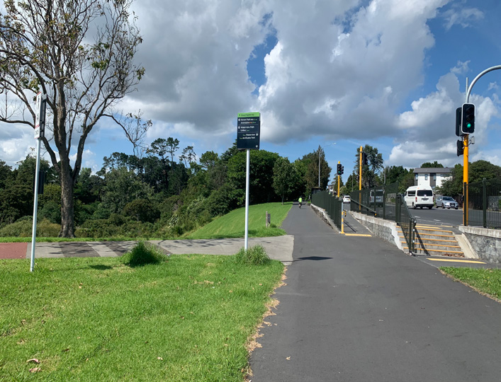
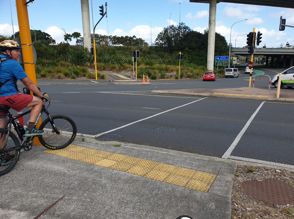
Buses don’t accommodate standard bikes, so we didn’t consider them in any of our audits. However, Auckland’s train network is accessible to wheelchairs users and both standard or non-standard cyclists. Towards the end of Waterview Shared Path is Avondale Train Station. The gradient up to the main road is challenging without power-assist. There is then a controlled crossing to traverse. Once across, a series of ramps take you down to access the station platforms. The team found these ramp gradients accessible.
The team then cycled along the recently built shared cycleway leading to New Lynn. Leaving Avondale Train Station, the route takes you across the busy Jude Street at an uncontrolled crossing. It was decided that this crossing needed to be controlled for safety reasons. After waiting for a gap in traffic, you then need to cross another road to gain access to the cycleway. Safety and travel around public transport should be seamless.


These images show the inconsistency around linking up to different cycle paths. As you can see, the cycle path itself is wide, flat and easy to ride on. However, getting onto this path means experiencing a journey on/off the footpath. This is where trikes and tandems can easily tip or get stuck.
LATERAL CONNECTIONS LINKS
There are many access points onto the Waterview Shared Path. The team found a number of these laterals inaccessible due to steps or steep winding gradients. It would be helpful to have signage warning cyclists of potential gradients, corners and steps coming up along these routes.

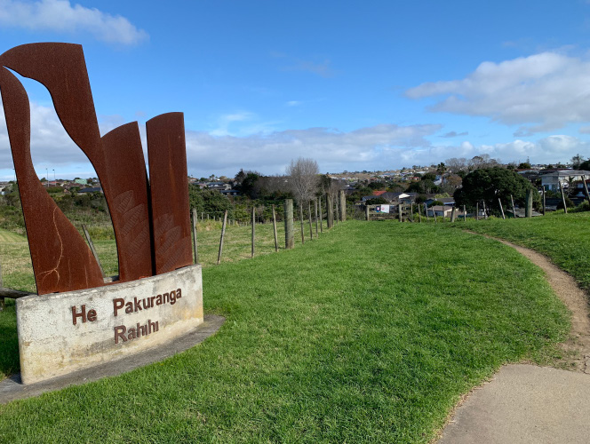
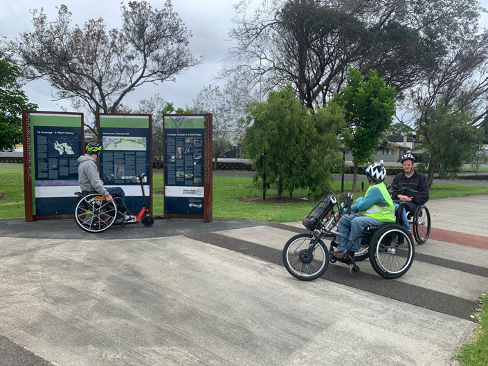
2.3 Glen Innes to Ōrākei – Te Ara Ki Uta Ki Tai
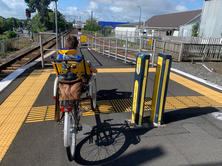
The new cycleway Te Ara Ki Uta Ki Tai, from Glen Innes to Ōrākei, starts at the entrance off Merton Road, St Johns. The entire ride is approximately 5km. The team parked in various places as a clear, accessible long-term car park was not identified. At the time of auditing, the Glen Innes Train Station was closed due to line upgrades. The tandem wheelchair bike team parked at the station in a designated mobility park, making their way via a steep footpath. Others parked up at the Countdown supermarket and were able to ride down to the entrance via the shared footpath.


The first section of the cycle path is challenging due to a steady, steep climb, bringing you out onto St Johns Road. During its peak, the climb reaches a 9.4% gradient. On reaching the road, you turn right to head along a footpath. You then cross over at a controlled crossing before the Meadowbank Pony Club. Just past the club, on turning right, you will find the second section of the cycle path. This section starts with a steep incline gradient that runs for approximately 700m before levelling out.
CROSSINGS
Once a cycle path comes to an end, ideally the onward route is cycling-accessible to local amenities and public transport. Below is an uncontrolled crossing which is manageable as long as the vehicles see you.


Once you get to the other side, the footpath is overgrown, narrow, and not well maintained. It has no dropped kerbing to enable crossing back over to access the cycle path or the Glen Innes Train Station.

Clearly work has been made to create a shared footpath for cyclists on one side of the road. However, if you were accessing it from across the road, there has been no development of cycling provision at all. For anyone using an adaptive cycle, this is often where barriers are faced.
USING PUBLIC TRANSPORT
Glen Innes Train Station can be accessed directly off the cycle path. Our manual tandem wheelchair bike team found the gradient challenging; however, our recumbent hand-cyclist managed it easily.

The underpass is very busy with foot traffic around peak commute times. It would be safer for cyclists to dismount through here. This is not possible for many cyclists who have a disability. Recumbent riders sitting lower to the ground can become quite vulnerable along this route. We noted no signage through here indicating platforms or station entry. A mirror midway would be beneficial for all commuters, to anticipate foot traffic or cyclists coming around the corner.

LATERAL CONNECTION POINTS
Our recumbent rider found the access to John Rymer Place off the cycle path accessible.
There is a second route just before this turn off with less of a climb, but it is winding and a lot narrower. Tahapa Reserve East has a very challenging gradient signposted at 19% and maintaining this climb for any length of time relies on a great deal of strength. Assistance was needed to push the manual tandem wheelchair bike up and the recumbent rider chose not to attempt it.
Our tandem wheelchair bike, trailer bike and recumbent found turning into section two at St Johns Road a challenge. The angle is at 90 degrees, leaving a limited turning radius to negotiate the centre post.


This hairpin, combined with cambered gradient, challenged our recumbent, trailer bike and tandem wheelchair bike. We had to negotiate the outer lane heading up and found no dropped kerb to access the road on the corner.


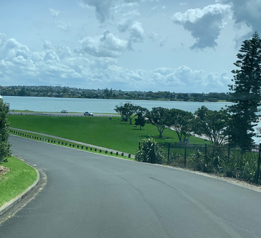
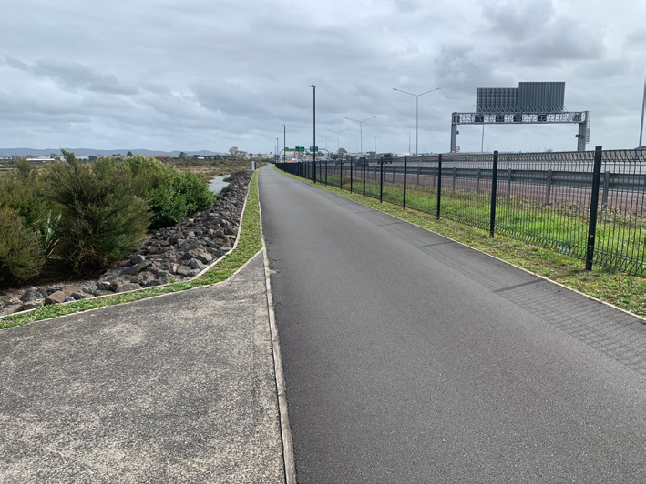
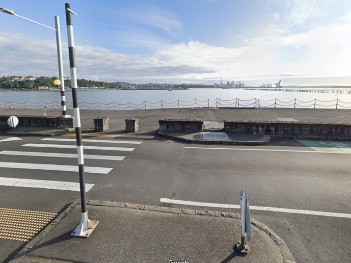
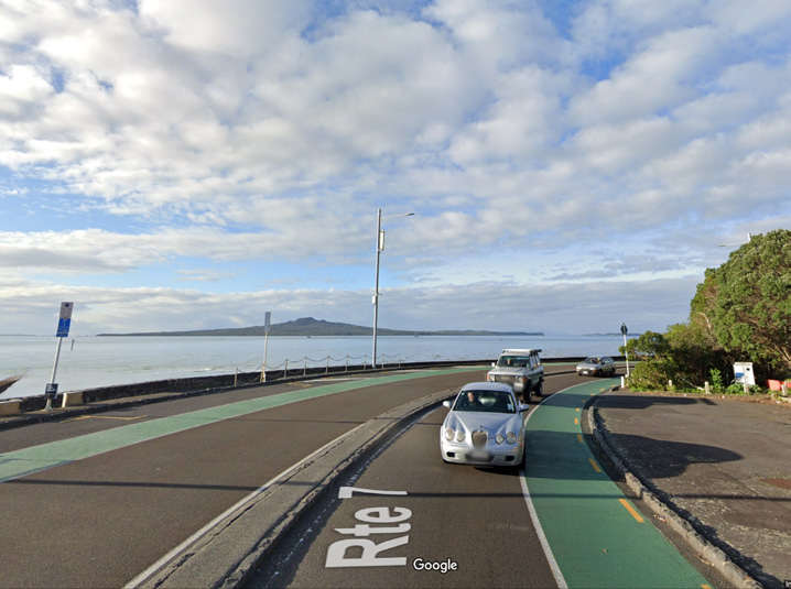
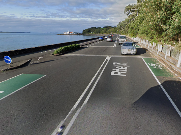
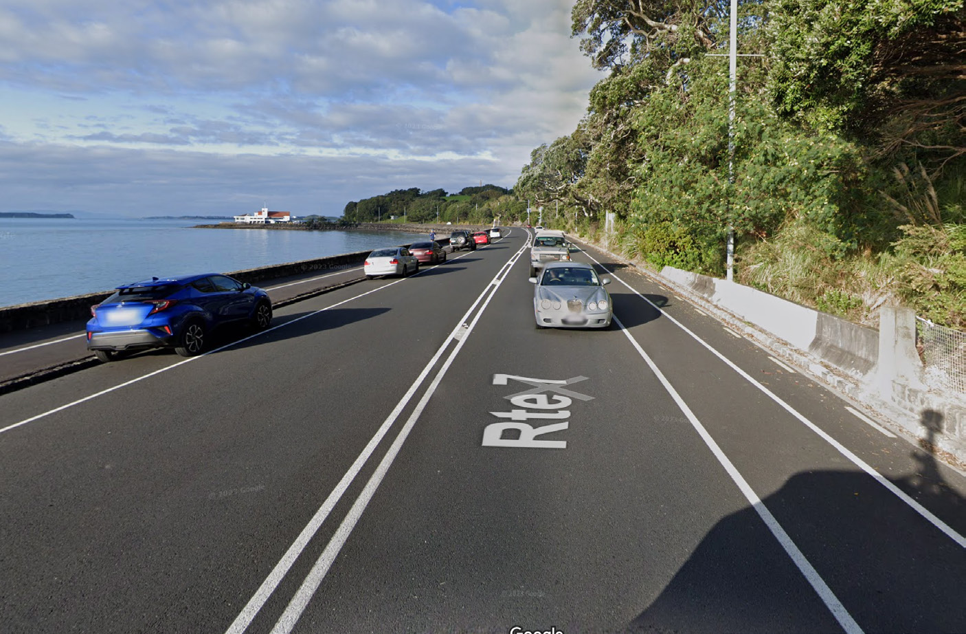
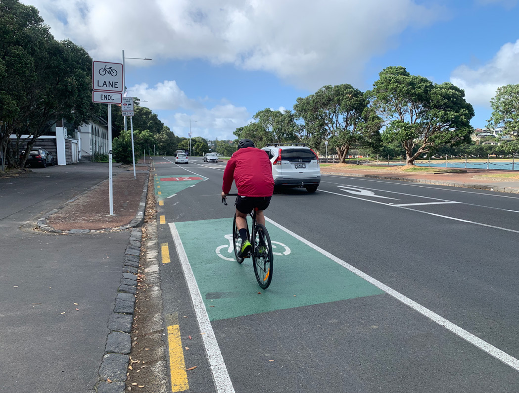
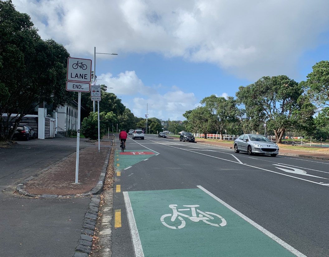
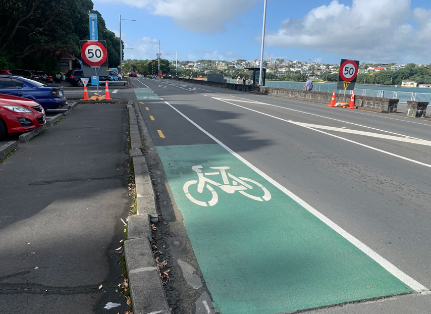
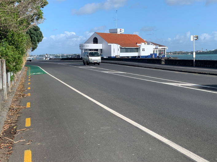
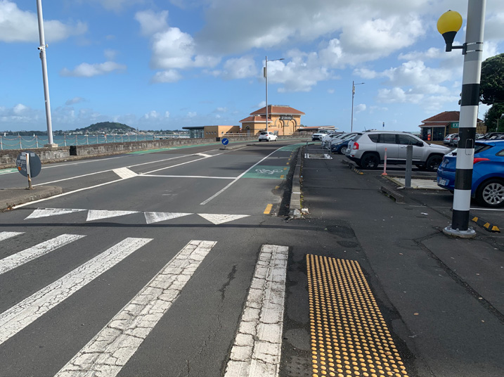
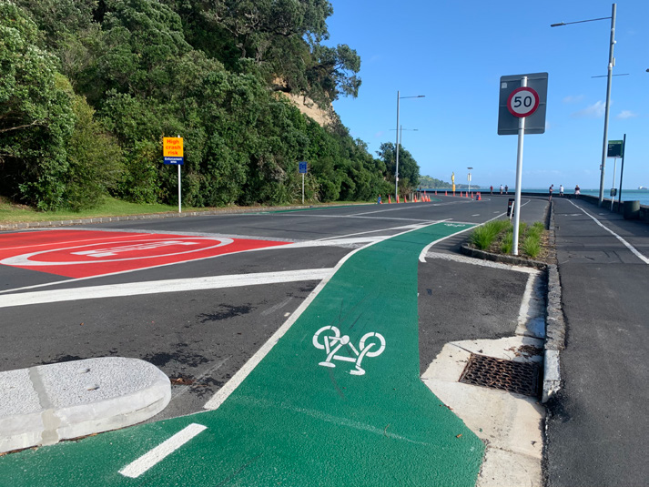
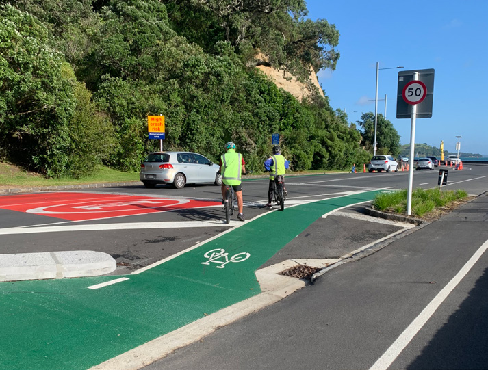
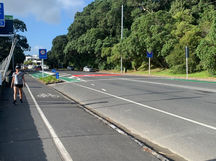
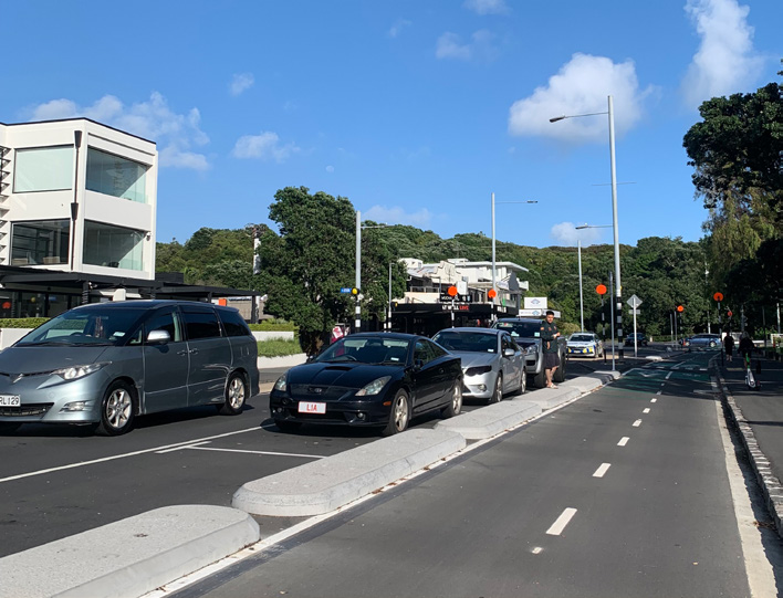
2.4 City to Bays – via Tāmaki Drive
City to Bays Cycleway – Mission Bay to the Viaduct via Tāmaki Drive. This cycleway is a very busy mix of all modes of traffic. We found huge inconsistency along this route, with priority given to the car. The cycleway starts well at the city end, linking seamlessly with public transport. It then starts to lose itself the closer it gets to Okahu Bay, jumping on and off the footpath on the approach to Mission Bay. In some areas there appears to be two cycle lanes, one on the footpath and one on the road. It then will end abruptly. You see speed cyclists themselves using the road with cars all along the route.
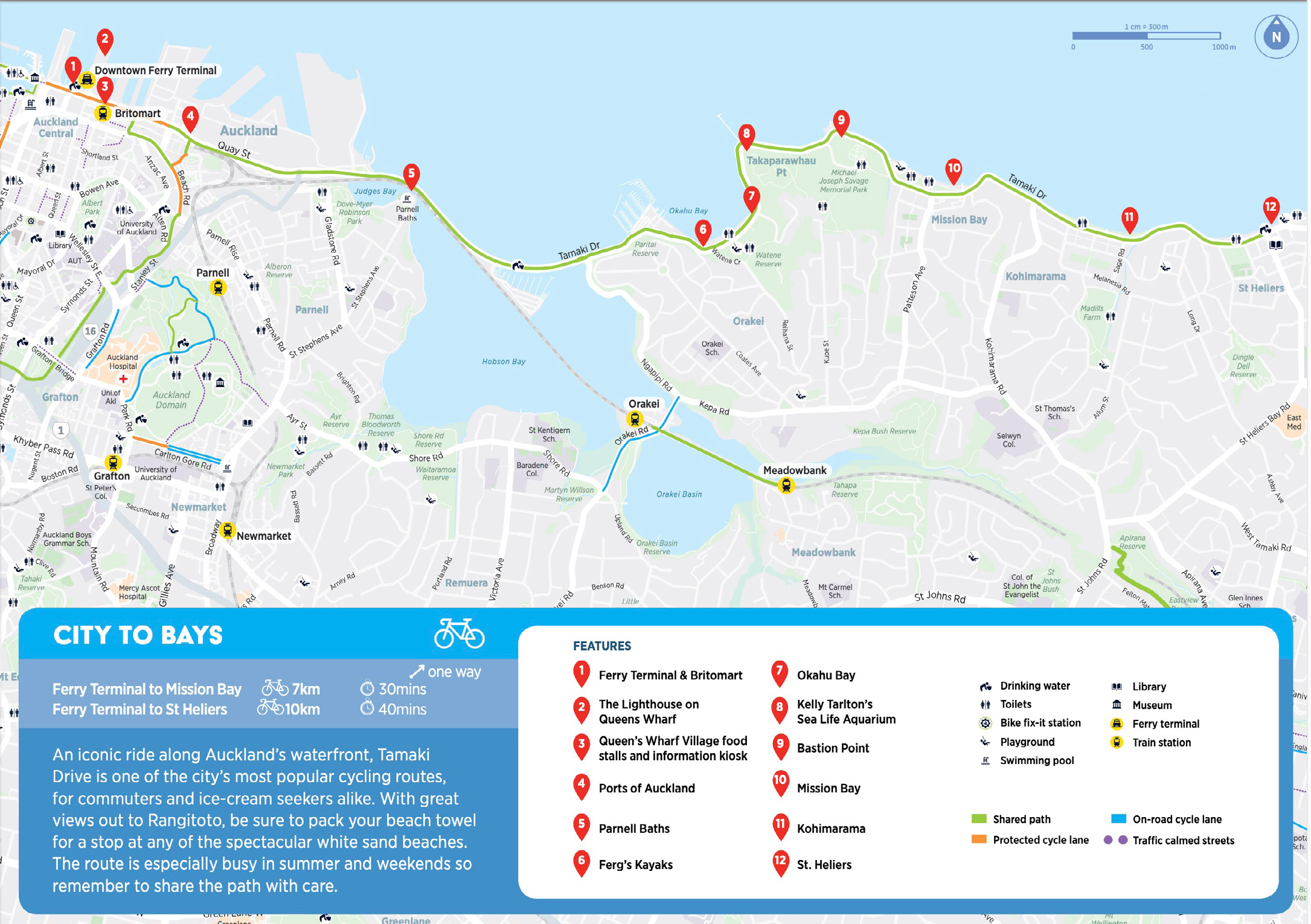
Over the next year, it should be possible to access this cycleway all the way from Glen Innes. Right now, however, there is a lot of maintenance happening, resulting in several deviations leading to nowhere. This route does not feel safe for our mobility impaired cyclists as it is.
The review team for this route consisted of a hand-cyclist, bike with trailer, wheelchair with front powered clip-on and tandem wheelchair bike. We were unable to find someone keen to take on Tāmaki Road in a recumbent.

PUBLIC TRANSPORT
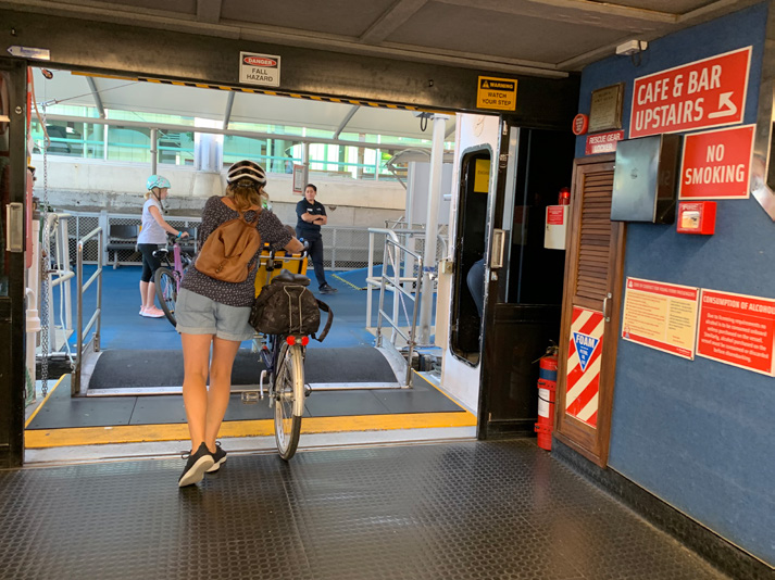
Via ferries from Devonport to City
Devonport is a popular tourist destination in Auckland, located at the end of a peninsula, which makes it a challenge to get there. Ferries arrive and depart Devonport regularly, providing great access to the city. It is a popular way to get into the city to avoid the rather long way around driving via the Auckland Harbour Bridge. The Auckland Harbour Bridge is not accessible for cyclists, and cycling via the Upper Harbour Bridge would be a very long journey, so the ferry is the only way to get across for most who travel by bike.

Auckland’s ferry network can be challenging, depending on which ferry is in use at the time of your crossing. The Kea was one of the best ferries for transporting cyclists across to the city. Since the Kea was decommissioned, the capacity to take cycles has reduced. On some of the smaller ferries it has come down to a maximum of six. Any additional people with bikes will be turned away and told to wait for the next ferry. For many of our riders who use their cycles as mobility devices, this leads them to feel uncertain as to whether they will be able to board the ferry to or from their destinations. Mobility impaired cyclists are often forced to experience the ferry journey sitting outside at the back of the ferry. This space becomes restrictive with the number of bikes parked up, with everyone trying to keep clear of the toilets and passageways, and it can be very cold with wind, sea spray, and sometimes rain.

(now out of action)
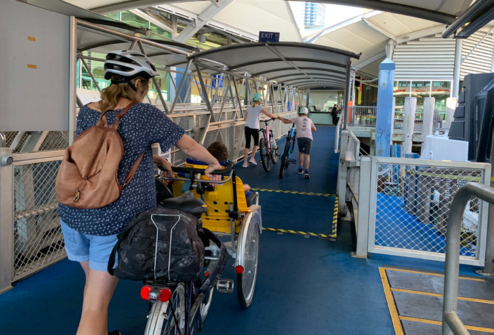
Via train from Britomart
Trains are another public transport option that can be accessed with bikes and non-standard cycles. Access from Auckland city to get onto the cycle path to Mission Bay and St Heliers couldn’t be easier.

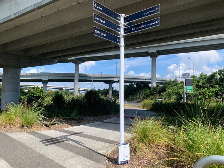
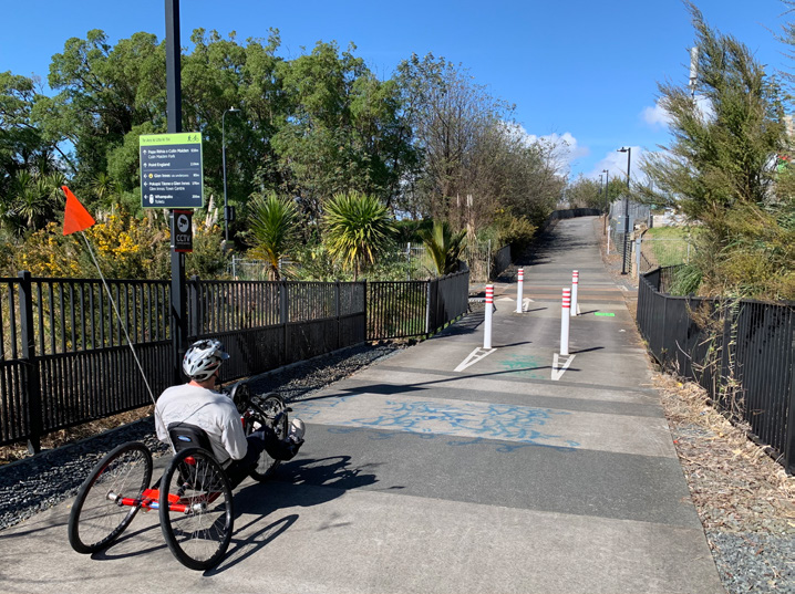
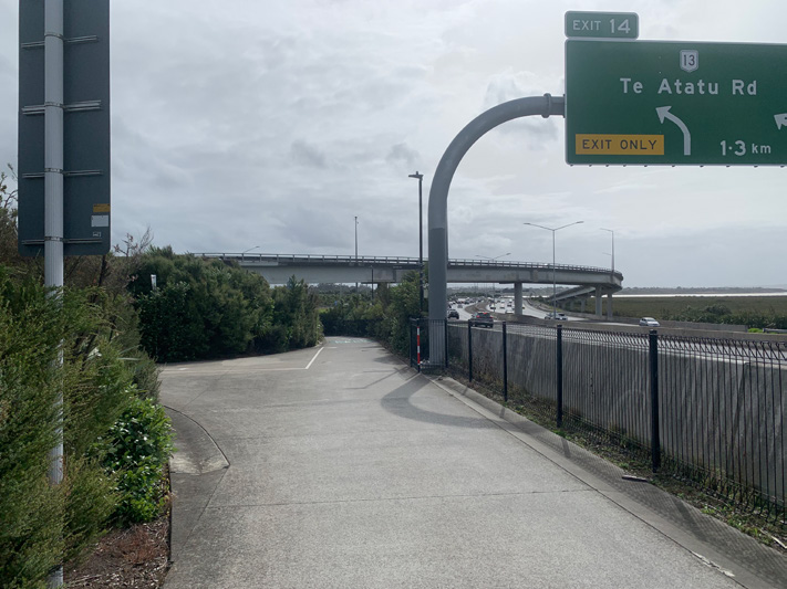
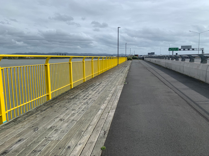
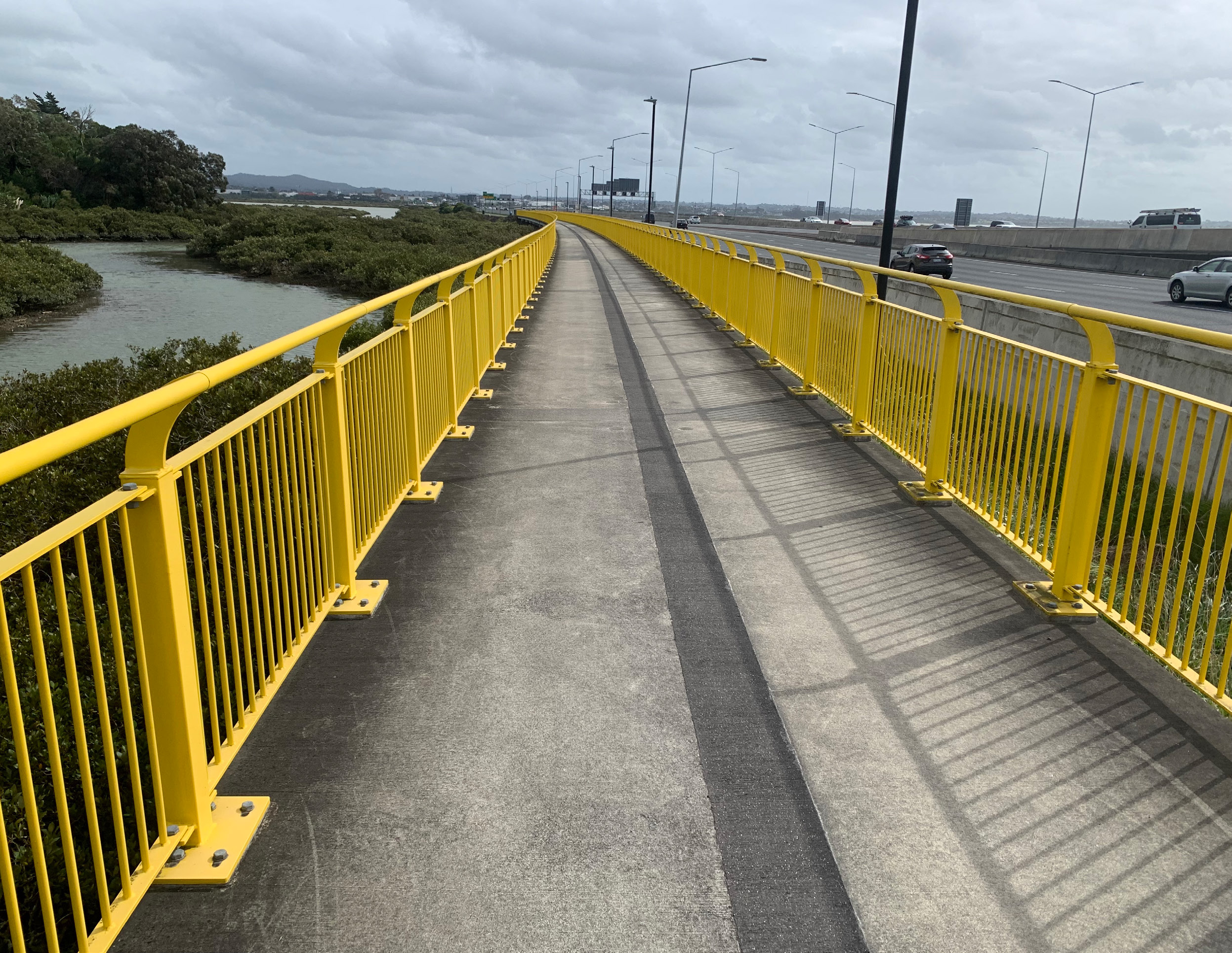
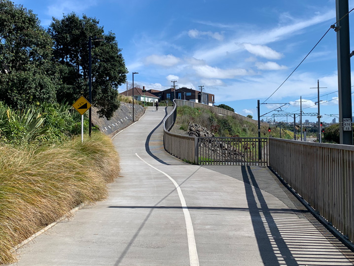
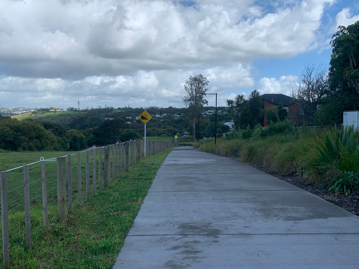
2.5 Northwestern Cycleway – Point Chevalier to Westgate
The team decided to ride the Northwestern cycleway in two parts, opting to start with the easier section first, from Point Chevalier to Westgate. They parked up at the Eric Armishaw Reserve car park again, being already familiar with the route from there, the nearest train station to Point Chevalier ending at Baldwin Avenue, followed by Mt Albert.

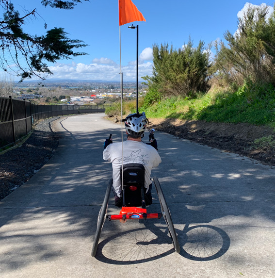
Henderson is a major suburb using the Northwestern cycleway to link into the central city or through to Westgate. The team decided to check out the route through to Henderson to see how accessible it was. It is classed as a trail meandering through areas via quieter routes. Generally, the concrete path is 1.3m in width. It is windy in places, and is a busy route with dog walkers and general foot traffic. There are areas in need of maintenance due to weather, along with a number of pinch points as trails get narrower and steeper. Evidence of motorbike/moped activity was noted along this trail, suggesting there may sometimes be a risk of a close-pass or crash with a two-wheeled motor vehicle on the trail.

The trail has steeper sections with blind corners, making it hard to anticipate traffic along the route.
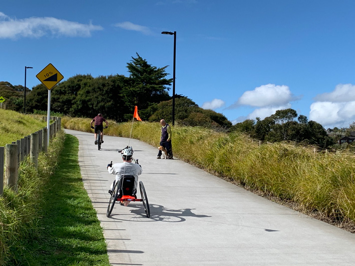
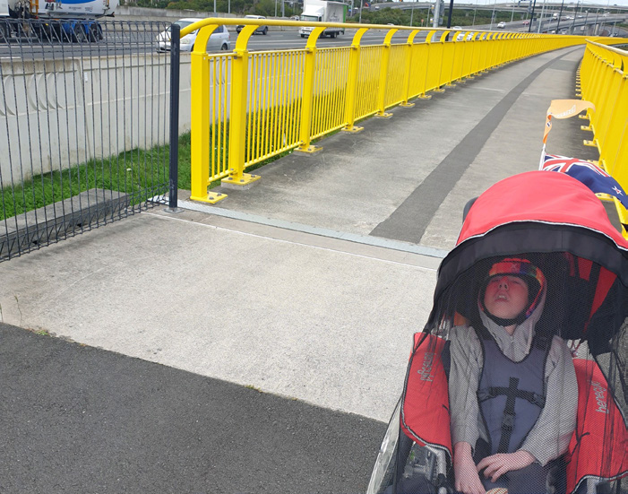
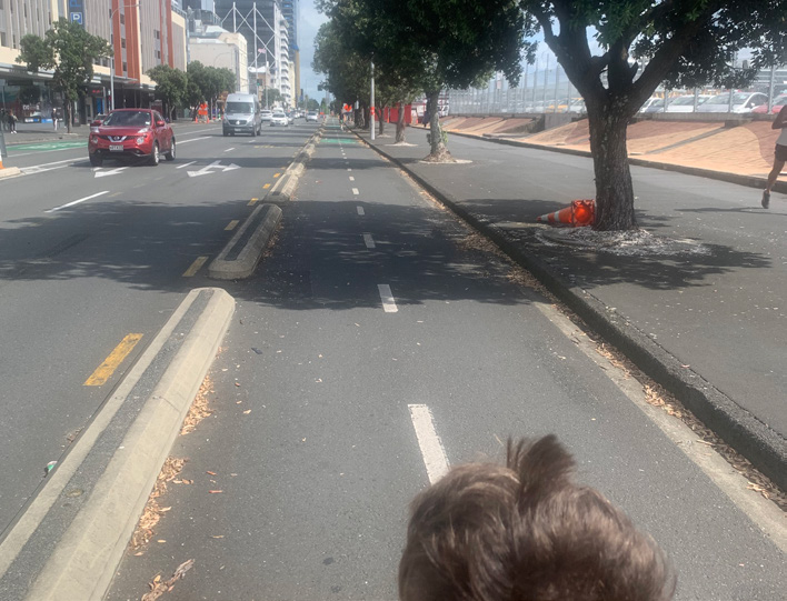
The Northwestern cycleway itself from Westgate follows alongside the motorway through to Point Chevalier. It’s a 3-4m-wide stretch of concrete path with minimal shelter from the elements. It is also well lit all the way. The day the adaptive cycling team reviewed the path, a cool head wind was blowing through.
This part of the cycleway scored high with the team as a commute in and out of the city. Its only drawback to riders was the lack of amenities available along the route. The connection points onto the cycleway have their own challenges in terms of gradients.

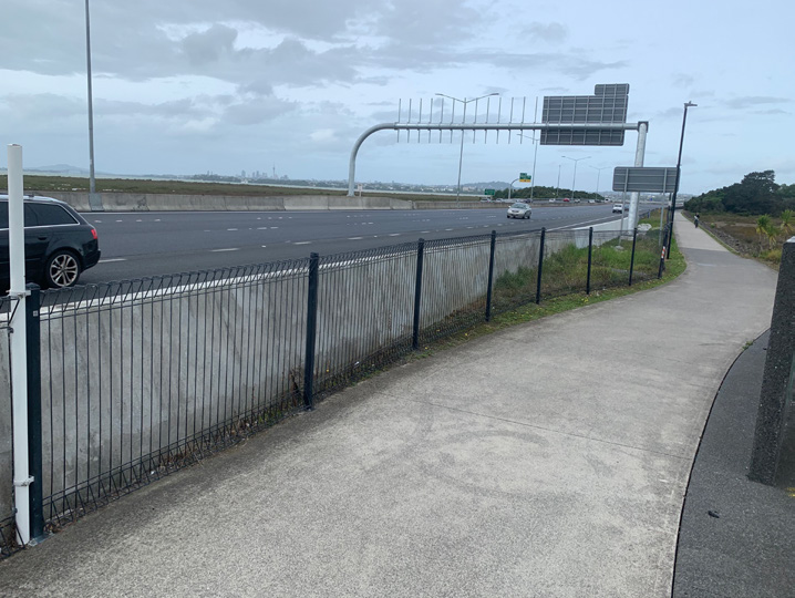
2.6 Northwestern cycleway – City to Point Chevalier
The Northwestern cycleway has an abundance of cycleways leading off it. As it’s not logistically feasible to look at every lateral point onto the cycleway, the team noted the ones that stood out.
Cycle path and footpath separation
Accessing our neighbourhoods can be physically challenging and this is especially restricting for those in wheelchairs or with reduced mobility. If we wish to get people to consider active modes of transport like walking and cycling, we have to consider our more physically challenged members of society. Planning with their access needs in mind will ensure we have an infrastructure set up for everyone.
Steep paths connecting us to places are a regular occurrence in and around Auckland. Of course, a lot of our hilly terrain just cannot be helped. A discussion brought up regularly in our disability community is around the state of our footpaths. As well as our cycling infrastructure network being built, we should be equally maintaining our footpaths. To enable this to happen, a higher proportion of the transport budget needs to be allocated to walking and cycling.
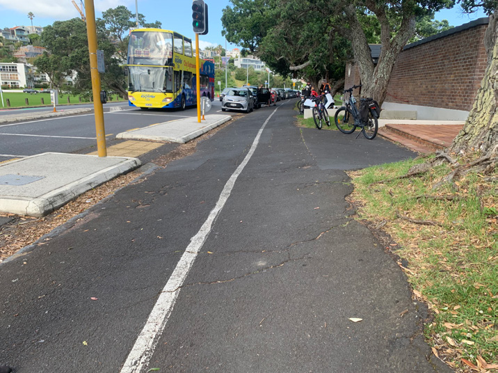
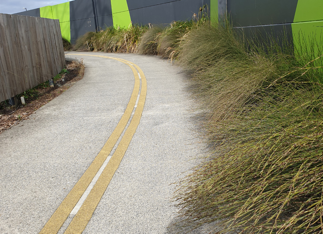
Shown in the two images below is a section of the Northwestern cycleway along Takau Street, where the footpath splits away from the cycle path. Separation is good for all users along here as it is safer. However, if you are an independent wheelchair user, a parent with a pushchair or elderly, which route would you prefer to take? The flat, well-maintained cycleway or the steep, rooted footpath?
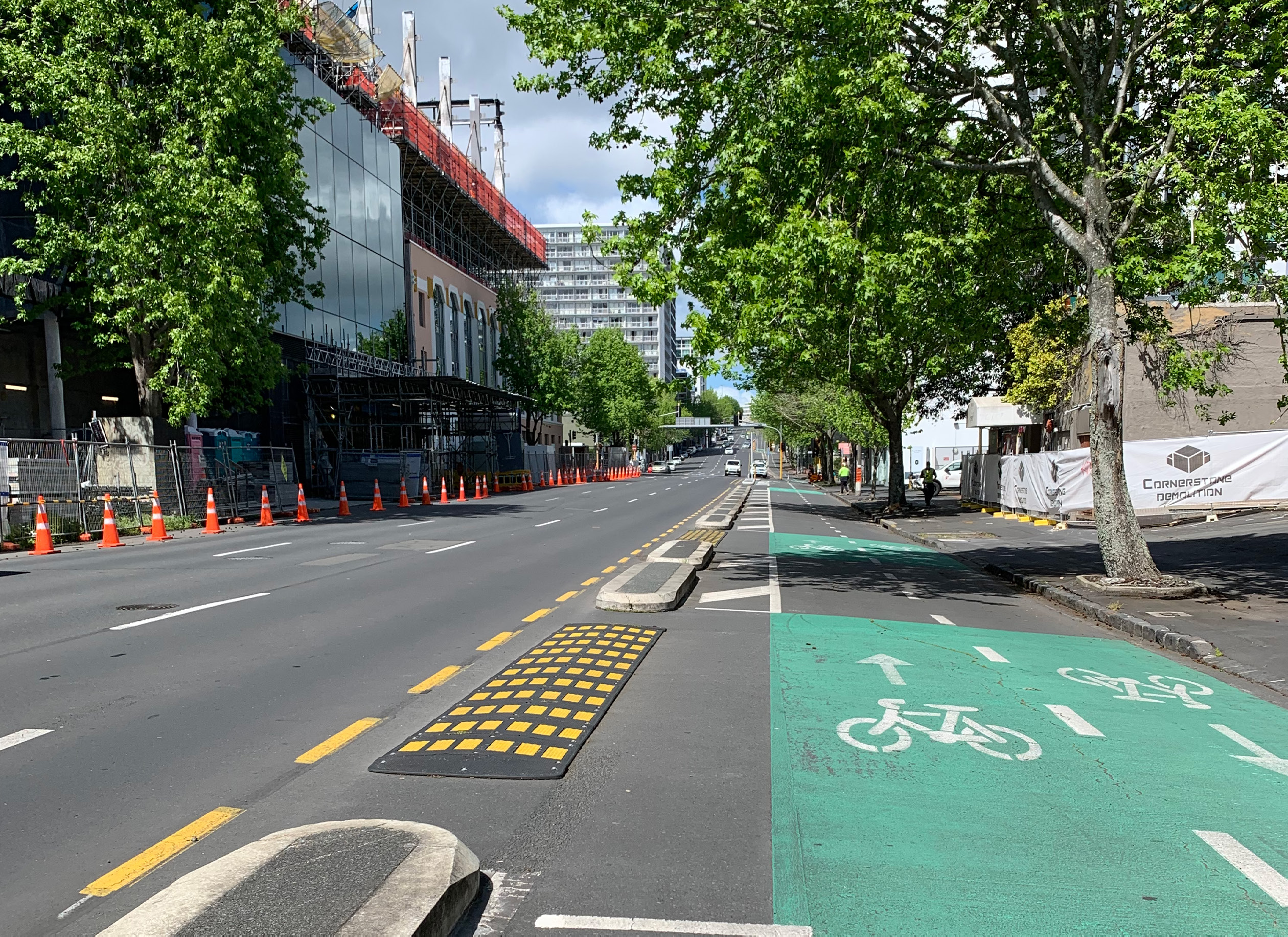
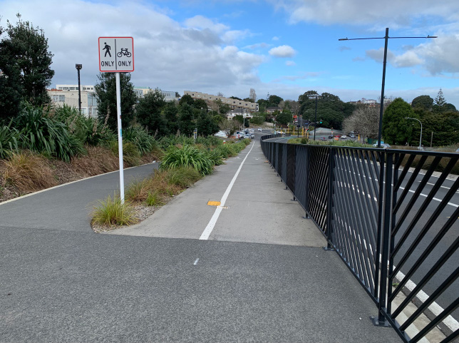
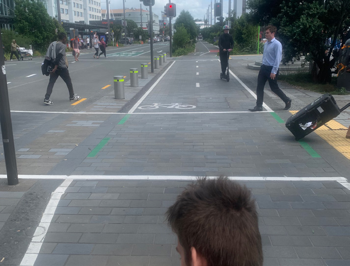
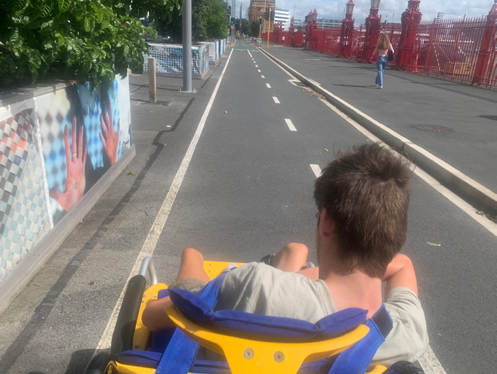
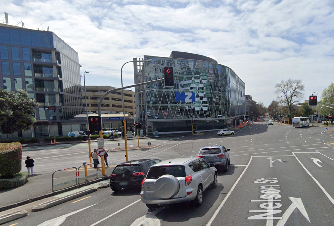
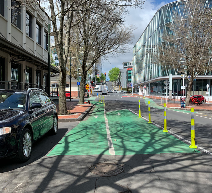
Nelson Street access to the Pink Path and Northwestern cycleway
Nelson Street gives you a more direct route when accessing the Northwestern cycleway or the Pink Path from the city centre. A largely protected bidirectional (two-way) cycle lane runs along it, sometimes splitting into unidirectional lanes (one-way) on either side of the street. The cycle lanes have a few imperfections to navigate through.
Images below show where the cycle route crosses over a side road from the footpath via a steep kerb drop. On crossing the side road, you then have a sharp turn to contend with before continuing on with the two-way cycleway towards the city. The painted cycle lane on the footpath is narrow and further restricted by the fact that it is trying to accommodate two lanes. This is a real pinch point, a classic example of how we need to focus more on the cycle lanes connecting onto footpaths. We are seeing a lot of concrete separators being placed at angles unsuitable for trikes, trailer bikes, cargo-bikes, wheelchair tandem bikes and recumbent cyclists.


A potential solution to this section could be to start the transition further up Nelson Street. The driveway located just before the existing crossing point would provide a smoother turn and a gentle kerb drop.

3.0 Wayfinding
– using signage, maps and information
Accessible and inclusive signage
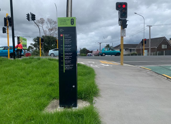
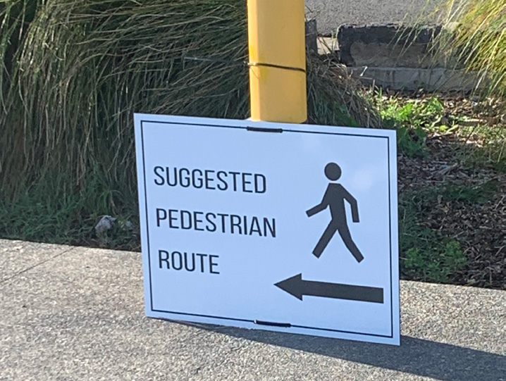
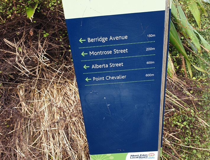
As our cycleway network is in constant development, this can reflect in signage becoming outdated as new styles come in. Consistency across the network makes it easier for users to familiarise themselves with the route. Getting lost and finding yourself in an inaccessible location is a real challenge for those relying on mobility devices to get around. The disability sector often comes across signage that indicates a route from a walker’s perspective. The signage does not always guide you towards using an accessible route. Below is a prime example of this found along the Southwestern cycleway towards Onehunga.

At the beginning of the cycle path the sign reads wheelchair accessible. However, once you get to the end you discover the steps.
Note: This has since been rectified by the Puketāpapa Local Board.

During the cycle audits, the team often discussed signage. Recumbent cyclists in particular feel it’s easier to follow signage marked on the ground. This is preferable to straining necks upwards trying to decipher small font sizes at a distance. Consideration needs to be made for those who are travelling at a faster pace than walkers, with only moments to digest information on passing.
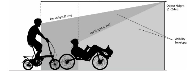
This diagram shows the visual radius, height and distance needed for someone who views signage seated lower to the ground.
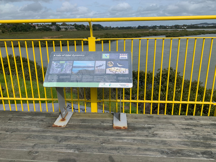
Wheels for Wellbeing is an advocacy group for inclusive cycling in the United Kingdom (UK). They have recognised effective ways in raising awareness for inclusive cycling. One example is an overlay to the City of Bath’s cycle network map highlighting inclusive routes. They have also developed signage to illustrate the broader range of cyclists, expanding on the traditional bike symbol.

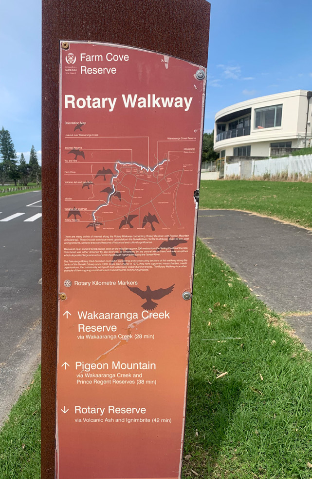
3.1 Pakuranga Rotary Path
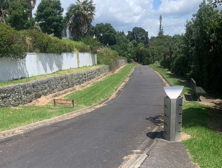
The Pakuranga Rotary Path started out as a leisurely walking path. The path was developed by the previous community board with funding through Rotary. Since its construction, it has morphed into a shared path for cyclists and foot traffic. It is now a busy part of Auckland’s cycling network infrastructure. The signage here looks vastly different to other shared paths we have looked at. It is more suited to recreation than the general commute.
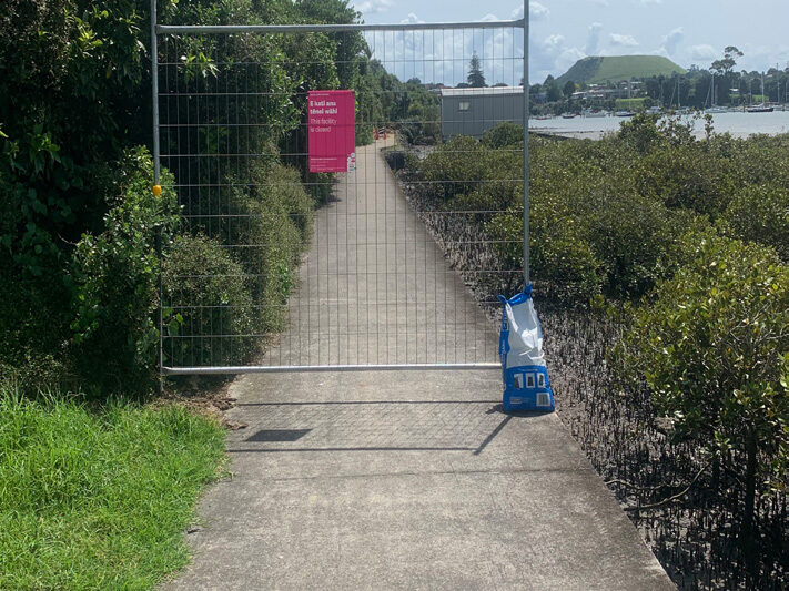
The team visited this path shortly after the devastation of Cyclone Gabrielle, which caused flooding throughout Tāmaki Makaurau. The path had been affected by landslips and broken trees, with one particular landslip leaving the Kerswell Road end of the path closed. The path is generally a narrow one, particularly in the area where the landslips occurred. A recumbent rider needs sufficient circulation space (ideally 3-5m) in order to turn around. This means a warning of the closure needs to be given at a place where riders can turn around successfully. This signage for the closure was around a blind corner, giving the recumbent rider no prior warning.

Hairpins | Blind Corners | Gradients | Maintenance
Signage around a sharp gradient change will guide riders to anticipate challenges. Pre-planning along the path is crucial when navigating the narrow stretches shared with other users. The two hairpins encountered on the path were challenging. Images below show how one hairpin forks, offering no directional signage to continue or exit the path. More mirrors are needed to make the path safer for all users. Adapted cyclists ride in wider cycles, so it’s very important to know what is coming around a corner. This is especially important on paths that are less than 2m wide. We found many walkers on this path walking dogs on retractable leads. These leads are hard to see across a cycle path, leaving a recumbent rider sitting lower to the ground vulnerable to being caught around the neck.

Below are some examples of inconsistency to cycleway connections. It is easy to lose the cycle path at times.

KEY FINDINGS
- More mirrors set up on blind corners
- Signage indicating gradients so that riders can make informed decisions
- Signage indicating where the flat pull-off rest areas are located
- Earlier notification of path closures.

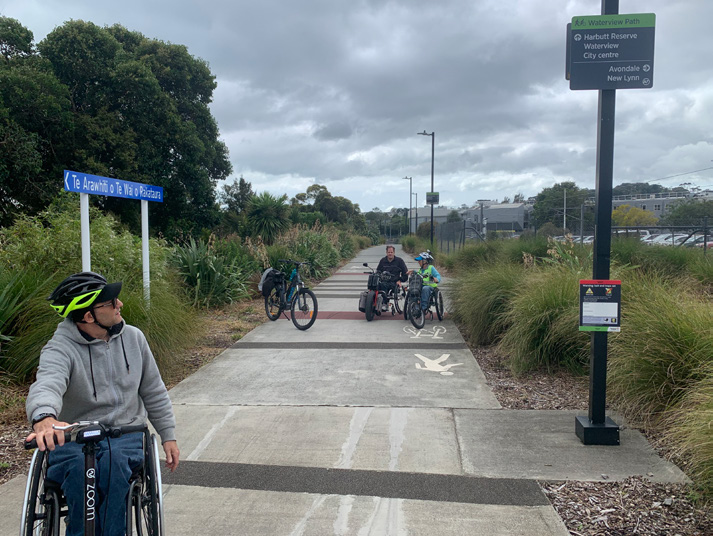
3.2 Waterview Shared Path
Signage on the Waterview Shared Path was a real focus for our audit around inclusive cycling. The team found signage set high, pointing towards multiple different routes to the same destination. One example of this is the two options to cross under the motorway to access the path. The route takes you via a footpath or over a bridge. The footpath looked confusing, so the team opted for the bridge. Adaptive cyclists need to know the quickest and most accessible route possible to avoid getting stuck. Gradients, terrain imperfections, steps and tight widths are just a few pinch points or barriers that our team prefers to avoid. After heading down one path, a team member discovered a dead end with steps. If it had been an adaptive rider, there would have been insufficient space to turn around. This is where signage is hugely important in warning people that the route is inaccessible for some people.
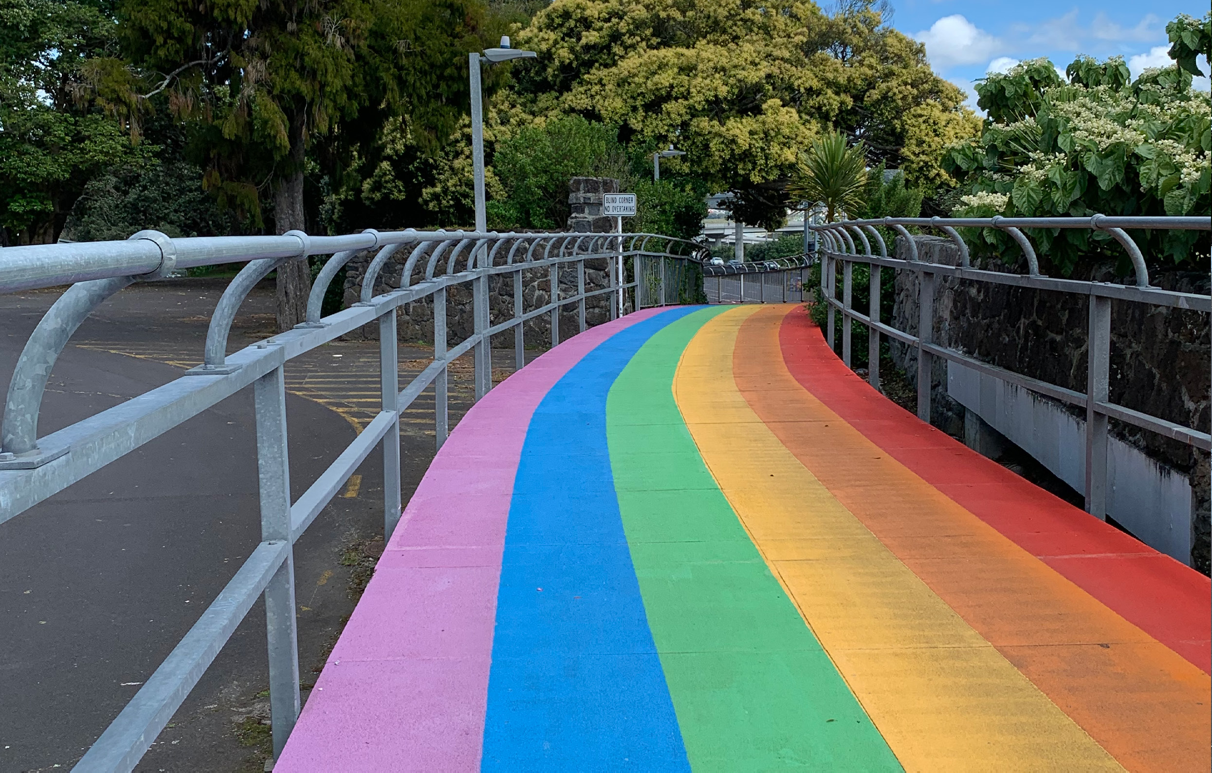
We chose to start our review from the Eric Armishaw Reserve as it seemed the most accessible place to park up and explore from. The reserve is marked as a highlight on Auckland Transport’s Central Auckland Bike Ride Waterview Path map. It indicates the path, and shows areas of interest to stop at. However, the map didn’t outline to us where the Waterview Shared Path officially began or ended. The team was led to believe the Rainbow Path was part of the Waterview Shared Path, ending at Valonia Reserve. It then continues on to become the Southwestern cycleway towards Māngere Bridge.
Instead of taking the bridge (left), it’s possible to cycle up the Northwestern cycleway (right) to join up with the Rainbow Path to the city

But signage here is confusing – which is the best accessible route to take to the same location?

We discovered these two paths meet up further along the path. This leads to indecision for riders as to which route to take


Maintenance path closures
Inclusive signage
When a shared path is less than 4m in width, it can be challenging to leave a 1m clearance when passing other users. This is particularly challenging on a gradient with a blind corner, like the Rainbow Path section.
The ‘Shared Path Guidelines’ signage does not consider power-assist, wheelchairs, trikes and recumbent riders, who take up more space on a path. This is an example of signage that is not inclusive. It also highlights that a 2-3m path width does not allow enough space for any cyclist riding anything up to 1m in width.

Mirrors could be an added solution here. The SLOW on the path is good!
Finding the official start to the Waterview Shared Path
Finding the official start of the Waterview Shared Path was obvious once you knew. From the BP station, the team came to a split in the footpath. At this split we expected to see signage indicating it was the Waterview Shared Path. There is general signage indicating that a cycleway begins, but it does not specify that it is the Waterview Shared Path. Perhaps signage indicating towards the beginning of the Waterview Shared Path would be better located at this decision point.


Once the team discovered information boards, the official start to the Waterview Shared Path became clearer. The team felt that from initially following the map, it was the ‘points of interest’ located outside the official Waterview Shared Path that led to confusion.


Just before heading across the bridge over the rail tracks (which connects to Soljak Place in Mt Albert), a signpost informs you that you’re still on the Waterview Shared Path. Once over the bridge, there is no signage indicating the end of the Waterview Shared Path or where a cycleway continues. The first signage can be found at Alan Wood Reserve, with the general sign informing that a ‘Cycleway Begins.’ Perhaps it needs to read ‘Waterview Shared Path’ ends and ‘Southwestern cycleway’ begins? This would then give a clear, consistent message to cyclists who are unfamiliar with the area. Power-assist riders do not want to spend time getting lost due to their valuable battery life.

3.3 Glen Innes to Ōrākei, Te Ara Ki Uta Tai
The team found the signage and wayfinding excellent along this shared path. There were only a few considerations that they felt needed sharing. The riders cycling closer to the ground draw their natural eye gaze directly in front of them. Our recumbent riders say that it is easier to look at the road markings ahead, than the signage overhead. Travelling at speed, you need to be able to take information in quickly. The font size needs to be legible with good contrasting colours. This is particularly important for those with low vision.
In the image below, painted on the ground, you will see a pedestrian figure and bike with an arrow guiding you straight ahead. Ahead is a wall which is the same colour as the concrete. This painted arrow leads our recumbent cyclist straight into the wall. What is needed is the arrow to be pointing right, and the copper signage continued through to help with contrast (where the pathway joins Merton Road, Glen Innes).

On reaching the top of Section 1 onto St Johns Road, the team wanted to see signage directing them to continue on. This was not easily evident. The recumbent rider expressed the need for signage to be lower, so as not to cause neck strain. Again, it is helpful to paint the shared path continuation onto the footpath. It was noted that while the signage here was evident, it had faded, and in some places had totally disappeared.


Bollards, painted white and red, are directly in front of you as you exit the path, which gives the impression that this is where you cross over. Looking across the road you see this is not possible due to no formal crossing over the busy main road. There is potentially a need to remove these bollards to limit confusion.
Coming out at St Johns Road onto a shared footpath. No signage indicating where the cycle path picks up. We turned right, crossed over to Meadowbank Pony Club via a controlled crossing. Steep incline at the next part of the shared cycleway. The path starts to flatten out after 700m.


Gradient signage
The team found informational signage around gradients extremely helpful along this new cycle path. It allowed the team to anticipate the effort needed to take on the inclines. Our manual recumbent hand-cyclist enjoyed the gradients for improving the heart rate. The only gradient he decided against riding was at 19%, at the exit point to Tahapa Reserve. Our manual tandem wheelchair cyclist, however, struggled on many of the gradients due to the extra load. The contrast using aggregate is useful in pinpointing the level rest areas.

3.4 City to Bays – via Tāmaki Drive
It is common to see signage exclusive to people who can walk. This signage is not practical for those unable to simply ‘get off’ and walk. An accessible route and recognition of this, could be considered in order to improve awareness and to have an accessible route to suit all types of cyclists using our footpaths and cycleways.

“Inclusive signage is a great way to raise awareness of the different users on active modes of transport”
It is obvious enough to know the direction that you take cycling from the city to Mission Bay and St Heliers. What is not easy is locating where the cycleway stops and starts, and what type of ‘cycleway’ you are actually riding on. Is it protected, painted on-road, a shared footpath or even running in both directions?

Kelly Tarlton’s is a busy visitor attraction with parking. This area is problematic with the increase in traffic crossing the painted cycle lane to enter and exit the car park. It is here we see an inconsistent and unprotected cycleway painted along both sides of the road, which then tends to vanish. Sometimes it becomes a T2 lane or is used for street parking. Cyclists are not given any warning of the transitions along the way and often find themselves stranded on the busy main road. This is not safe for any cyclist who rides a non-standard bike. It is particularly unsafe for trikes, recumbents, bike trailers and tandem wheelchair bikes, who need prior warning of any transition.

The Waka Kotahi NZTA Cycling Infrastructure Code states that there needs to be a minimum of a 1m buffer zone between parked vehicles and a cycleway.
Below we have common signage informing you that the cycleway is ending. There is no clear guidance as to where you should continue on. These sections often change to T2 lanes during peak times, and then become parking spots at off-peak times. This is not prioritising the safety of cyclists.
As you continue, the cycleway forks off in the same direction, offering both the footpath and the road. This branching is indicated by signage painted on the ground. Confusion is created for the mobility impaired cyclists as to which cycleway to choose. They do not wish to be left stranded on the road amongst the cars, nor immersed amongst the heavy foot traffic. Neither option is safe or pleasant for our team.
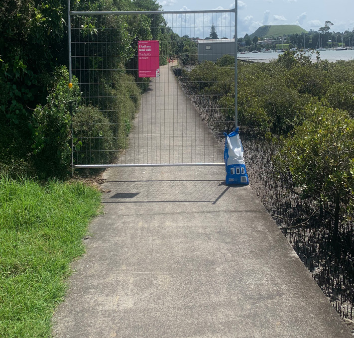
3.5 Northwestern cycleway – Point Chevalier to Westgate
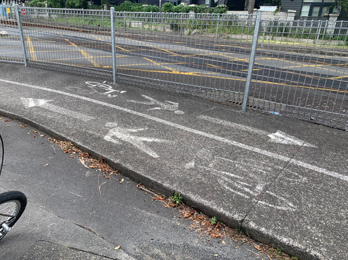
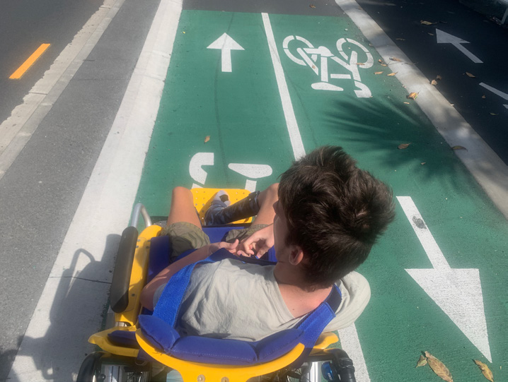
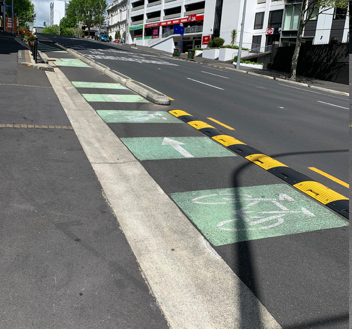
As a whole, the wayfinding along this section of shared cycle path is very good. The cycle path follows the motorway with few distractions leading you off course. It is a good commuting path, allowing you options to gather speed. Because of this speed, it is important to “keep left”, especially when coming up to blind corners. Reminders of this are clearly painted on the path. Below are two examples recorded along the route. One is faded (white paint on concrete) and difficult to see, and the other uses a good contrast in colour (green and white). Of the two, the ideal signage is option (b).
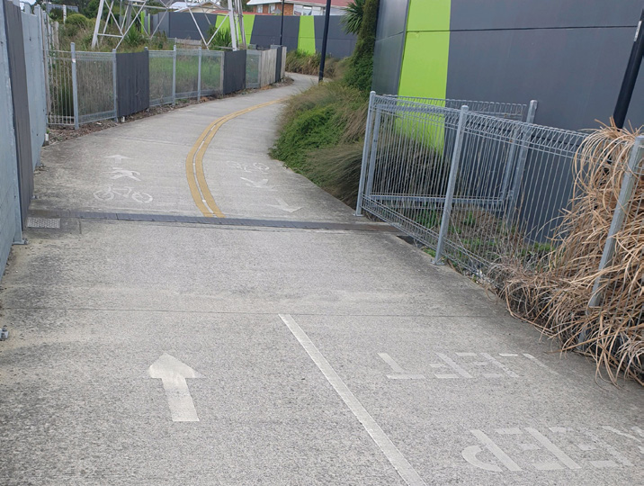
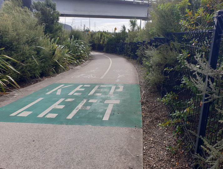
Looking at image (c), the use of concrete texture and colour highlighting the centre line, shows a clever and effective way to keep cyclists and walkers on the right side.

A larger font size on wayfinding signage with good colour contrast is always helpful. This will assist anyone with limited sight (not necessarily people with disability). Signposts often need to be lower for mobility impaired cyclists who ride closer to the ground, like recumbent cyclists. Having some on lower posts can be helpful.
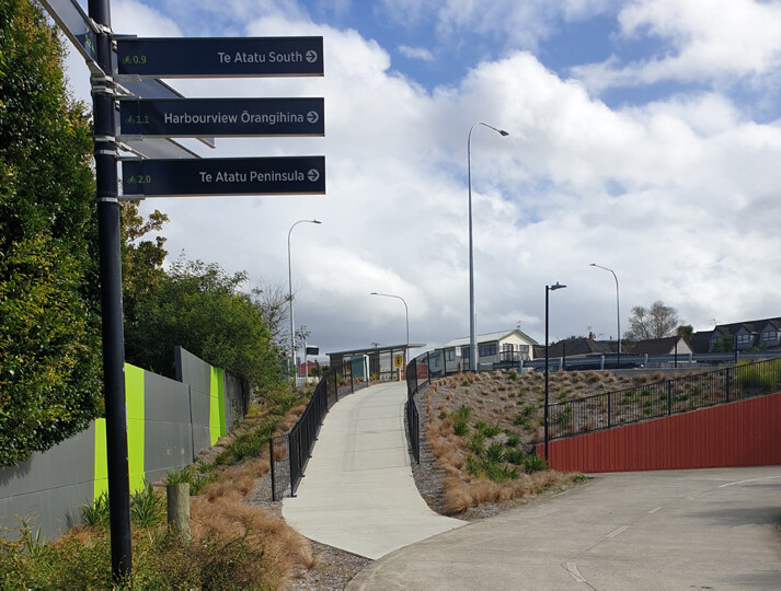
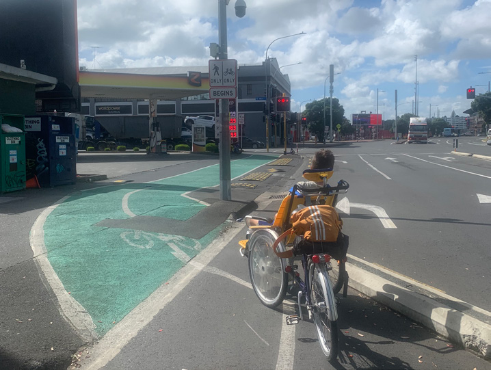
This photo was taken at the end of the pathway from Eric Armishaw Reserve. No signage here so we just headed for the path in the centre of the photo (beyond the road cones). Once we arrived here there was still no clear signage indicating which direction we needed to go for the Northwestern route. We eventually found the route using guess work.
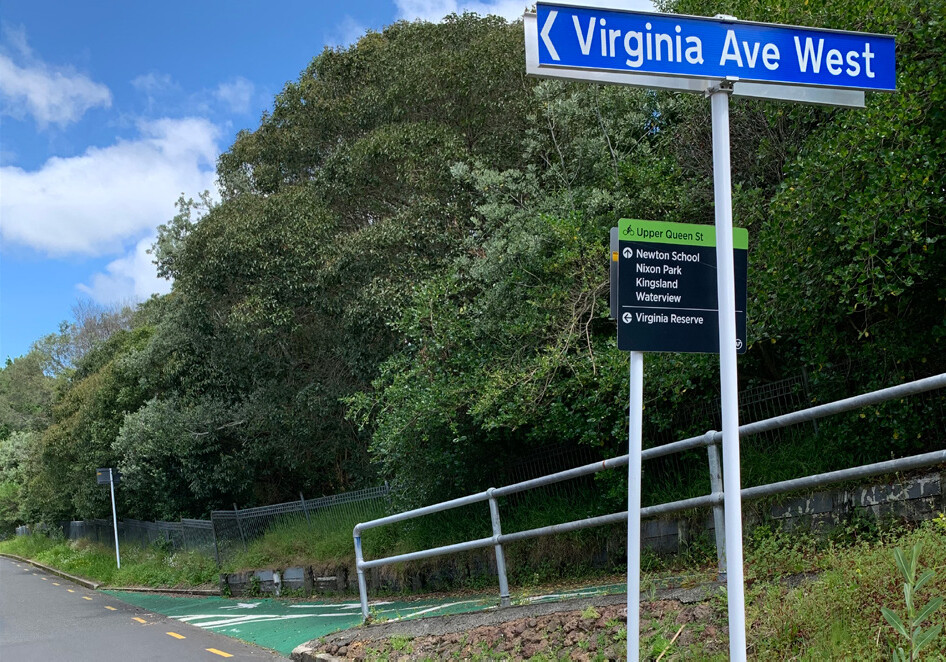
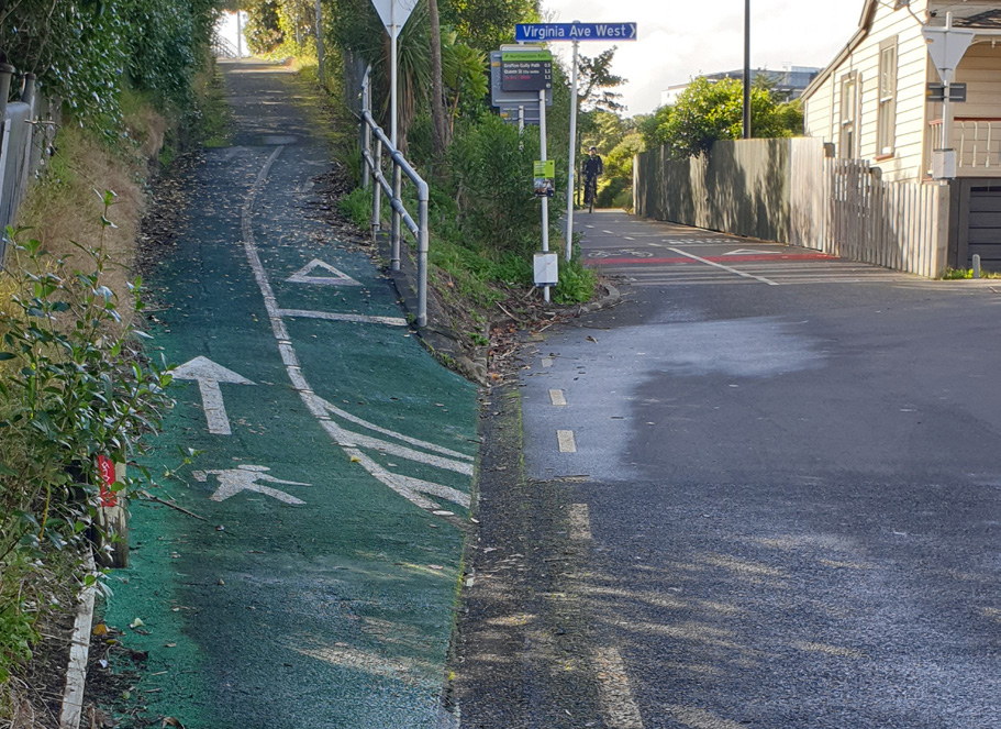
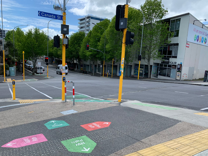
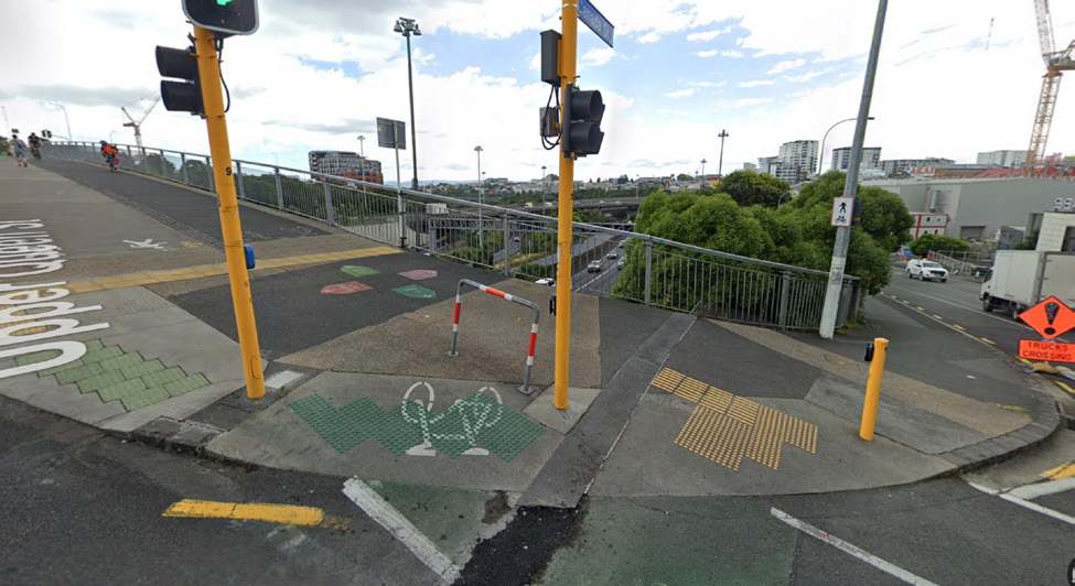
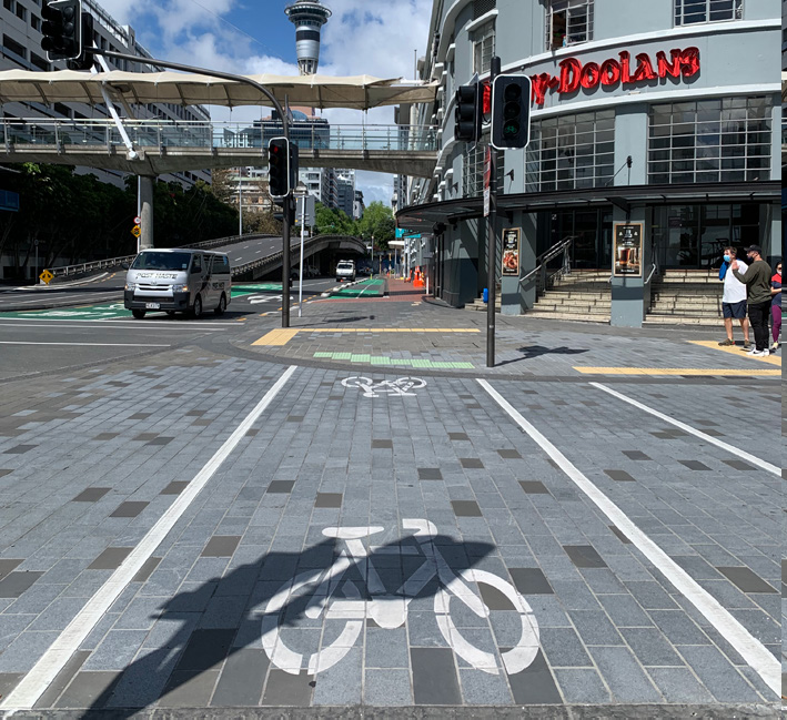
3.6 Northwestern cycleway – City to Point Chevalier
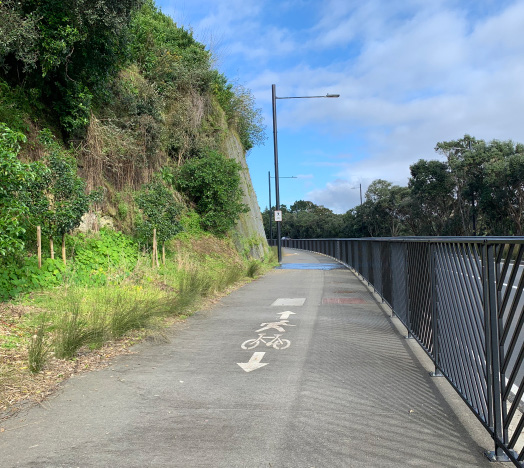
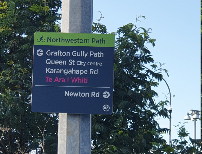
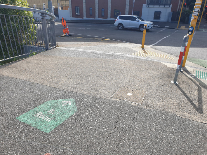
Wayfinding through the city can be difficult to navigate at times. However, it did get easier once we came out at Upper Queen Street, just before Ian Mckinnon Drive, because of the colourful signage painted on the footpaths guiding us along.
At the end of the Pink Path, heading towards the city, the team found no signposting to connect us with the cycleway back towards the Viaduct or the onward journey. At the end of the path, all that was discovered was a green cycle image indicating left and right. The signage gave no information as to where those arrows were pointing to, in terms of a destination.

**UPDATE**
More signage has been added between the time of the audit and the release of this document.
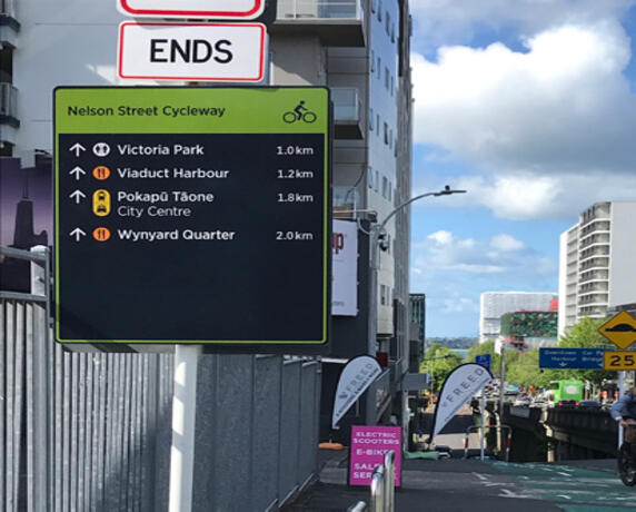
Solution: To paint the same wayfinding signage found elsewhere onto the footpath. Indicate the direction needed to go in order to pick up the cycleway into the Viaduct.
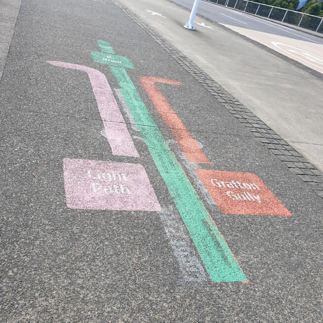
The team wondered about the pink pattern along part of the cycle path, shown below. It looked to highlight the kerb separation between footpath and cycleway. The ‘keep dogs close’ signage is helpful in reminding people about the cyclists.
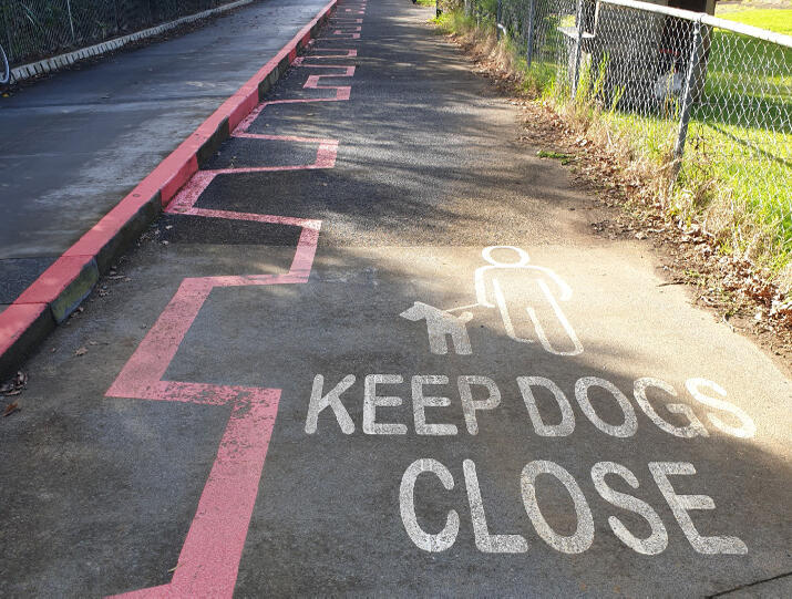


Note: No centre line painted as a reminder to keep left.
4.0 Infrastructure Barriers
– posts, gates, terrain, pinch points, maintenance and construction
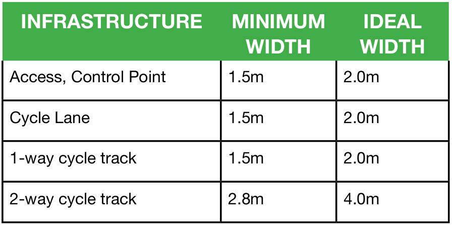
Ideal (and minimum acceptable) widths of various types of cycle infrastructure
“When riding with someone who has difficulty following instructions, it can be necessary to distance yourself from others. Finlay often puts his arm out to touch things and to interact with people. If a shared cyclepath is only 1.2m in width, it does not allow enough space to keep him at arm’s length from potential hazards.”
Kimberly Graham and Finlay
GYW, tandem wheelchair bike
Key considerations
- Cycleway width, always aim for 2m per lane and 4m for two-way
- Minimise gradients to below 2% ideally
- Always use sealed terrain
- Create good pull-over space, considering turning circle radius for longer cycles
- Keep off footpaths.
Parking
Did you know that almost 35% of survey respondents in the 2021 UK national survey of disabled cyclists reported a lack of appropriate parking or storage as one of the biggest barriers to cycling? For instance, ‘double-stacker racks’ are difficult to use for people with poor manual strength, dexterity or standing balance, and are too small and unsuitable for non-standard cycles.
In New Zealand, we are only just beginning to consider inclusive cycling, so hopefully locking up cycles at destinations is part of that consideration.
4.1 Pakuranga Rotary Path
The team found this cycle path challenging due to gradients, blind corners, general width and mixed usage. Instead of a leisurely ride, we needed to be vigilant to a lot of potential obstacles. The flat, paved, open and straight runs were where we could finally enjoy a more relaxed ride. Along these sections, visibility is good and the sealed terrain is flatter with minimal gradient changes.
Someone riding a manual or e-assist cycle will need to anticipate the need to change gear up or down, as the path is shared and the widths inconsistent, ranging from 1.4m to 2m. Along with an inability to see far ahead, this makes this path a challenge to cycle with the extra width and stability for the adapted cycles they use.
The path here is 1.2m, but much of this is obstructed because the gate posts have been placed on the path rather than outside it. This becomes less than a 1m clearance space for people and cyclists to pass through.

“I keep myself fairly fit when it comes to handcycling. Many gradients I take on as a challenge. This hairpin gradient took a lot of manoeuvring, only managed through assistance given in getting me around the corner.”
Lee Warn, recumbent cyclist
“I had to step off to get the tandem wheelchair bike around the hairpins. Not having power assist made this a challenge to push my son up.”
Kimberly Graham, tandem wheelchair bike
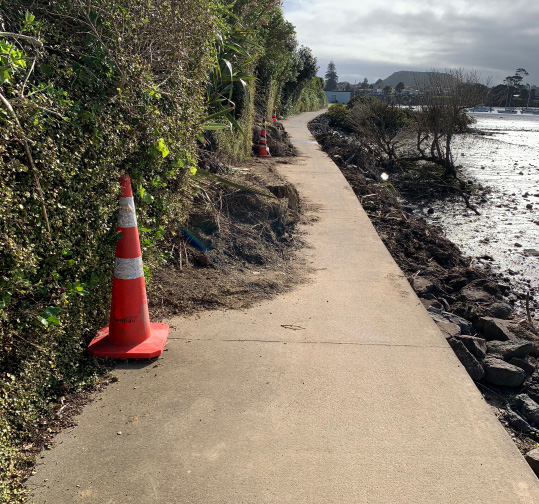
After the extensive damage brought on by Cyclone Gabrielle, the path was closed for months at the Panmure end due to a slip. Part of the team returned three months later. It was noted that the gate that closed off the path had been removed, however the landslip remained impassable for anything wider than a bike. Due to the path falling away abruptly into the water, this remains a hazard for anyone unable to turn around on such a narrow path. It is situations like this that people with disabilities encounter on a daily basis. This is where a contractor assumes everyone can safely get past.

Blind corners and kerbs

Blind corners need well-placed mirrors to anticipate what’s around the corner. Dogs on and off-leash, children on foot and bikes, e-bikes, e-scooters, speed cyclists, and elderly share this path.
As the path transitions onto a road, there is no kerb cut to allow for an easier ride. In some cases, this could be too much of a barrier.
Gates and posts

Terrain
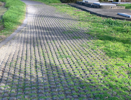
Cobbled terrain should never be used on public paths. They cause wheels to become stuck, especially for wheelchair users.
4.2 Waterview Shared Path
BP Station, Great North Road (Access to start of Waterview Shared Path)
Great North Road is a busy highway and there is a lot of cycle traffic in this area as well. The chance of a collision between a vehicle and cyclist is probable without extreme care from both parties. There is signage here asking cyclists to dismount. This is not possible if you are a cyclist using a mobility device.
The cyclist has to cross the BP station driveway in front of the traffic turning in from the busy main road. The cyclist then has to cross the BP station driveway in front of traffic turning back out to the main road. Both crossings are uncontrolled, relying heavily on motorists seeing and allowing cyclists to cross.

The maintenance work just after the BP station has been going on for a long period of time. There have been a number of complaints but it has still remained the same.

Maintenance
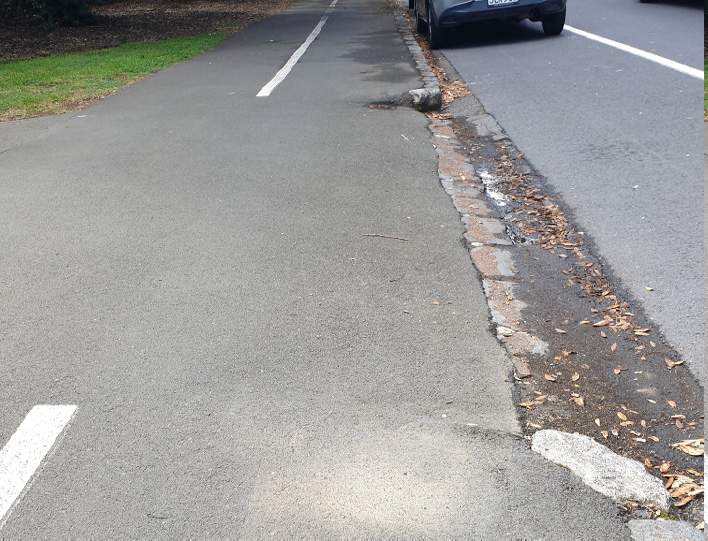
Bollards were a big feature along the stretch of cycleway around Unitec. The team reported no problem navigating through them, with widths satisfactory for gaining access through.


This bollard at the Phyllis Road Car Park can be hard to distinguish as there is no contrasting colour from the paint on the ground. Perhaps it should not have been installed on red paint amongst Give Way markings.
4.3 Glen Innes to Ōrākei
On this cycle path, infrastructure barriers were not a problem. The gradients could potentially be a barrier to some, but these were all assisted by level rest areas to catch a breath. These level resting points are subtly pointed out by stretches of aggregate concrete contrasting against the rest of the path. We found the challenging areas of this cycle path were more around accessing it rather than the user experience on it.

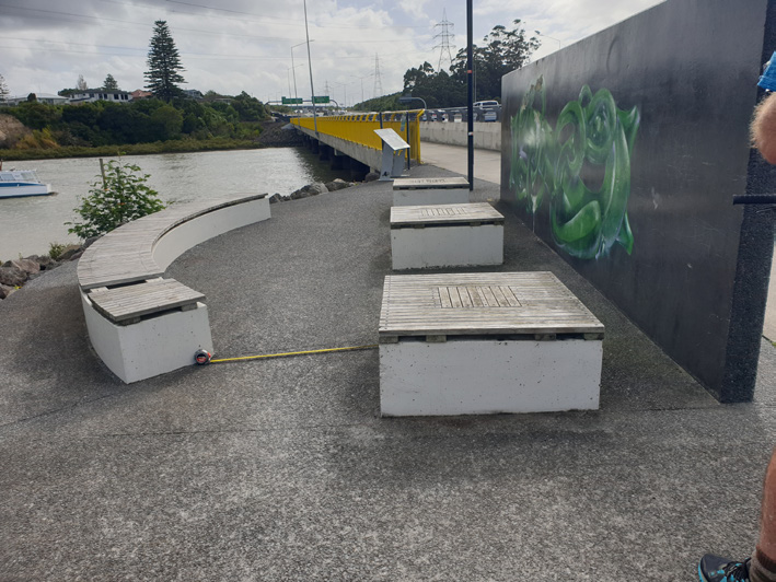
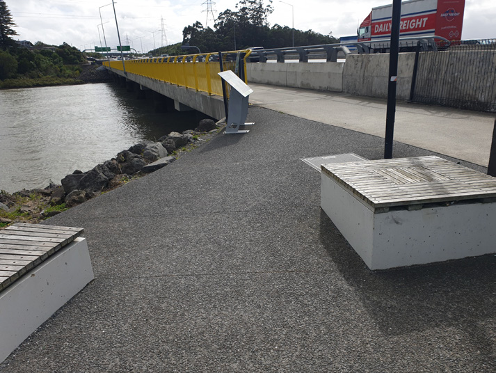
Here at this rest point it would have been ideal to have 5m (instead of 3m) of circulation space. This allows the longer cycles an adequate turning radius.
If this seating allowed for gripping onto the armrests at its edge, a recumbent rider could consider using them to access the seating.


“This cycle path feels like a motorway for cyclists. By far the best cycle path review to date.”
Mike Potter, Recumbent hand-cyclist, CEO Disability Connect.
4.4 City to Bays (via Tāmaki Drive)
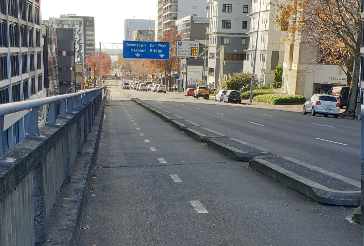
Starting from the city, the two-way cycleway is separated from both the road and the footpath. Space is allocated for cyclists, with their own traffic control buttons to get across safely. The cycle path is protected from the road with a series of precast barrier kerbs, plantings and raised cycleway sections. Cycling symbols are painted on the path with stretches of green.
This stretch of cycleway feels safe and well maintained until it reaches the Countdown supermarket and follows alongside Auckland’s ports. This is where the on-road cycle path transitions onto a shared footpath. It then becomes a wide footpath with a white line painted to separate foot traffic and cyclists.
In the below images, note how the concrete separator is angled acutely towards a cambered transition. This resulted in a cyclist tipping up.


The cycle path continues on alongside a busy main road, well maintained with approximately 1.5m width allowance in both directions. If it was a minimum 2m width in each lane direction, then it would improve the turning circulation for longer cycles. Recumbents have a preferred circulation radius of 5m. We would encourage more turning bays and rest spots in case there is a need to pull off the cycle path. We found ourselves blocking the cycleway on occasions.


As we rode further away from the city and passed the turn off to Ōrākei, the cycleway started to become lost. The two-way protected cycleway on one side of a busy main road becomes a single painted cycle lane on the road. There is another painted cycle lane heading the opposite direction on the other side of the busy main road. Unfortunately, this isn’t always consistent; for example, the painted cycle lane disappears and becomes a T2 lane.


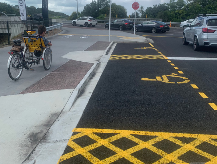
Arriving at Okahu Bay, the on-road, two-way cycleway switches from the road to the footpath. White paint is used to divide foot traffic and cyclists. The footpath has plenty of imperfections and obstacles to negotiate. During the weekend these footpaths become extremely busy and hard to navigate. Vehicles are parked alongside the footpath, with less than a 1m clearance from the cycleway. This results in car doors opening out onto the cycleway. Families spill out of vehicles onto the busy cycleway and footpath.


Below are typical sections of the cycleway (both painted on-road, and shared spaces on footpath) offering no separation from motor vehicles or foot traffic. These particular sections are more accessible than other areas, as the footpath and marked cycleway are wider, there is less camber, they are free of parked cars, and are flatter (not root stricken), with improved visibility and less foot traffic.


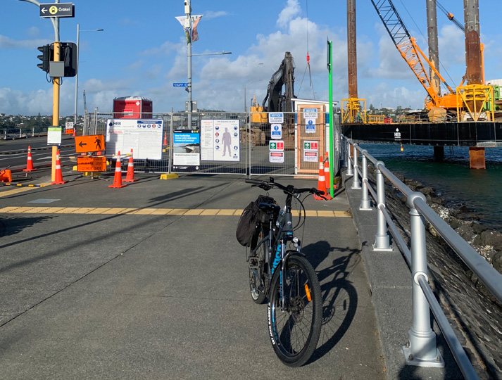
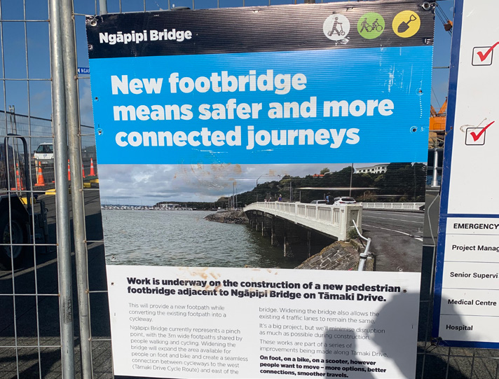
We are aware of the improvements being made with the new footbridge being built. It will eventually connect with the last stage of the Glen Innes to Ōrākei cycle path. However, it does put off adaptive riders when maintenance and detours are such a key component to a commute. Often deviations are oriented towards those who can walk and get around easier.

As you can see from this image, 1m is not a safe enough width for adaptive cyclists. If we were to meet a cargo bike coming the opposite direction, we could easily clip each other.
The section of cycleway around Kelly Tarlton’s highlights confusion for cyclists. The on-road painted cycle lane vanishes and crosses on and off busy footpaths. As it’s a busy road and a popular tourist attraction, this area needs to be addressed for cyclists in general.
Below is another designated on-road cycleway that appears, then comes to an end. Someone cycling from Mission Bay to the city has a choice to carry on along the shared path using the area marked out by a white line or to cross to the other side. However, there is no crossing here and no signage indicating that a painted cycle lane is available across the road.
Closer to Mission Bay and St Heliers, the congestion on the shared path becomes quite clear. Foot traffic ignores the painted white line giving access to cyclists. Motor vehicles are in constant flow and parked up along the main road. We saw many cyclists choosing the road over the cycleway. The experience is very stop-start and only a two-wheeled bike can hop around pedestrians and built-up traffic.


These kerb separators do not give access to the footpath to those using the roadside parking that have pushchairs, wheelchairs or other types of mobility devices. They also trap wider cycles from exiting the cycle path if they need to. The separators need to be better spaced out, leaving at least 1.5m of access so that all cyclists can exit the cycle path if they need to. As the road is so busy it is important to keep young children safe when exiting their vehicles. A potential solution would be to increase the parent and mobility parks inside the nearby car parking lots themselves.

Parked cars, how do parents with young children and wheelchair users gain entry to the footpath?
4.5 Northwestern cycleway – Point Chevalier to Westgate
Overall, this part of the Northwestern cycleway is accessible to everyone. We noted several pull-off areas available to take a break. The terrain itself is smooth and well maintained and gradients are minimal apart from when you need to turn off the main cycleway to access neighbourhoods and services.
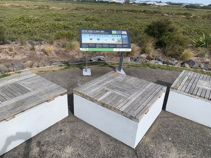


At this rest area there is adequate space to pull over from the cycleway. However, the ability to access the information signage is restricted for wider cycles. The gap from the corners of the two square seats is 830mm and the gap from the seat corner to the sign edge is 800mm. Turning the corner to get around both is narrow and sharp. Because of signage placement, it means even with extra clearance made, a longer cycle would still not clear the box seat corner. There needs to be a more sweeping angle here.
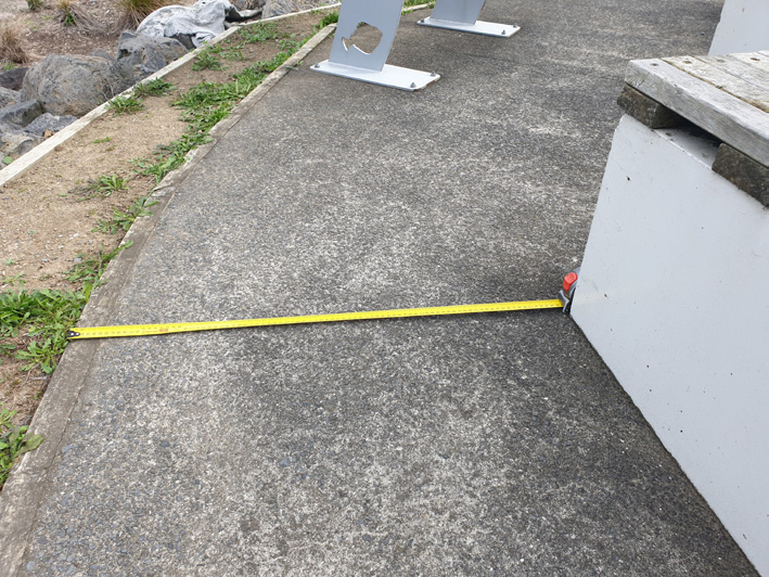
Below is curved seating with a 1m clearance. Signage information is to the side. This access is far better than the previous rest area.
Maintenance
Grasses certainly look attractive but they need to be managed. Below you see grasses overhanging onto shared paths. This causes the path to become narrower in a section where you are reminded to “keep left” of the centre line. Wider cycles need to avoid grass getting caught in their wheels. Hand-cyclists also need to avoid areas like this as grasses are notorious for getting caught up in mechanisms.
4.6 Northwestern Cycleway – City to Point Chevalier
Corner of Upper Queen and Canada Street
Heading up from the Pink Path to continue onto the Northwestern cycleway, you come up to a corner. This corner presents a few imperfections, with the camber and a sunken drain resulting in an area which could trap wheels and cause a trike to tip over.

Coming up from the Pink Path, this corner poses dangers for the majority of non-standard bikes. The camber and imperfections cause tipping.
Pinch point diversions
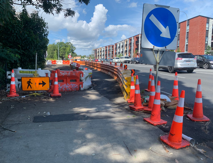
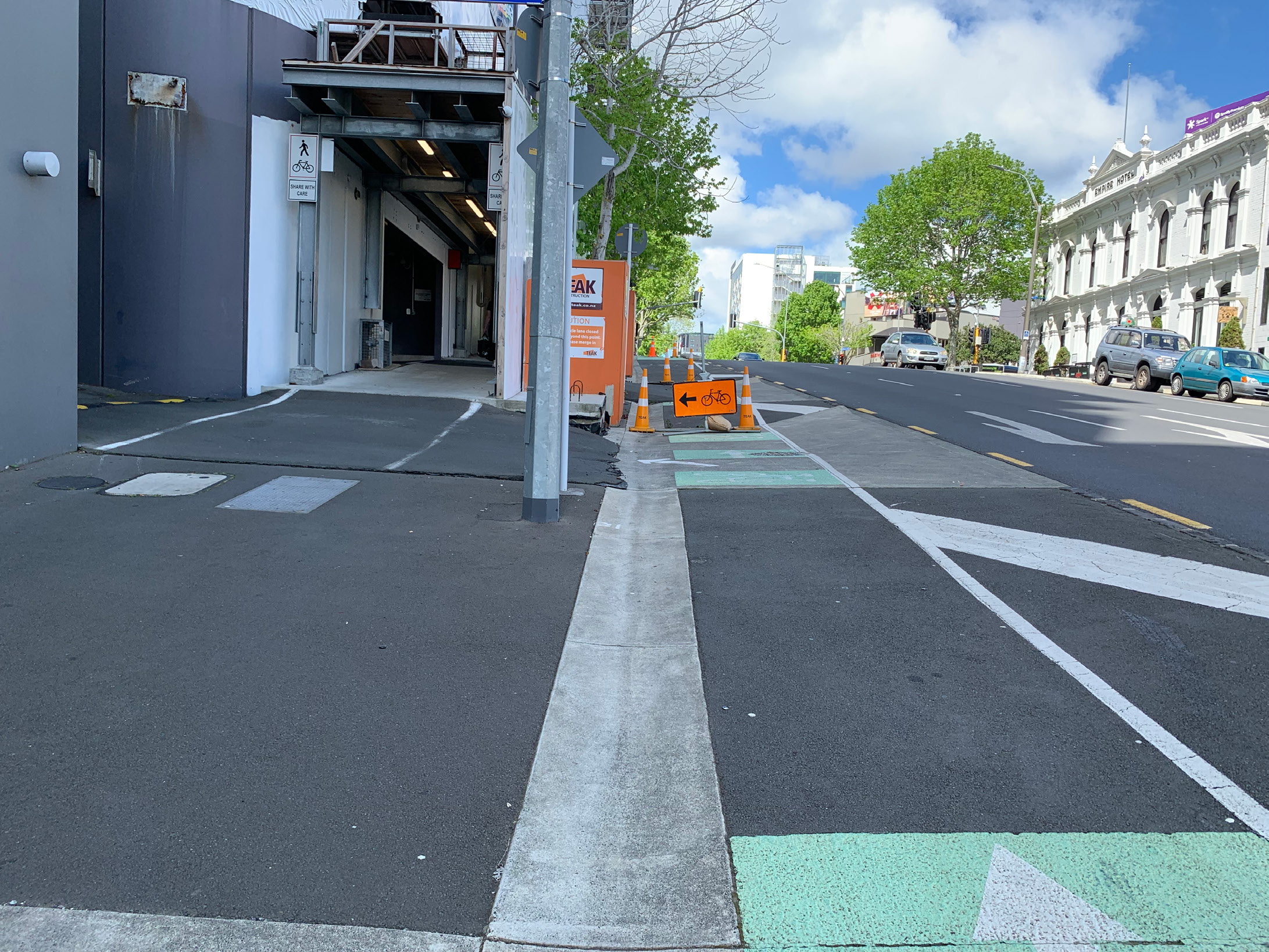
This maintenance deviation along Nelson Street at the turn off to Vogel Lane creates a series of obstacles for a non-standard bike or cycle to overcome. It is not only a hard left turn, but the drain channel along with the camber and terrain changes create a tipping hazard for a tandem wheelchair bike and trike. It is also difficult to see what might be coming down the covered alley. Many cyclists would dismount here, which is not possible for many riders with mobility impairments. Nelson Street is also a steady climb up through the CBD with minimal flat areas to take a rest. This deviation has been active for a couple of years.
Sharp transition from footpath to cycling on-road
Two examples of transition switching from one street cycle lane to the next. They both have challenging angles to access them.

The quieter section of cycleway
Once out of the central city, the Northwestern cycleway turns into a series of quieter paths, some shared and some dedicated to cyclists. Apart from some busy areas where foot traffic is high and gradients steep, the team found this stretch quite accessible.


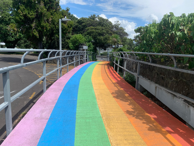
Rainbow Path
The Rainbow Path is a good location pinpointed as it appears on every map published, and on signage in the area. Our only concern with it was that it was too short. If you really want to see it, go on for longer. The blind corner with gradient posed a slight pinch point as it’s often a busy stretch of path.
5.0 Access to recreation
– playgrounds, picnic areas and beaches
Is the recreation along our cycleways inclusive?
In a nutshell, not really. We have a long way to go in Auckland. However, the conversation is beginning to happen. In New Zealand, we are still only looking at accessibility; that is, a path that can get you to your destination. What we all need to do is consider inclusion, then accessibility becomes a given.
- What can we do once we arrive at our destination?
- Can we sit at that picnic bench if we are in a wheelchair?
- Can a child using a mobility device or with vision impairment play and communicate alongside their peers?
- Are there suitable fully accessible public toilets available in case I need them?
- Is there a car park where I can offload my gear and leave my car?
- How about parking my wheelchair while I go for a ride on my recumbent cycle?
- Is the beach accessible for me?
All the above questions are basic considerations that our communities expect to see. Just imagine if society designed a built environment that took away those questions. Considering inclusion is the way forward in getting more people with disabilities out and about. This is why the team decided to review the recreation along the cycleways and include it in a chapter. Internationally, access and inclusion is considered an important way forward in designing urban environments that cater for all people no matter what their disability is. There is a saying within the disability community …

5.1 Pakuranga Rotary Path – Farm Cove
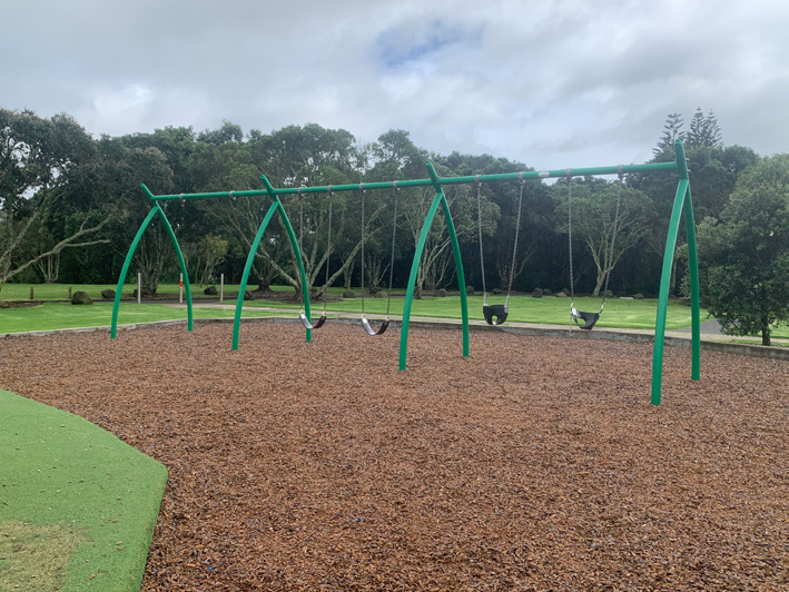
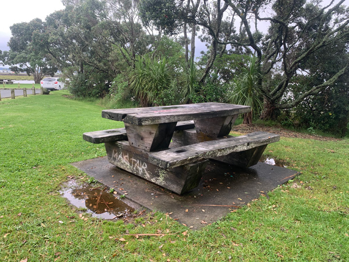
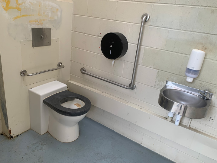
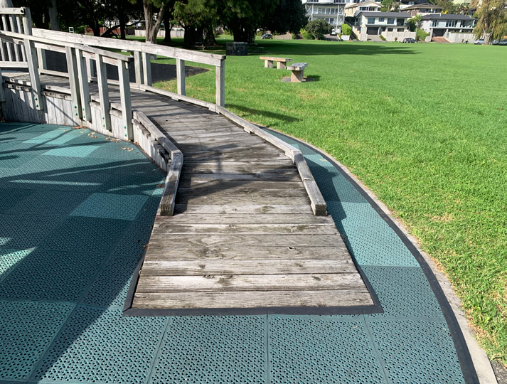
Farm Cove is a good place to park up, with plenty of mobility parks on offer. The facilities are pretty standard when it comes to accessibility; there isn’t a lot of inclusion happening. The snakes and ladders themed playground has to be the most inaccessible playground you can get. It offers no inclusion, nor does the design of the picnic benches. Beach access is possible depending on the tide and whether you have the wheels to take on the sand. The public toilets are universal (meaning for use by everyone) rather than being a dedicated accessible toilet. The majority of accessible toilets lack the space to have anyone inside to assist. This makes them only accessible for those able to use a toilet independently.
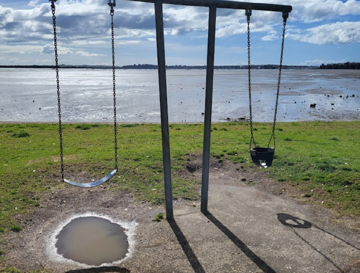
Playground
- No accessible swings
- No inclusive play elements
- Terrain is complex
- Bike parking is only suitable for two-wheeled bikes.
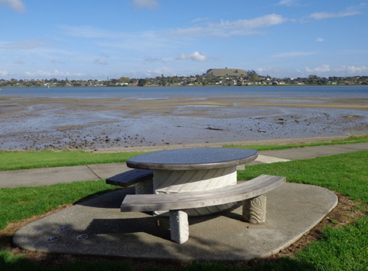
Picnic areas
- Wheelchair users sit away from table
- Concrete pad too small
- No path access: Grass terrain, only accessible if firm and dry.

Public toilets
- Universal, no dedicated disability toilet
- No toilets available for those who are needing assistance.
Mobility parks
- Plenty of parks
- Good flat sealed terrain.
There is another playground at the end of the Pakuranga Rotary Path at Prince Regent Drive. This playground offers no accessibility or inclusion due to a wall keeping the bark chippings in. The play elements themselves have no inclusion at all. This playground is a relatively older design, which is often the case.
5.2 Waterview Path – Eric Armishaw Reserve
Cycling is a recreation in itself and a lot of our cycling network takes in a lot of our scenic areas such as reserves, playgrounds, waterfronts and picnic areas. Cycling to these places is a healthy activity which is fun to do with families and friends. So, what happens if you are someone unable to walk, but are out cycling with your family and friends? Here is a snapshot of the barriers many people with mobility challenges face when getting out and about.

A simple playground with a retaining wall around it to keep bark chips inside.
- Wheels can not enter
- Bark is a barrier to wheels
- There are no inclusive play elements to experience
- Disability becomes a spectator.

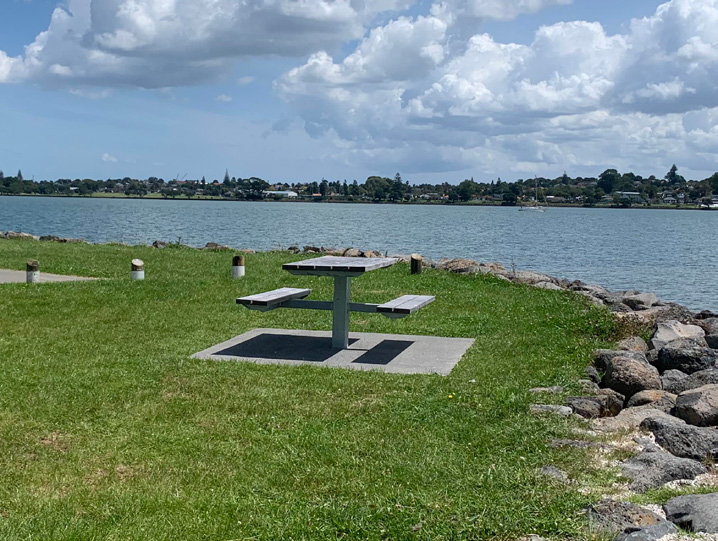
A simple picnic table area with no path.
- Wheels cannot enter
- Grass is sodden, concrete platform too small
- No space at bench for a wheelchair user to engage in conversation
- Disability becomes a spectator.
Mobility parking
- No transfer spaces
- No dropped kerb to give access to beach or picnic benches
- Disability becomes a spectator.

Public toilets
- What if a stroke left you paralysed down your left side?
- What if you are unable to self-transfer?
- Maybe you need more space for someone to assist?
Solutions do exist and they do not need to be expensive. We need to consider starting with our destinations by making them as inclusive as we can. Starting this at the design phase is a lot cheaper than retrospection at a later date.
A great resource has been put together by the New South Wales Government, ‘Everyone Can Play’, which provides some excellent guidelines on how to create inclusion in our playgrounds.
5.3 Glen Innes to Ōrākei
Non-standard bike parking (lock ups)
Solving non-standard bike parking systems are still under review. Wheels for Wellbeing’s ‘A Guide to Inclusive Cycling‘ has considered some solutions. The infrastructure for the heavy e-bikes is only just starting to come in. Transport for London has brought out an in-depth Workplace Cycle Parking Guide, however, there is no guidance in it around locking up non-standard bikes. Looking at what is available today around Auckland, there is minimal space to lock up a non-standard bike. These cycles require more space.

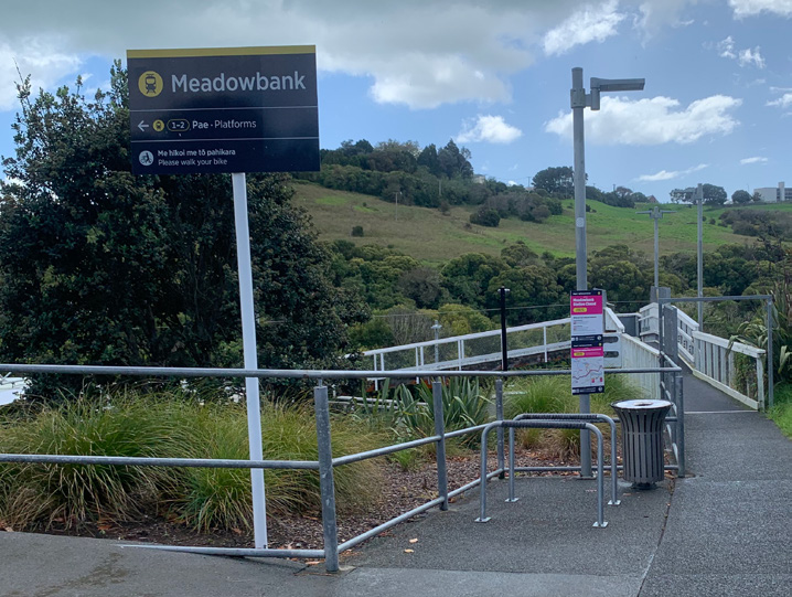
Mobility parks are always challenging for their users. However, when you see new ones like the two at Ōrākei Train Station springing up, there is cause to worry. Both are not fit for purpose as (a) there is no safe transfer clearance for independent wheelchair users, (b) hoists block access to the footpath when let down, and (c) they are simply too small and narrow.

The team popped into Glen Innes Train Station to check out the public toilets. The angle of the entrance along with the circulation inside would never be accessible for a recumbent cyclist. Only a recumbent rider able to dismount would be able to use these bathrooms, for example, a recumbent cyclist using feet to pedal.
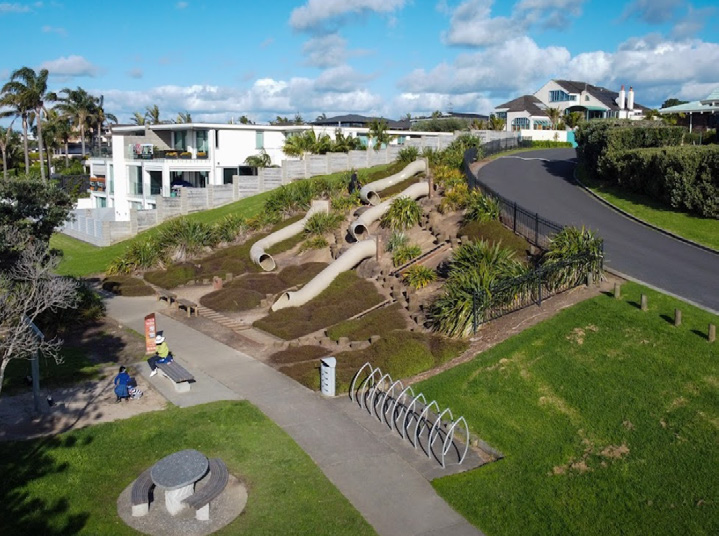
Playground at Tahapa Reserve
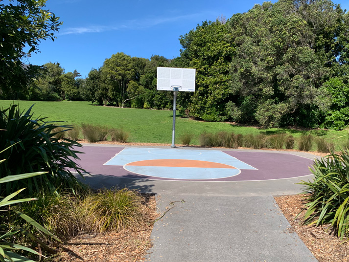
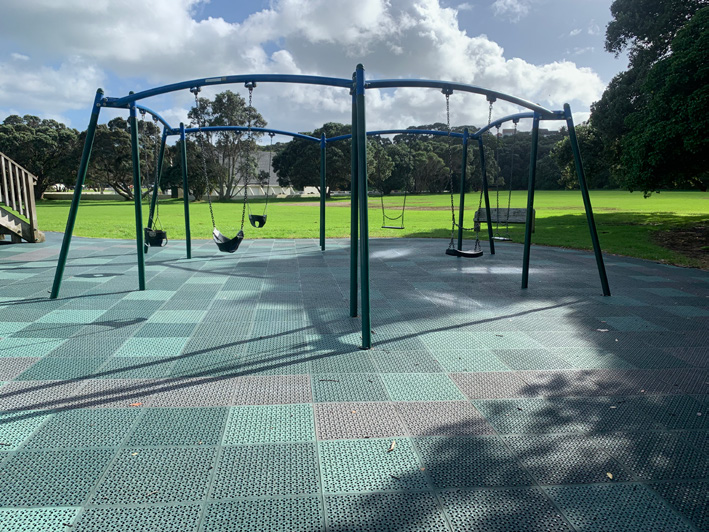
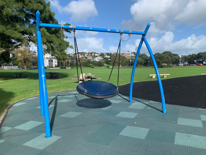
The playground at Tahapa Reserve is a newly developed playground. It is a great example of considering accessibility, but not inclusion. The bark chippings make a barrier to inclusion for those getting around with mobility devices – wheelchairs or walkers. The bench seat set on concrete has no space for a wheelchair to sit alongside; they would have to block the path instead. There is a basket swing which is considered as an inclusive play element, however, this one is a rope netted variety that would need something softer to lie or sit on. The basketball court is accessible however, at a height for children.

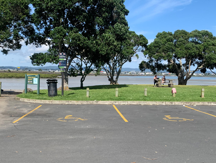
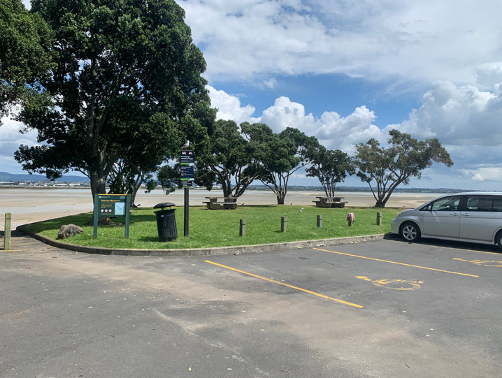
5.4 City to Bays – Ōrākei, Okahu Bay
Parking is a challenge for everyone, but what if you have a disability?
Along this stretch of cycleway, the team parked close to the Ōrākei playground in front of Okahu Bay. This area seems to be quieter and free of parking meters. The team need space to transfer into their cycles and try to avoid places where mobility parking could be abused or potentially not up to standard. Many of our mobility parks do not have the essential space to transfer from both sides of the vehicle. This means if you are the driver needing to transfer, then you want transfer space on the driver’s side. If you are trying to get your adapted cycle out of the back of the car then you need safe space to gain access to it. This makes your search for a mobility park even harder to meet your access needs.
If you are driving a longer, high-top van with a rear entry hoist, you are even more limited. Many parks are not long enough and transfer has to happen onto the road, blocking traffic. You are also unable to use any side parking along a road in case someone parks too close and blocks the hoist coming down. There are many factors to consider when parking, especially when you need to transfer into a non-standard adapted cycle from a wheelchair.
After parking up to access, we took a look at the Ōrākei playground for access and inclusion. We then crossed over Tāmaki Drive to Okahu Bay to access the cycleway. Okahu Bay is not accessible, however the playground is.


What makes this playground accessible?
Firstly, the rubber crash surface and the concrete path leading right onto it without any steps or wall. The fact this playground has not used bark chippings allows parents in wheelchairs access to their own toddlers in the playground.
Is the playground inclusive?
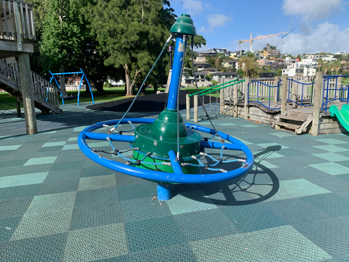
Inclusion has crept in a little around this playground. There is a ramp that allows access to the slides, although not all of them. There is a basket swing available if a caregiver is able to lift someone into it. The climbing fort is not accessible, so fails on inclusion. The ‘spinning element’ offers some inclusion, but would certainly exclude some children from using it independently.
6.0 Key findings
– gradients, crossings, inconsistency and protected cycleways
Gradients, crossings, inconsistency and protected cycleways
Auckland’s terrain is far from flat, so developing a cycling network that works for everyone is going to have its challenges. Riding a standard bike as a fully fit and able person is a whole different experience to riding a non-standard cycle with physical challenges. This is where e-assist and power can overcome many of those physical challenges.
Snapshot of cycleways reviewed
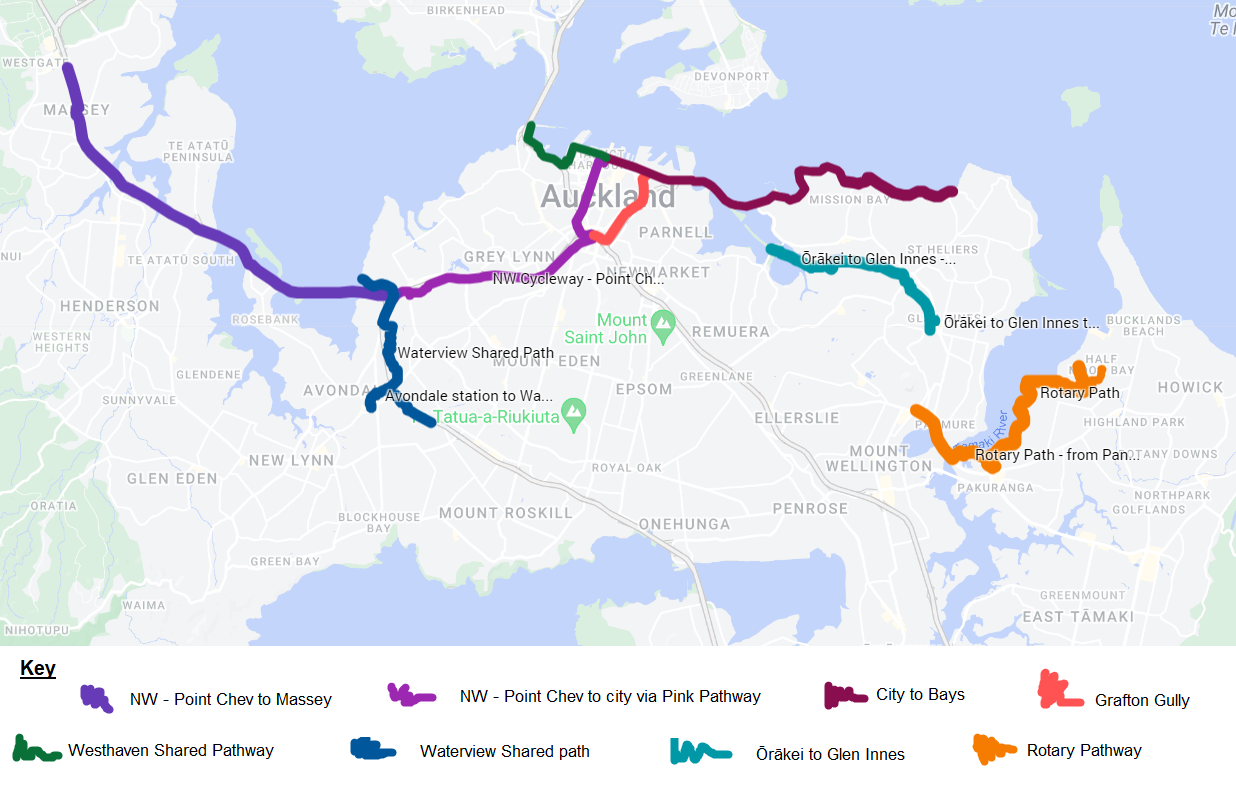
The adapted cycling audit team put together a snapshot around their cycling experience along key cycleways in Auckland. By using this matrix and star rating the team can produce a snapshot of which cycleways are delivering on inclusion and which are not. It also allows you to follow down columns to see what the deficits are if the cycleway scored poorly. Clicking the tables below will open them in a new tab, enabling you to zoom in!

6.1 Gradients
Much of the city end of the Northwestern cycleway is plagued by gradients, cambers and inconsistency. The gradients in particular are challenging, even for the standard bike rider. This was evident by the number of riders witnessed walking up many of the gradients along this route, the Grafton Gully and Ian McKinnon Rise being particularly challenging. You have to have a good level of fitness to be able to take on these climbs using a manual bike or trike. These gradients are challenging for riders unable to dismount and walk up. The Grafton Gully, in particular, has caused wheelchair users with power attachments to run out of steam. Battery strength and range will feature high for power-assist riders.

Gradients were also a key challenge along the new Glen Innes to Ōrākei dedicated cycle path. The gradients were challenging for the tandem wheelchair bike here, as it’s manual, relying on one rider’s pedalling strength. What makes these gradients suitable for other mobility impaired cyclists is the gradient signage, the even terrain and the level rest areas during steady climbs.

On reading the information put out by The Climbing Cyclist, which refers to gradients for the standard bike riders, it is interesting to see their definition of what it’s like to tackle a certain gradient percentage.
An introduction to gradients and standard cycling
| Gradient % | Cycling Challenge with Standard Bike |
|---|---|
| 0% | A flat road. |
| 1-3% | Slightly uphill, but not particularly challenging. A bit like riding into the wind. |
| 4-6% | A manageable gradient that can cause fatigue over long periods. |
| 7-9% | Starting to become uncomfortable for seasoned riders, and very challenging for new climbers. |
| 10-15% | A painful gradient, especially if maintained for any length of time. |
| 16% plus | Very challenging for riders of all abilities. Maintaining this sort of incline for any length of time is very painful. |
The descent into the city along Nelson Street has a particular camber that makes the tandem wheelchair bike feel unstable. It was important to make sure brakes were fully primed before arriving at the Nelson Street and Fanshawe Street intersection. The steep gradient versus the weight of the two people riding needs careful consideration. A companion on our ride using an e-scooter found their brakes were not as efficient as they would like in this location.
6.2 Inconsistency
The cycle lanes within the city are inconsistent in design, making them difficult to navigate at times. Adding further to this, is when a bidirectional (two-way) cycleway changes to unidirectional (one-way), stops altogether, or turns up on the opposite side of the road. There is also constant maintenance along these routes prioritising deviations to vehicle and foot traffic. Cyclists are often left with a sign placed on the cycle lane informing them that that the lane is closed with no alternative route. For someone who rides lower to the ground, these inconsistencies can creep up without notice. Dismounting and walking is not always possible for people using a cycle as a mobility device. Clearly painted cycle paths help guide cyclists to where they need to go.


6.3 Protected cycleways
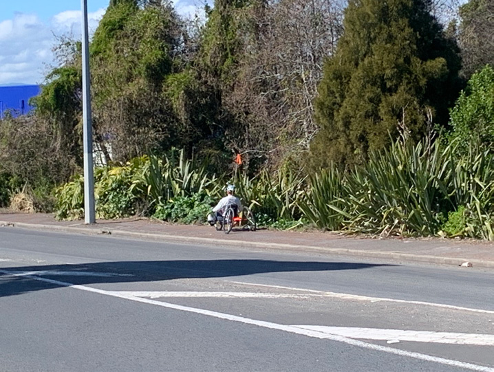
John Lyall is a recumbent rider who uses his legs to pedal. He is able to stand up and walk around with the help of sticks or a trolley. He cycles every day to get a coffee with friends and to do some shopping. He cycles for the exercise and prefers to ride on the roads at the same speed as the traffic. He chooses to ride on the roads locally because sections of cycleway are not wide enough. In places, a cycleway hardly exists. He doesn’t wish to use the dedicated shared cycle paths, as most of them are away from shops. He also mentions that if he was to have a puncture on one, it would make it harder to get help.
John is an exception when it comes to most adaptive riders. John is a keen rider who feels comfortable on his local roads and enjoys the commute. Many recumbent riders we spoke to avoided the roads entirely. To empower more recumbent riders to get out and about we need more accessible and inclusive cycleways.
For recumbent riders like John, we need wider protected cycleways which are more connected to local shops and amenities, and which are consistently available along the route.
We need consistent, protected cycleways alongside all arterials, allowing for one-way
2m widths, or two-way 4m widths space to include all riders.

Riding on the footpaths
According to Auckland Transport’s Cycling Safety Guidelines, riding on the footpath is not legal unless you’re delivering mail or on a bike with wheels less than 355mm wide. Anyone biking on a footpath should look out for cars pulling out of driveways and be considerate of pedestrians.
If cycling on a footpath is illegal then why do so many of our on-road cycle lanes, shared paths and protected cycle lanes lead onto footpaths? Footpaths are at capacity, they share space with driveways, trees, signage, power poles, street lights, rubbish bins and quite often parked cars. We need to avoid using the footpaths and provide a separate, safe, consistent space for all active mobility. The minimum width of 2m (one-way) is essential for all active mobility to co-exist. It needs to be separated from both vehicles and foot traffic.
To ensure that cycleways are a comfortable and inclusive width, space can be reallocated from the road corridor (eg. the median) where possible. The team identified 0.5m-wide concrete separators being fitted as safety buffers between new on-road cycleways and traffic. When road space is constrained, do the separators need to be so wide? Being flexible about reallocating road space and allowing for narrower separators when required will enable the cycleways to be more consistently the desired width of 2m or wider.
6.4 Summary of What We Want to See
Signage and wayfinding
- Signage not just aimed at walkers and regular cyclists
- Signage at a level where recumbent riders can see it (lower down)
- Signage indicating the flat, easy to pull off, rest areas
- Earlier warning around path closures
- Good signage design (contrast colours)
- More mirrors used on blind corners.
Access to the cycle path / cycleway itself
- Mobility car park spaces nearby to transfer in/out of vehicles and wheelchairs
- Dropped kerbing that allows space for adaptive cycles to enter/exit a cycle path
- Safe access to public transport and enough space provided on board (i.e. ferries, trains).
- Bollards and staples (often seen at 1m clearance) need to be at a minimum 1.5m clearance to allow for wider cycles.
Space
- For shared paths ideally a 4m width or 3m at minimum (as per the Auckland Transport design guide).
- For protected cycleways, ideally a 2m width for unidirectional, or a 4m width for bidirectional
- Enough space for adaptive cycles to turn around, ideally 5m.
Inclusive recreation at destinations
- Ability to enter a playground (no walls/bark)
- Space around picnic tables for wheelchairs
- Inclusive play equipment
- Accessible public toilets
Maintenance
- Detours/alternative routes/mitigation that allows for wider and longer cycles, not just walkers/two-wheeled bikes
- Keep trees, bushes and grasses trimmed back from cycleways, to minimise risk of wheel entrapment.
Gradients
- Clear informational signage around gradients to allow adaptive riders to anticipate the effort needed to take on the inclines.
Consistency
- Consistency in design where possible, continuation of cycle paths (not changing sides of the road, or from footpath to road, then disappearing, then appearing again on footpath).

7.0 References
- A Guide to Inclusive Cycling by UK disability advocacy group, Wheels for Wellbeing
- The Official New Zealand Code for Cyclists 2020 by Waka Kotahi NZ Transport Agency
- Everyone Can Play – A Guide to Creating Inclusive Playspaces by the NSW Government
- [1] From the P42 Cycle infrastructure design by Department of Transport UK
- [2] From A Guide to Inclusive Cycling by Wheels for Wellbeing
- [3] From A Guide to Inclusive Cycling by Wheels for Wellbeing
- [4] From Cycleway User Dimensions (Figure 6.1.3) by Sustrans UK
- [5] From The joy of riding uphill & a guide to Victoria’s best climbs by The Climbing Cyclist