Auckland’s North Shore can sometimes feel like a cycling desert, with ordinary folk on bikes gasping from oasis to oasis across unforgiving gaps, and occasionally finding the well has run dry completely. Of course, springs of hope are constantly bubbling up to nourish the soul – not least our excellent burb groups, the original Bike Devonport, feisty newcomers Bike Kaipatiki, and fresh-faced Bike Albany (who have a shared lunch this weekend, if you’re nearby). But it can be pretty parched out there.
Which is why it’s fantastic to see the proposed Northern Corridor Improvements poised to deliver a whole new watershed of cycling potential. What the NW cycleway has done for the west and GI-Tamaki will do for the east, this will do for the Shore. Streams, indeed rivers of people on bikes!
We reported on the early shared path designs last August – including a firm request for more motorway crossings – and the refined plans are now up for public consultation, with feedback welcome until 8 July 2016.
HERE ARE THE PROJECT DETAILS AND LINKS FOR FEEDBACK
Here’s the official leaflet (PDF): Northern Corridor Improvements – Newsletter
And here’s the guts:
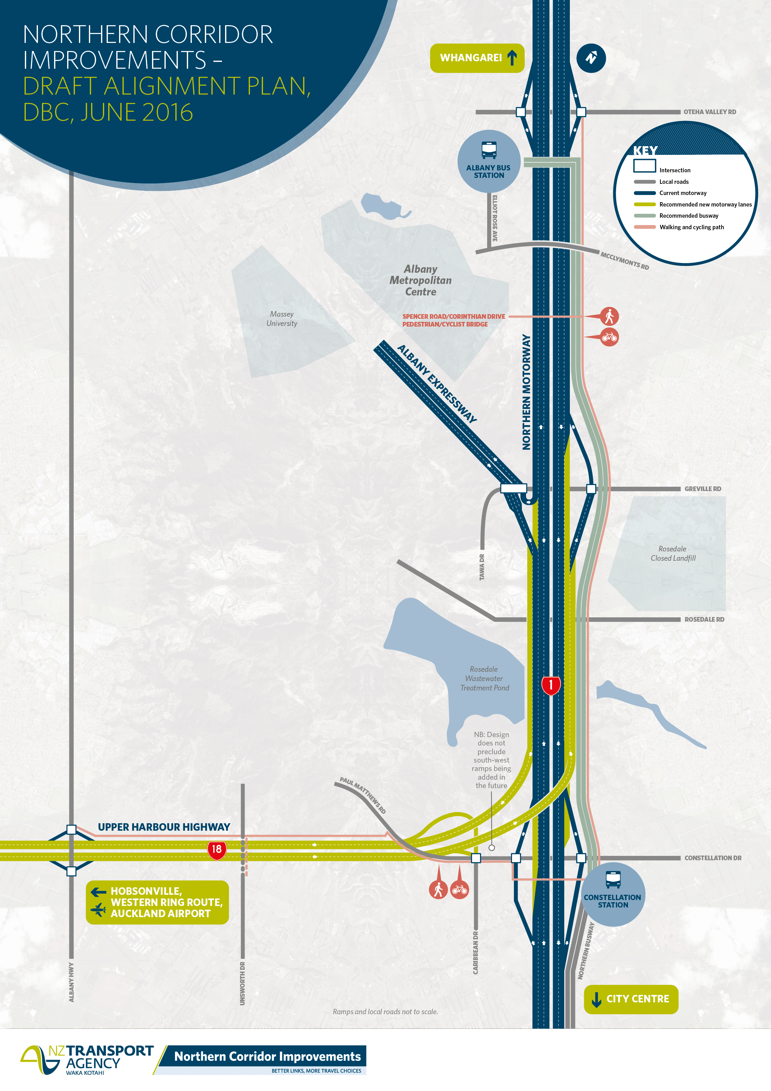
A new 5km shared walking and cycling path alongside the Northern Busway and SH1 all the way from Oteha Valley Road down to Constellation Drive and then across and along SH18, joining up to the new cycle path on Albany Highway.
The first proposed connection will be the Spencer Road Bridge – a new pedestrian and cycle bridge across the motorway, connecting Pinehill and East Coast Bays residents with the Albany metro area and offering great views of Auckland and Rangitoto
This map shows the shared path and new bridge, in pink:
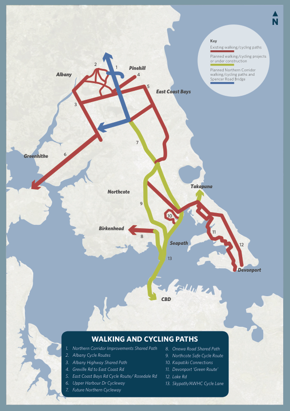
And here it is again in blue, showing how the new paths will fit in to the larger walking/cycling network, both existing (red) and proposed (green):
Right. Feedback time. How would you use these new paths? Where would you go? To Rangitoto College, or Massey-Albany uni? To the mall? To bus stations (including the potential new Rosedale station)? To sports, including North Harbour Stadium? To SeaPath, and heck, eventually across Skypath right to the CBD?
The official survey would like to hear your thoughts on these questions:
- What features would encourage or discourage you to use the new shared paths and bridges?
- Where would you like to see other connection points to access these new walking and cycling paths?
- Where would you like to see more locals paths?
- What issues or opportunities are associated with the Spencer Road Bridge?
It’s really important to have your say – not just if you cycle already, but also if safer paths might make you more likely to go by bike. And we’re eager to hear your ideas below, so we can add them to our official feedback.
Need more context? There’ll be an info booth on Sunday June 19 2016, all day in the centre court at Westfield Albany, and further public outreach to come.
To squeeze the last drops out of our original metaphor, adding these pathways along SH1 and the Upper Harbour Highway will be like installing canals through an active-transport desert… enabling a steady flow of walkers and cyclists alongside our ever-growing and often sclerotic motorways.
By adding walking and cycling at the ground level, NZTA is proving it’s not just a motorway builder, but truly a full-spectrum transport agency.
Let’s get cracking with the support, and make this the best it can be. Here’s that feedback link again!
PS Of course, NZTA can only do so much within their corridor, so we’re very glad to hear that ‘Auckland Transport is also investigating what other routes could be prioritised in the area to form a comprehensive network.’ Smooth motorway routes for bikes, more protected on-road cycling for local trips, and a whole lot of plain sailing through greenways via quiet streets and parks? Sounds like a long cool drink of water to us!