Local bike advocates explain why proposed Plan Change 121 would be bad for walking and cycling corridors. They also share why it’s a failure to plan for these corridors from Auckland Council.
What is the Karaka Road Precinct?
In the words of the public notice:
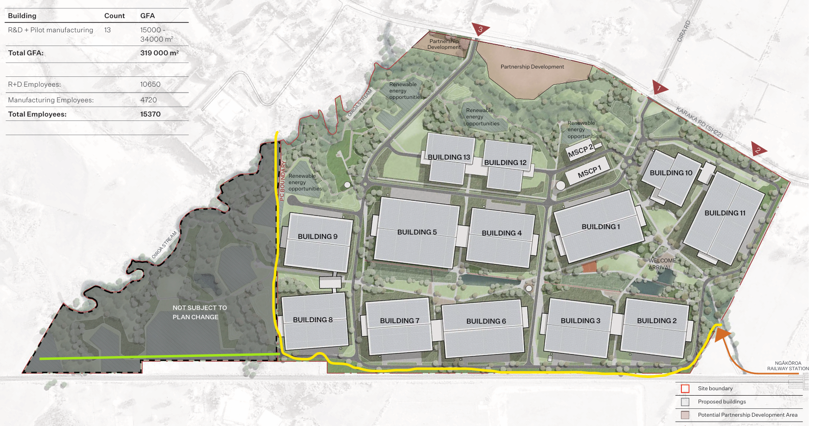
“Plan Change 121 seeks that approximately 86.5 hectares of land be rezoned from Future Urban Zone (FUZ) to Business Light Industrial Zone (LIZ) in the AUP.
“The land comprises 300, 328, 350, 370 and part of 458 Karaka Road and sits between Karaka Road/SH22 to the north and the North Island Main Trunk Line to the south.
“The private plan change request also proposes to introduce a new precinct called the ‘Karaka Road Precinct’ into the AUP to cover the entire plan change area.”
Why is the Karaka Road Precinct a problem?
The proposal to go ahead as it is shuts down any option for an active transport corridor between SH22 and the Kiwi Rail Corridor.
“This is not future based planning to be proud of,” say local advocates.
“We want the plan to be amended so that at the east end there is a legal public access connection to Ngakaroa Station. There is legal public access through Fisher & Paykel Healthcare land for walking and cycling. At the western end there is a connection out through the part formed and part unformed Woodlyn Drive. Ideally there would also be a legal public access corridor next to the North Island Main Trunk Line.
“Overall this is an example of how Auckland Council needs to have better planning processes in place to help better Active Corridor Connections between communities.”
Take 5 minutes to voice your support for public access in the Karaka Road Precinct
Email unitaryplan@aucklandcouncil.govt.nz before 5pm on Friday 12 December.