The Pt Chevalier Streetscape, which has been waiting in the wings for a while, is back out for consultation with a refined design. Public feedback is welcome until Friday 20 December.
Auckland Transport’s project page is here, and a letterbox drop is on the way out to the neighbourhood.
We are very happy to support this design, and strongly encourage you to do so as well. Please tell AT what you like, what you’d improve, and any other suggestions and thoughts. All going well, we could see a great local example of Healthy Streets under way in the coming year and completed in 2021, featuring better biking, walking, and streamlined bus travel for young and old on neighbourhood arterials. This has the potential to be a truly exemplary project.
There’s a lot to discuss, so this won’t be our only post on the project. For now, scroll down for basic info about the design and our initial suggestions for feedback. We’re keen to hear what you think.
Also, public drop-in sessions will be held at the Point Chevalier Library at the following times:
- Saturday 30 November, 10am – midday
- Thursday 5 December, 4pm – 6pm
- Tuesday 10 December, 4pm – 6pm


Background of this project
Originally on the Urban Cycleway Programme for delivery 2015-2018 as part of the strategic plan to build out the central city network and connect the inner burbs, this project has been waiting in the wings for a while.
The last public consultation was in April 2017 (we took a historic perspective and the did the numbers on future impact). In the two and a half years since then, a few things have changed.
For starters, with Auckland officially facing both road safety and climate emergencies, the need for safer and more sustainable travel is impossible to ignore. And local developments underscore the need for more efficient ways to get more people – young and old – where they need to go, around the neighbourhood and beyond.
For example: population-wise, the Unitary Plan and Housing NZ plans for the area open the prospect of more people living along Pt Chevalier Road, while the government is also planning to build thousands of new dwellings on the Unitec site just south of Pt Chevalier.
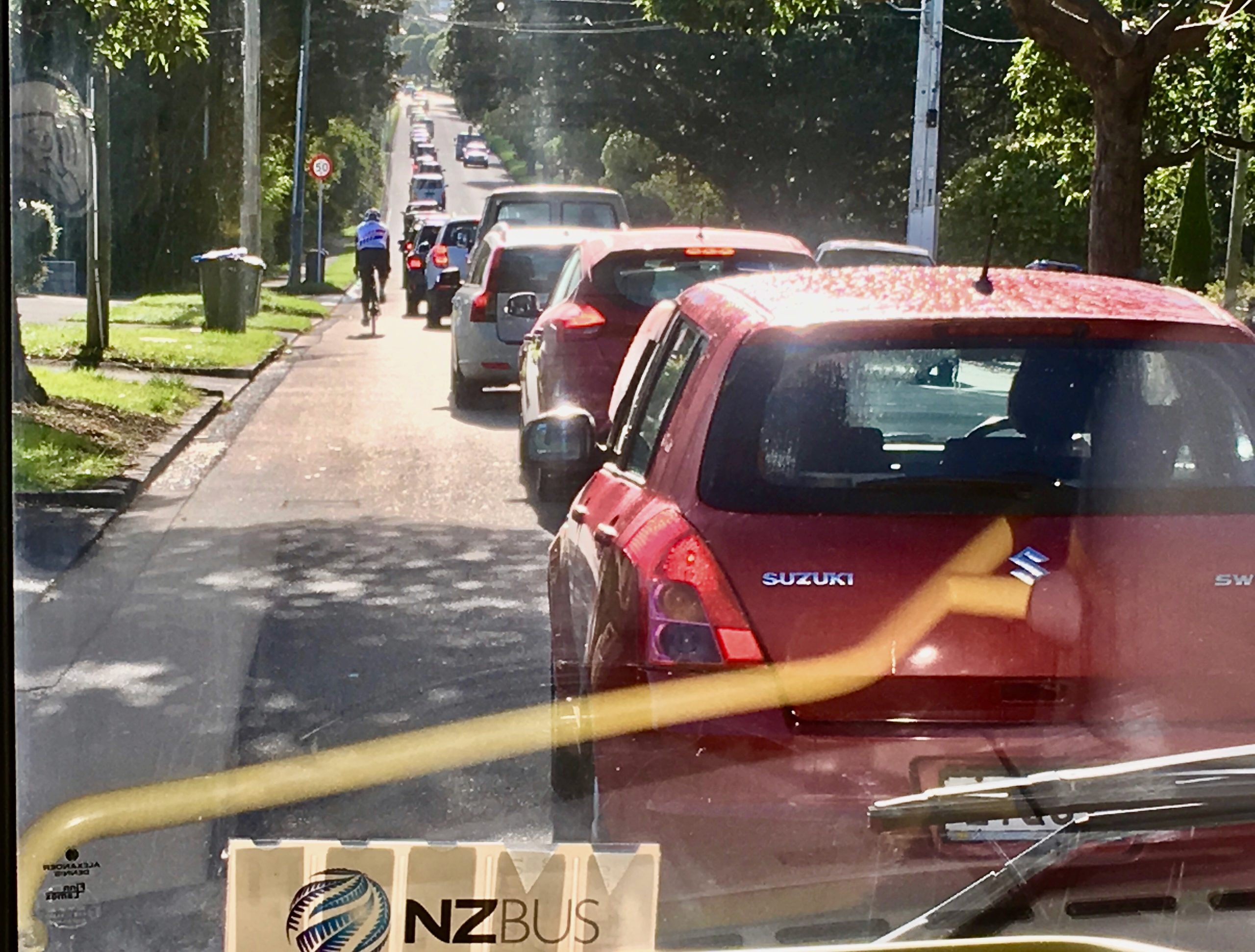
Meanwhile, the opening of Waterview hasn’t reduced traffic on nearby streets; instead, drivers increasingly try to dodge SH16 congestion into the city by detouring via Pt Chevalier Road and Meola Road. This means a relentless stream of through-traffic at peak hours, which overlaps with locals, young and old, walking, scooting, biking to school, shops and work; and full buses crawling along in a queue of largely single-occupant cars.
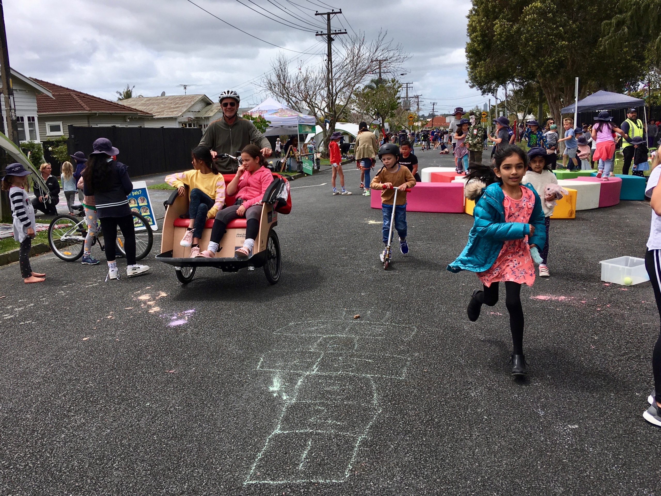
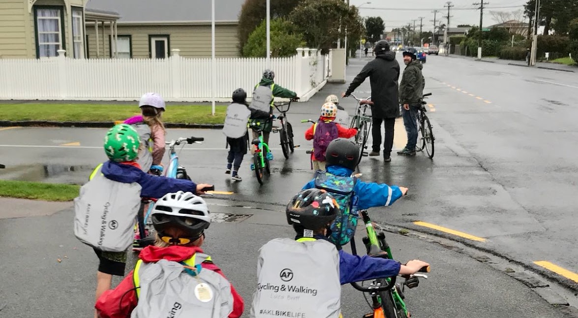
Thankfully, some positive things have happened in the last two and a half years, too. The neighbourhood has an increasing proportion of kids who bike, walk, and scoot to school, mostly riding on footpaths to be safe. Over half of the primary school kids don’t arrive by car, and fully 25% of kids at the local intermediate get there independently by bike – while 80% of Western Springs College students walk, bike or bus to school. Pt Chev is also now home to the city’s first official bike train for the youngest school children.
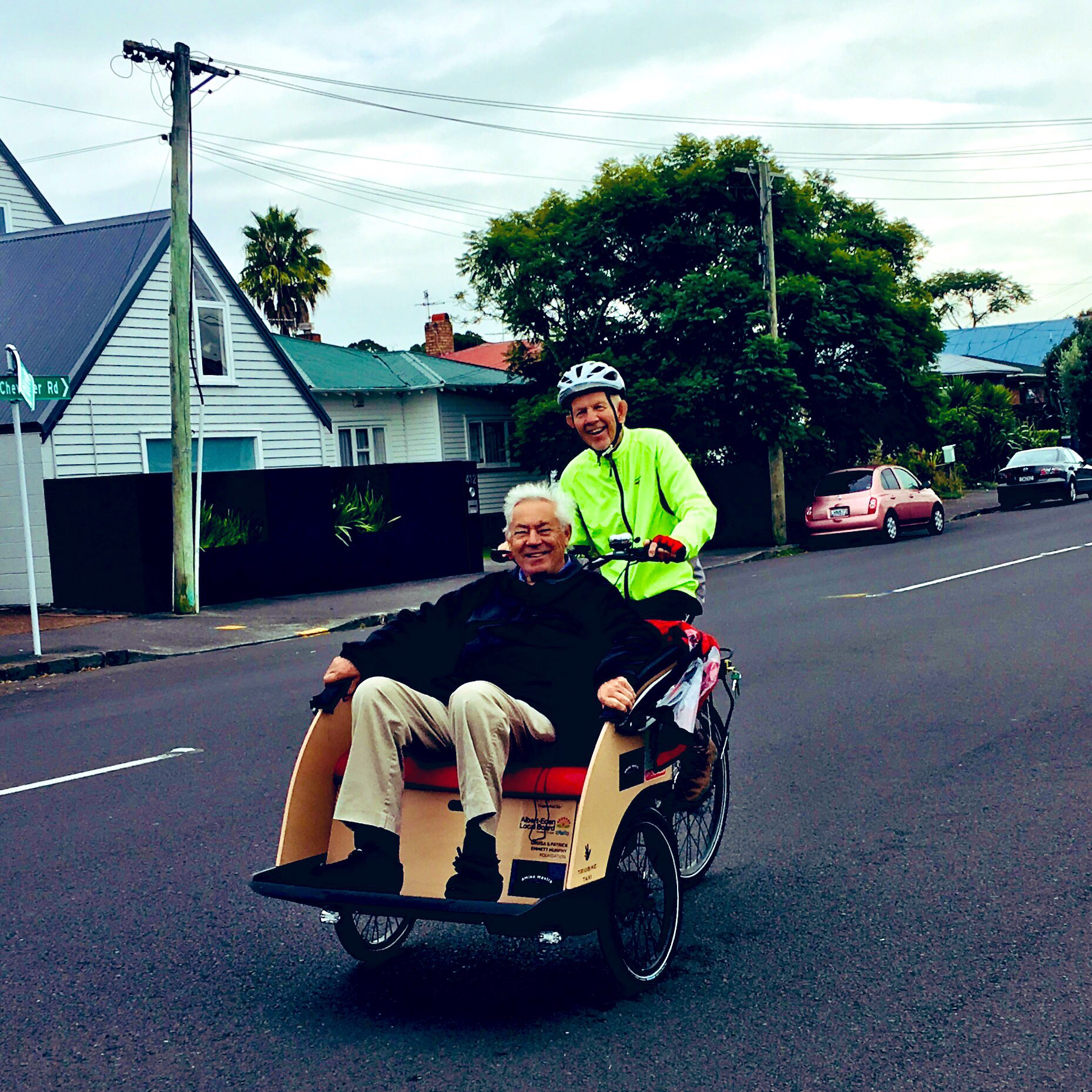
Biking (and increasingly scooting) is an all-ages proposition in Pt Chev . The Cycling Without Age “trishaw” offers the hundreds of retired Selwyn Village residents a chance to pedal around the neighbourhood (usually on the road to keep the footpaths clear).
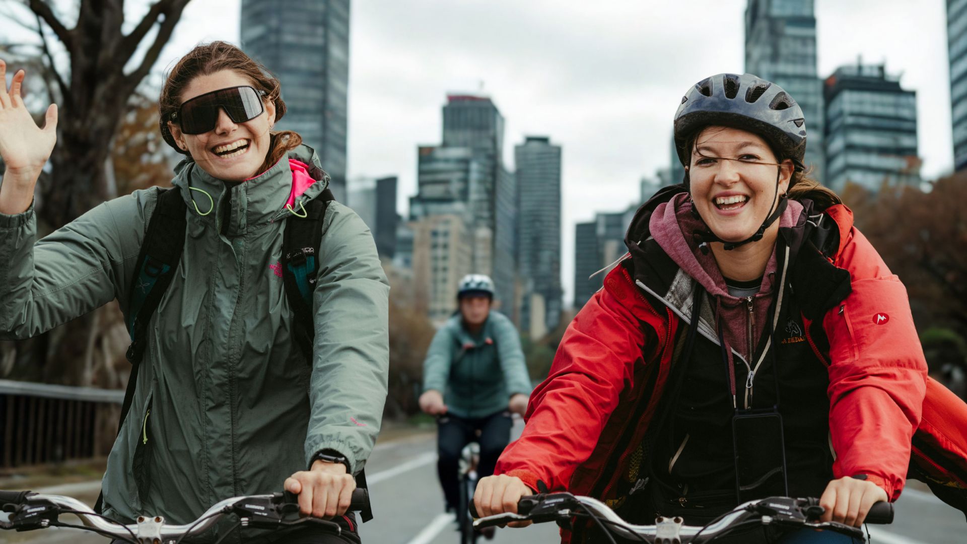
And a rising number of adult commuters use Pt Chev Road (braving the door zone) to get to the nearby NW cycleway, which continues to grow: daily traffic is up by 50% since the last consultation round and has doubled in the last five years.

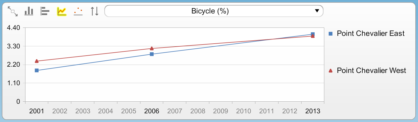
The suburb-wide growth of cycling is hardly surprising, really, when even at the last proper census in 2013, Pt Chevalier already had a far above-Auckland-average rate of adults cycling to work. When people’s propensity to ride meets a connected network – and when parents are confident enough with their own riding to encourage children to ride, too, you see a positive feedback loop.
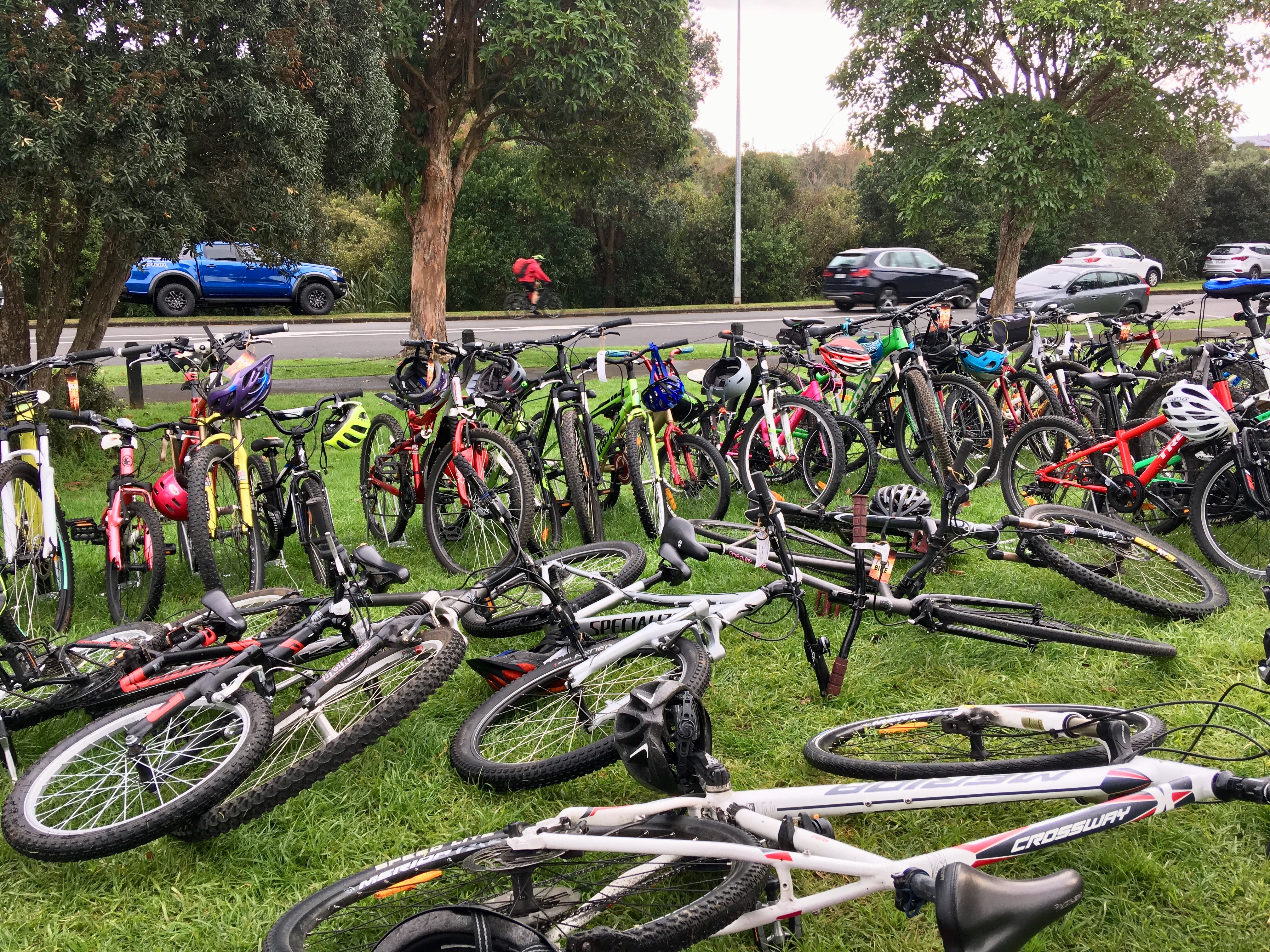
And there’s potential for much faster growth. Recent local initiatives like Bike to Football and the recent Here Comes the Sun play street (see great video here) have revealed heaps of people willing to hop on a bike when it’s made easy to do so, and masses of pent-up demand for a more bikeable, walkable, scootable ‘burb.

When all this enthusiasm meets inadequate infrastructure, the result is that the footpaths on Pt Chev Road and Meola Road are abuzz with people on bikes, scooters, mobility devices from Selwyn Village, wheelchair users, joggers, pram-pushers, and all possible combinations of people of all ages, walking, running and rolling, and accompanied by a variety of small wheels, and four-legged friends.

So the streetscape needs to grow up fast – to accommodate what’s already happening, as well as what needs to happen – and without at the same time making it harder for people to walk. The case for much fairer street space is clear. So, is Pt Chev poised to be one of the city’s first neighbourhoods to actively embrace and reveal the power of “healthy streets”?
What’s in the plan?
Since the original consultation, AT has adopted a whole new design manual for how to build safe and attractive streets that encourage walking, biking, and public transport. Auckland is also now a Vision Zero city, which holds that road design should never trade human life for other benefits. Even without these new formal conditions, lessons have been learned from recent projects, so the new designs have a much greater emphasis on road safety than before, and a much better understanding of how streets work best for people on foot and on bikes.

The project scope covers Pt Chevalier Road from Great North Road to Meola Road, and Meola Road to the Garnet Road roundabout, plus a small extension along Garnet Road to the Westmere shops. It will deliver:
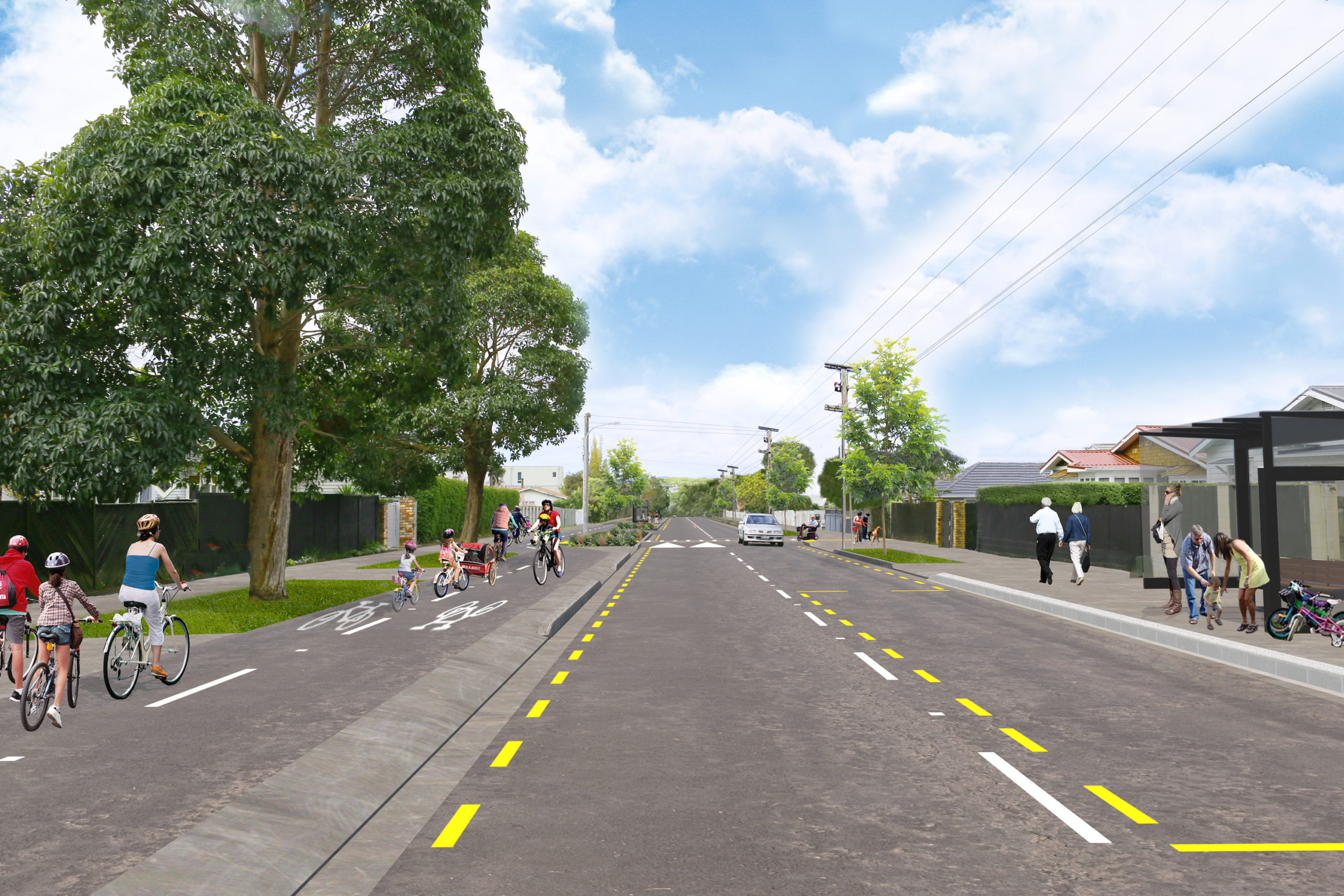
- One-way bikeways on each side of Point Chevalier Road, separated from foot traffic and motorised traffic.
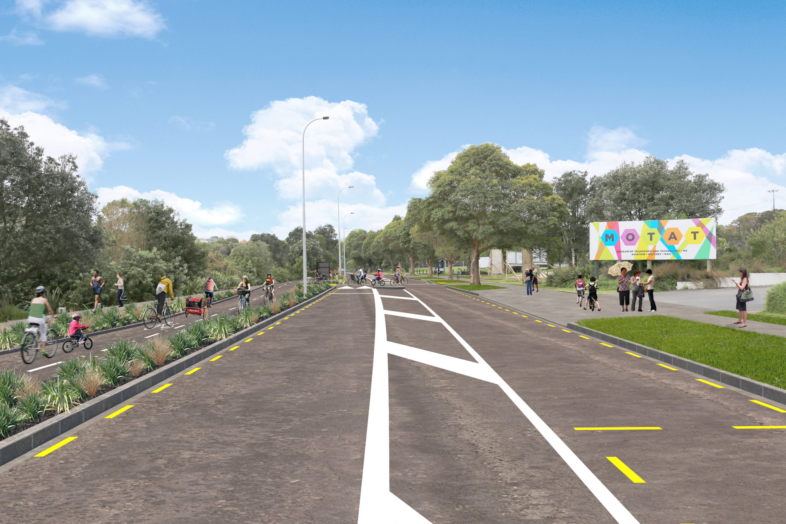
- A two-way protected off-road bikeway along the whole northern side of Meola Road.
- One-way bikeways on each side of Garnet Road between the roundabout and the Westmere shops.
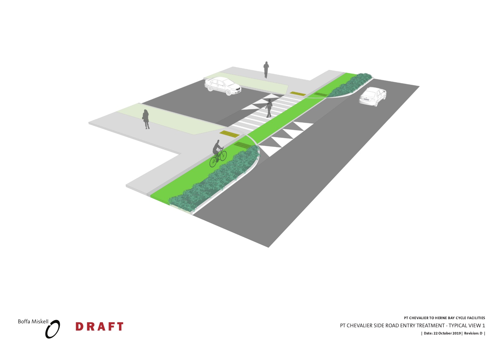
- Raised tables on many of the side streets on Pt Chev Road, Meola Road and the section of Garnet Road between the roundabout and the shops
- Signalising the Pt Chev Road / Meola Road intersection.
- A peak hour bus lane on Pt Chev Road, from just south of Wakatipu St to Great North Road.
- Some bus stops moved and/or combined to align with pedestrian crossings, for better safety.
- Improvements for existing pedestrian crossings:
– Signalising the existing crossing near Tui Street (heavily used by people heading to the shops and families attending St Francis School)
– Adding a raised table to the existing crossing at the tram-stop shops near Walker Road, a key desire line for both shoppers and those catching and changing buses.
– Adding a raised table to the existing crossing on Meola Road, near Walford Road; a key school desire line.
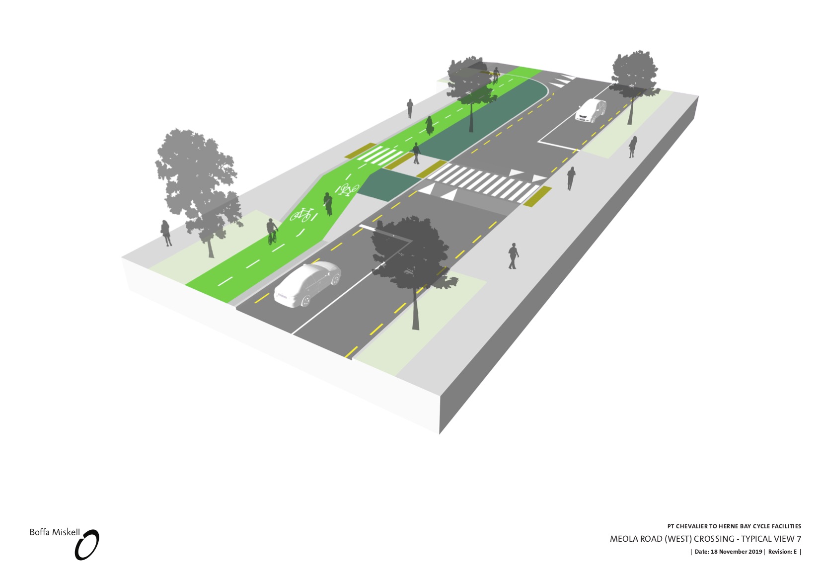
– At the Meola Road Reserve West Entrance, the existing pedestrian refuge will become a raised zebra crossing
– And between the entrances to MOTAT2 and Seddon Fields, the existing pedestrian refuge will become a raised zebra crossing. - New pedestrian crossings:
– Outside 119 Pt Chev Road, near Miller Street, a new signalised crossing for access to and from bus stops.
– Outside 151 Pt Chev Road, near Formby Avenue / Wakatipu Street, a new raised zebra crossing (not signalised), for access to shops and bus stops.
– Raised zebra crossings on all approaches at the roundabout at Garnet Road and Meola Road.
Here are the plans, and below are some cross-sections for those who love dimensions and details, followed by our observations about what each section of the route offers.


Details to note on Pt Chevalier Road
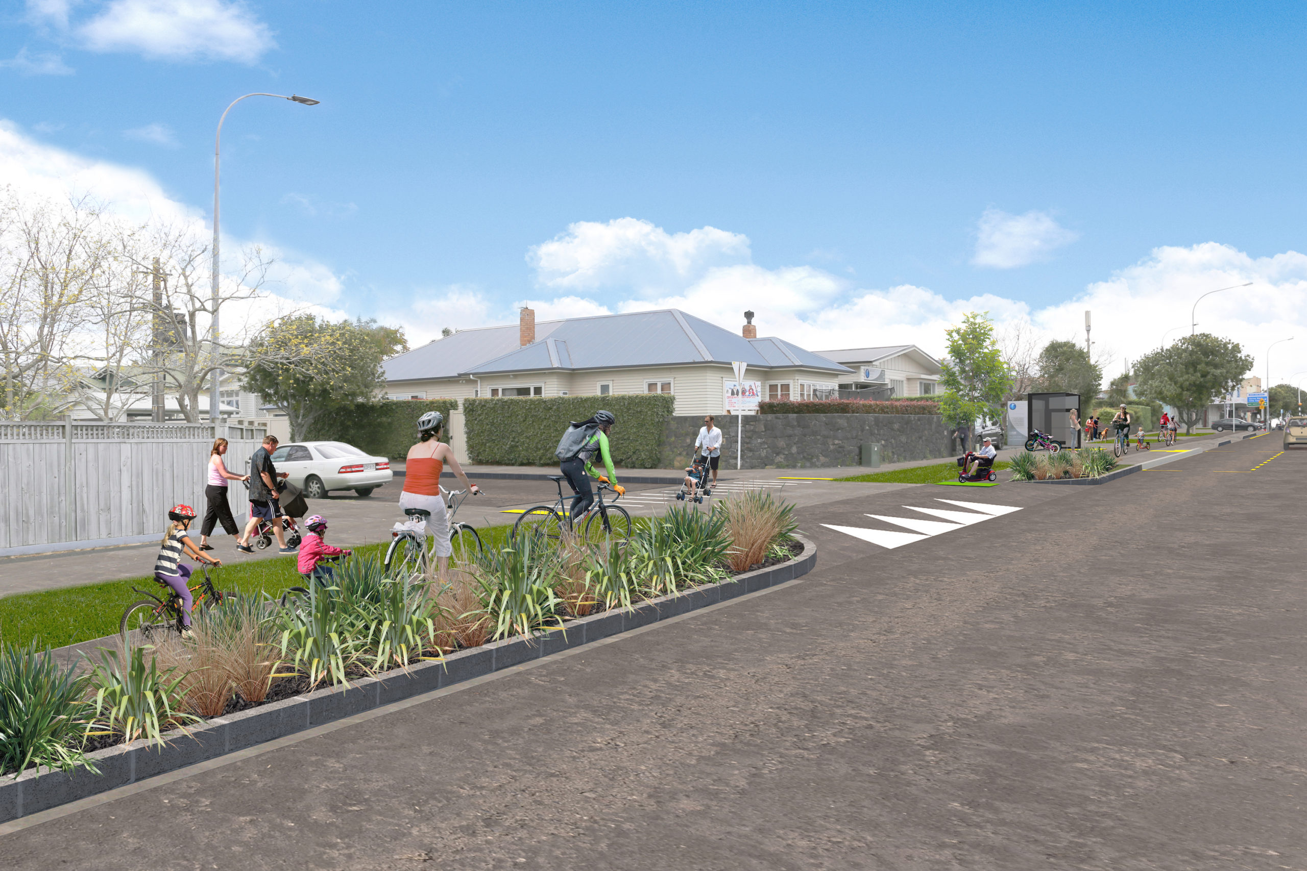
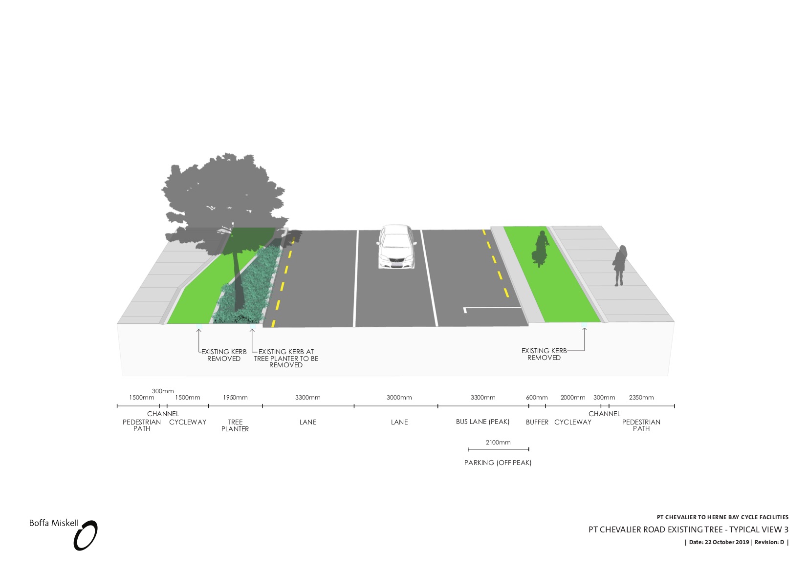
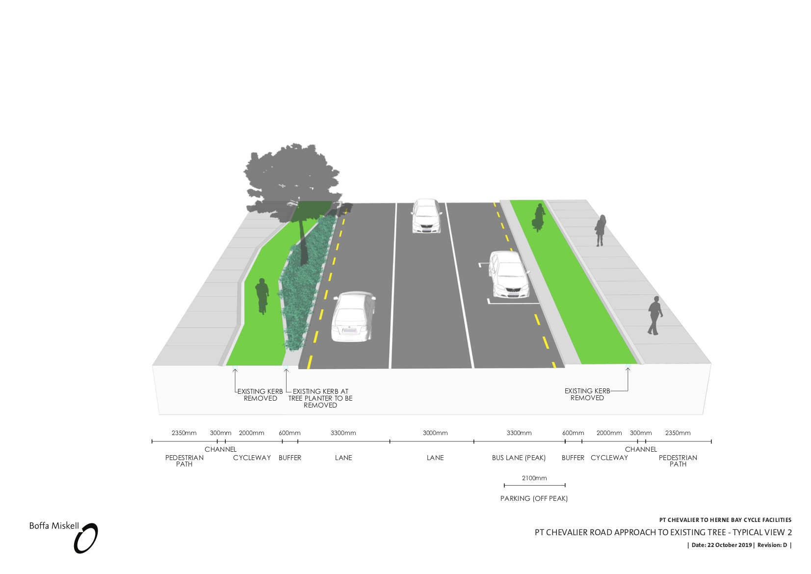
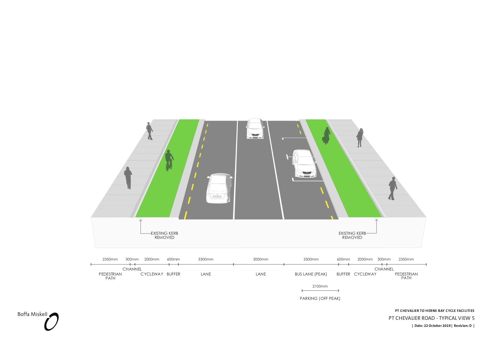
- Safe and separated 2m wide bikeways on each side of the street…
- … narrowing to 1.5m briefly as they pass the existing pohutukawa street trees, which are not only retained, but also gain enlarged planting areas (thanks to a strong nudge from Transition Town Pt Chev last time, and some design hints from Bike AKL!) and will be joined by half a dozen new pohutukawa. With all of the trees gaining enlarged root zones, the new ones will hopefully all end up like the best of the existing ones. What a streetscape for a seaside suburb that will be!
- Raised tables over the mouths of side streets for greater safety and convenience for pedestrians and mobility travellers.
- Raised zebra crossings plus new crossings, to make catching the bus and accessing local shops a lot safer for everyone.
- Elbow room and safety for all kinds of micromobility
- A peak-hour southbound bus lane on Pt Chevalier Road from just south of Wakatipu St, proposed to operate 7am-10am and 4pm-7pm, Monday – Friday. AT says that at peak, there are 12 buses per hour, including two frequent routes, with capacity to carry around 900 people. A dedicated bus lane would free up all those buses (and all those people!).
- Wherever possible, parking is retained on the eastern side of Point Chevalier Road, which is also where most of the shops are.
- A full signalised revamp of the Meola Road/ Pt Chev intersection. This is currently a “give way” T-junction that’s risky for all users – and especially unfriendly for those walking, biking, or otherwise outside of vehicles. (We have some detailed observations to make here, so stay tuned for more blog posts. But in short: the walk/bike paths should be wider, and we’d like to see the whole intersection as a raised table to discourage speeders and red-light runners).
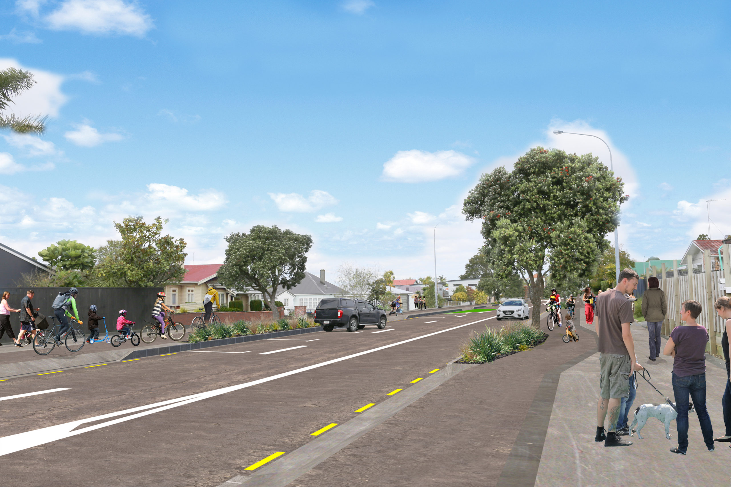
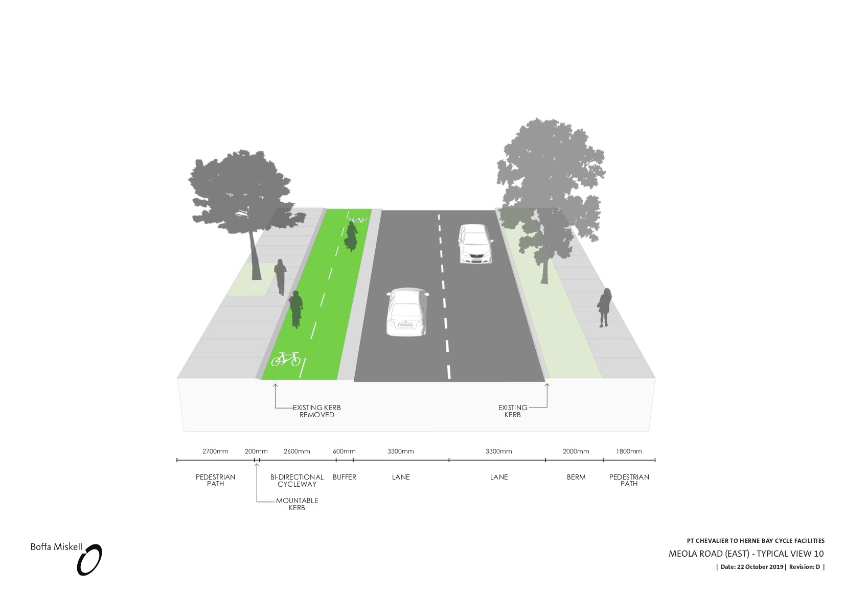
Details to note on Meola Road
- A raised crossing at the existing zebra near Walford Rd, and a new raising crossing between the entrances for MOTAT2 and Seddon Fields.
- A raised table at the entrance to Walford Rd as well. (However, the “Bird Streets” on the south side don’t get raised tables – this strikes us as a missed opportunity for pedestrian safety and convenience. Raised tables here would also send a signal to drivers that they’re entering what should be quiet and traffic-calmed streets).
- A two-way 3m wide bikeway along the north side of Meola Road. Note: this layout was arrived at after a lot of work and thought. It’s the preferred option for lots of reasons to do with space, road layout, and Meola Road’s unique multifaceted design – residential at both ends, recreational and greenspace through the middle. For a two-way bike path, the north side makes the most sense because there are many fewer side streets to cross on the north side, reducing conflict and thus reducing risks to those travelling in the bike lanes. The retained trees are on this side also generally of higher ecological value, as they have not had to be pruned harshly for overhead power lines like those on the south side (more on this below).
- Fairer travel space is achieved by taking parking off the whole of Meola Road. The question of sports parking for Seddon Fields (a key concern last time round) is addressed by a new off-road carpark planned for the MOTAT side, with around 350 new spaces.
- At the west end of Meola in the residential section, the Queensland box trees on the south side of the street (which are currently growing hard up against the kerb, and pruned around overhead lines) are proposed to be replaced with native trees and planting. Why? Because even with parking out of the picture, this end of Meola Road is simply too narrow for a safe road that is suitable for cars and buses and safe for people walking and biking. Moreover, we understand the current trees will need significant pruning to allow space for buses and trucks. Arborists confirm this will leave them lopsided and even more compromised than they currently are. After a lot of probing questions, and a lot of back and forth over dimensions, designs and potential workarounds, Bike Auckland is satisfied that we can support this approach. On balance, a safe and welcoming avenue for sustainable travel, with well-chosen native planting ensuring a corridor for birdlife, is a compromise we can live with.
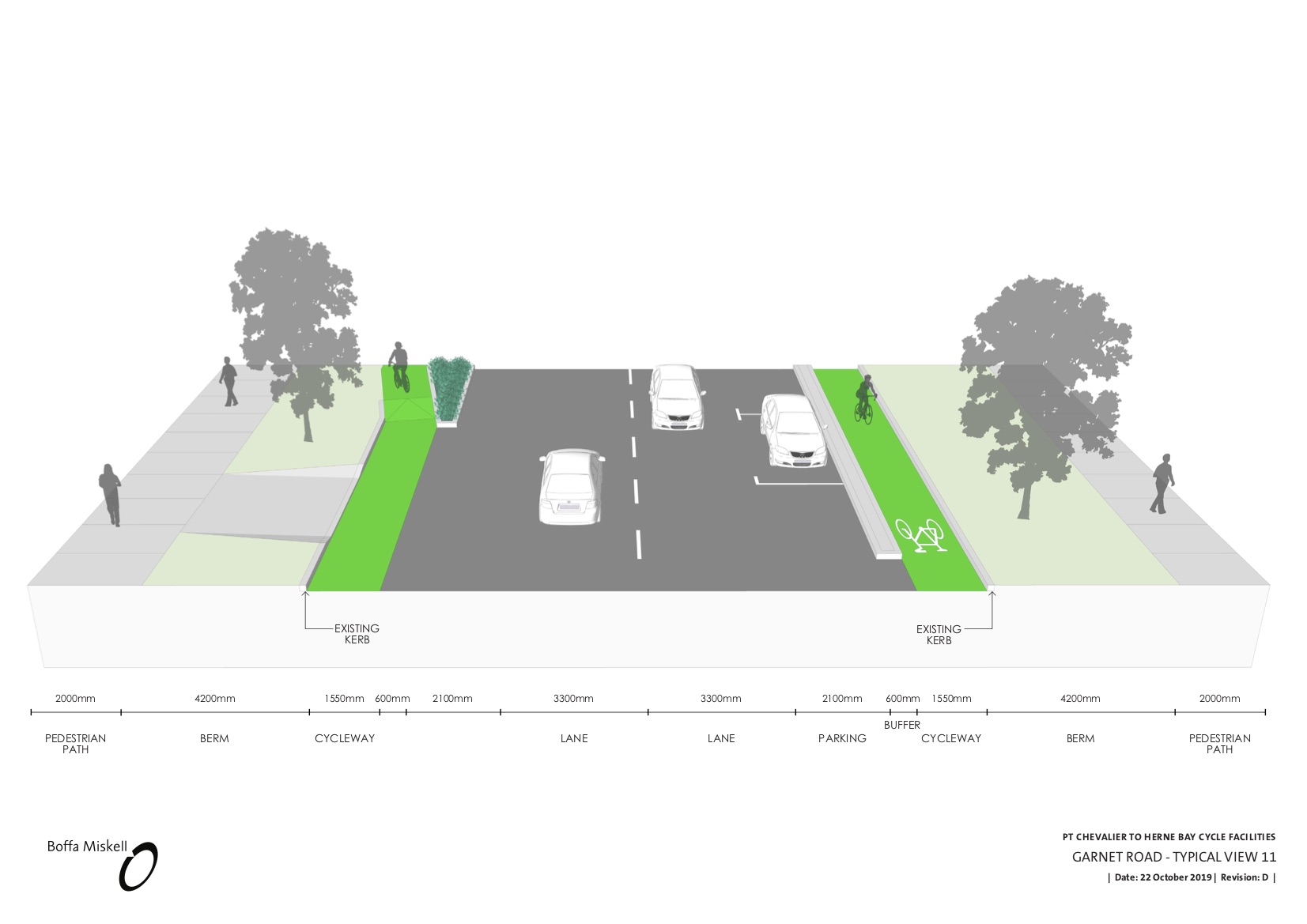
Details to note on Garnet Road
- Raised tables at the Garnet Road / Meola Road roundabout will make this risky intersection on key school routes a lot safer for people walking, catching buses, and biking. This alone would be a project worth doing tomorrow!
- One-way off-road cycleways on both sides of Garnet Road from the Meola Road roundabout to Oban Road. (The future plan would extend safe bike routes beyond the shops, but this is the limit of the project scope for now.) The protection here is similar to last year’s updated design for the rest of Garnet Road, i.e. raised solid buffer strips.
- A raised table at the entrance of Westmere Crescent (albeit not across Faulder Road – an omission you might want to push AT on). And Oban Road, which has a very wide and sweeping entrance, is unfortunately just out of the project’s scope.
Feedback suggestions
We’ll be covering this project in more detail in future posts, so please do tell us what you like, any potential issues you’ve spotted, and any questions you have.
But if you want to jump in to provide your support right now, we certainly won’t discourage you! Here’s an initial list of what we think would be good to mention:
- Support the great protected bikeways – and if you like, talk about what they will mean for you and your family! Both in your feedback, and on social media. It’s good to put a face on how bikeways benefit all kinds of people – e.g. as a pedestrian or cafe patron, maybe you’ll enjoy having the footpath to yourself plus that extra buffer from the noise of passing traffic?
- Support the repurposing of car parking and the painted median where necessary to make the project safe and functional for all ages and all kinds of travel
- Support the new raised and signalised crossings, and the raised tables over the side streets – safe walking is so important, and these will be great for kids, Selwyn Villagers, and people catching the bus!
- Ask for a full deal, with raised crossings too for the entrances of the Bird Streets on the south side of Meola Road, and Faulder Road off Garnet Road.
- Support the new peak hour bus lane on Pt Chevalier Road – for faster, more reliable buses when we need them most.
- Support the retention and addition of trees and greenery on Pt Chevalier Road, and…
- Support the replanting plan on Meola Road’s south side, which is needed to make the project feasible
- Support the traffic signals at Pt Chevalier / Meola – and ask for them to be on a raised table (to slow down red-light runners) and with wider paths around the edges for walking and biking.
- Ask for more bike parking as part of the plan: especially at shops and bus stops. (The sports fields/ MOTAT precinct will need dedicated bike parking, too; that’s a separate convo, but one worth mentioning here).
- Ask AT to work with the Local Board to connect these routes to Point Chevalier School on Te Ra Road – there are existing plans and discussions, but the kids deserve timely delivery!