Some of you may have been wondering how the (ongoing) Waterview Shared Path construction is going. And we know that some of you have really started to worry about the New Lynn-Avondale-Waterview path, because things have been so quiet from the official side recently.
Well, have no fear. There have been some temporary setbacks, but some good people are hard at work overcoming them (hopefully in time for the overall dates to not slip seriously).
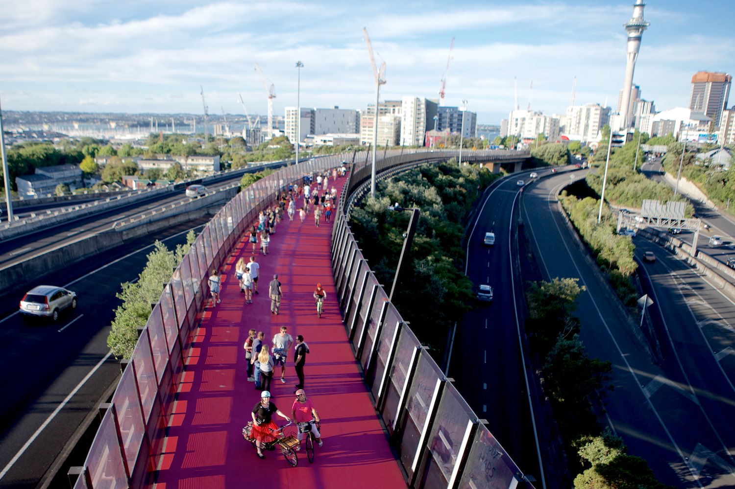
Waterview Shared Path
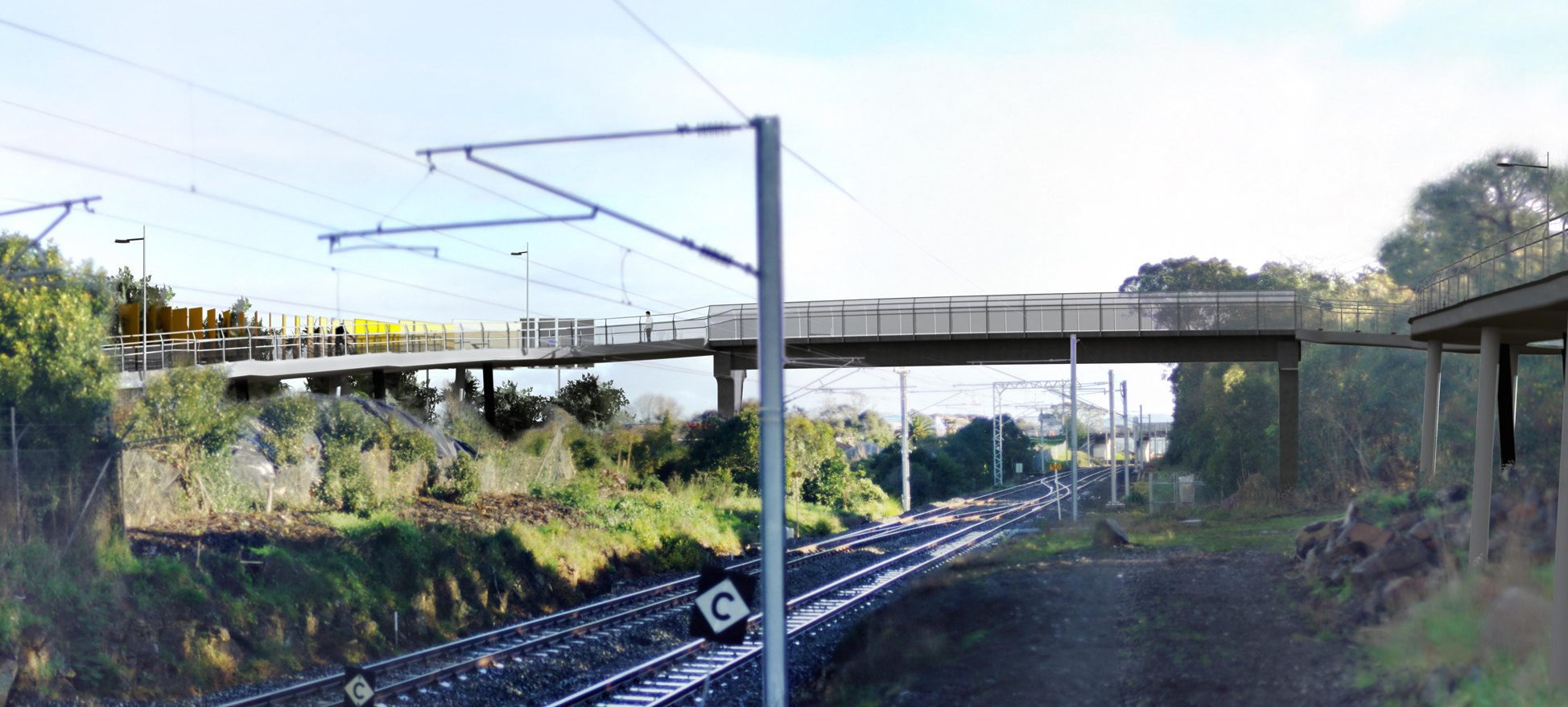
On the Waterview Shared Path, the most visible works are at the Alford Street Bridge, crossing over to Unitec.
These works are going along well – the Well-Connected Alliance (the same folks building the motorway tunnel) have erected a pretty huge temporary bridge on the western side of Oakley Creek, so they can bring in the big rigs for constructing the bridge pillars without damaging the creek below.

There are some photos and a time-lapse video here.
(Not shown: The huge pile of pig and cattle bones they said they found around the footings of one of the future piles – or the poor folk who had to sift through all of them to confirm that there were no human bones in the pile…)
The opening for this first section, from Waterview to Albie Turner Field in Phyllis Reserve, should be in January 2017. We hear there are some great festivities planned, so watch this space.

The middle section, including the boardwalk bridge along the creek between Phyllis Reserve and Harbutt Reserve, is hoped to open March 2017.
The last section will go from Harbutt Reserve to Trent Street / Blockhouse Bay, and also across the rail line at Soljak Place, to the paths along SH20 in Alan Wood Reserve (the latter will also open around April 2017 or so, for an almost car-free ride all the way to Onehunga!).
This third section at Soljak Place is the one that has run into rocky ground – literally.
Test drilling during the design stage indicated some issues would be likely – but now that the actual rigs are out and trying to drill the foundations, the team has found that the area had been used as the ‘Flintstones’ own dumping ground’!
Basically, it seems that when the railway line was built here, the area under and west of the line near Soljak Place was filled with a huge number of rocks. BIG rocks, many of them half a meter or a meter across. The project manager described the situation as ‘that’s where they dumped all the ones that were so big and solid they couldn’t crush them’.
In some areas, this boulder field is over 5m deep, and the drilling rigs literally can’t get through – because all they can manage is to start spinning around the rocks rather than punching through.
Digging the boulders out was considered, but a bridge needs quite a few piles – and with the depth, that kind of dig would not only be very expensive, but would also be likely to destablise the rail line.
The design team is currently looking through a variety of alternative solutions, including potentially supporting the bridge on an MSE wall.
They are working hard to make sure they don’t lose too much time – but the opening of this last section could well slip out to mid 2017.
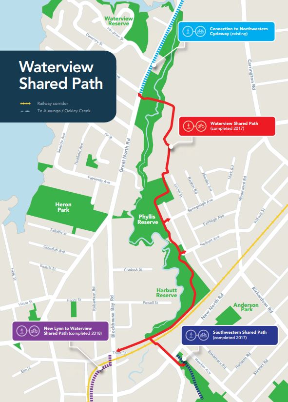
New Lynn – Avondale – Waterview Path
Consultation for this project was a few months ago, and since then, things have gone a bit quiet. We checked up on this, and have gotten the okay to update you.
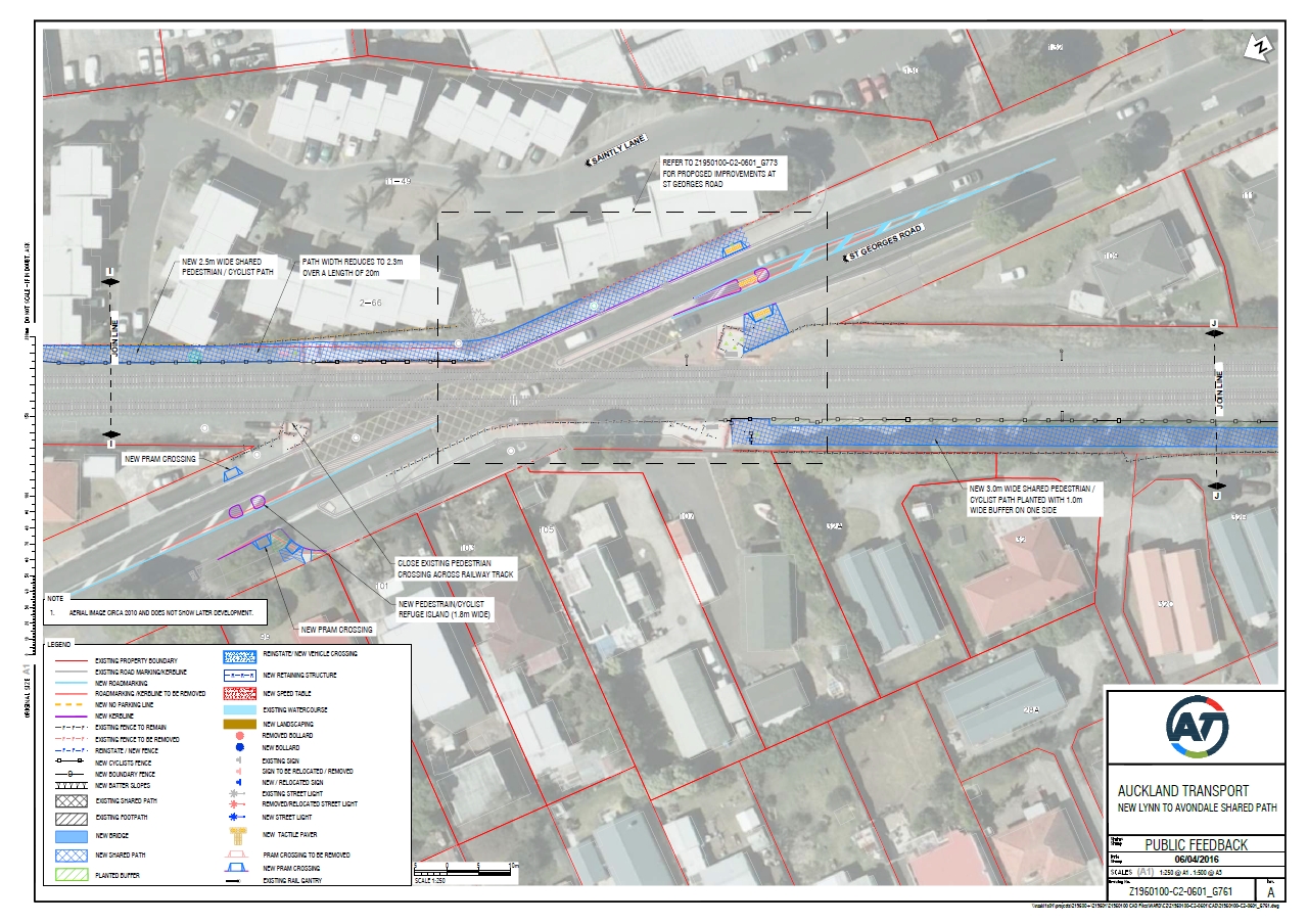
Sadly, there is indeed one major setback. Rail authorities have indicated that they would rather not add any more ‘level crossings’ – i.e. they don’t want the new cycleway to go across the rail line at road level at the St George’s St crossing down.
Now, you could argue about whether or not that’s a reasonable criticism of the design that AT’s walking and cycling team put forward – after all, cars (and bikes and pedestrians) can currently cross there, and will be able to cross for a while longer, until someone finds a way (which is to say, the money) to grade-separate the crossing.
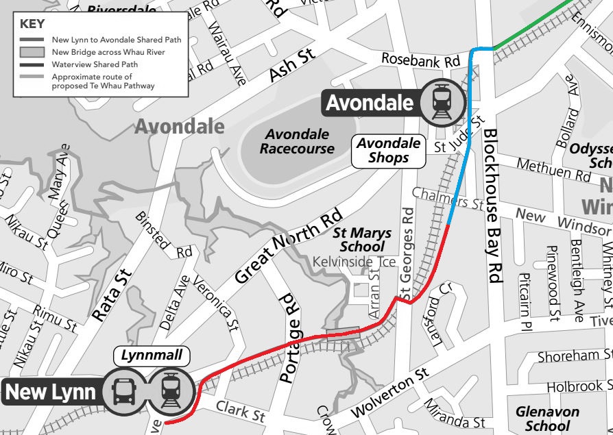
Blue: Currently in detailed design.
Red: Currently being revisited: the design of St George’s Road crossing – and possibly the exact route as well.
But for now, AT is back at the drawing board and ‘considering all options.’ These options include whether the path could stay on the eastern side (probably not?) or whether it could instead cross the railway line via a bridge or an underpass.
The end result of this process could be really great, but of course the price tag would rise (overpasses and underpasses don’t come cheap), and it could well make for a delayed opening of the path…
AT is well aware of this, so they have decided to crack on with the construction design for the unproblematic blue section (Trent Street to Chalmers Reserve), while they revisit the southern section. This way, even if the St George’s St issue gets delayed, at least the first section can be built and opened earlier.
Similarly, the design (but not necessarily construction) of the new bridge over the Whau River at Olympic Park is continuing apace. (This would kind of imply that the final route WILL have to cross to the west in the area somewhere?).
So, it’s not exactly clear sailing yet on the Waterview and New Lynn paths – some rocky shoals are having to be navigated around.
But the projects are both very much live, on ongoing, and it sounds like we might get a string of opening ceremonies, rather than just one or two.
So look on the bright side of the rock – and in the meantime, don’t forget to add your voice for a Bikeable Auckland, to help remind the city we want to grow our network of bikeways, small and large!