Over the last couple of years, the new Urban Cycleway Fund has begun to deliver big, eye-catching, protected and dedicated cycleways like Lightpath, Quay Street and Glen Innes to Tamaki Drive. But urban cycling also means neighbourhoods that are safer and more pleasant to ride in. And when we have thousands of kilometres of roads to retro-fit over the coming decades, those smaller local projects are crucial.
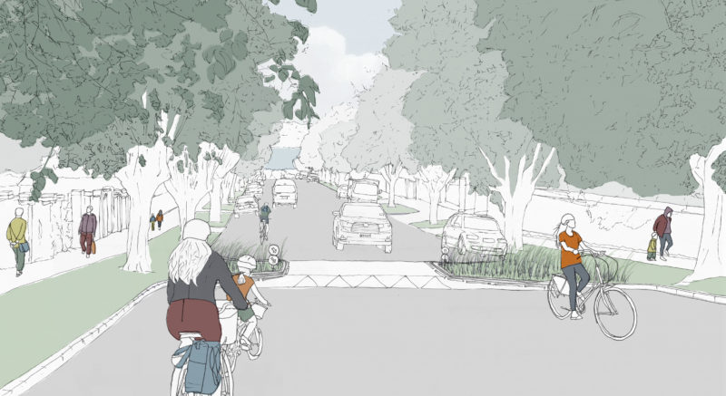
Cue the Herne Bay Residential Streets project. Originally shown on the maps as a single line – part of the wider planned cycle network from Pt Chev to the city – this has now grown into an area-wide approach. Auckland Transport is now proposing to treat all local roads in this area to make it more pleasant to walk and cycle here:
Public consultation closes 18 December 2016, and construction is scheduled to begin in late 2017 – early 2018. Here is the link for feedback.
Check out the project information here. And there are two Open Days:
- Thursday, 1 December, 11am – 2pm. The Governor, 228 Jervois Road, Herne Bay.
- Saturday, 10 December, 11am – 2pm.. Leys Institute (Ponsonby Library), 20 St Marys Road, Ponsonby.
Overview
Bike Auckland has long been calling for area-wide projects that make a whole neighbourhood better for people to bike around (and walk! and play! and cross the streets to chat to neighbours!). This is a really promising example.
From international experience, we know you can achieve a great bike-friendly neighbourhood environment by combining three factors:
- street design that reduces speeds, allowing people to be and feel safer riding in traffic.
- street design that reduces traffic volumes, creating fewer instances of interaction with cars.
- a culture where drivers and people on bikes coexist positively.
The Herne Bay project, as we see it, will be a great step forward on the first factor – and will hopefully make some good inroads on the second and third.
So, what’s being proposed?
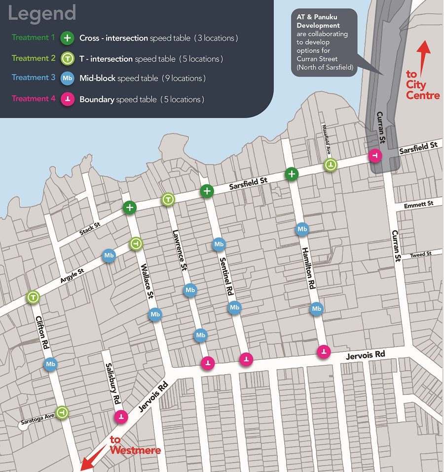
Slower speeds by design, not just by decree: the official intention is to bring the local area down to “Local Path” guideline speeds, i.e. 30 km/h or less on average, via traffic-calming features dotted around the neighbourhood – mainly raised table intersections and mid-block tables.
Do raised tables work? Raised tables tend to be reasonably nuisance-free for people on bikes, and do a good job of slowing down traffic as long as they’re substantial enough (in height and ramps). But you do need them at regular intervals – if they’re too far apart, people just slow down sharply and then speed right up again. And they work best where streets are relatively narrow and don’t look like racetracks. (Time to ditch those bright white racing-stripe centre lines, AT!)
Auckland Transport is proposing 22 treatments in a relatively small area, so we feel they are taking this quite seriously.
The number of raised tables may also help with factor 2 – bringing down the volume of vehicles. In particular, Sarsfield Road sees some 4,000 cars daily, which is at the top end of what a residential road should have, and certainly too many for a good on-road cycle route. AT has said it expects the traffic-calming will drop this to 3,000 a day – still relatively high, but already a lot better. (That said, with no plan to actually close off any street entrances, Sarsfield will continue to be a rat-run to the Harbour Bridge).
Check out the before-and-afters:
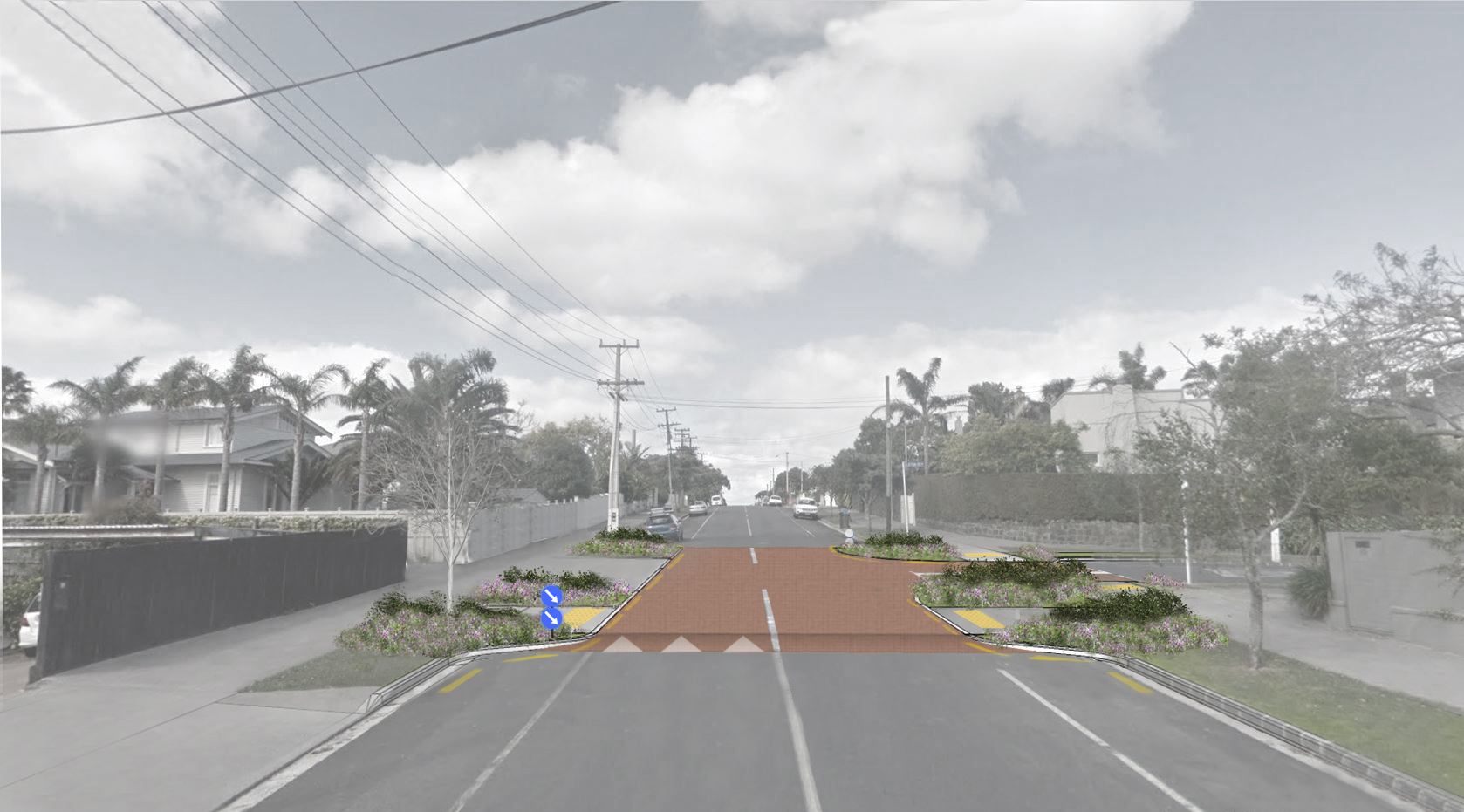


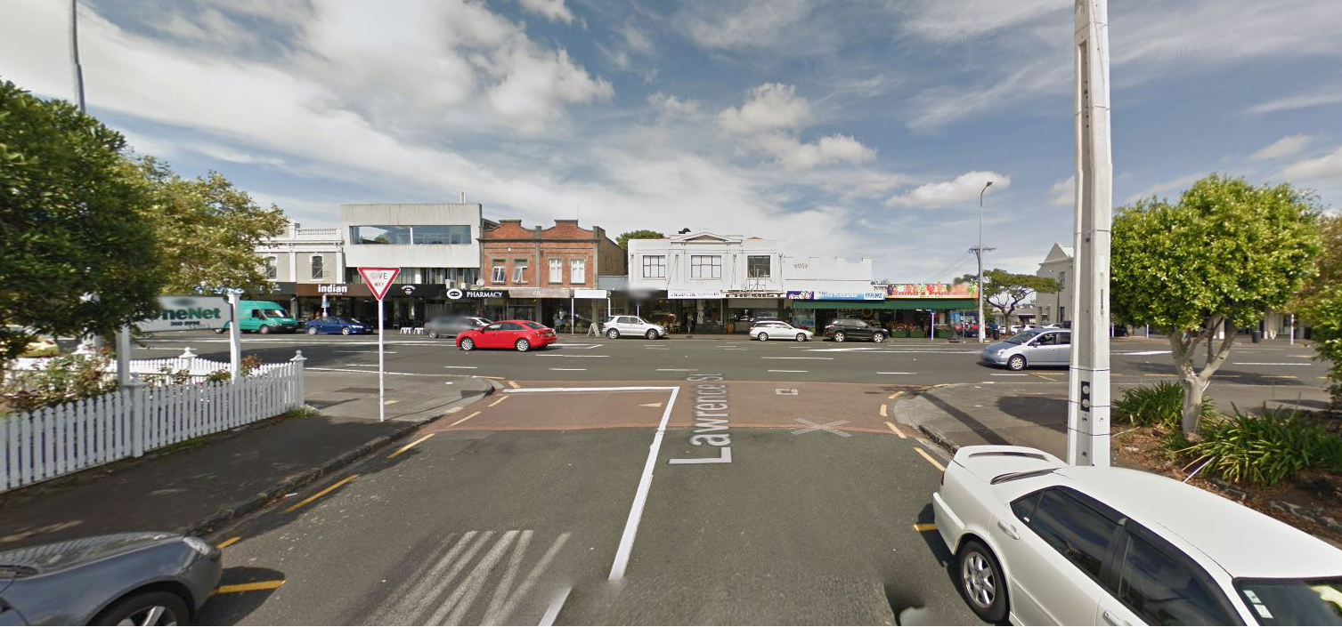
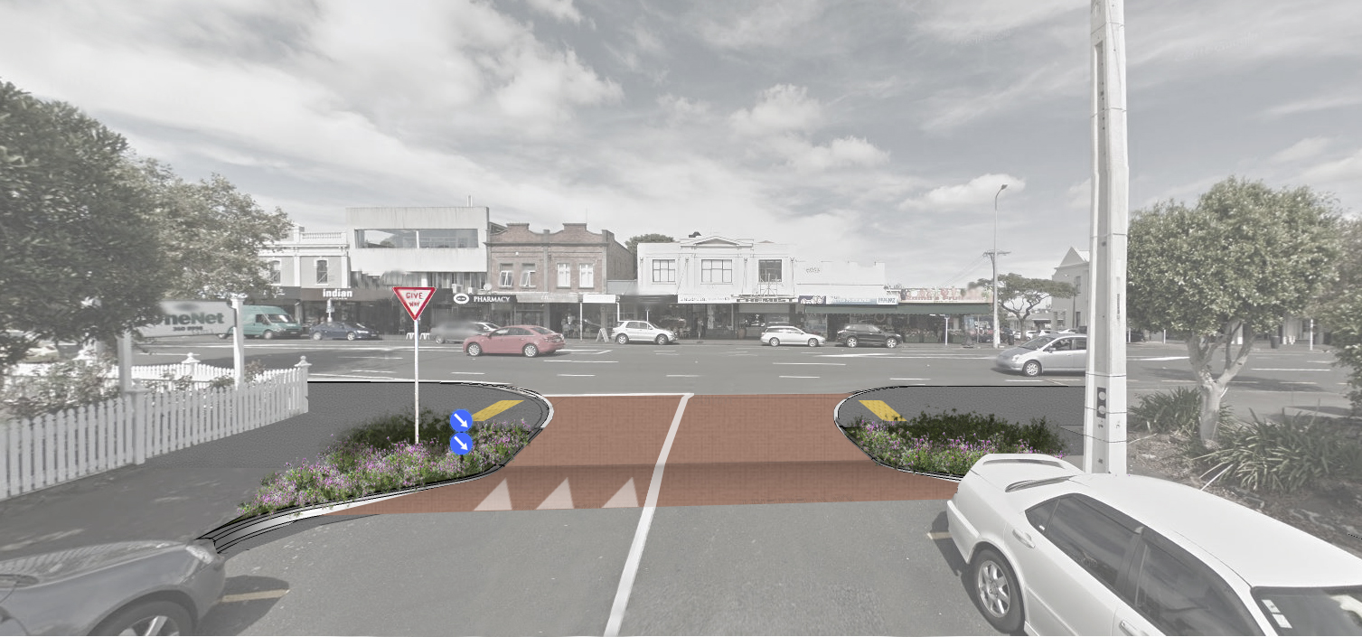
What’s to like?
Being passed by drivers at speed is one of the scarier experiences on a bike – and this approach should make it happen less often, and at less intimidating speeds.
Faster riders (or e-bike folk) may be able to keep up with the flow, which will help drivers decide they don’t need to overtake on quiet roads, a useful habit to learn. And of course, in the event of a crash, slower speeds will make all the difference between a graze and a long hospital stay, or worse.
Indeed, once these street treatments are in place, this area would be a shoo-in for a 30 km/h speed limit under the new speed limit rules. We understand that many locals think that official slower speeds are the way to go here – hopefully the Local Board and the residents’ association agree.
So on the whole, we think this is the right project for the right time and location. It’s not quite a fully fledged 8-80 design – but it is a great start, and has strong local support.
What could be better?
Like all great projects, there’s room for improvement. So what do we think is important to give feedback on?
- First off, one thing we DON’T want changed: the gruntiness (yep, that’s a technical term) of the speed tables. The traffic-calming effect strongly depends on the ramps being reasonably steep. We understand it will be 1:10, which meets AT’s standards, and is quite effective. But some motorists may call for the speed tables to be weakened or ditched altogether – as has happened in Northcote Point, for example. Please keep the raised tables strong for effective traffic calming.
- AT is planning to design the roads so people will voluntarily drive at an average of 30km/h. But we can definitely call for a formal limit too – if nothing else, AT will find out how many people support the idea. Introduce a 30 km/h formal speed limit for this area, to reinforce expectations.
- Auckland Transport acknowledges that expected traffic flows will still be high, albeit slower. But on weekday mornings especially, traffic could still be too heavy for many people to feel safe riding on Sarsfield Street. This includes kids and parents travelling to and from Ponsonby Primary School on Curran St, and Bayfield School at the top of Clifton St. We suggest adding one more raised table on Sarsfield St, between Sentinel and Hamilton.
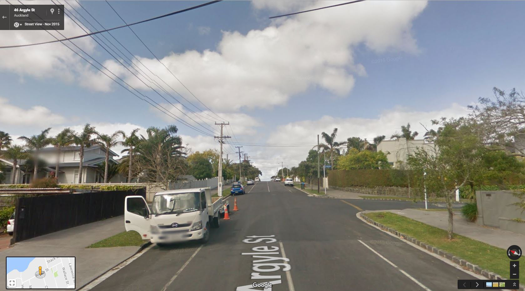
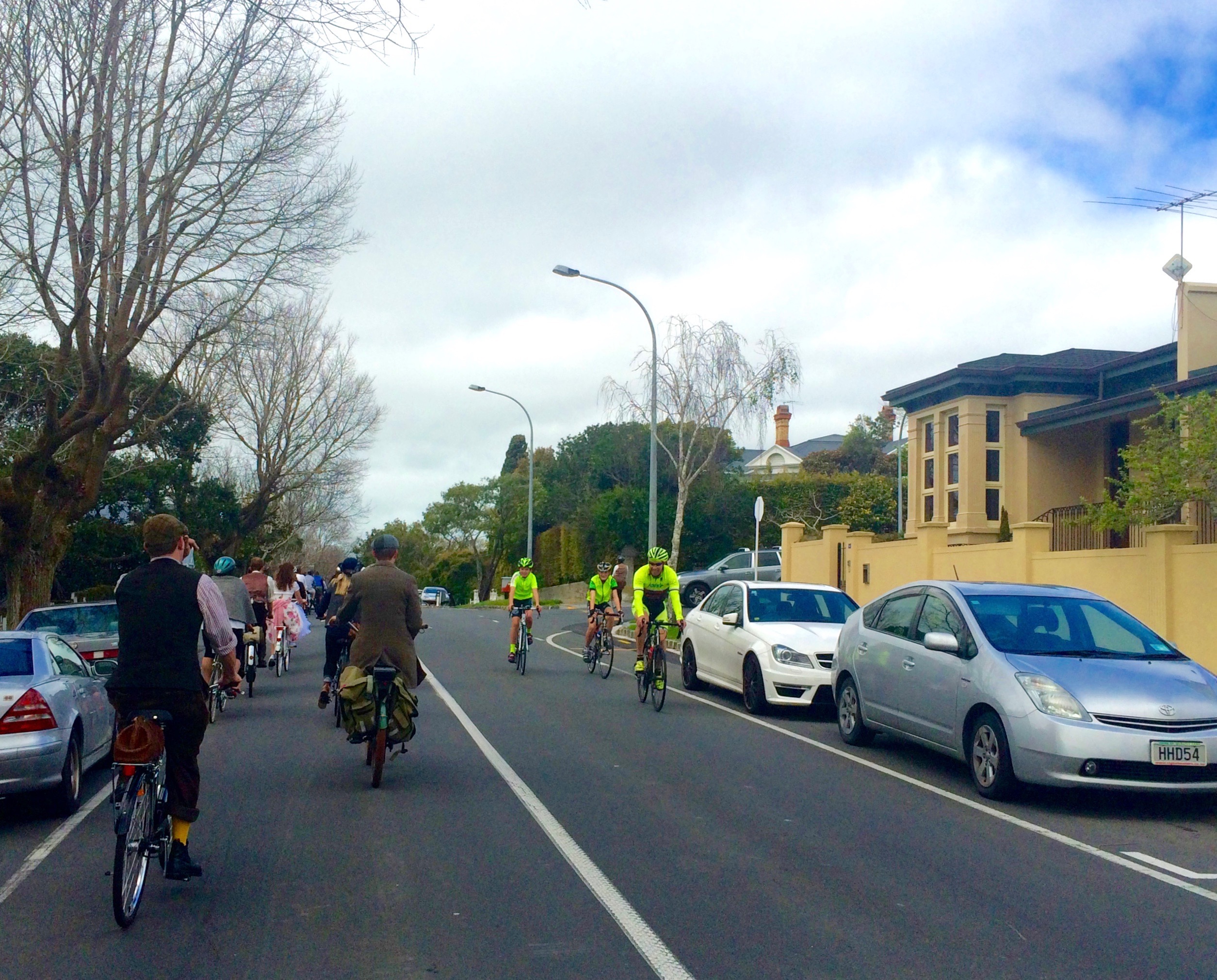
- Removing white centre lines can reduce speeds by a significant factor – 5kph in one study – and would make sense here as well, as the following photo illustrates. Please remove the white lines on Sarsfield Street, to reduce the ‘race track’ effect.
- And, where Sarsfield St meets Curran St, we need strong pedestrian/ cycle improvements to get across Curran, and for traveling north-south, especially on the west side. Ideally this would include traffic calming of Curran Street traffic itself, to slow down the downhill race past the primary school. Please consider extending the scope of this project to include Curran Street.
Lastly, an exercise for readers:
- The mid-block speed ramps are flanked by kerb build-outs, and we see pros and cons. So we’re keen to hear what you think. Yes, narrowing the street helps slow traffic – but on a wide straight street, these pinch points can pose specific dangers to people on bikes, as the “Wrong Side of My Car” blog points out in the example of Northcote Point – especially if the raised tables are single-lane. Should AT investigate bike bypasses for the mid-block speed tables?