We’re back with our monthly round-up of Auckland’s progress towards a bike-friendly city! And we know what you want to hear about: shovels in the ground. Honest-to-goodness cycleways you can use, and more bike-friendly streets as roads get repaved around the city. You made that pretty clear in our reader survey at the beginning of the year…
Big ticket items
Let’s address the #1 item of interest first. On the one hand, NZTA has just invited expressions of interest for SeaPath and notes its crucial connection to ‘the planned Auckland Harbour Bridge (AHB) Shared Path Project to link across the Waitemata Harbour.’ On the other hand, the plan for delivering SkyPath – or indeed any kind of walking and biking pathway over the harbour bridge – is still fuzzy at best, with latest talk of 2022 at the earliest.
On balance, leave the champagne in the cupboard for now. And don’t promise your Americas-Cup-loving friends they’ll be able to walk or bike the bridge while they’re here.
More positively, there are three key cycleway projects on the near horizon, although none have yet broken ground:
- The Karangahape Road enhancements, a joint AT/ Council project, was set to begin early this year. We’ve been told by AT that ‘our plan at this stage is to start it by the end of April,’ but are also hearing from other quarters that there may be further delays. These last-minute slowdowns are frustrating, especially on such a great project, funded, consulted, consented, and ready to go.
- The New Lynn to Avondale path (an AT project), is now set to go out to tender in a week or two, we’re told. It’ll be built in stages, likely starting with the already consented Whau Bridge section. The March Business Report to the AT Board mentions May as a possible start date.
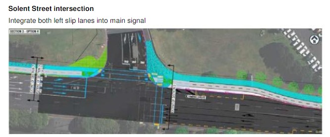
- The Tamaki Drive cycleway from the Strand to the Ngapipi Bridge (also an AT project): we’re told this is consented and now seeking a contractor. We’re also hearing that Ports of Auckland is still not happy about the proposed removal of slip lanes at Solent Street, something we’ve mentioned before. We’re calling upon Auckland Transport and leaders at Auckland Council to ensure the safety of riders (and runners, and pedestrians, and scooting folk) is paramount at this key intersection where freight vehicles cross Auckland’s busiest bike route.
- Related: the Ngapipi Bridge widening project will finally be designed and consented this year, with a view to starting construction in early 2020.
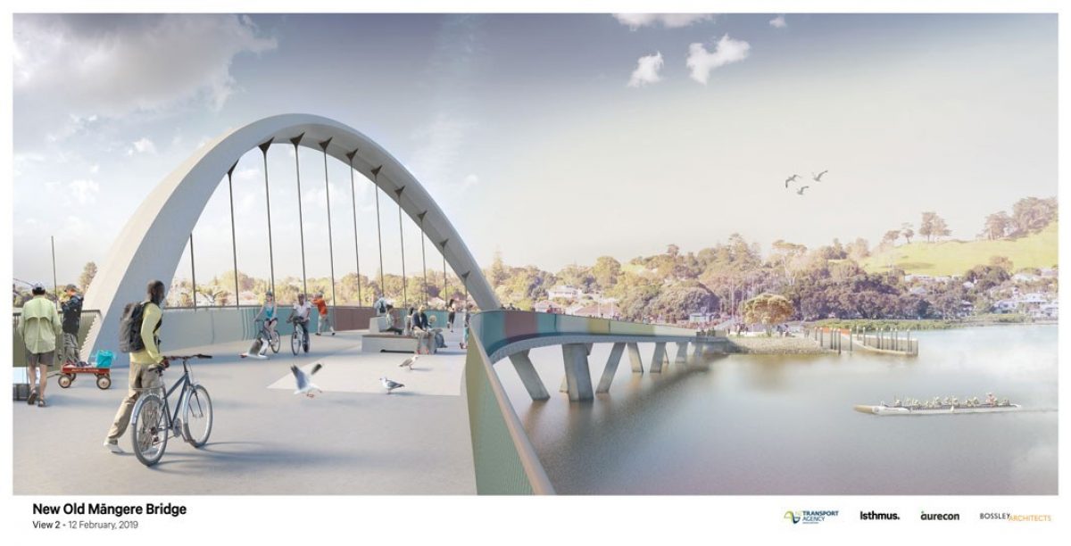
As we reported last month, the New Old Mangere Bridge, an NZTA project, is set to begin construction in the middle of the year. Yep: the Manukau Harbour will return to having not one but two walkable/bikeable harbour crossings!
But let’s be clear: if you’re looking for cycleway openings to celebrate this year, you’ll probably have to visit another city. None of these projects will be completed in 2019.
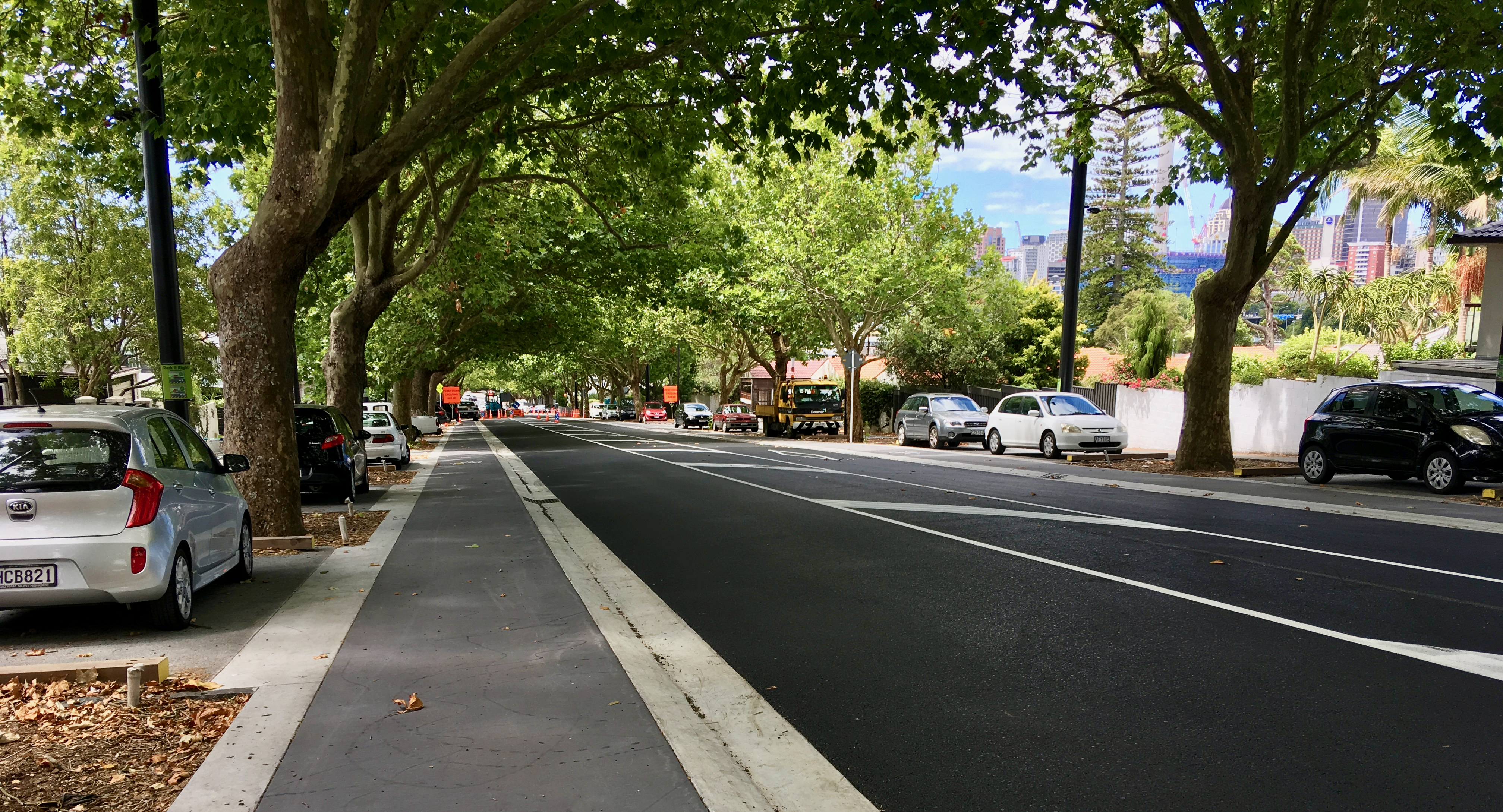
Thank goodness, then, for the full-on streetscape upgrade of Franklin Road, where progress is looking good, with bike lanes as smooth as butter, and completion likely by October.
If you recall the struggle to ensure that bike lanes were included at all, you can share our happiness in seeing them finally rolling out as part of a comprehensive and truly elevated street design. This will be a great biking and scooting connection from Victoria Park to Ponsonby Rd, especially once parking etiquette – and enforcement! –are fully bedded in.
(And with Ponsonby Rd covered in AT’s proposed Integrated Corridor Programme – see map – the idea of a bikeable boulevard along the top of the ridge is starting to feel hopeful rather than merely wishful.)
Timelines and deadlines
As the late great Douglas Adams said: ‘I love deadlines. I love the whooshing sound they make as they go by.’
Many of the routes scoped as part of the Urban Cycleways Programme for 2015-2018 are still hovering in the vague future. For example, Parnell, Pt Chev, and the Glen Innes local links all are still in the ‘pipeline’ where, according to the March papers to the AT Board, they are undergoing ‘design and value engineering.’
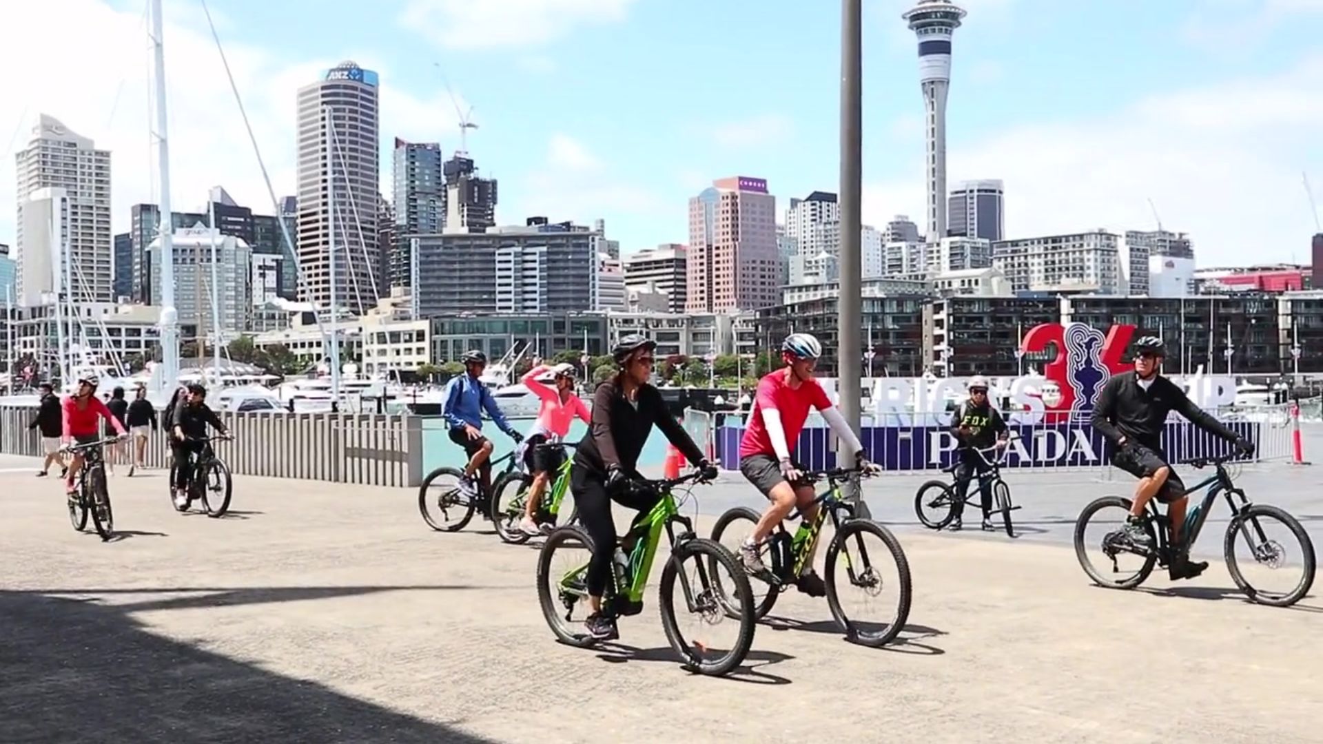
Future historians may well look back at 2019 and rack their brains trying to work out where the urgent action was. Especially in the face of record growth in bike ridership, strong and consistent political directives from central and local government (and budgets increasingly to match), and of course the growing climate crisis accompanied by increasingly urgent calls for more sustainable transport options.
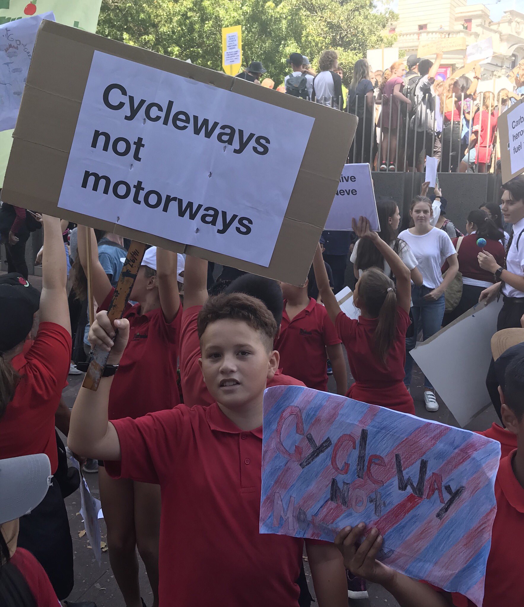
You’d think, in the year of the School Strikes for Climate, we’d see urgency for delivering at least one good neighbourhood project, one safe and completed route for kids to bike to school.
Well, there’s the Northcote Safe Cycle Route. This local cycleway, a mix of 5.2km of on-road bike lanes, shared paths, and parking-protected Copenhagen-style lanes, is largely complete (albeit the Lower Queen St section towards the Northcote Wharf was seriously watered down in safety terms).
Yet to come are the two walk-bike bridges across SH1, alongside the Northcote Road overbridge: the March Monthly Indicators Report to the AT Board notes ‘the Northcote Safe Routes bridge required further structural designs as the existing bridge is unable to support additional weight’, while the Business Report says ‘procurement and funding approval’ for the bridges ‘is under review’.

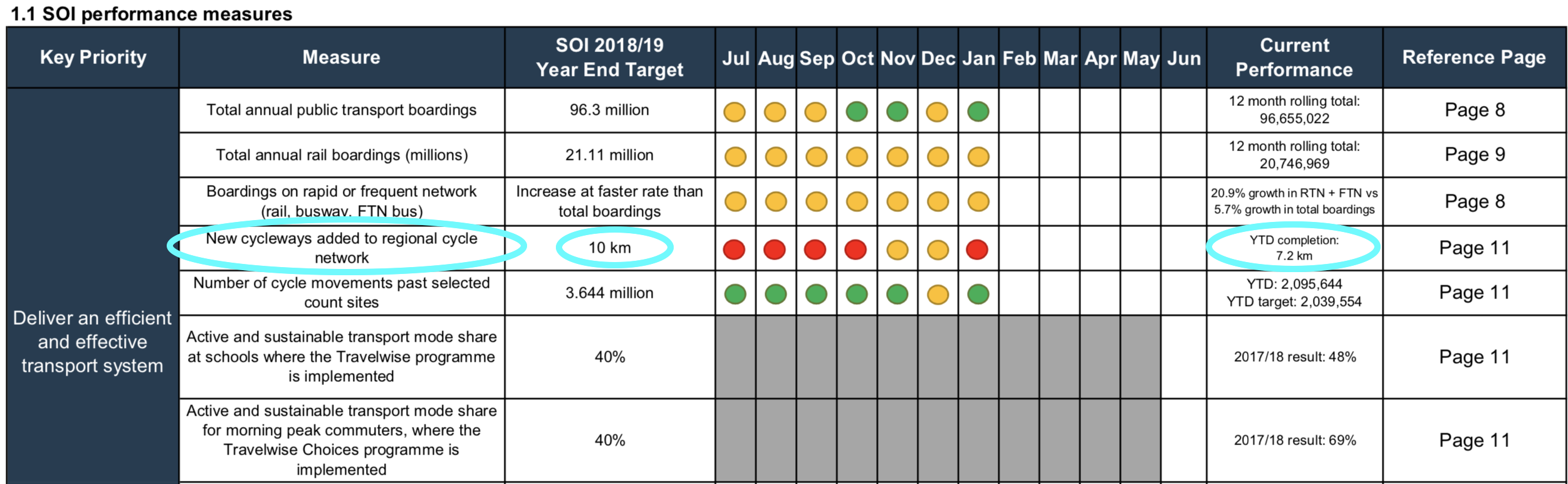
This seems the moment to point out that the Northcote route accounts for the biggest chunk of cycleway delivered in the 2018/2019 financial year, along with Seabrook Ave in New Lynn, the Quay St extension, and the Ian McKinnon Drive cycleway. Nonetheless, AT will fall short of the goal it set for itself in its Statement of Intent:
‘An SOI target of 10km has been set for the construction of new cycleways for the 2018/19 year. The forecast for the cycleway construction programme in 2018/19 is now 7.9km.’
Despite our determined optimism, these are numbers to grit our teeth about as the calendar ticks on.
Central city progress (?)
Back in the central city: Waitemata Safe Routes, from the city to Grey Lynn and Westmere, was initially due for completion by mid-2018, this project was paused after protests and then spectacularly redesigned in 2018. The new designs were reconsulted just before Christmas, and the results are still being compiled. We hope for a public update by the end of April.
Meanwhile, the Great North Road section of this project – from K Road to Grey Lynn – has now moved over to the Integrated Corridors programme, aka Connected Communities, which aims to redesign major routes so as to prioritise public transport and active transport. This may well turn out to be a very good thing for GNR, assuming an excellent design and timely delivery. But once again, we’ll have to wait and see, and it will be a minimum of two years before anything starts.
Also on the to-do list: the Herne Bay to Westhaven traffic calming, essentially a bunch of raised tables to encourage slower speeds. Last August, we were told this project would get under way in March 2019. Last heard, it’s still some months away from starting construction.
The final stage of the Viaduct connection to Quay St is also still stuck in the process, per the March Monthly Indicators Report: ‘Westhaven to CBD section 2 has been delayed to manage stakeholder issues from adjacent businesses’, and Victoria Street East West ‘has been delayed pending additional assessment in relation to the interface with the Victoria Linear Park.’
As for the Cook St Cycleway, a bonus project that materialised last year – it’s currently undergoing a business case review, with the funding team working on a funding memo. What does this mean for delivery? Your guess is as good as ours.
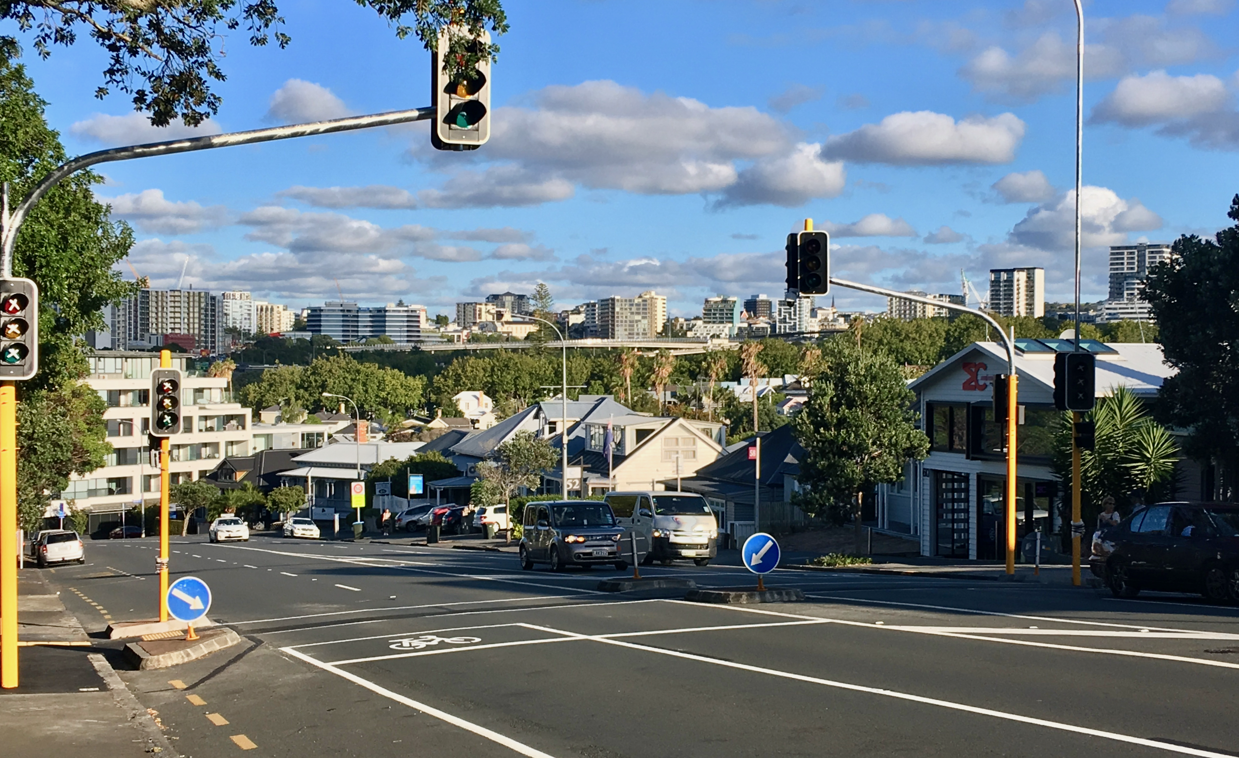
And you know how we’re always on the lookout for tactical ways to improve and connect cycling routes? The College Hill traffic lights have been installed, with the pinch points we highlighted as dangerous to people on bikes. Well, we gave it the old college try… We sincerely hope the design as constructed does not lead to an injury down the track.
No dice, either, on the tactical bike lanes we pushed for in line with AT’s own parking policy – although it’s worth noting that College Hill appears on the initial map of Integrated Corridors which suggests future improvements for public transport, walking, and cycling.
Of course, this crossing will be a boon for school foot traffic and other people crossing this road, once it starts operating – with the end of Term 1 in sight already, we hope that’s soon.
Remember that a logical linchpin of AT’s 10-year strategy was investing in building a network from the centre outwards – creating links through the most densely populated areas, with the highest propensity to ride for transport, and thus the greatest value for both more efficient street use while also taking the strain off public transport at its busiest point.
And with rising numbers of people on bikes and scooters, especially in the inner city, it’s concerning to see so many delays and missed opportunities for good connections and safe routes in the central city and inner burbs. We’d love to see AT bring extra energy and urgency to delivering this part of its programme.
Looking further afield…
Of course, bikeable ‘burbs and well-connected local hubs are equally key to our big vision of Auckland as a place that’s a joy to get around – and it goes without saying that everyone deserves safer streets and connected routes.
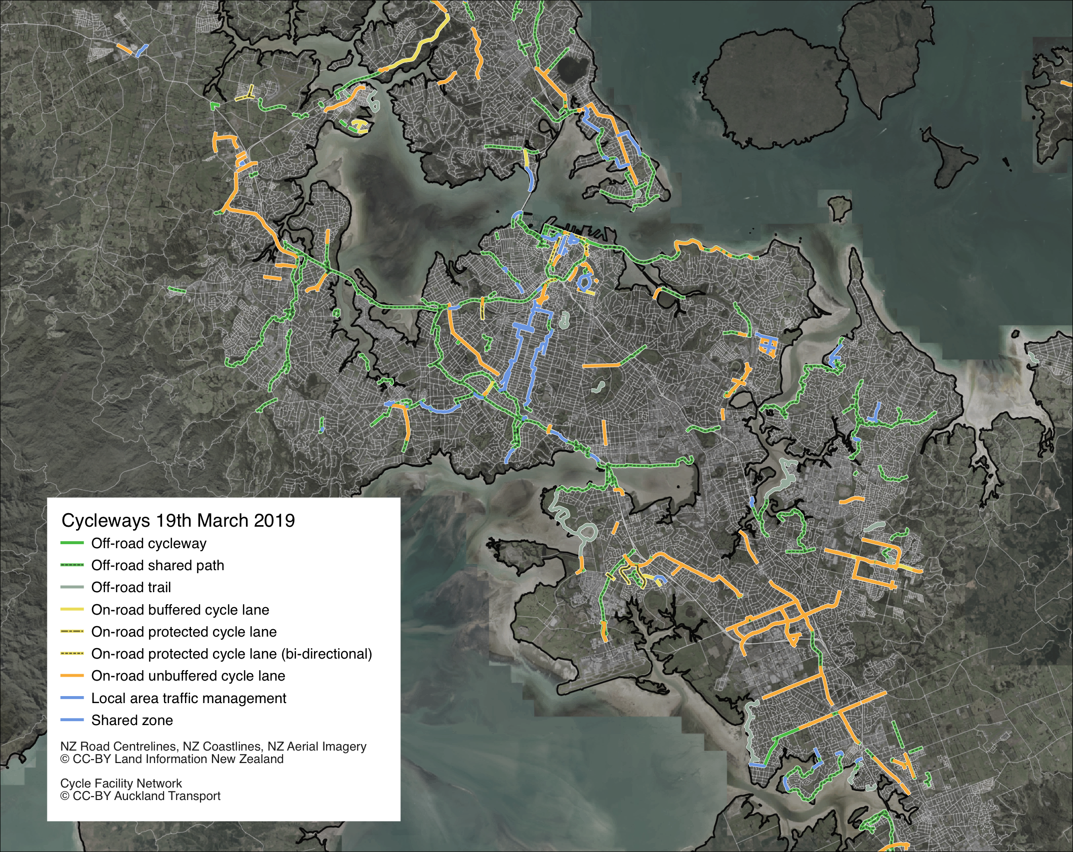
This is the state of it. Fair to say, if the road network looked like this, hardly anyone would drive. So how is progress looking out there?
Glen Innes to Tamaki Drive (GI2TD)
This 7km off-road walking and cycling route began in 2015, and has huge potential to totally transform cycling opportunities for a huge swathe of the eastern suburbs – Glen Innes, Pt England, Meadowbank, St Johns, Orakei, Kohi and Remuera. Once complete, it’ll be the eastern equivalent of the Northwestern Cycleway, a river of new riders and growing by the month.
We are seriously worried about ongoing delays on this project, in an area of the city where students desperately need safe walking and cycling routes to local schools, and where the lack of safe routes for biking to jobs and tertiary learning in the City leads to thousands of daily driving trips. Here’s where things are at:
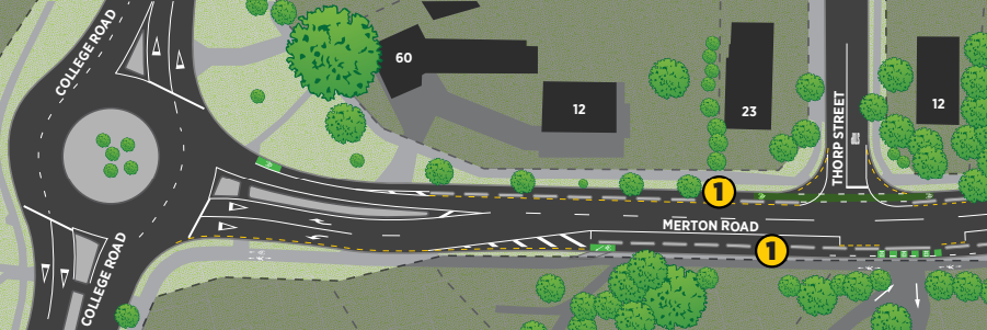
- Stage 1, from Merton Rd to St Johns Rd. Construction began in October 2015 and opened just over a year later in December 2016. It was a glorious day when it opened, as everyone present had faith that the onward path from St Johns Rd to the Orakei boardwalk would be delivered at the same pace. Sadly, no such luck. This section is currently stranded and disconnected investment, enjoyed for local leisure rides but not the gateway to connectivity it should be.
- Stage 2, from St Johns Rd to the Orakei Basin through the Purewa Valley, has been stuck in investigation and design since the beginning of 2017. The latest newsletter from NZTA predicts construction starting at the end of 2019, ‘subject to obtaining funding and consents’. Once complete, this section will provide a safe walking and cycling route to schools separated from many students living across the Purewa Valley.
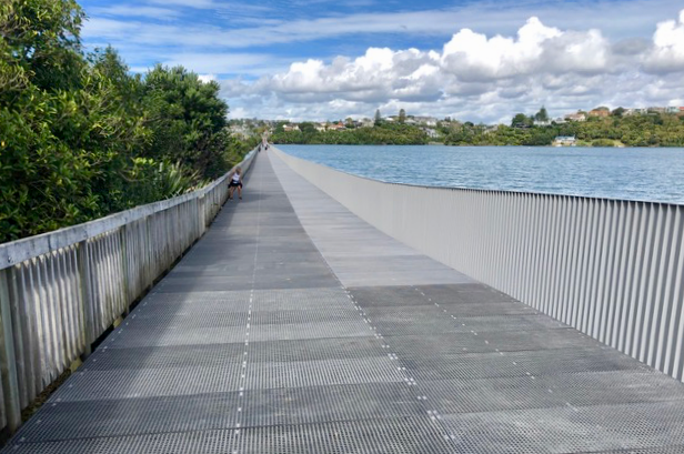
- Stage 3, the Orakei Basin boardwalk. Work to widen the boardwalk began in September 2017 and is still going. It’s predicted to be finished around the middle of this year.
- Stage 4, Orakei Basin to Tamaki Drive. This is the most vital stage in terms of delivering on investment. It’s also been subject to the most uncertainty and delay. The proposed route – alongside Ngapipi Road – was eventually confirmed by AT in August 2017, but since then there’s been little evidence of progress on consent documentation and detailed design, let alone funding. NZTA’s latest newsletter bravely projects completion mid-end 2021. We’d like to be confident about that.
The Northern Corridor: a wonderful bridge, a bike lane win and a WHAT?!
We are delighted with the new red walking and cycling bridge across the motorway, Tirohanga Whanui, built and opened last month by Watercare and the NZTA. It’s a wonderful addition of colour to the landscape and provides a much longed-for link for walking and cycling communities on either side of the motorway.


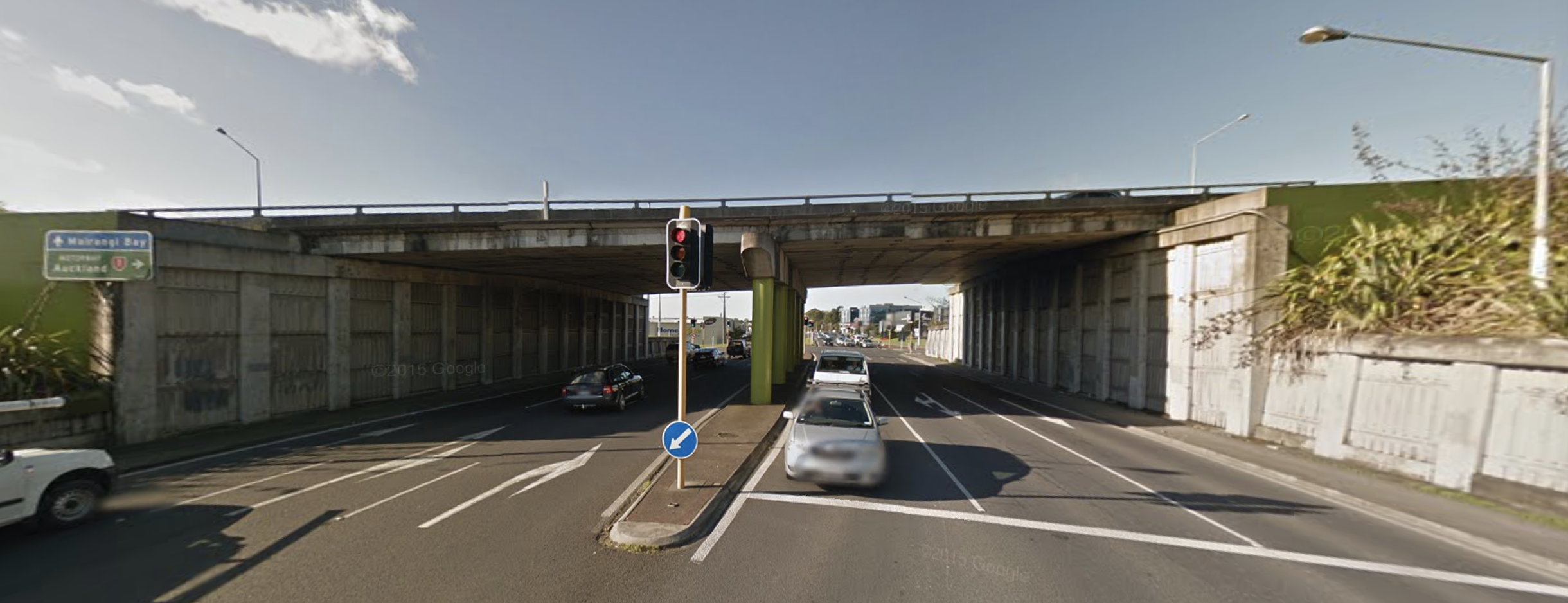
The NCI project brings further good news in the form of the confirmed extra busway station at Rosedale, which means a widening of the motorway underpass for Rosedale Road… which will mean proper protected bike lanes between the Tawa Drive signals and the bus station. Yay!
However, the news is less cheerful at Constellation Station, where the SH1 and SH18 paths meet at Constellation Road. Here, the original designs proposed using space occupied by the existing northern and southern footpaths to create a single, decent width shared path on the southern side.
However, it now transpires this won’t be possible. The early concept design by NZTA missed one key detail: the bridge is split into two spans with a row of columns in the middle. This means the (already narrow) traffic lanes cannot be moved over as planned.
With NZTA unwilling to remove one of the six traffic lanes through the interchange, their current proposal is for a 2m wide shared path under the motorway bridge, squeezed in between the abutments and a safety railing to protect people from traffic. Other options, such as widening the underpass or creating a tunnel for the shared path, are ‘not in the budget’, we are being told.
This is particularly frustrating because early on in discussions, we stressed the point that any shared paths should be minimum 3m wide, increasing to 4m near the bus stations in order to accommodate higher densities of cyclists and pedestrians.
How on earth can we accept a 2m bi-directional shared path to a busy bus station in 2019? Given the current width issues on the NW shared path through Kingsland, we say no way! And no way should we have to spend the next decade or so trying to argue for funding for a new underpass here. We’re confident there’s a solution, so NZTA can get this right the first time.
Safer crossings at St Lukes and Western Springs
Some good news to finish with: NZTA has agreed in principle to our request that the upgrade to the slip lane crossings at St Lukes Rd will not only include bike-priority crossings, but raised tables as well.
We’ve been told the delivery target is December 2019 or earlier. That’ll be over three years since the other interchange works were completed, but the higher-quality outcome is a welcome result, especially given the original 2011 consented design featured just a painted lane on the bridge.

Meanwhile, there’s also some movement on the other side of the motorway: at the Western Springs offramps, where a rider was injured when hit by a car in January. AT has confirmed it will be ‘accelerating’ the path upgrade and crossing improvements so as to deliver it ‘as soon as possible’.
This still likely means the end of the year. In other words, a year and a half after the project was designed and consulted on, with a bike injury crash marking the not-quite-halfway point. To the public eye, the wheels of safety grind very slowly.
So which offramps will be made safe first? AT’s on the north side, or NZTA’s on the south side? We reckon this is a prime opportunity for both agencies to bring their best safety selves and work together to deliver both projects as soon as possible.
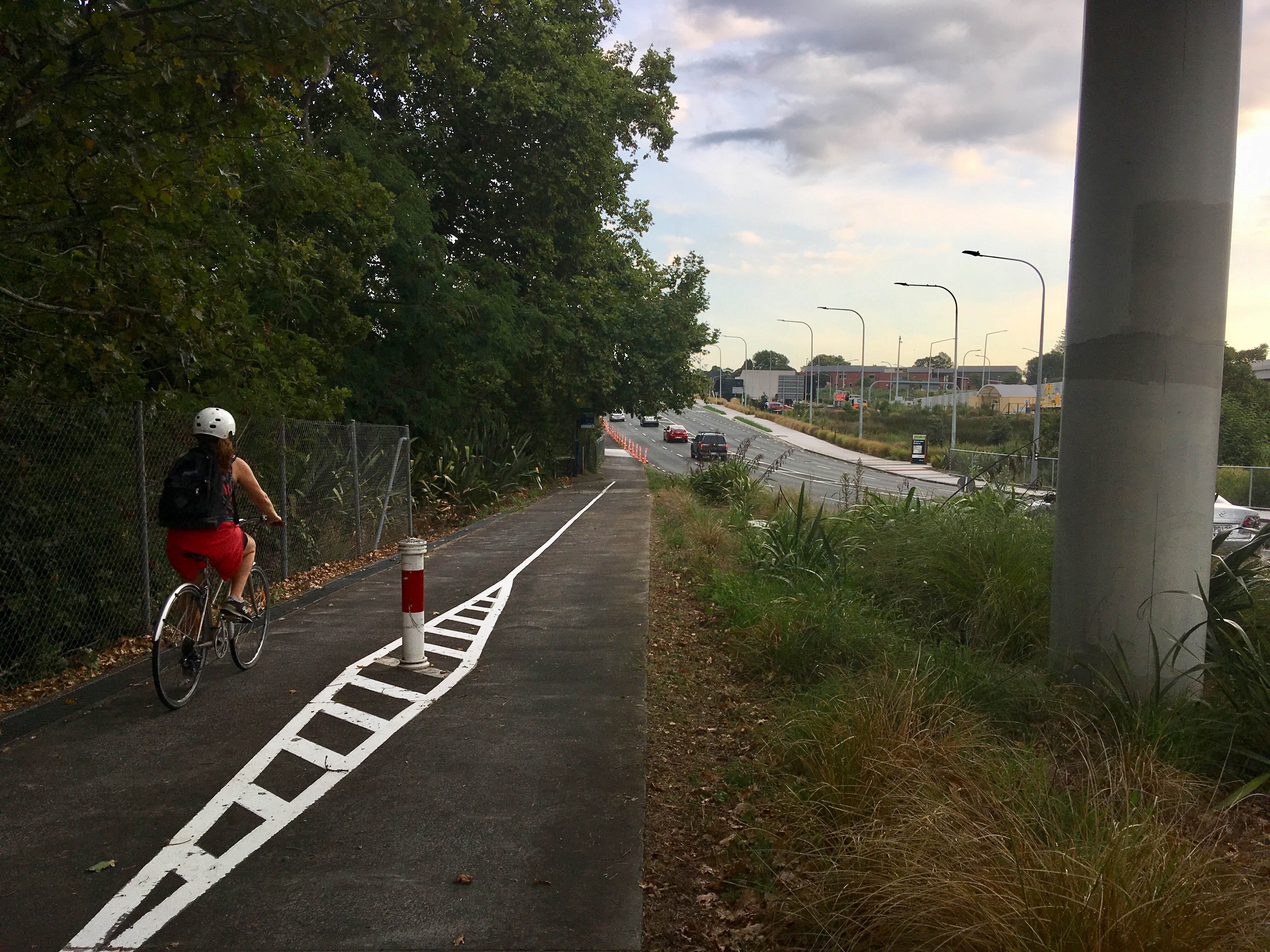
The great NW pruning project
In the last week of March, the great Northwestern Cycleway vegetation control project finally cleared the way along our fastest-growing bike route. Greenery was trimmed from Waterview to Newton Road, including some very overgrown sections that had needed citizen intervention over the summer.
Naturally we’re very glad this work has finally been done. And we know exactly what your next questions will be:
- How did it get like this, and will maintenance now be done on a regular schedule?
- How about some trimming on other overgrown paths around the city?
- What about maintenance of cycleway surfaces, which were also in the news in March and not in a good way?
As of April, AT and Auckland Council will be officially divvying up the work into ‘clean’ (AT will be in charge of surfaces) and ‘green’ (Council’s Parks department will address things that grow). We’re meeting next week with representatives from both teams, and will convey the vital message that maintenance isn’t just a nice-to-have, it’s a safety issue. And we’ll report back to you about their respective plans for staying on top of requests and regular upkeep.
Speed calming for Papakura and Te Atatu South
Speed calming measures for local areas in Papakura/ Rosehill and Te Atatu South were consulted on late last year, and will start construction in April. These are model projects aimed at lowering speeds to reduce crashes and discourage rat-running.
Expect to see more of these neighbourhood traffic calming projects in coming years – and we hope the safer speeds programme expands to match, with survivable speed limits in residential areas and around schools.
Raising the Roundabouts
Auckland Transport is also proposing a number of roundabout upgrades, such as this one at Bader Drive and Idlewild Ave in Mangere Bridge, and this one in Onehunga at Church Street and Victoria Street (open for consultation until 3 April).
The great news is that the roundabouts will either be entirely raised, or will have raised zebra crossing platforms on the approaches. They’re also largely single-lane, despite some pressure to make them multiple-lanes. Single-lane small roundabouts are already one of the safest intersection types, and with approach ramps to further slow down drivers – plus added walk/bike priority crossings – they can be actively great for people walking and cycling.
Even so, these intersections (and the streets they serve) are still lacking bikeways, even painted ones. While it’s good to see AT making existing roads and footpaths a lot safer, we’d like to see more tactical thinking to leverage the safety opportunities these roundabouts will provide.
So, as we move into April and the second quarter of the year, our question to Auckland Transport in particular is: can you get tactical, and fast?
If you can put up hit-sticks more or less overnight to protect verandahs from double-decker buses, can you do the same to protect people on bikes from passing traffic?
Can you take better advantage of planned road renewals to deliver sections of basic bike network while the diggers and paint pots are on site?

And can you prioritise some quick and clever safety solutions in the parts of town that – at least in the current plan – will otherwise have to wait a decade or two for safer streets for cycling? The public you serve is eager for answers.