Imagine if someone announced a new 7km off-road cycleway connecting well- established residential parts of Auckland with wide smooth paths, spectacular city and harbour views, high-flying bridges revealing historic pathways passing bush, streams and estuaries, and linking to train stations. Would we be ecstatic and bursting with anticipation? You bet!
That’s how we responded in 2014 when the Glen Innes to Tāmaki Drive Shared Path (GI2TD) – Te Ara Ki Uta Ki Tai (the path of land and sea) was first announced. It was miraculous and ironic that the route would occupy the wide strip of land formerly planned for the eastern motorway intended to carve its way from East Auckland through Glen Innes, St Johns, Meadowbank, Orakei and Parnell. From the moment Waka Kotahi discussed the cycleway concept with Bike Auckland we have been staunch, vocal cheerleaders for the project, in public and behind the scenes. Tamaki Drive has been beloved by road cycling groups for decades, but we knew that GI2T would create dramatic scope for safe, high quality transport cycling in the valleys behind Tamaki Drive towards the city from Glen Innes, as well as providing connections to ‘landlocked’ parts of suburbs it traversed.

For the past 8 years Bike Auckland has spent hours giving feedback on draft designs, reviewing progress, asking questions, pushing for more funding behind the scenes, helping the project teams raise awareness of public consultations and calling for faster delivery and project completion, as well as advocating for ‘branch connections’ (like the John Rymer Place link). You’ll see at the end of this introduction that our work hasn’t finished – we’ll be staying on task and calling for project completion by the end of 2025.
Back to the start! It was an emotional day in December 2016 when Stage 1 from Merton Rd to St Johns Rd opened. It felt so full of promise of more safe cycling to come, linking to Tamaki Drive, the busiest cycling route at the time in the country.
As 2017 dawned we were starry-eyed, accepting the news that the rest of the construction would occur as 3 stages to speed up delivery and help with funding. It seemed a bit odd that Stage 2 was parked, and construction moved to upgrade the existing Orakei Basin boardwalk running beside the railway line. Even more confusing was the delayed start to the work and its slow completion in 2019, but we were glad to have the wider pathway across the Basin, with its connections to the Meadowbank and Orakei Train Stations.
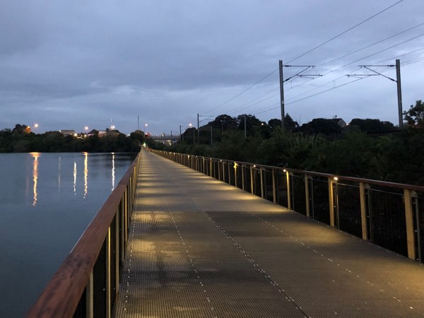
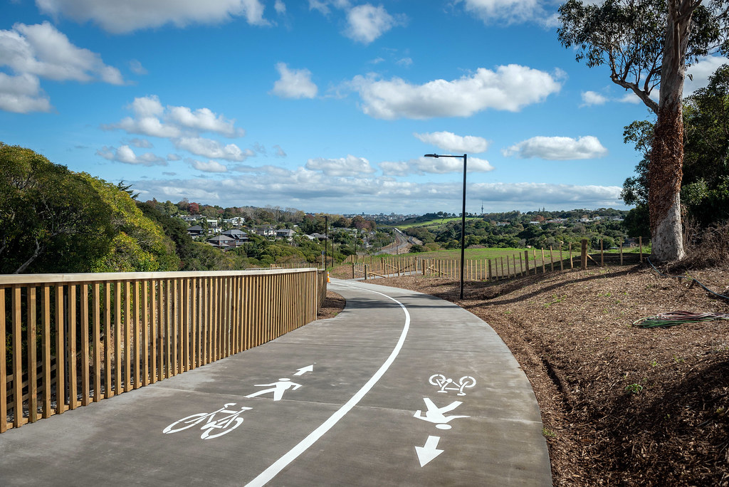
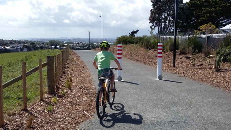
Our spirits lifted with the sod turning on Stage 2 in 2020, and since then we’ve been positively buzzing as we’ve watched the huge bridge piers emerge from Purewa Valley to straddle the railway, along with boardwalks and the tempting sight of wide smooth concrete concrete pathway threading behind houses to connect finally with the Meadowbank Train Station.
And Bike Auckland were not only cheering the project on, we were advocating for better connections to the proposed path.
Another Bike Auckland win to celebrate along the way
Bike Auckland have consistently made the case for linking the cycleway to existing recreational paths and nearby streets, so as to make local journeys possible and to integrate the path into the neighborhoods it passes through. (We’re also battling tirelessly for better cycle facilities on the roads that will bring people to the cycleway). And, along with shopping centres, businesses and health centres, there are probably 3000 homes within cooee on both sides of the valley.
More than 1,000 of those homes, in places like John Rymer Place and the Gowing Drive area, would have been “islanded”, with no access to the path, unable to get along the path to Meadowbank train station – or across the Pourewa Valley safely to St Thomas’s School and Selwyn College.
You heard right: there are two schools whose zones straddle the green corridor – St Thomas’s and Selwyn College. At the moment, those kids living south of the railway have to take a trip round three sides of a rectangle via urban arterial ‘trucking routes’, St Johns Road and Kohimarama Road on the east. Properly connected, this path could change their lives, by making it possible to get to school while taking lots of cars off the roads (and this is pretty topical with the Cycling and Mobility Programme Business Case just being approved this month).
As one observer noted, constructing this section of path without side links is the access/mobility equivalent of running water and power lines past houses… but not actually hooking anyone up.
So in 2016 Bike Auckland worked a bit of magic using an Open Street Map to show the impact of a 150m connection on accessibility to the path.
Using an Open Street Map, with the new Stage 2 section of the path added in red – we estimated the catchment first with, and then without a key additional side path. We started from Meadowbank Train Station, which is a good local marker because everyone knows where it is.
Then we went out 2km, and then 3km, following all the branching paths and local roads (major caveat – not all routes on the map are cycle-friendly), to see just how far that took us.
The results are in the animation. See how one short side path of 150m opens up a new catchment that’s within a 3km ride or walk of the station?

Pretty stunning, eh? Suddenly, the path is not just something to pass through on – it starts to provide a local role. It makes it easier to get to schools, train stations, friends, shops, activities… That’s the power of an actual network and people advocating for an actual network.
While the John Rhymer connection is ready to go we will wait with anticipation to see this section of the path working at full capacity with the opening of the Gowing Drive connection in the next couple of years.
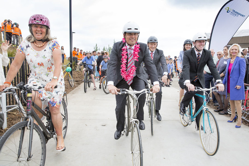
It’s now 2022 and we’re about to witness the opening of Stage 2. This is an astounding achievement given that the work has straddled the horrendously difficult construction months of Covid. We are fully in awe of the contracting team and their supporting sub-contractors that delivered this result. We take our hats to you and convey huge gratitude for your commitment and hard mahi!

The brilliant features of Stage 2 beg to be ridden, so it will absolutely be a red letter day in Auckland’s cycling calendar. It will be the talk of the town, but let’s not forget that the hugely important last stage of this epic project has yet to be started. Stage 4 from Orakei follows the foreshore of Hobson Bay, shielded from nearby residents by mature waterside pohutukawa, basking in all day sun, over harbour waters, with a backdrop of the city. We can’t oversell how valuable this connection will be, and how adored it will be by the citizens of Auckland. We were all consulted about this stage in 2019, yet work has yet to begin.
It will be a decade in 2025 since the 7km project of Glen Innes to Tamaki cycleway began. Let’s commit to doing everything we can to make sure we are riding the whole route before the end of that year!
Mark the 25 May at 9am in your dairy and come and join us to celebrate the opening!

Read more about the history of the Glen Innes to Tāmaki Drive Shared Path – Te Ara Ki Uta Ki Tai (the path of land and sea):