Post by Ben L
Following on from the previous post on cycle streets, just as with the network for motorised vehicles requires “arterials” to carry high traffic volumes, cycle networks need the same. But these routes will often be popular for motorists as well and will require some work to be suitable to both.
The North Shore suburb of Bayswater is a dead end peninsula with the ferry terminal on its tip. It also has Belmont Intermediate, the school with the highest mode share of cycling in Auckland – and the recent opening of the new pipeline bridge has helped to bolster cycling and walking numbers. Below is an aerial shot of the peninsula:
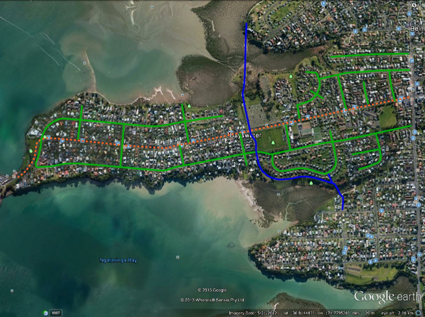 The dotted orange line is Bayswater Ave – the main arterial for motorised traffic. The solid blue line is the existing off-road shared path (called the “Green Route”, but bear with my colouring logic!), and the solid green lines are the remainder of the streets around Bayswater.
In order to create a link between Lake Road, the ferry terminal and the Green Route, the Roberts Ave/Norwood Road route could be turned into the main arterial down the peninsula for non-motorised traffic. This cycle/pedestrian boulevard would run from the corner of Lake Road down Roberts Avenue, along Norwood Road to Sir Peter Blake Parade and terminate at the Bayswater Ferry Terminal.
The second aerial shows the proposed route in green (with the existing off-road route in blue):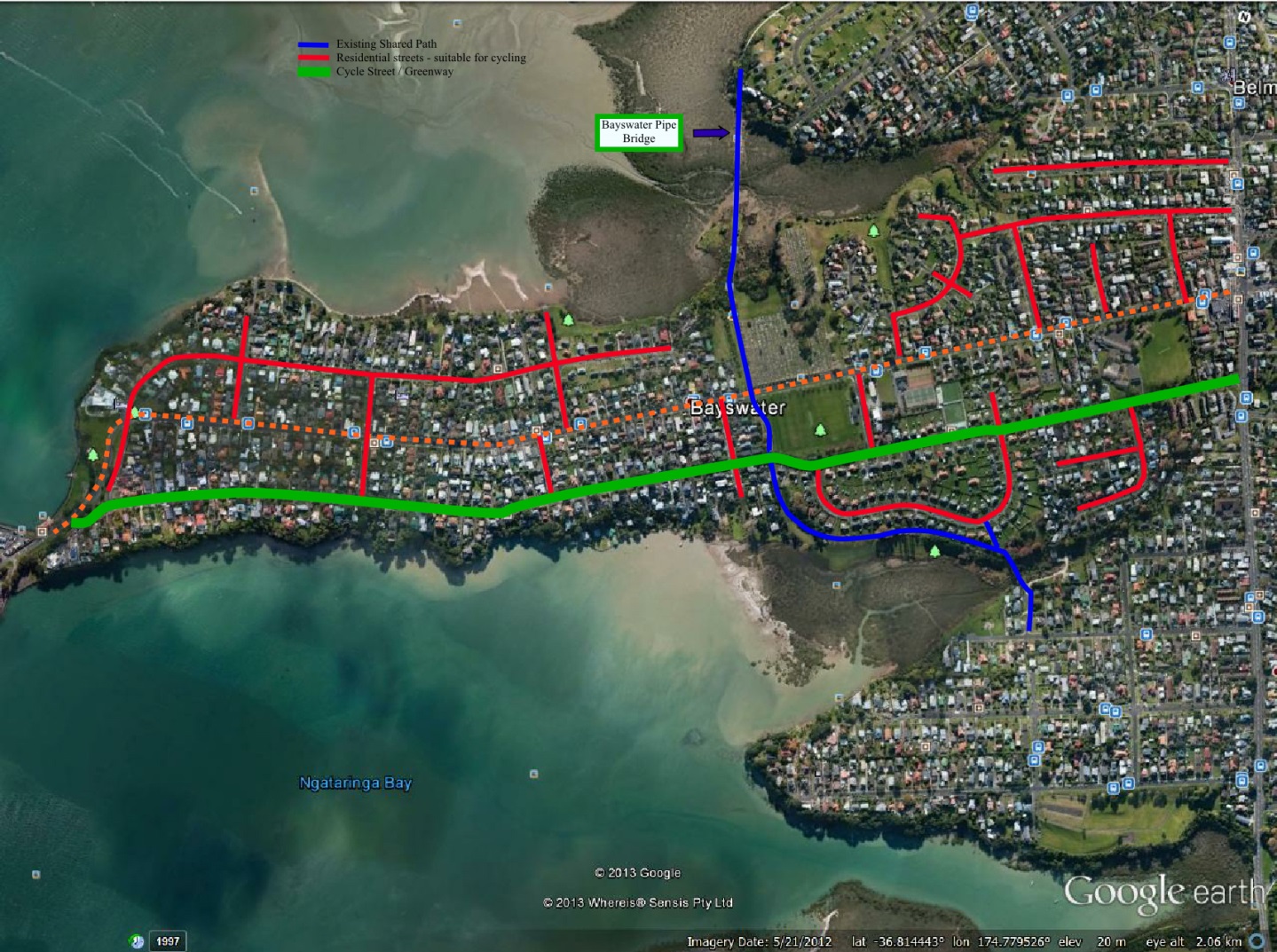
The features of the first stage of the boulevard would be:
- Signage to indicate new street environment and destinations for cyclists.
- Removing centre line from the whole length of boulevard route.
- Painting lines to indicate parking areas with small door clearance buffer to narrow road.
- Periodic traffic calming, possibly with curbside separated cycle bypass paths (to prevent cycle pinch points)
At first, we were proposing mainly speed bumps. However, at the recent (and hugely successful) opening of the new pipeline bridge in Bayswater, a police officer told me that these are generally opposed because of the constant braking and accelerating they cause.
A much more popular option for some are chicanes. A good – if not quite perfect for cyclists – example of the kind of effect achieved by chicanes can be seen down Clayburn Road in Waitakere.
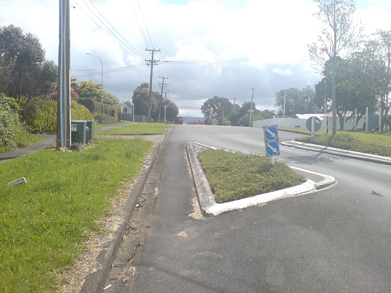
Though for cost reasons, the first iteration could possibly just be marked out with bollards or maybe plastic planter pots (if we use appropriate spacings, we might not even need complicated cycle bypasses – riders could just slip between the posts / planters).
[Editor’s note: The question is, though, whether we should accept the fact that some people dislike speed tables – spaced appropriately (i.e. closer than some motorists would like) they can ensure that speeds overall drop and become more consistent. A slow down/speed up behaviour may just show that we haven’t really been strong enough yet in number or type of this treatment. Chicanes also need to be rather “harsh” to have any speed calming effect (i.e. creating single lane pinch points for cars, with cycle bypasses each side to be safe for riders). However, the big advantage of chicanes – especially as trial schemes – could be that they would be cheaper and quicker to install.]
If demonstrated increase in cycling is achieved, further stages could offer further safety and traffic calming measures (e.g. raised tables at intersections with northern side streets, one way ingress/egress at northern side streets) as well as more elaborate chicanes.
Just to be clear, the proposed cycle boulevard will NOT:
- Remove on-street parking for residents or visitor
- Remove traffic lanes
- Affect the ability of traffic to travel at safe speeds on the boulevard
- Require expensive cycle paths or other separated cycle infrastructure
- Affect any arterial roads in the area
The cycle boulevard WILL:
- Make traffic to travel at a safer speed of 30km/h so that cyclists, especially school children, can feel safe on the boulevard
- Have cheap traffic calming measures to ensure traffic travels at safe speeds on the boulevard
- Encourage school children to travel to school on the boulevard
- Encourage commuters to travel to the Bayswater ferry terminal by cycle
- Replicate the form of the successful cycle boulevard/neighbourhood greenway network in Portland, Oregon
- Create cycle friendly, low speed streets that have been very successful in the Netherlands and Portland, Oregon
- Integrate with the existing Green Route and the cycle lanes on Lake Road
- Have clear signage indicating the route of the boulevard and destinations accessible from the boulevard
We have had great support from local schools, the Bayswater Community Committee and all the residents who attended the pipeline bridge opening (though possibly a partisan crowd). Boulevards like these can create walking and cycling “arterials” to allow residents to move freely between the smaller, quieter residential streets. This creates walking and cycling as real transport alternatives, whether it is for a bottle of milk, a trip to a friend’s house or a swim at the beach. This is how we start to reduce congestion and create a more liveable city – not with expensive road widening.
If you know any residents of this area, please forward this to them for their support. If a proven concept, we hope this cheap and effective solution could be rolled out to more suburbs to create cycle friendly corridors all over Auckland.
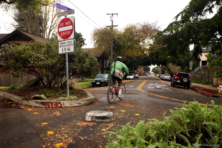
We’ll leave you with an example photo of a bike boulevard in Berkeley, in the US. If they can do it, so can we.
