
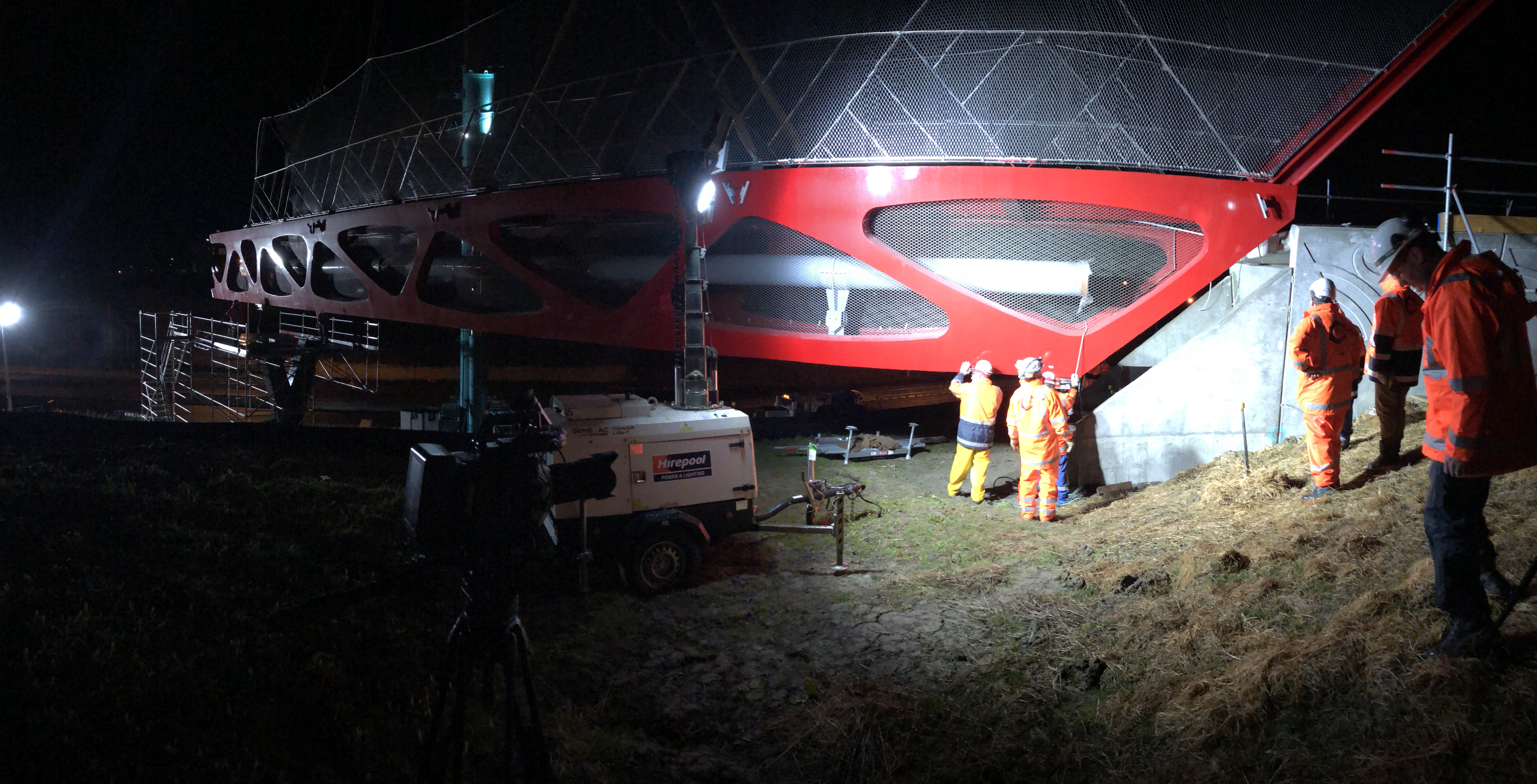
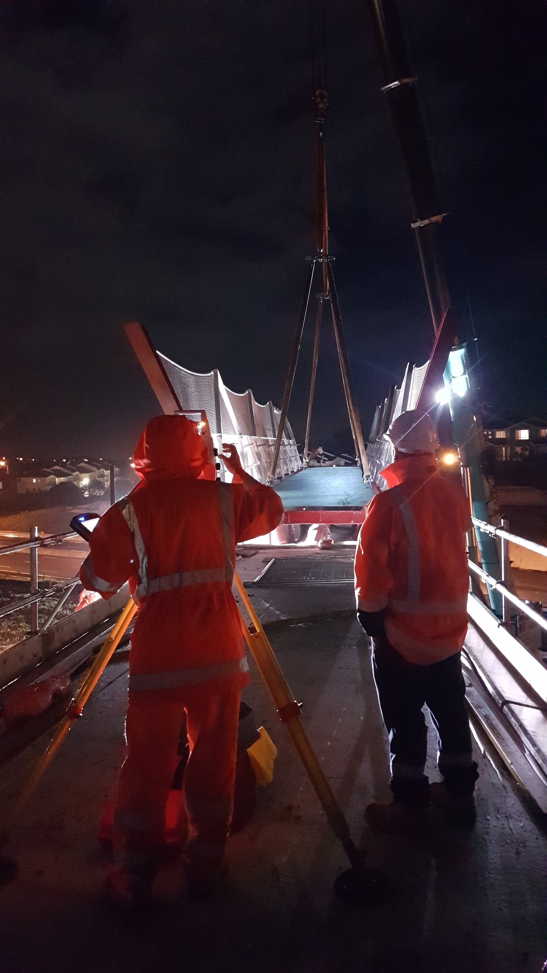
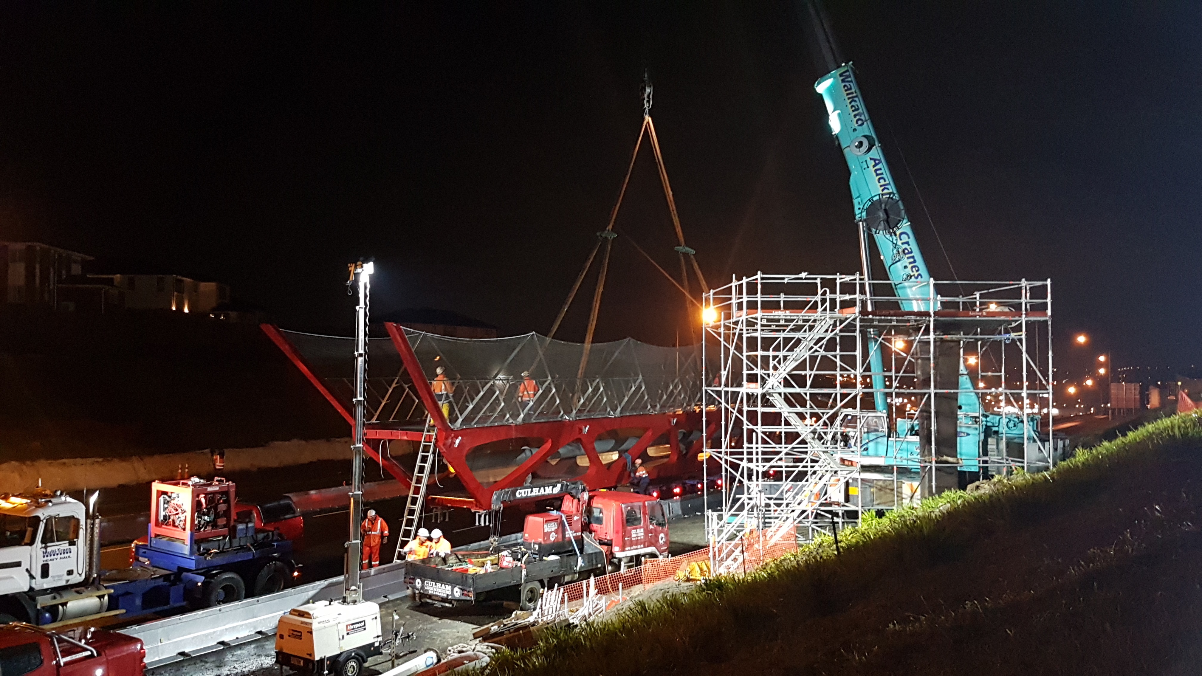
A brand new walking and cycling bridge is appearing this week across the Northern Motorway at Albany, slotting neatly into place – one third at a time – over a series of night works. This is Tirohanga Whanui (the name means ‘A Panoramic View’), which will join Spencer Rd to Corinthian Drive, and reconnect Albany metro with Pinehill and the East Coast Bays.
If you’ve driven up that way lately, you’ll have spotted the parts of the new bridge sitting by the side of the motorway like so many giant pieces of highly artistic Lego. Thanks to our friends at the Northern Corridor Improvements team, we can share these dramatic images of the grand process of lifting and manoeuvring the first section of the bridge into position.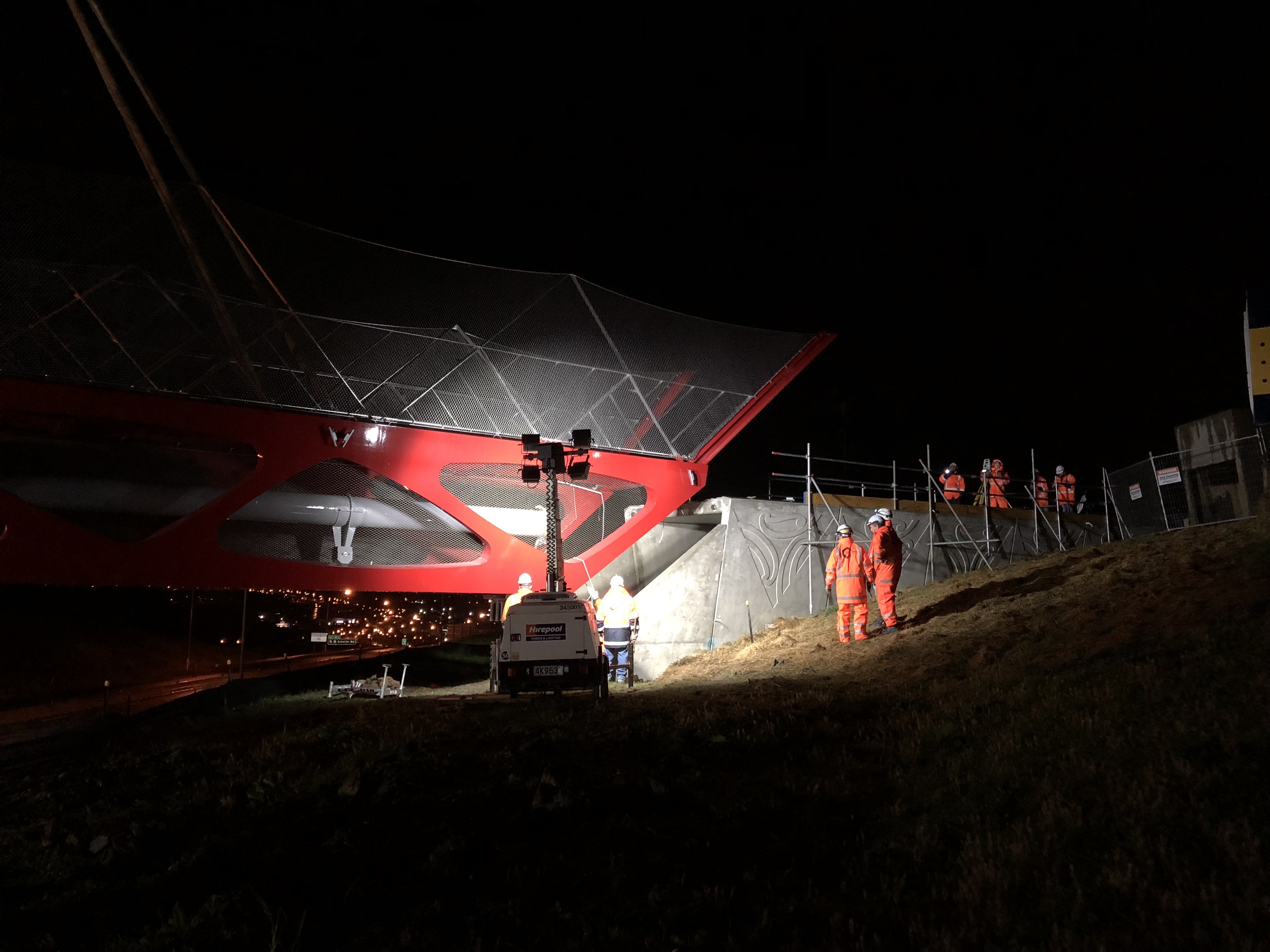
The design of the bridge, by iwi artist Graeme Tipene, invokes the idea of knitting the landscape back together: Spencer Road, before the motorway cut it in half, traced a ridge path (ara), one of many originally used by tangata whenua to traverse the area and navigate the waterways (awa) in the valleys, so the bridge helps restore that connection. The concrete abutments depict the ridges and valleys amidst rising mist, and the bridge structure and handrails featuring a traditional weaving pattern.
At the pragmatic level, this is also a clever two-for-one project, as NZTA and Watercare have worked together to efficiently add an upgraded water-main, which will be suspended under the bridge.
But wait, there’s more!
The new bridge is a key connection to the new cycleway and walkway being built as part of the Northern Corridor Improvements project. Images of the planned path were a crowd-pleasing highlight at our AGM in August (our thanks to Alex Elton-Farr for a riveting presentation!), and we’re excited to share those details here, especially as the design narrative is so powerful.
Overall, the project will deliver 7.1km of shared path along SH1 and SH18. (See the NCI shared path and local connections here (PDF) or click the image below to enlarge).
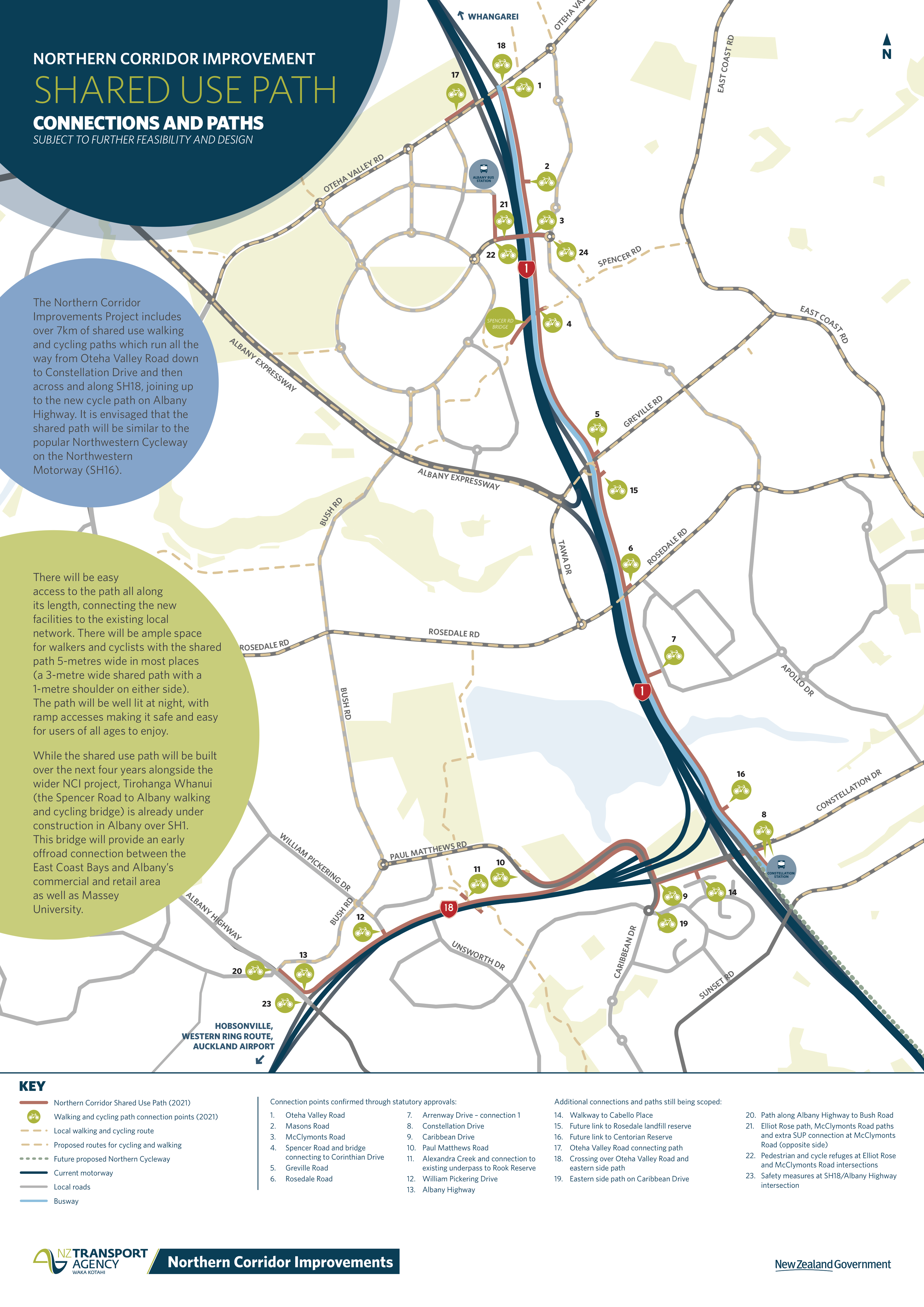
The original design included 14 connections to local streets or to greenways (i.e. through parks). At the Board of Inquiry, which brought Council and AT into the mix, Bike Auckland asked for a whole lot more local connections – resulting in side agreements that will deliver a total of 25 local connections. The new connections also include an extra link at Constellation Drive courtesy of the delivery team, and AT has also committed to funding a new SH18 underpass at Rook Reserve as part of the Alexandra Stream connection.
(Yep, that’s eleven extra local connections Bike Auckland won on your behalf – you’re welcome! Our enduring gratitude goes to our North Shore infrastructure liaison Steve Southall in particular, for his clarity and patience and many hours spent making the case for these links).
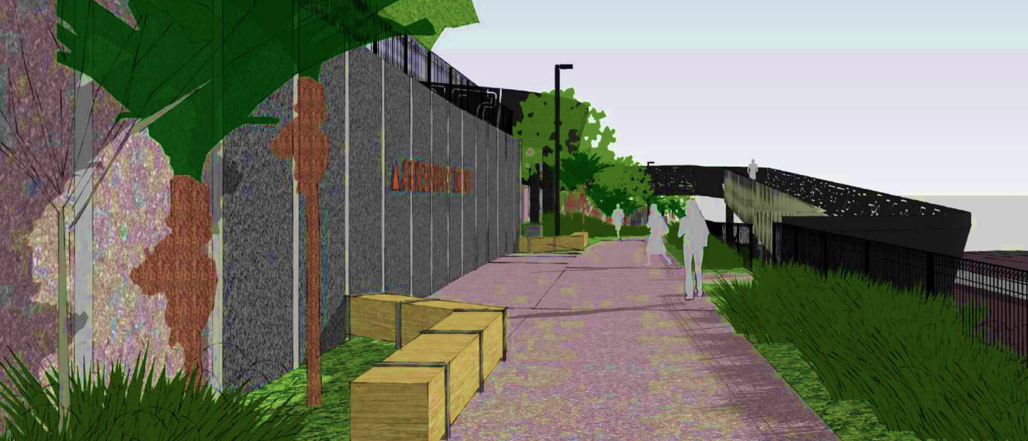
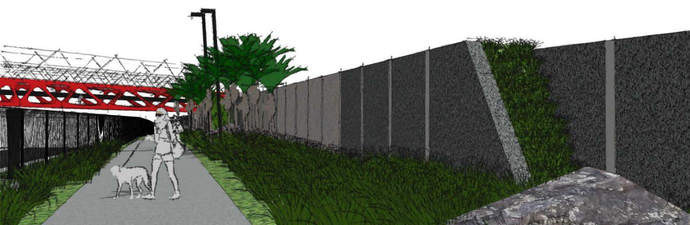
The main ‘spine’ of the path will be 3m wide, with 0.5m shoulders for most of its length, so it will feel wider. There’s an impressive quality to the design language, which ties into the local landscape, following themes of pathways and waterways, ara and awa, and the foliage that once blanketed the area.
There will be substantial native planting along the path, for example:
And two bridges along the pathway will deliberately reference the sinuous patterns of the kareao, the supplejack vine.
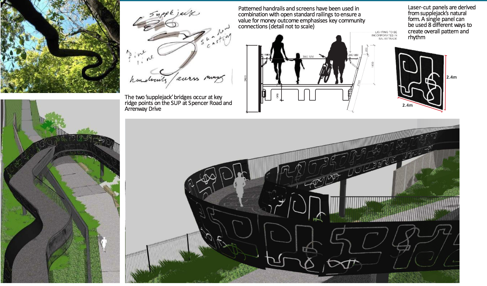
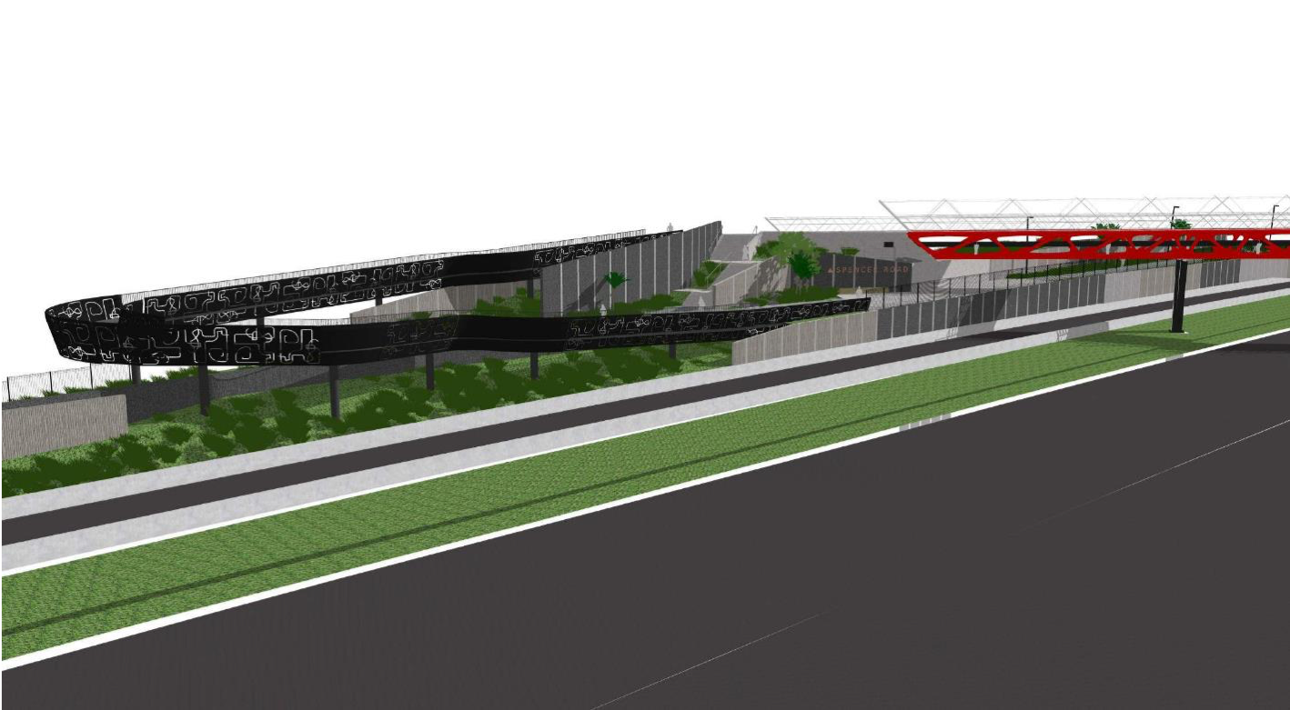

We love the gorgeous design flourishes on these bridges, and appreciate the way the subtle chicane effect will help slow down people on wheels.
That said, something we’ve raised with the design team is the issue of visibility on those tight inner corners. As with the Canada St connecting bridge to Lightpath, people will need to be able to ‘see through’ the bends so as to have advance notice of oncoming walkers and riders (especially wee ones shorter than handrail height, as in the silhouette in the first image above). This could be achieved by, for example, using more of the vertical-railing panels at key points – with attention to the way even these can form an opaque barrier when viewed at an angle. In any case, the project team is looking into it, and we’ll let you know of developments.
Above all, it’s exciting to see our city’s cycleways and walkways maturing from the strictly functional and utilitarian to beautiful artworks in their own right, especially when they’re also about restoring human-scale connections and natural detail to an increasingly urbanized landscape. We look forward to traveling this new pathway and rediscovering the valleys and ridges of this part of the North Shore when the whole project is complete (the current timeframe for completion is 2022).

UPDATED December 2018 – Check out this video of the installation:


