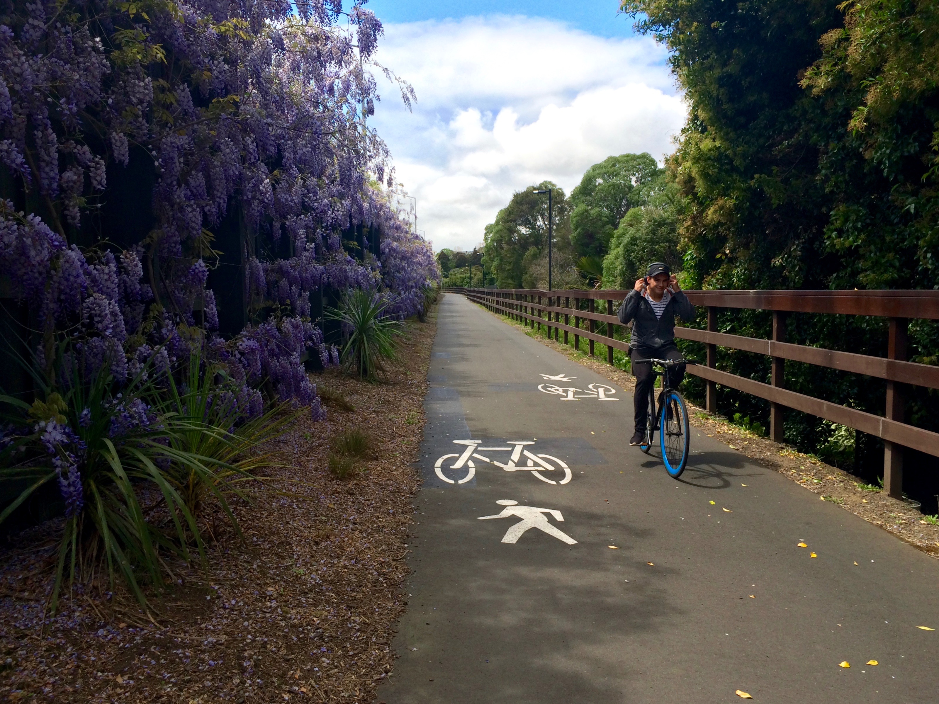
This is a tale of two paths. We begin out west, on a stretch of the Northwestern Cycleway. This is a ‘road of national significance’ for people on bikes – a commuter path from the far west into town. But at the local level, it also makes all sorts of handy journeys possible for people like Penny and her family, who use the path to access school, daycare, and work.
Motorway-style routes have a seductive A to B directness, whether they’re for cars or bikes, but what makes them truly useful, as Penny’s family’s story shows, is the exits – the on- and off-ramps, if you will.
Of course, the Western Springs/ Kingsland stretch of the NW cycleway is especially rich in access points, a legacy of how SH16 was sliced through the heart of the original connected neighbourhood. Take the 2.5km stretch from St Lukes Rd to the Waima St over bridge that leads to Penny’s school. There are by a rough count 14 connections to local streets. One every 180m or so!

This frequent access and deep connectivity (albeit it strongly favours the southern side) have made this section of path a busy thoroughfare, and not just for cyclists. School kids use it morning and afternoon, joggers and dog-walkers share the path, and in spring when the wisteria is in flower, it could be a slice of Europe.
Compare this with another 2.5km-ish stretch of the NW cycleway nearby, along the Causeway between Rosebank Rd and Waterview. It’s a smooth ride – but a long walk if you get a flat tire, because this Two and a Half K has zero connections to local streets.
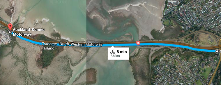
That’s because of course this 2.5km is mainly home to excellent bird life and the occasional stranded whale (although, that said, the planned connections to the ‘islanded’ Waterview and Pt Chev back streets on the right will be extremely handy for locals; especially Waterview, which has to contend with the moat-like Great North Road.) But all in all, it’s a long uninterrupted ride from one end to the other, and it simply connects A to B. Which is not such a problem, because on that section, there’s little XYZ along the way.
Imagine the frustration if the section of path through Western Springs/ Kingsland had no exits. Picture it. In fact, how about a thought experiment so we can really feel it. Let’s think about this distance in terms of travel time.
Google’s a bit optimistic about biking speed, but let’s call 2.5km a ten-minute ride for ordinary folk. For comparative purposes, how far could you go on a motorway in a car in ten minutes, assuming free-running traffic and sticking to the speed limit?
Google says 16.6 km. To put that in perspective, a reasonable 10-minute motorway trip under Sunday-driver conditions might take you from:
- Town to Te Atatu
- Town to Takapuna
- Princes St to Princes St: from the university to Otahuhu.
Now, imagine exits every kilometre or so along those routes, analogous to the Kingsland section of the cycleway – oh wait, there are! Righto. That’s a well-connected stretch of motorway.
But now imagine if there were zero exits along the way (exactly like the cycleway along the Causeway). No exit between town and Te Atatu. No stopping between the city and Takapuna Beach. No way off between Auckland U and Otahuhu. Connectivity denied.
—
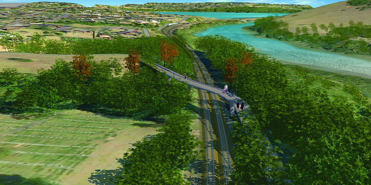
And that brings us to the second 2.5km path in this story: the GI to Tamaki Shared Path, currently being designed and constructed in four stages (thanks to the Urban Cycling Fund). When completed, it will run all the way from Glen Innes, through the Pourewa Valley (the green corridor once set aside for the Eastern Highway) and across and around the Orakei Lagoon, to connect to Tamaki Drive near the city.
Just as its NW counterpart has done for the west, this NE cycleway will open up huge swathes of the east to bike commuting.
From our first engagement with this project in November 2014, we’ve seen this path as not just a utilitarian urban access route for long distance commuters, but an iconic destination and local treasure in its own right. We’ve consistently made the case for linking the cycleway to existing recreational paths and nearby streets, so as to make local journeys possible and to integrate the path into the neighborhoods it passes through. (We’re also battling tirelessly for better cycle facilities on the roads that will bring people to the cycleway).
In other words, this path will not only link Glen Innes to downtown, but will also allow for smart local trips like Penny’s family’s rides – if it comes well-supplied with local connections.
Wait a minute. Did we say ‘if’?
Yup.
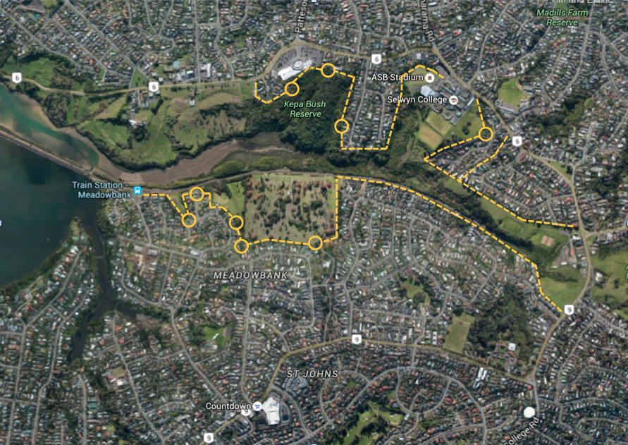
Because there’s a chance that Stage 2, which is the 2.5km stretch between St Johns Rd and the Orakei Boardwalk, may yet make it through construction with no side connections (only the future possibility of them).
This would be a massive shame, to put it mildly. Because unlike the scenic Causeway out west, this section of the journey isn’t just for the birds.

The connective potential is huge.
In this 2.5km section, Meadowbank train station (10 minutes to Britomart) is on the route of the path itself.
And, along with shopping centres, businesses and health centres, there are probably 3000 homes within cooee on both sides of the valley.
More than 1,000 of those homes, in places like John Rymer Place and the Gowing Drive area, will be “islanded”, with no access to the path, unable to get along the path to Meadowbank train station – or across the Pourewa Valley safely to St Thomas’s and Selwyn College.

You heard right: there are two schools whose zones straddle the green corridor – St Thomas’s and Selwyn College. At the moment, those kids living south of the railway have to take a trip round three sides of a rectangle via urban arterial ‘trucking routes’, St Johns Road and Kohimarama Road on the east, or via Orakei Road / Kepa Road in the west. Properly connected, this path could change their lives, by making it possible to get to school while taking lots of cars off the roads (and this is pretty topical).
What’s more, the Pourewa Valley itself is a unique, ecologically significant place: it’s by far the largest tract of estuarine native bush in the isthmus, and is being lovingly restored. The GI to Tamaki path runs right through it, past an established network of trails. If these trails were connected to the path, they’d get even more use, which would make for a safer and livelier space.
Imagine bridges, a boardwalk or two across the creek to make loops for walking and running, linking Meadowbank and Kepa Bush, and Kepa Road to Meadowbank Train Station. A fully connected shared path would bring this space to life. And give your kids (and you) an awesome backyard ride or walk, too. Some balance to the Xbox and smartphone sedentary seductions that we all tend to fall prey to in our daily lives.
So why is nothing proposed to be done about this right away?
We’re not saying that anyone among the decision-makers is just willfully closing their eyes to the possibilities. There are a couple of factors that make this difficult, including terrain: the gully is pretty steep and bush-clad, so creating paths, especially for bikes, is not like crossing an open field.
But the major hard issues are boring stuff: zoning and costs.
Zoning – well, for instance, we’d have to go back a couple of decades, and ask the people who laid out places like Gowing Drive what they were thinking?!? A street of over a kilometre long that turns its back to the gully and has not a single gap in the row of private properties. Not one alleyway. Not one track. Not even one maintenance access. Not a thought given to a project like this happening one day, when people might want to explore the public green space over their back fences. So this means that, short of Council buying a property to get through-access, Gowing Drive may stay “islanded” for a long time yet.
On the northern side, things look a little better. Some accesses may well be doable – but not on the cheap, because you still need to build the connecting path, maybe with the odd small bridge, etc. And that money is simply not in the budget for the main path. We’ve asked, and the cash is tight. Yes, NZTA and the Minister of Transport are putting in a lot of funding for this flagship project – but it won’t cover any additions, we’re told, especially as the project managers will need to keep some in reserve for contingencies (you never know what issues you might find once you start actually digging…)
But there’s still time to make sure this is done right
How many side connections could there be in this 2.5 km? One every 200m would make for a dozen connections. The potential is huge. Let’s aim for at least a few, and see them built this decade, rather than the next.
As one observer noted, constructing this section of path without side links is the access/mobility equivalent of running water and power lines past houses… but not actually hooking anyone up. And the likelihood is that without ‘official’ links in place, people will try to work out how to get across as soon as the rail overbridge is in place. (Probably not by bike… but you never know!)
That’s why as transportation advocates who have been influential for lobbying for the project, we want to make sure that this situation has been well recognised and anticipated while everyone involved has ample time to do something about it.
So who needs to do what?
- We will continue to advocate for a quality path, maximised side links, and safe connections at each end, to Tamaki Drive and Merton Road (that’s another story altogether).
- And the Local Board could sponsor side links and prioritise their construction.
Here’s the good news: the Orakei Local Board’s list of priorities for the 2016/2017 budget (see full list here) includes scoping and providing connections to the path:
- developing cycling and walking connections to the Orakei Spine (Glen Innes to Tamaki Drive path) from Tahapa East and West Reserves
- providing additional funding in 2016/17 for design and consents for additional connections to the Orakei Spine (Glen Innes to Tamaki Drive path)
You can help by giving supportive feedback on the Orakei Local Board’s priorities, using this feedback form (scroll down to find Question 5b about the priority projects).
Anyone can comment, but feedback is especially valuable if you’re a local and can say how adding side-links would improve your walking or biking life.
NB Feedback must be received by 4pm Thursday 24 March 2016.
This really is an important and visionary project, with massive potential to open up the neighbourhood – let’s make sure it’s accessible to as many people as possible, so they, too, can experience the happiness of having a cycleway in the back yard.