
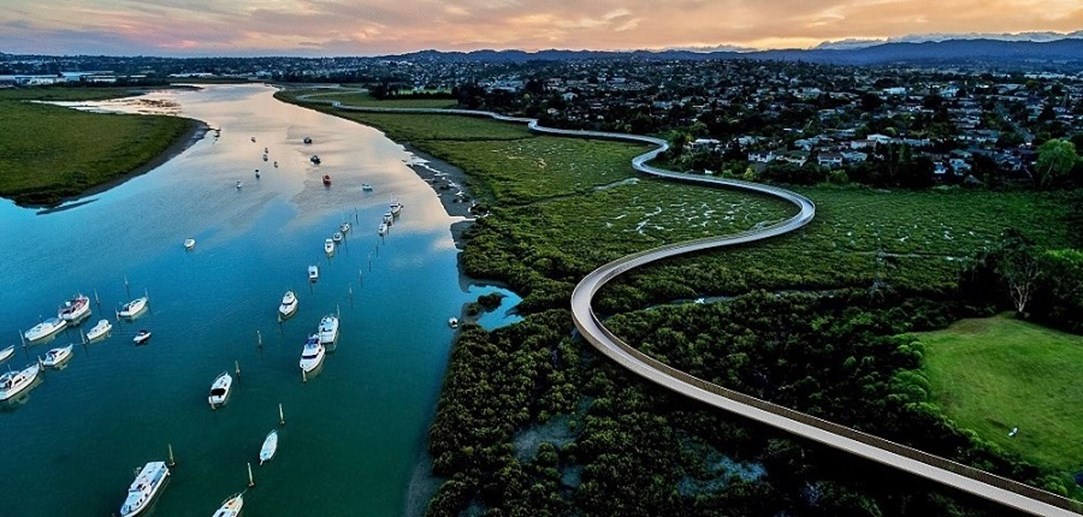
The fabulous Te Whau* Pathway project is leaping ahead, with a draft preliminary design now out for public consultation. We’re reported before on how this Greenway will create 12km of safe shared path along the western edge of the Whau River, from Te Atatu to Green Bay, to be completed over the next 5-8 years. Some sections are already in place, but this plan will make sure that future stages will work best for the grand vision!
(*If you’re not familiar with Whau, you may be tempted to pronounce it ‘Wow’ – in fact, it’s ‘Fo’, as in, yes, that beautiful vision is fo’ real!)
Te Whau Pathway is a truly exemplary Greenway project – ecologically and historically sensitive, handsomely designed, and fully attentive to multiple community needs, it brings together the Whau Coastal Walkway Environmental Trust, the Whau and Henderson-Massey Local Boards, Te Kawerau a Maki, Ngati Whatua Orakei, Auckland Transport and Auckland Council. And now you!
So what are your thoughts about the pathway? In particular, what would make it even better for people on bikes? See our thoughts below…
Connections
This will be both a leisure facility along the waterway, and an attractive transport connection between town centres, sports grounds, and schools, just for starters. So there may be local links that will help maximize its value as a transport route.
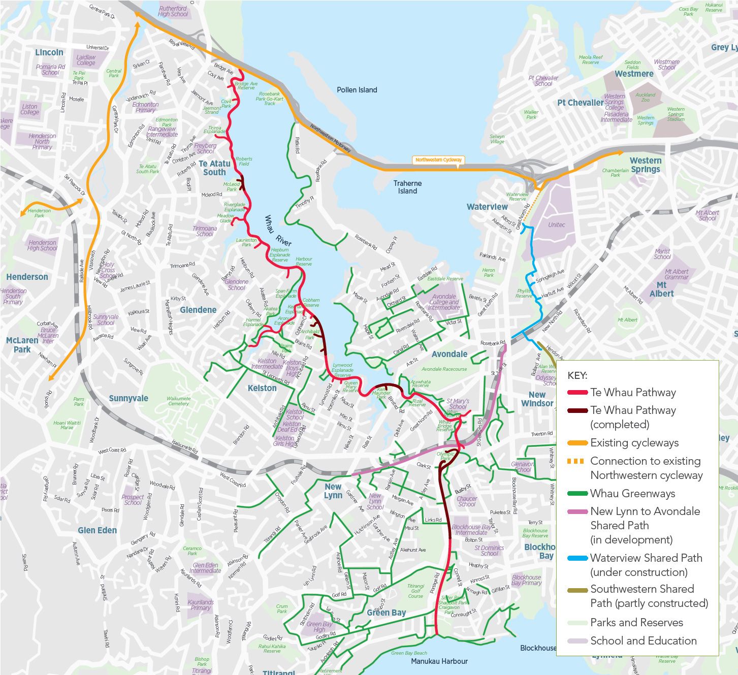
The design materials show the potential long-term goal of a bridge across the river to the Rosebank peninsula, via Hepburn Rd. Our mates at Greater Auckland (formerly Transportblog) have floated the idea of two bridges, one from McLeod to Patiki Rd (which would tie in nicely with the Northwestern Cycleway), and another at Archibald to Avondale Rd. What do you think?
And, looking beyond those immediate links, what potential does this new green ‘spine’ raise for improving biking through adjacent neighbourhoods? Commenter Stu at Greater Auckland has some astute thoughts on this. For starters, the on-road sections at the southern end are currently just paint, and projected to remain thus. And there’s potential for a much more direct alternative connection from the pathway to New Lynn, via Delta Avenue.
Width and separation
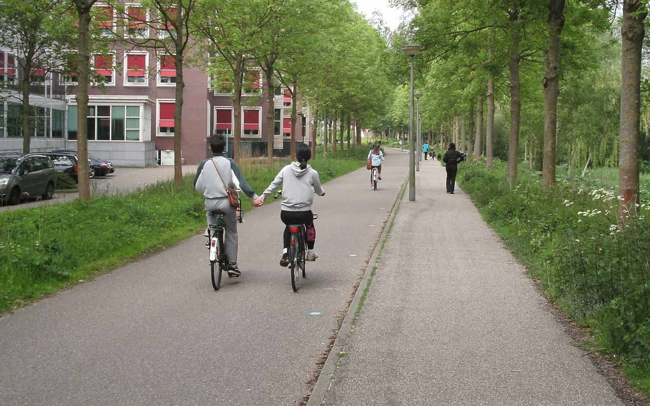
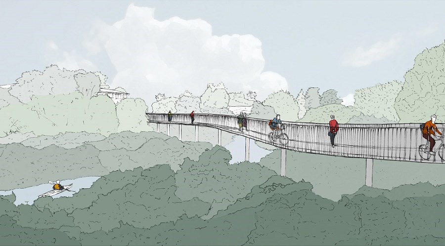
Given this will be a shared path for pedestrians and people on bikes, we’re glad to see a minimum 3m width is proposed for the full length of the project – and indeed, most of the boardwalk is planned to be 4m wide. Our first question is, why not continue that width through the reserves and parks?
What’s more, the effective usable width of the boardwalks will be more like 3.5m, because of the railings on both sides. So, could the boardwalks be made wider to begin with – thus allowing for full separation and future growth?
Yes, there’s a budget element to this – but as we’ve pointed out before, with bike and walk infrastructure it’s smarter to create enough space now for the numbers you expect to attract, and design it to avoid conflict between different kinds of users.
We know that pedestrians – especially, but not only, the elderly – don’t really like being passed closely by people on bikes when they are out walking. Rather than attempting to fix things later in response to difficulties, a small amount of extra width will make it possible to serve both groups well without having to rebuild later. (On that note, we’re glad to see the design accounts for future sea level rise).
Other design aspects
Good to see the plan is for a smooth continuous surface – no worries about rattling your teeth!
The curves are quite appealing; we’d just ask that visibility be considered here, especially where the boardwalk connects with side paths. Bike traffic is unlikely to be super-speedy – the path is designed for speeds under 20kmh, i.e. a leisurely pedal – but nevertheless, it’s always good to see what’s coming. (Contrast with some of the side connections to the Northwestern cycleway, where visibility is uncomfortably tight.)
We also note there are few places to stop and gather; we understand this is partly a deliberate design approach along CPTED principles, but we’d be interested to see some stopping points along the uninterrupted route, for people to take a breather and take in the view.
What else catches your eye, apart from the frankly gorgeous renderings? Feedback is open until Sunday 16 April. See the project plans and the big blue feedback button here.
To keep up with progress, check out the official website, the Facebook page, and AT’s project page. And it’s worth having a closer look at the plans, which should be at local libraries in the area.


