
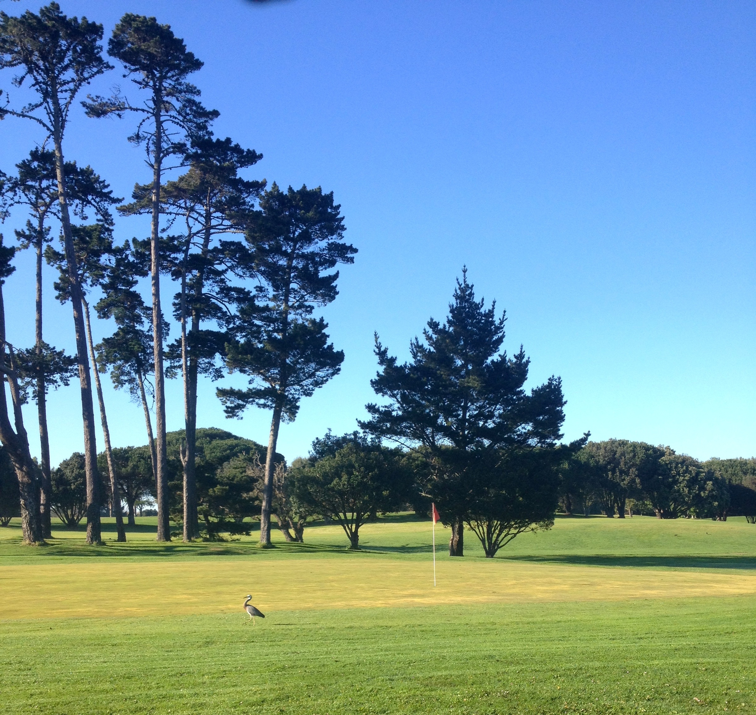

The possible revamp of the Chamberlain Park golf course (the only Auckland golf course both owned and operated by Council) has been in the news quite a bit recently. Currently, it is a very large and lush piece of greenscape at the Mt Albert / Pt Chevalier border that is open only to paying golfers – but the Albert-Eden local board wants to open it up for new path links, and more recreational activities than golf alone.
We won’t go into the discussions about the pros and cons of golf versus other activities here (some of this has been discussed on TransportBlog). As the Cycle Action organisation itself, we don’t have strong feelings on other sports uses in the park. However, we are strongly in favour of better links around the edges of the park and potentially through the middle of it, which is part of the Local Board’s plan.

As we discussed in our blog post a while back, not only is the park effectively closed to the public, but thanks to lack of foresight by planners many decades back, its fences also present a major barrier to the local community. Numerous streets at the edge of the park finish in dead ends, with no links between them. This could have been avoided by the simple expedient of zoning paths around the circumference and setting the fences back a little to accommodate them. Alas, it wasn’t done, and now simple trips like going from the end of Rawalpindi St to Sutherland Road (about 150m) require a detour of around a kilometre via Carrington Road.
At the same time, we have the Northwestern Cycleway (and Walkway) along the northern edge of the path. One of the criticisms we often hear about paths like this is the lack of fine-grained local connectivity. And for this section, it is certainly true. From the Pt Chevalier side, the motorway blocks all access onto the cycleway for 1.5km. The lack of a proper street / path grid at Sutherland Rd and at Chamberlain Park ALSO means that for 1.5km there’s no getting onto the path from the southern side either.
So getting better connectivity here is key, both for people in the local community who want to walk and cycle more, and so Auckland as a whole can get more use out of our assets – both the cycleway and the park.
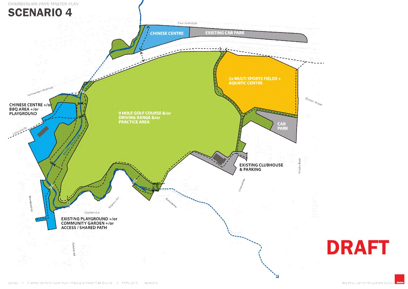
As such, we strongly support the Local Board plans. And we are glad to see that the option adopted for further design has key new routes north-south along the western edge of the park, as well as some new north-south routes at the eastern end and some west-east links along the southern edge.
The plan also shows a new walking/cycling overbridge along the creek over the motorway, connecting the walk/cycleway to a Motions Road route, making it easier for local trips to cross the motorway barrier. This proposal first came to our notice a few years back from the Waitemata Local Board. It will be a real struggle to get a multi-million dollar bridge like this funded, so it is unlikely to be an early part of the Chamberlain Park revamp, but it would be a major asset. That’s why it’s great to have it marked on more and more planning documents.
Shame the bridge plans weren’t firmed up when NZTA applied for widening the motorway by another set of lanes a few years back 🙁

But back to the Chamberlain Park plans: the changed uses of the park are still controversial, even though Stephen Town (Council’s CEO), when asked during an unrelated event about Council’s plans for public land, noted that some golf courses would be reviewed by Council, and mentioned that even Golf NZ, the national body, agrees that for some existing urban courses, this would entail changes to other uses.
So there’s some higher-level support for the redevelopment plans. But even so, and independently of what you think about the issue of “golf vs less golf”, the large-scale Chamberlain Park revamp is probably not going to happen all that soon.
What MAY well happen earlier – and this has been confirmed to us by the local board chair, Peter Haynes, as being the board’s priority – is the creation of the first path links along the Meola Stream at the western edge of the site. This connection would transform a rather forlorn adjacent local park – Rawalpindi Reserve, hidden behind houses with only one single narrow entrance, and currently a masterclass in how not to design urban parks – making it much more pleasant and accessible.
And most importantly for those on foot and on bikes, this link would remedy a key part of the missing connectivity between Sutherland Road / the NW Cycleway and the local community. We are keen!


