
If you have the luck to live or bike through the Puketapapa Local Board area, you will already know that foresighted investment over the last decades has created a network of local neighbourhood walking and cycling paths that many other suburbs around Auckland still only aspire to.

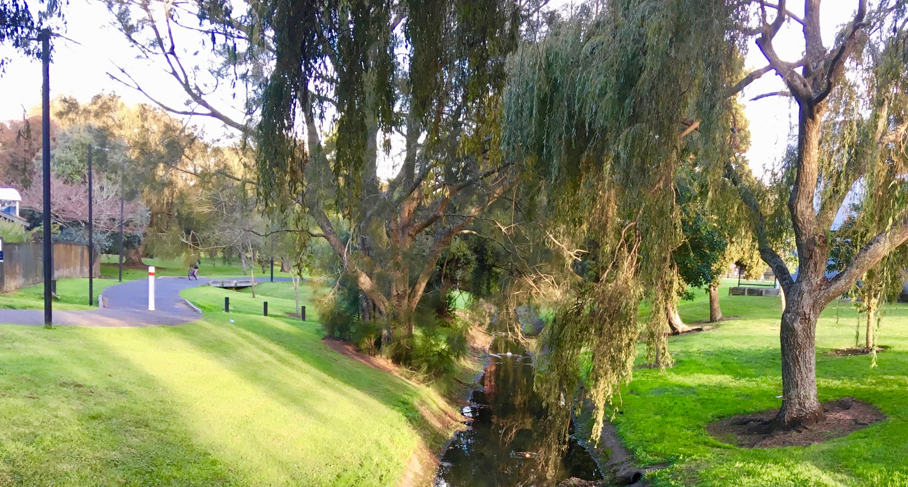
In addition to the main spine of the bikeway along SH20, there is a somewhat less direct – but even more pleasant – parallel network through several reserves and local streets in the Mount Roskill Area, including through Mount Roskill War Memorial Park.
For Mt Roskill War Memorial Park, Council is currently consulting on a new future plan. The plan includes:
- Developing a multi-sport clubroom facility on the park to replace the softball clubrooms in the existing War Memorial hall complex
- Improving sports field lighting and drainage, to maximise the use of fields during the winter months and after dark
- Improving accessibility on the path network, including adding increased seating
- Upgrading the May Road playground, skatepark, basketball half-court and adult exercise equipment
- Supporting ongoing naturalisation of Te Auaunga/ Oakley Creek by Healthy Waters and include passive recreation options such as an informal path circuit, artworks and natural play and educational features
- Upgrading a softball diamond to an artificial ‘skin’ surfacing
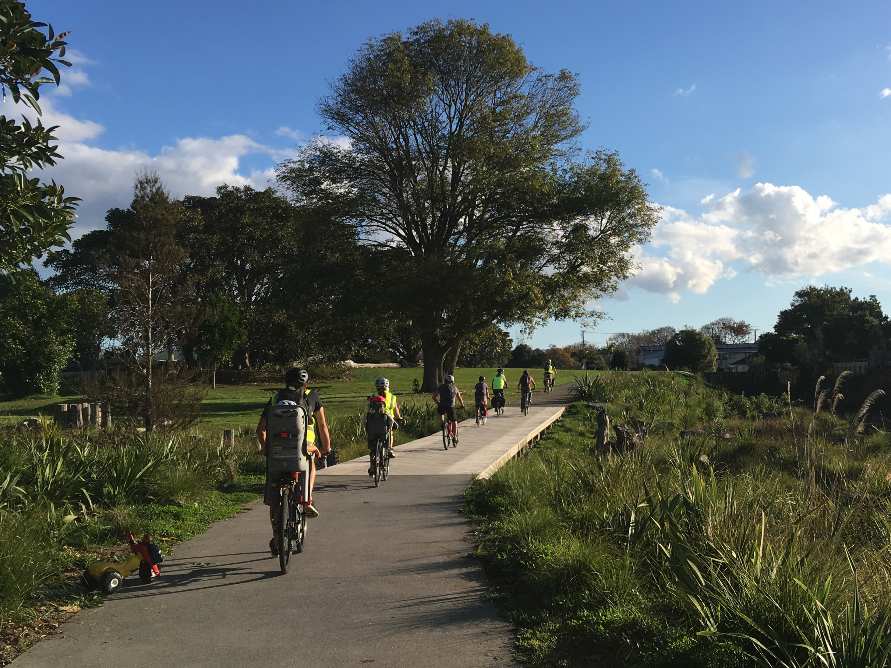
As Bike Auckland, of all the good things above what we’re most interested in is how the park could be made more accessible by bike and on foot. In past consultations in the area, we’ve had success asking Council – and a supportive Local Board – for new side accesses and widened paths.
So we took a look at what’s shown for the future of the park’s path network:

In terms of pathways, the current configuration stays pretty much unchanged, with the key route running along the northern edge of the park alongside Te Auaunga / Oakley Creek. The stream will undergo restoration along the lines of the project west of Sandringham Road Extension, reverting to a more natural, winding watercourse through vegetated wetlands.
So that’s great – riding through a park alongside a stream is even better with a real natural environment, rather than a lawn next to a straightened-out storm drain!
But the plan in our view has missed a trick – although thankfully it seems pretty easy to change: good bike links from the south, via Denny Ave.
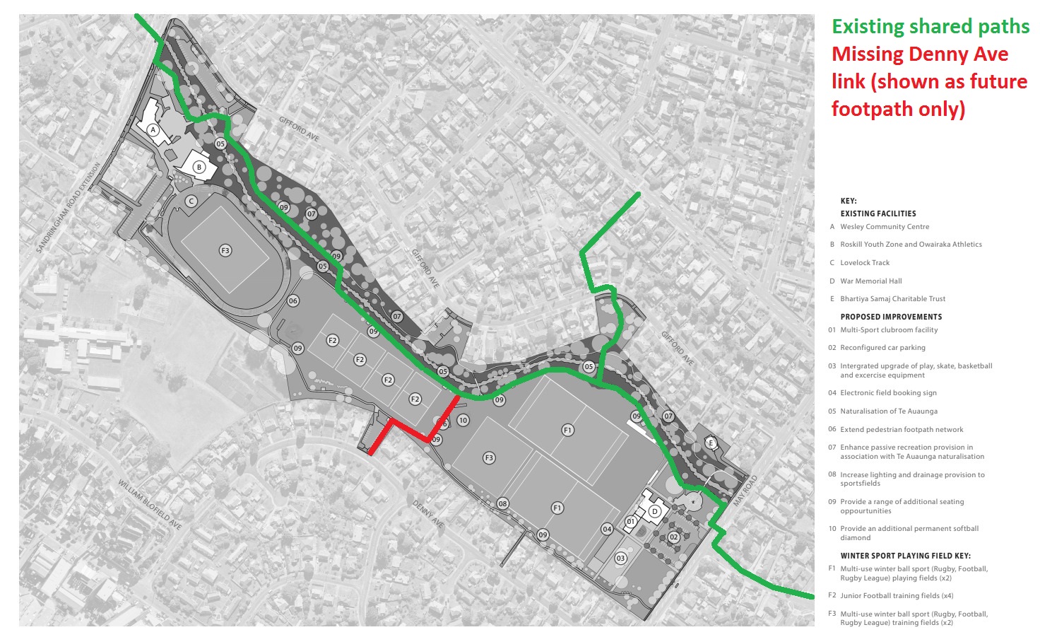
While there are two accesses from the south into the park (both off Denny Ave), neither of these are currently shown as bike paths. They’re narrow footpaths only!
But we know that people want to ride here, if given the chance, and with enough space to give way properly to pedestrians! Planning just narrow footpaths here would set up future conflicts, which will reduce the number of people both walking and cycling.
The eastern of the two Denny Ave side links is tucked between two properties, so there’s not really got enough space to be widened to suit bikes.
However, the western path is next to a Council car park that is proposed to be reconfigured. Now, we have our own opinions on whether that car park should be there at all – but clearly, if you are already re-configuring it to add a footpath along the east edge, you can go all the way and add a proper width shared path.
Then connect that path to the existing path on the other side of the sports fields via a short simple dogleg, and you’ve just given another whole neighbourhood new direct access to the whole park and path network on bikes (plus wider paths to walk on, too).
Seems easy? Then help us make it happen – have your say at this Council survey:
- Ask for a shared path link from the northern existing shared path to Denny Ave via the reconfigured Council car park (feel free to say “as per Bike AKL’s request”)
- Ask for other paths to be widened where suitable to make sharing between people on bikes and people on foot easier. A width of 3m should be the minimum, but 3.5m or 4m would be even better.


