
We’ve rolled our midwinter June-July round-up into one bulletin, because winter is traditionally a slow time of year for road projects, with shorter days and gluggy conditions. But there’s been no slowdown in the number of people on bikes!
Even in the depths of winter, Aucklanders are flocking to cycling as everyday transport, with year on year ridership up 8.9% in June. As always, the strongest growth is on weekdays, and on protected and connected bike routes. Proof positive that 1) if you build it, they will come, and 2) we won’t melt.
Now, on with the updates…
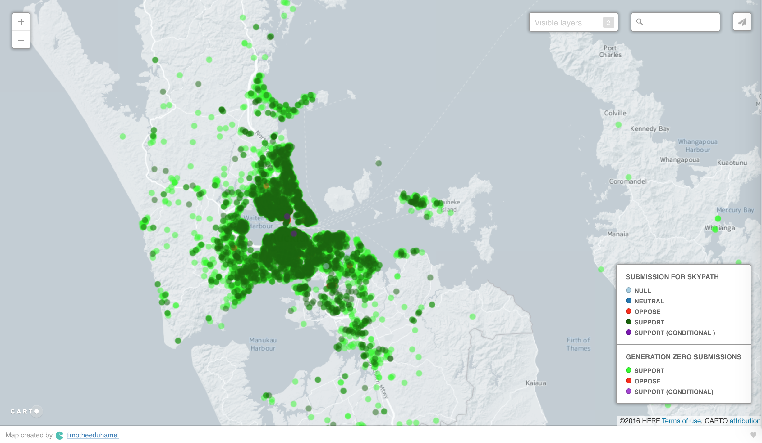
SKYPATH 2.0
With the project now in the hands of the NZ Transport Agency we’re confident it will be delivered at last, and delivered well – and you can rely on us to keep up the pressure to deliver it soon.
The next step: a consultation on the landings at each end, which will feed into the detailed business case going to the NZTA Board later this year. Read more about the upcoming consultation here. The options include ramps, and a lifts-and-stairs combo. We’re looking forward to more details, but are definitely in the ramp camp.
The chorus of “just build it already” is growing louder by the day. We know to never take anything for granted, so stand by to add your voice to the upcoming consultation.
A BIG WIN DOWN SOUTH
The new 4.5km stretch of cycleway along SH1 between Takanini and Papakura (part of the Southern Corridor Improvements) marches towards completion before Christmas. And we’re pleased to share some very good news: funding for the missing link on the Southern Cycleway has been found!
You may remember that early on, we identified a local connection as the key to making this new pathway as accessible as possible. For those coming from Takanini on the eastern side of the motorway, a link from Walter Strevens Drive to the path would save having to make a tiki tour around local streets to get to the path.

After a great deal of tenacity on our part, AT ensured a successful consultation process, and in turn, NZTA has now confirmed they will fund this add-on and build it as part of the motorway project. Yessssss! This means people from Takanini will be able to bike over the Walter Strevens Bridge (the sole connection across the motorway) and straight onto the path.
We’ve been adamant from the get-go that this link should open at the same time as the main bikeway, later this year. However, the delay in confirming funding might push it into the “close out” phase of the project – in which case, fingers crossed for early next year.
Bonus: special guests from NZTA will be showcasing this cycleway at our AGM on 28 August – including maps! – so be sure to come along if you’re keen to find out more.
PROGRESS OUT WEST
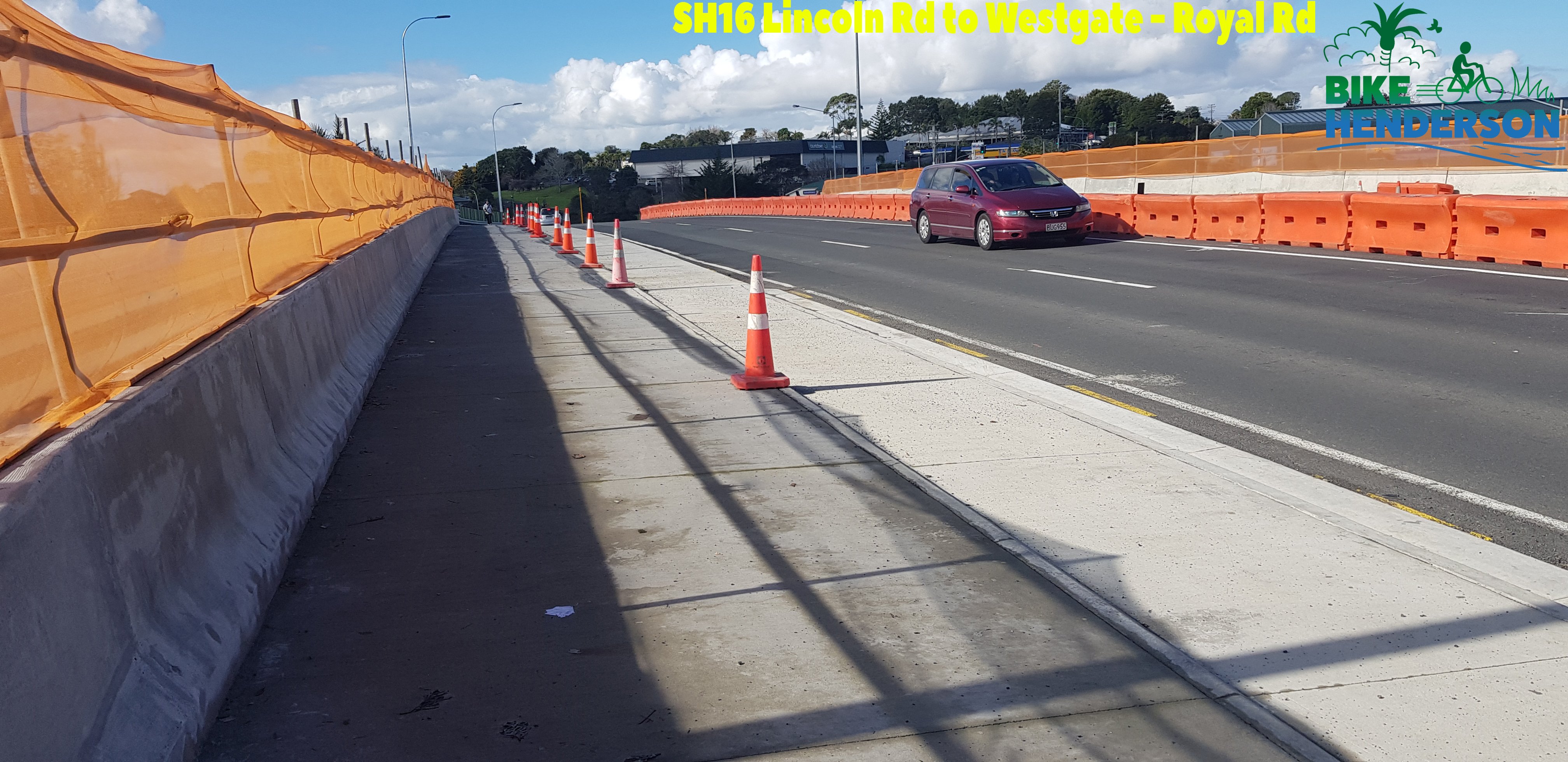
SH16 to Westgate
Another project we’ll be showcasing at our AGM: the Northwestern Cycleway extension from Lincoln Road to Westgate, which is set for completion by the end of October. Check out these photos of work in progress, from our buds at Bike Henderson.
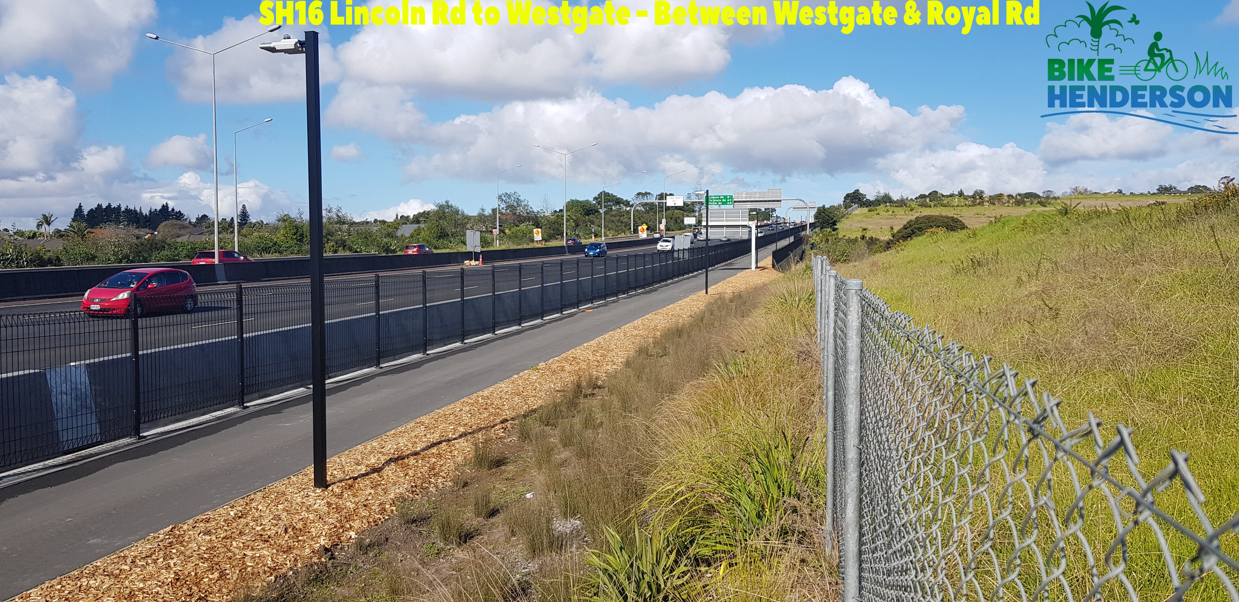
Back in 2011 when the core elements of this project were decided on, we campaigned vigorously for bridges and underpasses at the interchanges, to ensure safe, smooth, and continuous travel for people on bikes. Even then, we anticipated the growth along this route.
Sadly, NZTA weren’t persuaded about the interchanges. But we did win two key upgrades on your behalf:
- an extra access point at the Huhuhuru Rd Bridge
- and we convinced NZTA to add Copenhagen cycle lanes to the Royal Road Bridge.
So there’ll definitely be lots to celebrate when the newest extension of our oldest motorway bikeway opens in early summer!

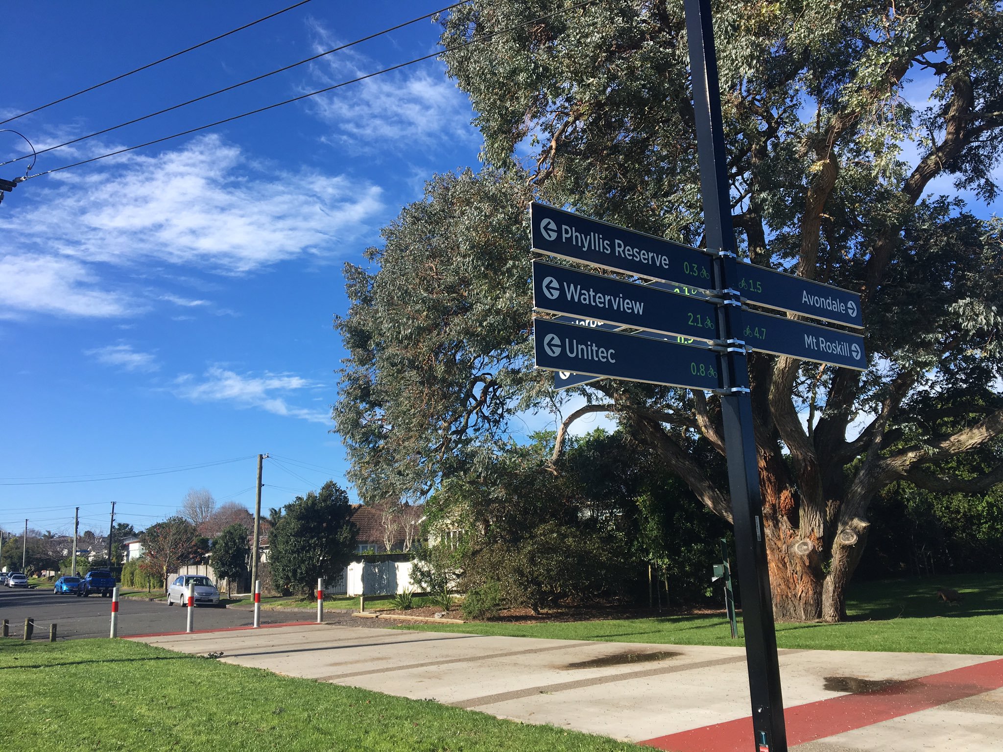
Wayfinding Galore!
Oh, what a difference a sign makes – and what a massive difference a full set of signs is making from the central city out along the NW cycleway and the Waterview Path. We’re glad AT has finally rolled out this essential element of the bike network – and astonished to think just how long we’ve been biking ‘blind’. The way ahead is now clear!
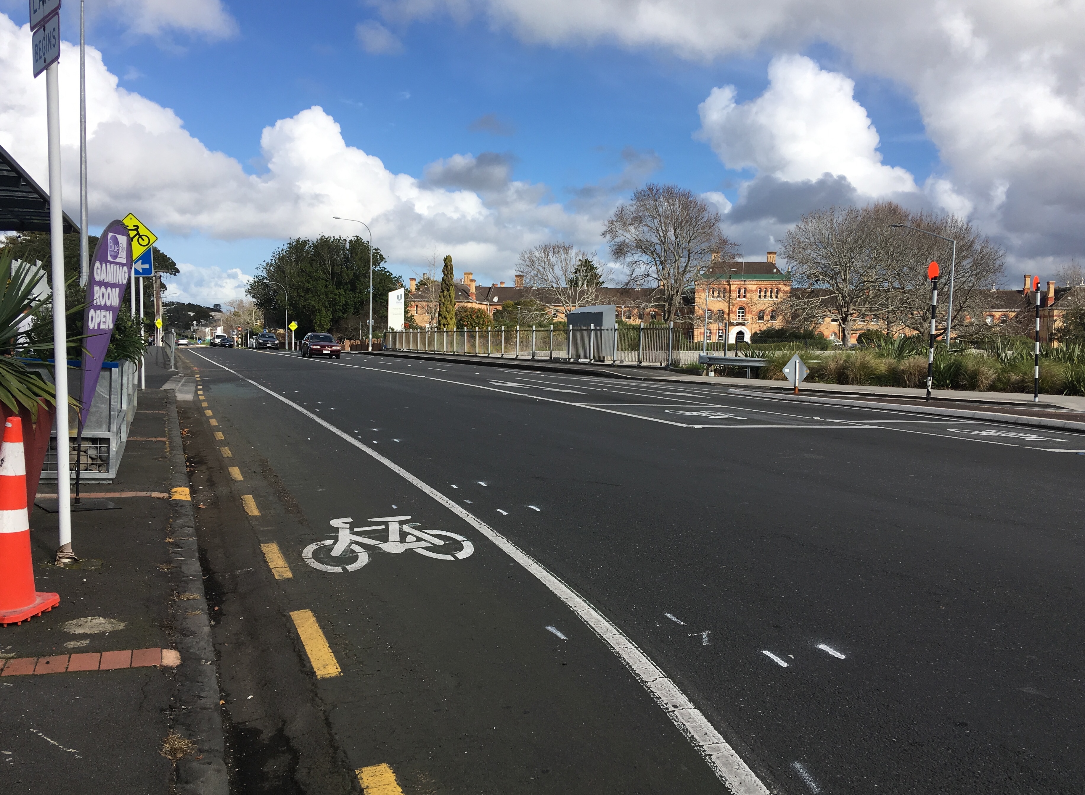
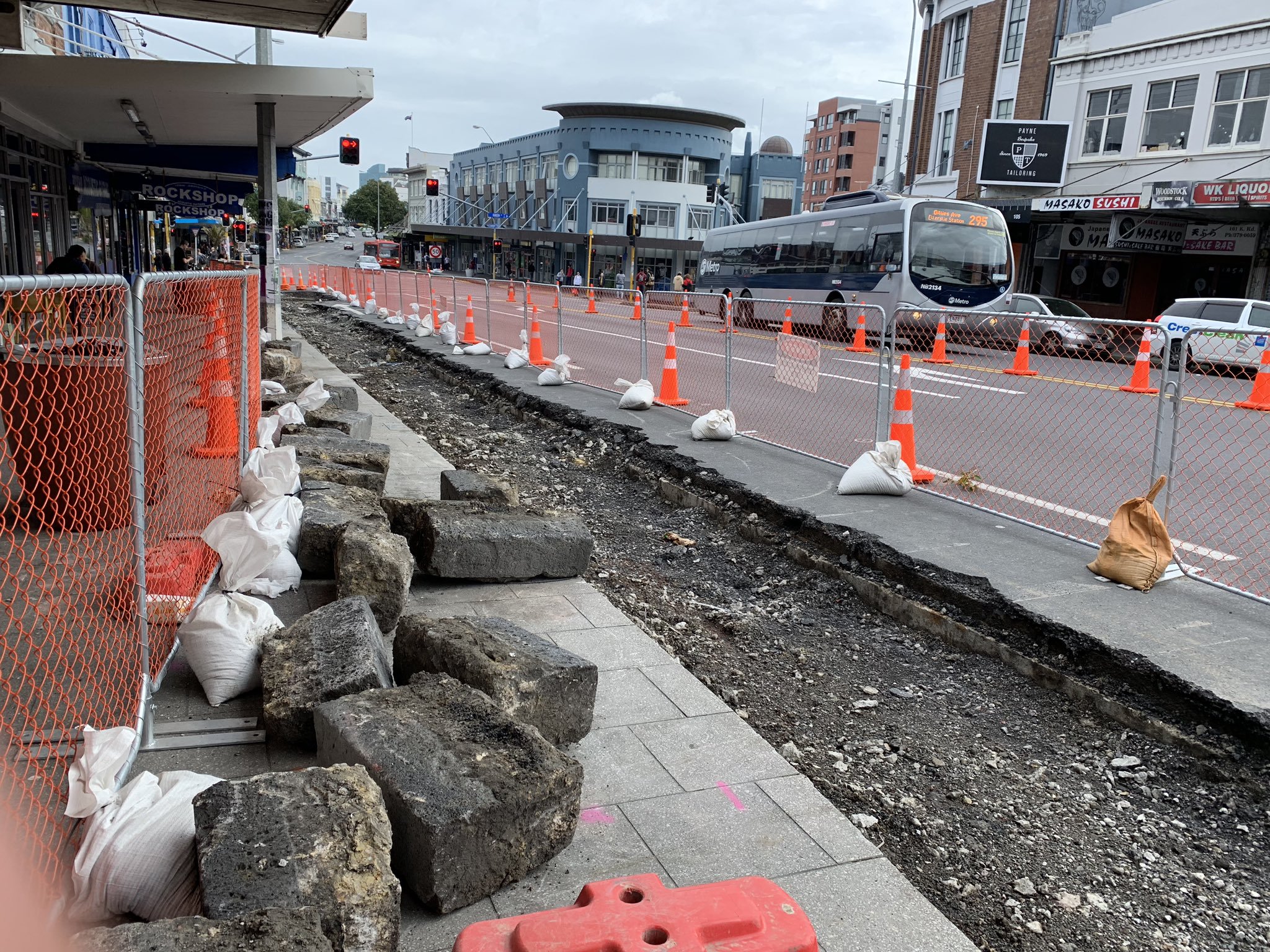
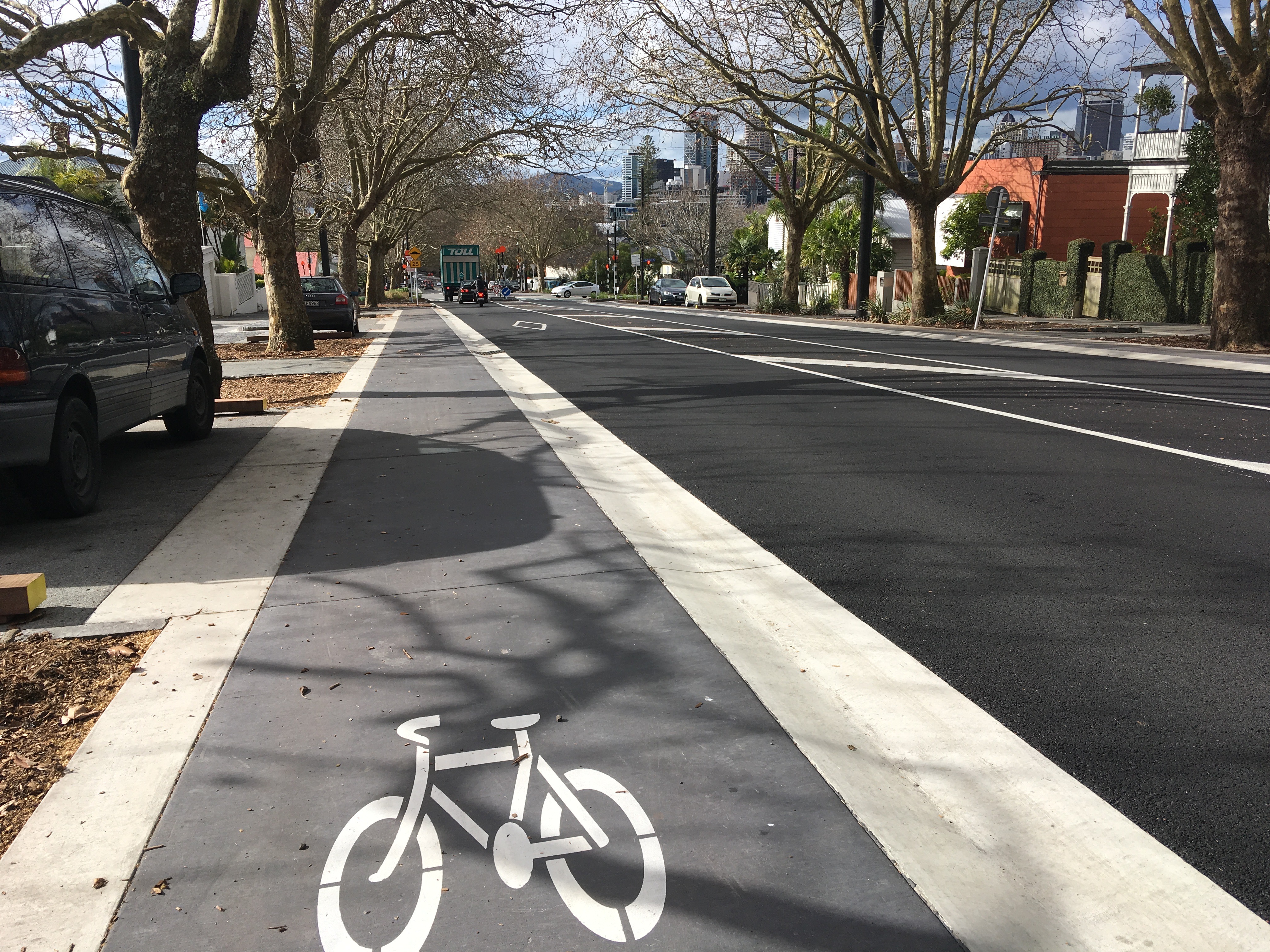
Carrington Road Crossing
The raised crossing is complete, and working well. How are you finding it?
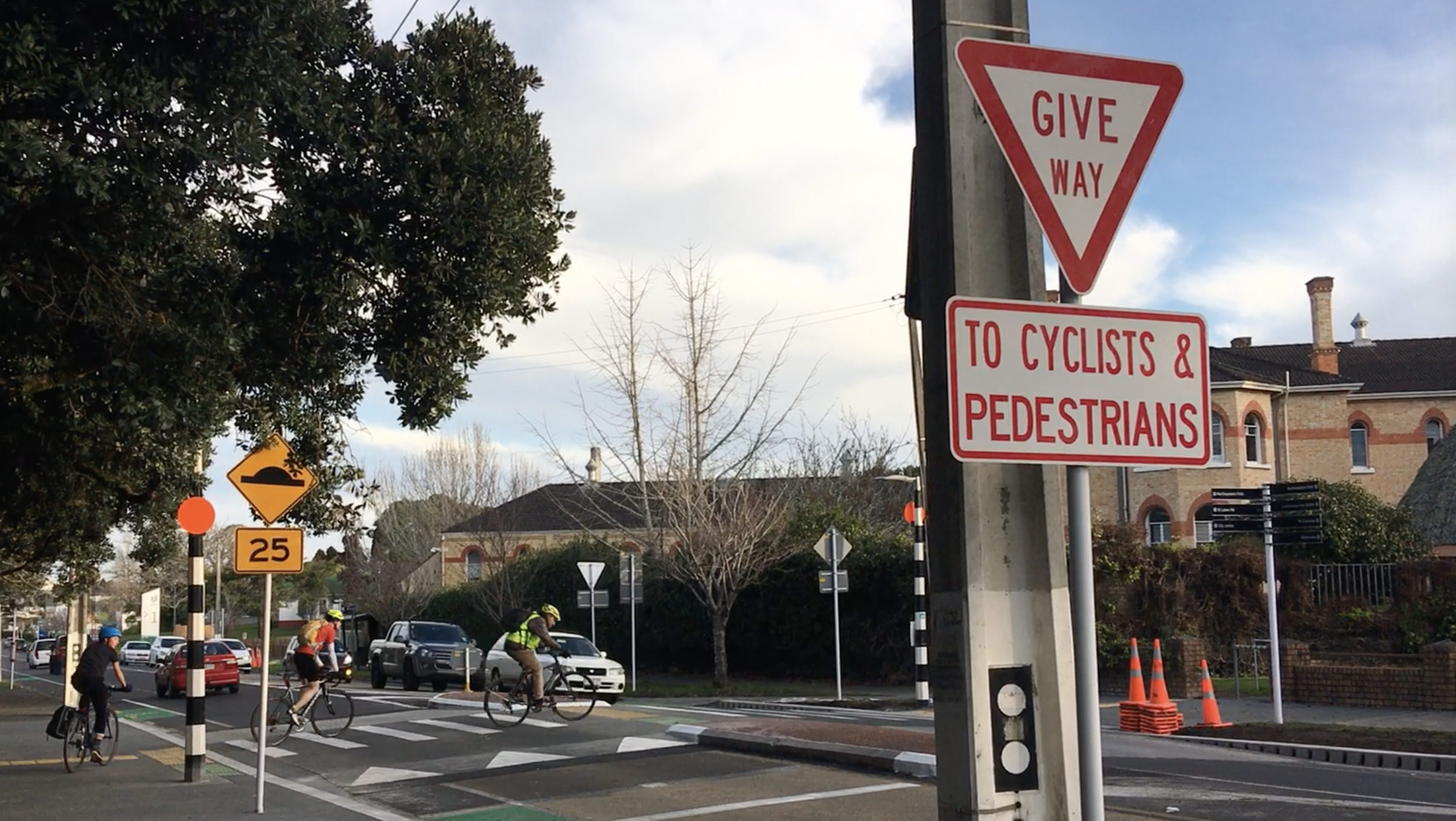
(We now have our eye on those metal barriers at the little entrance into Unitec grounds immediately on the west side of the crossing, on the right in the clip below. Watch this space!)
The Carrington Road raised crossing – working as planned for the people who need it. Just some greening and other final touches to come. ?? ? pic.twitter.com/Cq0KdltQIX
— Bike Auckland (@BikeAKL) June 29, 2019
The works also include one extra feature that we asked for: a smooth access to Sutherland Road. Our thanks to Auckland Transport for incorporating this detail at the request of our man on the spot, Max. Witness: the Robitzsch Ramp.
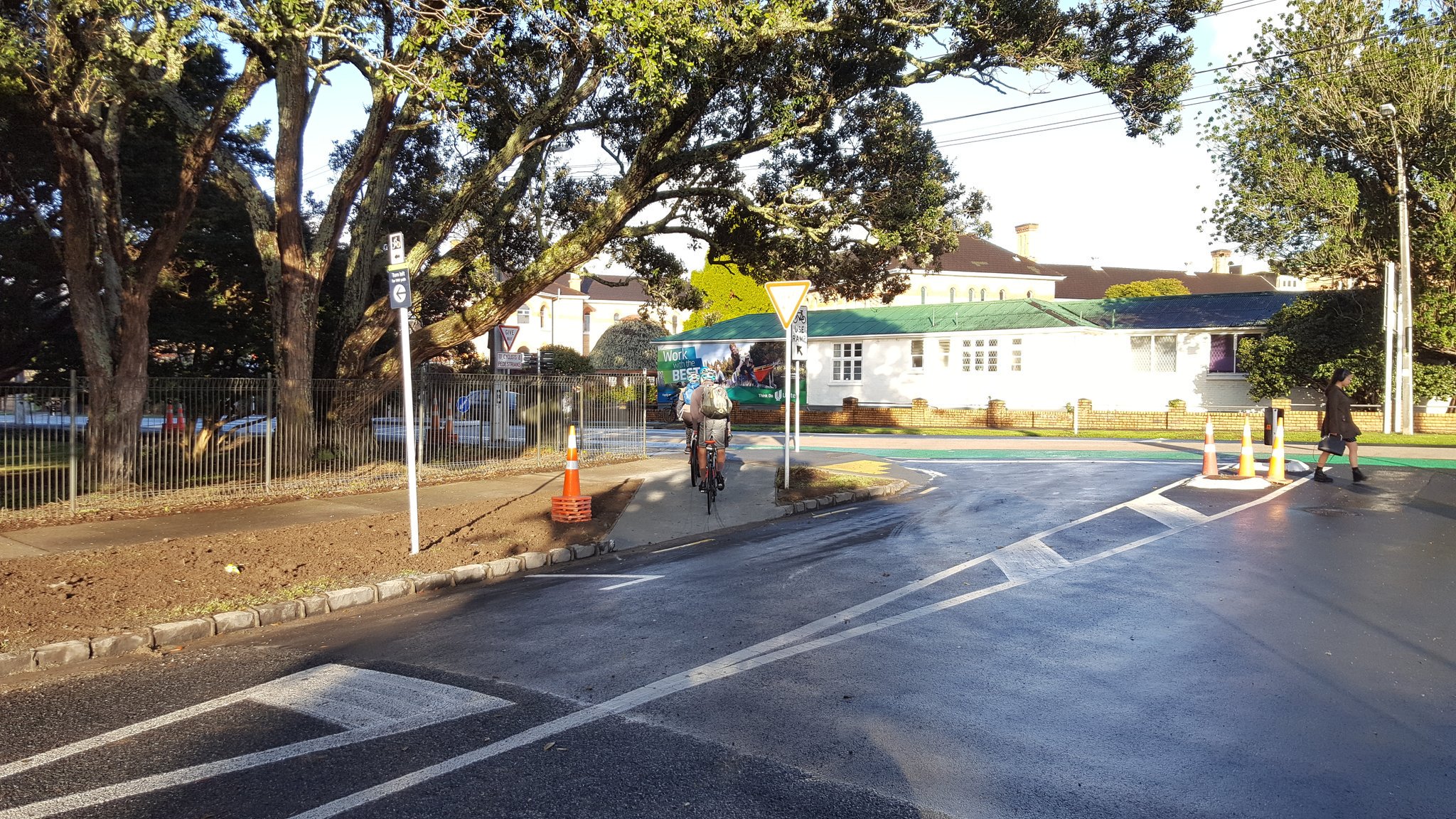
And lastly, you’ll also spot some paint on the Carrington Road overbridge over the motorway – that’s marking the last stage of this project, coming soon: protection of the southbound on-road cycle lane, one of those minor safety improvements with major impact, first mooted in August 2017.
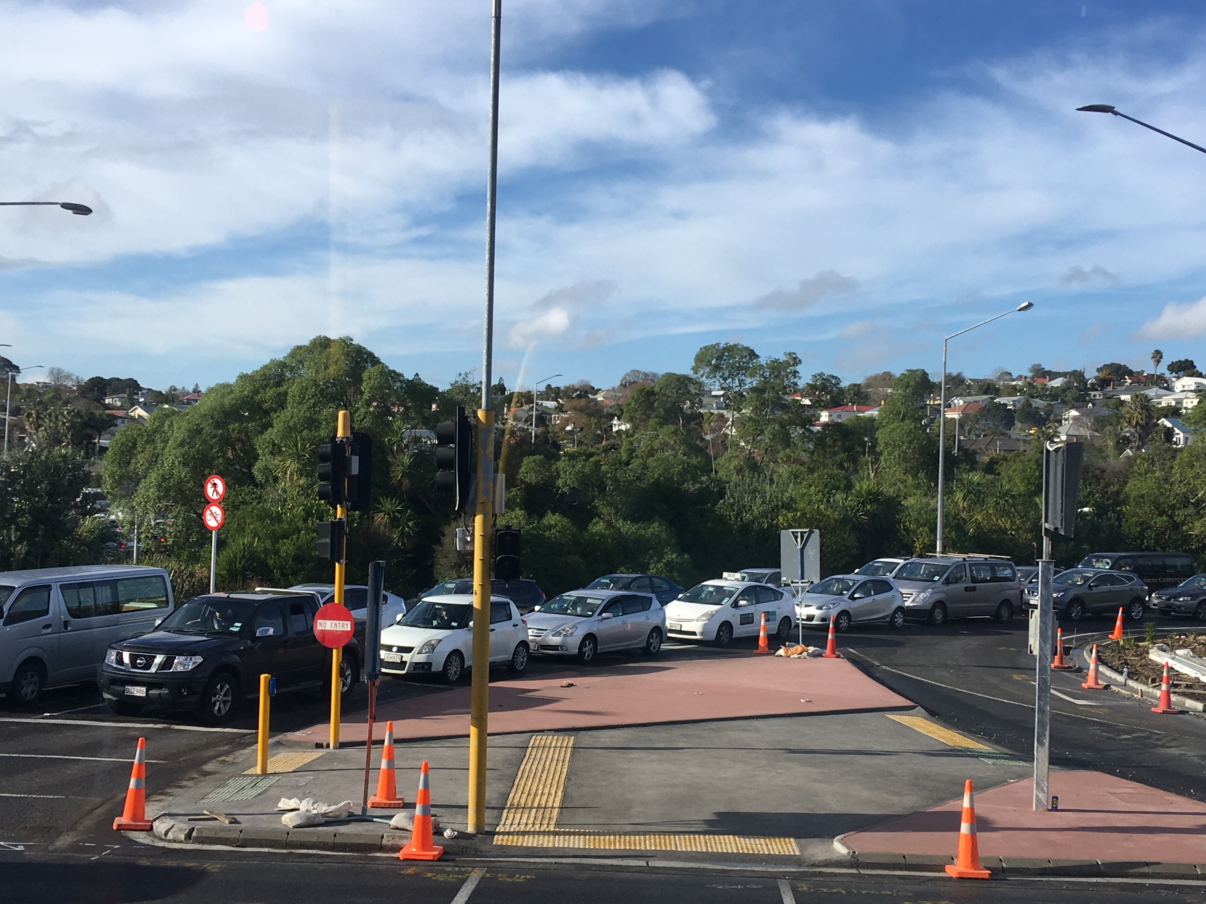
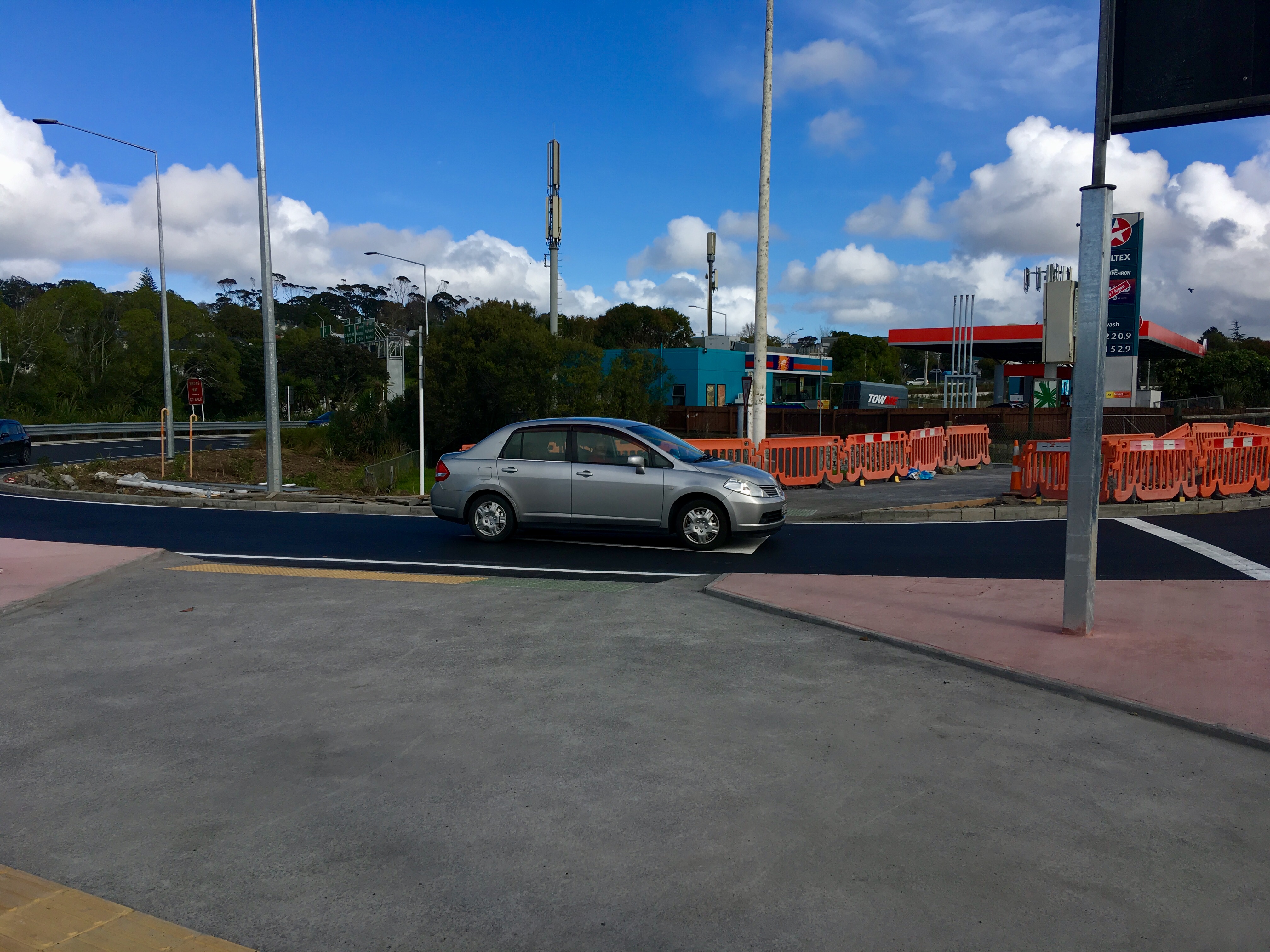
Western Springs/ St Luke’s Safety Upgrades
Mixed results, and mixed feelings here: the Western Springs shared path upgrade is almost complete, with excellent wide new traffic islands, and raised crossings at the entrances to the petrol station (one slightly more robust than the other).
The glaring omission is the lack of raised crossings over the motorway slip lanes, where traffic continues to peel through at speed – a last-minute change, due to a policy gap.
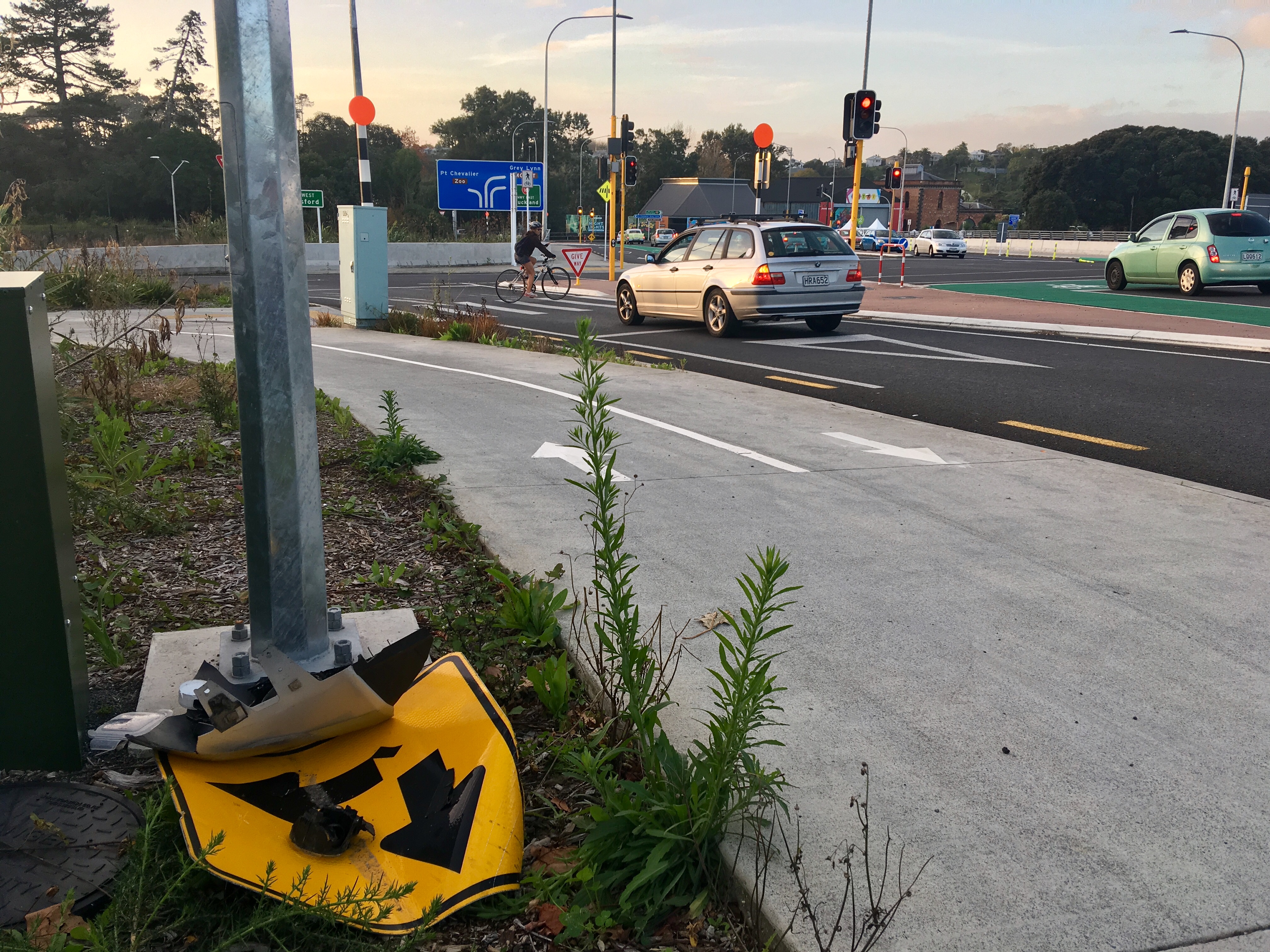
We’ve been told that NZTA is working “ at pace” on a policy that (it is implied) would finally allow zebra crossings on motorway on- and off-ramps to be set on raised tables. It’s hard to fathom that current (informal) policy forbids this. If you’re going to add pedestrian crossings to a motorway situation, how can it be inappropriate to add traffic-calming that makes them safe for people to use?
Raised tables will also be crucial on the St Luke’s side of the motorway, where NZTA is working on detailed design to improve the west-east bike crossings, especially across the motorway slip-lanes. The plan includes a proper protected bike lane southwards over the bridge, feeding into AT’s protected lanes further south.
However, funding for this work has not yet been identified. We see this as an urgent project on Auckland’s fastest-growing bike route: there are over a thousand potential conflicts on an average day (two thousand if you count both slip lanes). We’ve been told this work could still happen by December, but we’re concerned the timeline could stretch into 2020.
MEANWHILE, UP NORTH
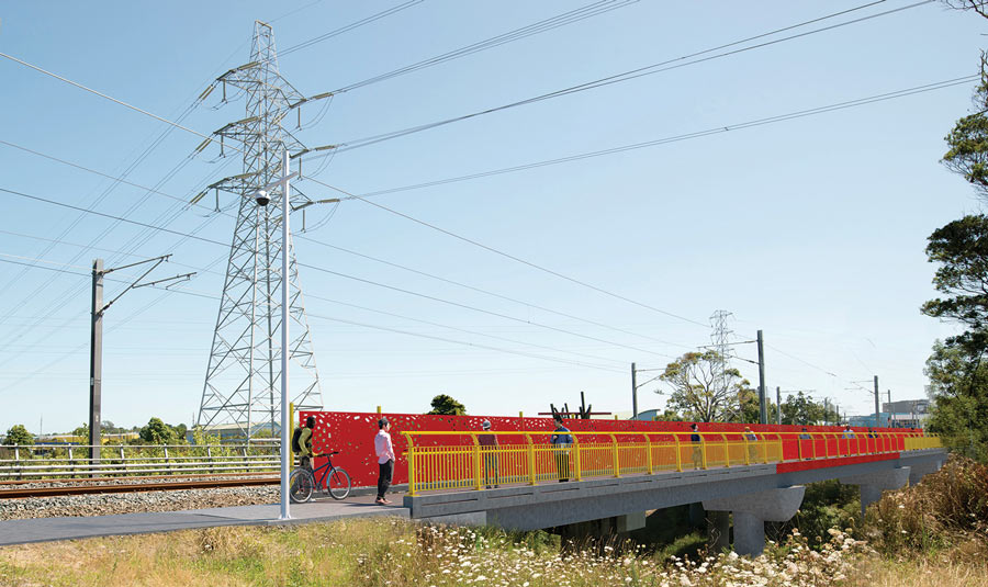
Alexandra Reserve Underpass
Another local link brought to you by Bike Auckland: work is beginning on the new underpass along the Alexandra Stream, which is just one of the accesses we negotiated for as part of the Northern Corridor Improvements. The old underpass will stay open while the new one is built, and once the new one is complete, the old underpass will be converted to a stormwater culvert and closed off. Great to see work commencing on this one!


CENTRAL CITY ACTION
K Road breaks ground!
Work has finally begun on the K Road project and is scheduled to take about a year. We’re excited, and looking forward to doing our bit to help keep the street humming during construction. To celebrate the start of works, we hosted a very well-attended Bike Breakfast at Between Cafe with support of the K Road Business Association. Stay tuned for our next gathering on K Road!
Franklin Road, looking good!
The midwinter opening of Franklin Road’s nose-to-toes makeover already feels like old news, but if you haven’t caught up with it yet, we have all the details over here. All eyes are now on the Victoria St cycleway, which has been designed and ready to go for some time. Will AT get under way by Christmas? Let’s hope!
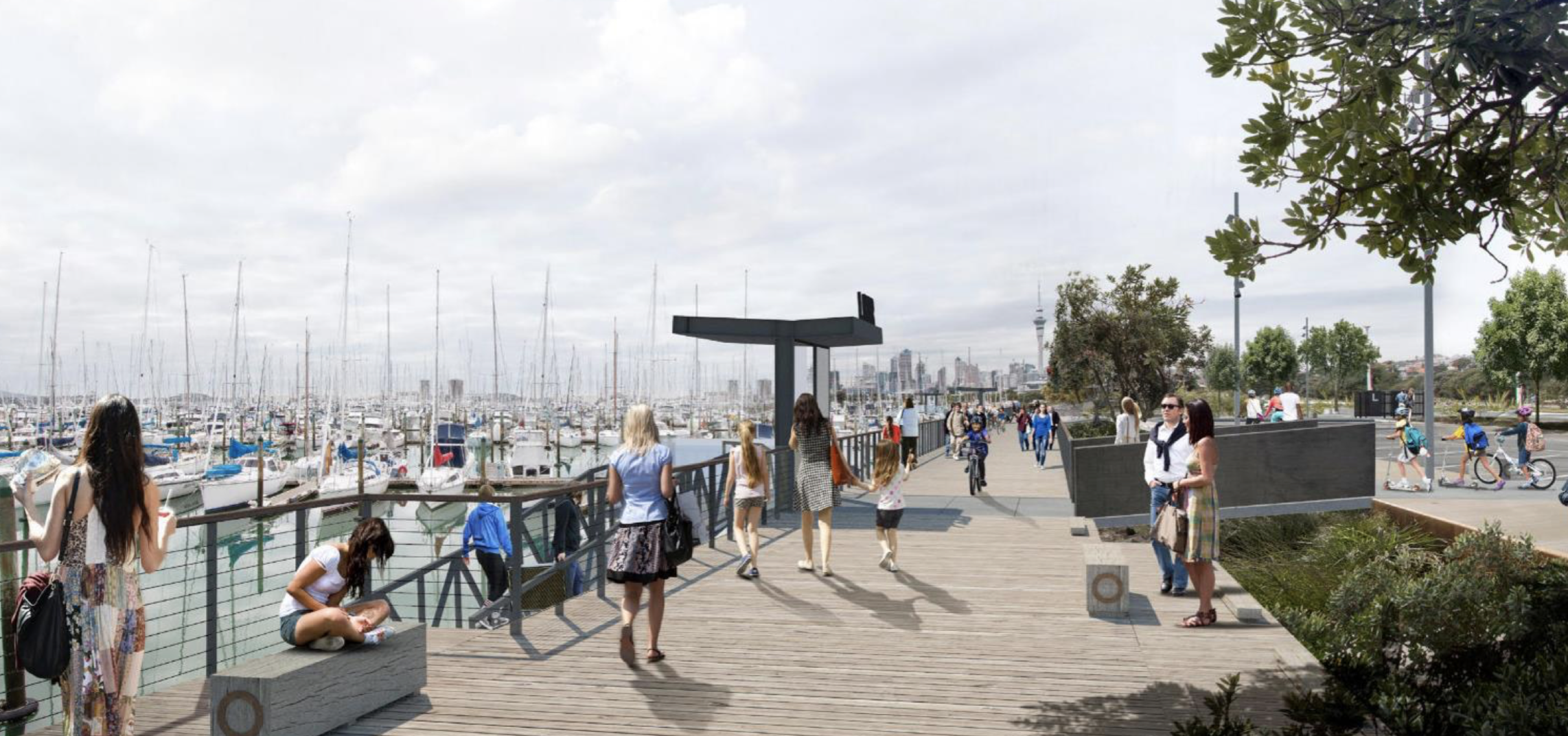
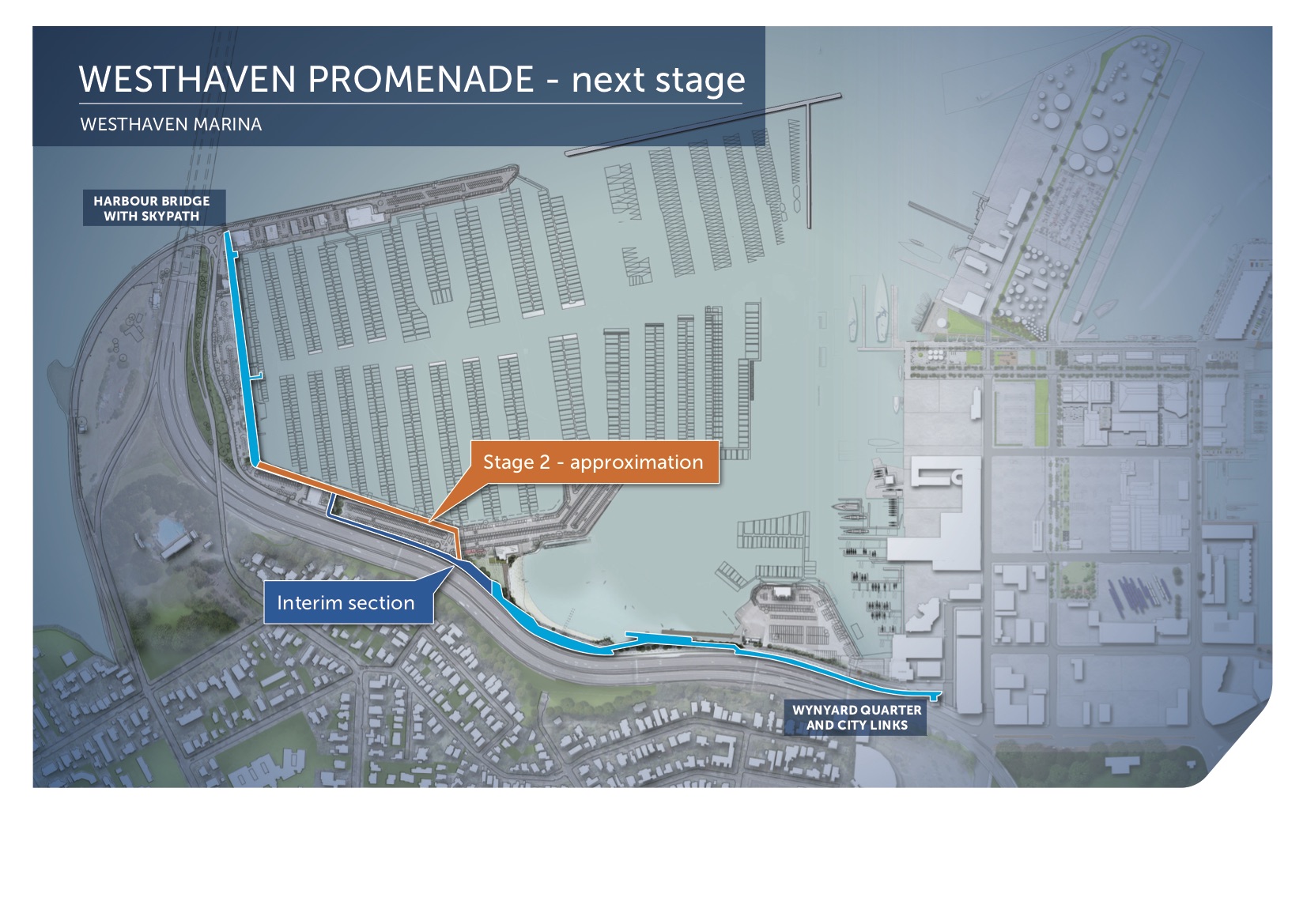
Westhaven under way
Meanwhile down on the waterfront, Panuku has started work on Stage 2 of the Westhaven Promenade, between Sails Restaurant and St Mary’s Bay, with the project set for completion by November 2020. You can find project updates here. When travelling through here during construction, you’ll be using the existing (but always intended to be ‘temporary’) diversion through the carpark and along Westhaven Drive. Be especially careful navigating around vehicles here, and keep a close eye on children.

ON THE HORIZON
New Lynn to Avondale
This long-awaited route – a 2.9km path following the train line from New Lynn to Avondale – is next out of the starter blocks, with works supposed to be breaking ground in October, starting with the bridge over the River Whau. This railway bikeway was first consulted on in early 2016 as part of the Urban Cycleway Programme, and at times we’ve wondered if it was still on track. Fair to say, we’ll be chuffed to see it finally full steam ahead. (Is that enough train puns?
SH20B and Airport Links
Bikeways are coming to SH20B, as part of the 20Connect project. This joint NZTA/ AT/ Auckland Airport project aims to improve airport connections, with safety improvements and priority bus lanes to allow buses to run every ten minutes between the airport, the soon-to-be-upgraded Puhinui Station, and Manukau.
A new shared path will run along the north side of SH20B from SH20 to the Manukau Memorial Gardens, cross at the signalised intersection, and then travel along the south side of SH20B. This work is set for completion by 2021.


SOMEWHERE OVER THE RAINBOW?
Tamaki Drive Cycleway
No start date in sight yet for this project. Last we heard, redesign was completed in July, but the design has yet to be finalised so it can go out to tender. Meanwhile, Auckland Transport continues to meet with Ports of Auckland to discuss the Solent St intersection.
Safety is the imperative here. Every month that ticks by without work starting is exposing more and more of us to dangerous conditions on Auckland’s busiest bike route, our major leisure route, and the pathway we send tourists and visitors along to experience the best of our city. Time to get on with it.

One small piece of tentatively positive news for Tamaki Drive: we’re told the safety improvements to the intersection of Tamaki Drive and Watene Crescent, first discussed in early 2018, should finally happen in October.
Cook St Safety Improvements
After a recent hit-and-run at the intersection of Cook St and Nelson St and follow-up reports of regular dangerous (and illegal!) left-turns across the cycleway, you may be wondering what’s happening with the safety plan for Cook St and Union St. We hear this project has not yet been able to secure funding; a worrying example of a pressing safety project that has become stuck in the pipeline. If we have one wish for 2020, it’s more streamlined responses to community appeals for safety.
LOCAL SAFETY PROJECTS
Te Atatu Road crossing
Even in the wake of tragedy and with a renewed dedication to safety as the overriding principle, a local safety project can still take years to deliver. A yearned-for safety project in Te Atatu came back into view recently, with an updated design for a new pedestrian and bike crossing on Te Atatu Road near Cellermans St – and hopes it will be built before Christmas.
Kudos to local powerhouse Bike Te Atatu for their tenacity on this one, helping engage the community, and ensuring the new design incorporates local desire lines. These dedicated locals maintain a wider vision for a more bike-friendly burb, including a “road diet” where the motorway-like four lanes of Te Atatu Road meet the quieter neighbourhoods of the peninsula.
https://twitter.com/carolgreen/status/1152420017192878085?s=20
Calliope Rd/ Victoria St in Devonport
This dangerous location has been in our sights for years. And years. And years. Since 2014, we’ve watched safer designs come and go and never be built. And, after a recent serious injury crash, it was back in our sights again. A fully designed option, with robust safety features for both pedestrians and people on bikes, sits on the table.
The latest news is that it’s been rolled into the wider Devonport Village Centre project, and a community liaison group is now being set up to “discuss the project and agree a design.”
Words cannot capture our despair at this timeline. We know AT has been encountering resistance to traffic-calming in some parts of the city (Mission Bay and St Heliers spring to mind). But we’re concerned that sending already designed projects back through a community liaison group process risks months or even years of further inaction on an urgent fix that is already many years overdue.

LET’S GET TACTICAL…
It’s time for some reappearing cycleways. While major projects grind through the design and consultation pipeline towards installation, there’s another approach: use installation AS the design and consultation process, with nimble, low-cost treatments that can be easily fine-tuned, adapted, and replicated as needed.

Remember how we asked for suggestions of existing bike lanes that could be quickly made safer with some pop-up protection? You responded with dozens of suggestions, thank you! We compiled them into a list and on maps (thanks to our team member Carlos) and took that list to AT. They’ll let us know later this month which projects can be quickly progressed.
Of course, temporary devices have limits. For starters, they don’t provide as robust safety as more permanent fixtures. And, especially in town centres and neighbourhoods, they might not meet placemaking expectations – although the Federal St kit is pretty cute! Even so, they do offer a modicum of safety, and can be extremely useful for demonstrating potential, testing community appetite, and fixing gaps on the map.
We’ll continue to advocate for quality bikeways. But we’re very conscious of the slow timeline, and how Auckland can catch up after decades of underinvestment. Plus: Auckland Council’s Climate Action Plan (open for feedback until 6 September; stay tuned for our feedback guide) calls for a citywide roll-out of safer cycling infrastructure “at scale and at pace”.
So, when it comes to tactical interventions, we say: bring it on! If Aucklanders’ eyeballs can cope with seeing hi-viz walking schoolbuses of tiny children in fluoro vests every day, they can surely also handle a few bright sticks marking out a bike lane so kids can ride to school safely. What do you reckon?
Lastly: we’ve been looking at near-miss reporting apps that could produce maps of traffic hot-spots and help show the scale of what we’re up against out there. A quick question for our community: would you use such an app?

Project Watch represents hours of work, meetings, and expert feedback from our team of volunteers. If you like what you read and want to support our work on your behalf, we always welcome donations to keep the air in our tires!


