Keen to find out more about how the GI to Tamaki path will open up the eastern suburbs? There are two open days this week where you can meet the project team, see the designs for the path, and ask questions about current progress and plans.
This is a great opportunity to get a sense of the overall project, dig into the detail, and meet some of the hard-working people behind the designs and diggers.
Where: St Chads Church, 38 St Johns Rd, Meadowbank
When: Tuesday 12th and Thursday 14th April, 3pm – 7pm
Section one (Merton Road to St Johns Road) is already under way, and should be completed late this year. That’s when construction will begin on sections two and three.
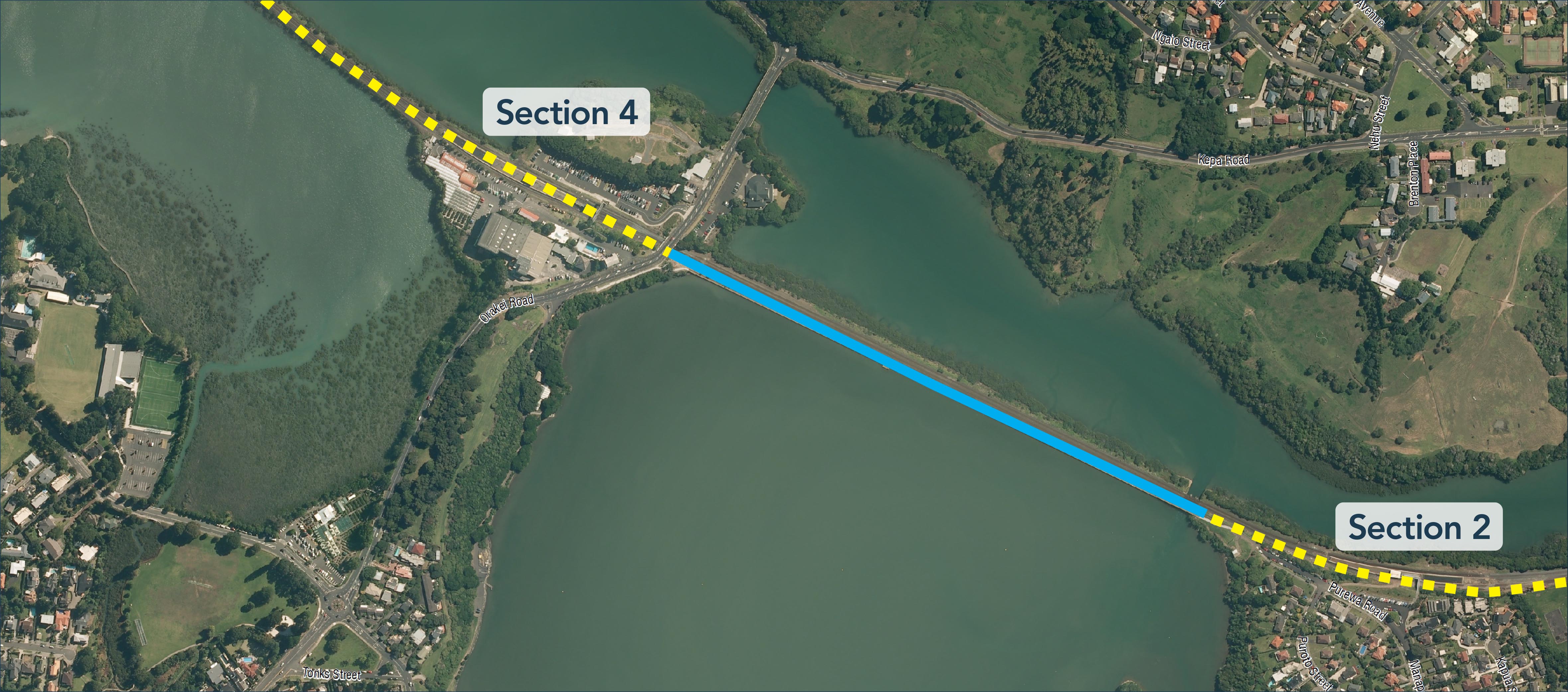
Section two goes from St Johns Road to the Orakei Basin, traveling through the green and lovely Purewa Valley, over streams and wetlands, and crossing the eastern rail line via a bridge at Tahapa Reserve to link up with Meadowbank Station.
This is the section we’ve highlighted as needing more side-path connections to be truly integrated with local communities.

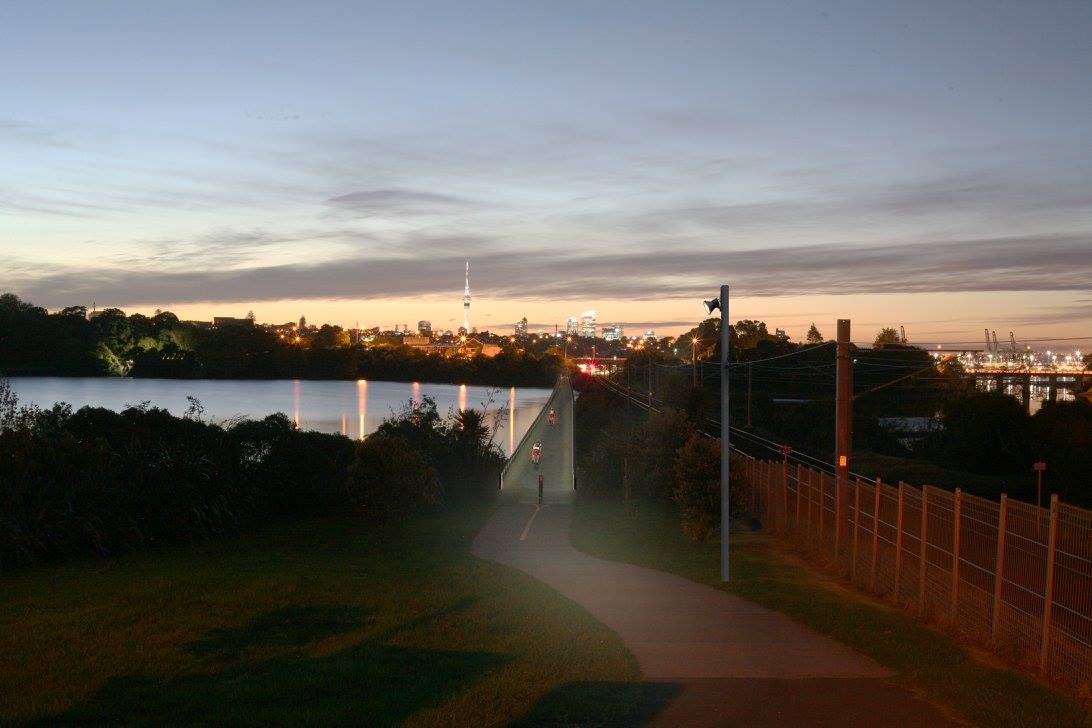
Section three is the boardwalk over the Orakei Basin. We’ve had our say about issues with the width; the official plan is still to widen it from 2.7m to 4.5m, in the hope that this provides enough space for future walking and cycling numbers. The new boardwalk will have a slip-resistant surface, and LED lighting incorporated into the wooden handrail for nighttime enhancement.
This section will begin construction at the tail-end of winter because that’s when fewer people use the boardwalk, although the promise is to keep the connection open for the duration of construction.
The project team will soon be applying to the council for the necessary consents for sections two and three – and these will be ‘notified’, which means you can have your say. Keep an eye on the project web page for further updates.
Oh, and here’s section four, which connects to Tamaki Drive and into the city. This will be a fun one to ride! The preferred option here is to follow the railway line across Hobson’s Bay (although a snaking route along the water’s edge via Ngapipi Rd is also officially on the table).