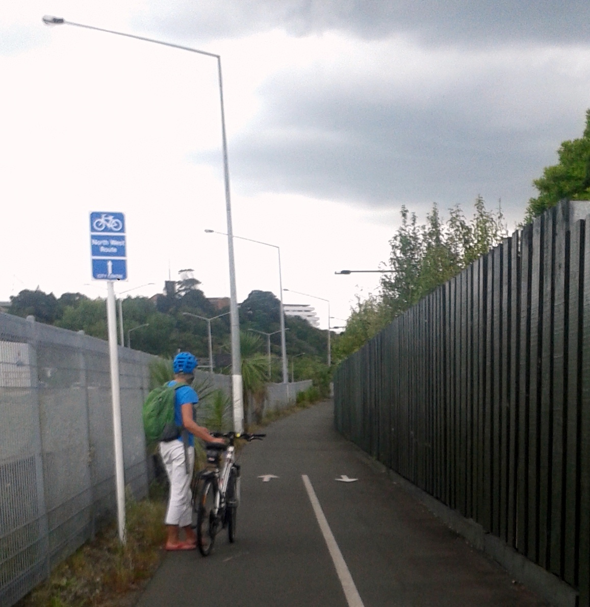
Auckland’s cycleways are a cornucopia of riding experiences. We’ve got the flashy (LightPath); the sophisticated (Canada St Bridge); the grungy (NW through Kingsland); the silky smooth (NW at Te Atatu); the hidden reveal of Grafton Gully and the urban chic at Westhaven.
They’re wildly different in function, character, length and width, but we’re used to their diversity.
Until recently, gaining new cycling facilities has been a haphazard and torturous process. New projects were rare gems; long anticipated and hard won. Little wonder that we showered praise and gratitude on the builders and funders, and tended not to niggle too much about those aspects that fell a bit short of ‘best practice’.
We’re now in a new age of booming cycleway delivery created by Government’s Urban Cycle Programme (UCP). 30% of the UCP’s $333m (including the funds from Council) will be spent in Auckland between 2015-2018. Additional cycleways are also planned as part of the Government’s fast-tracked and expanded new motorways. (Our Max and Steve are leading Bike Auckland’s work on most of these projects).
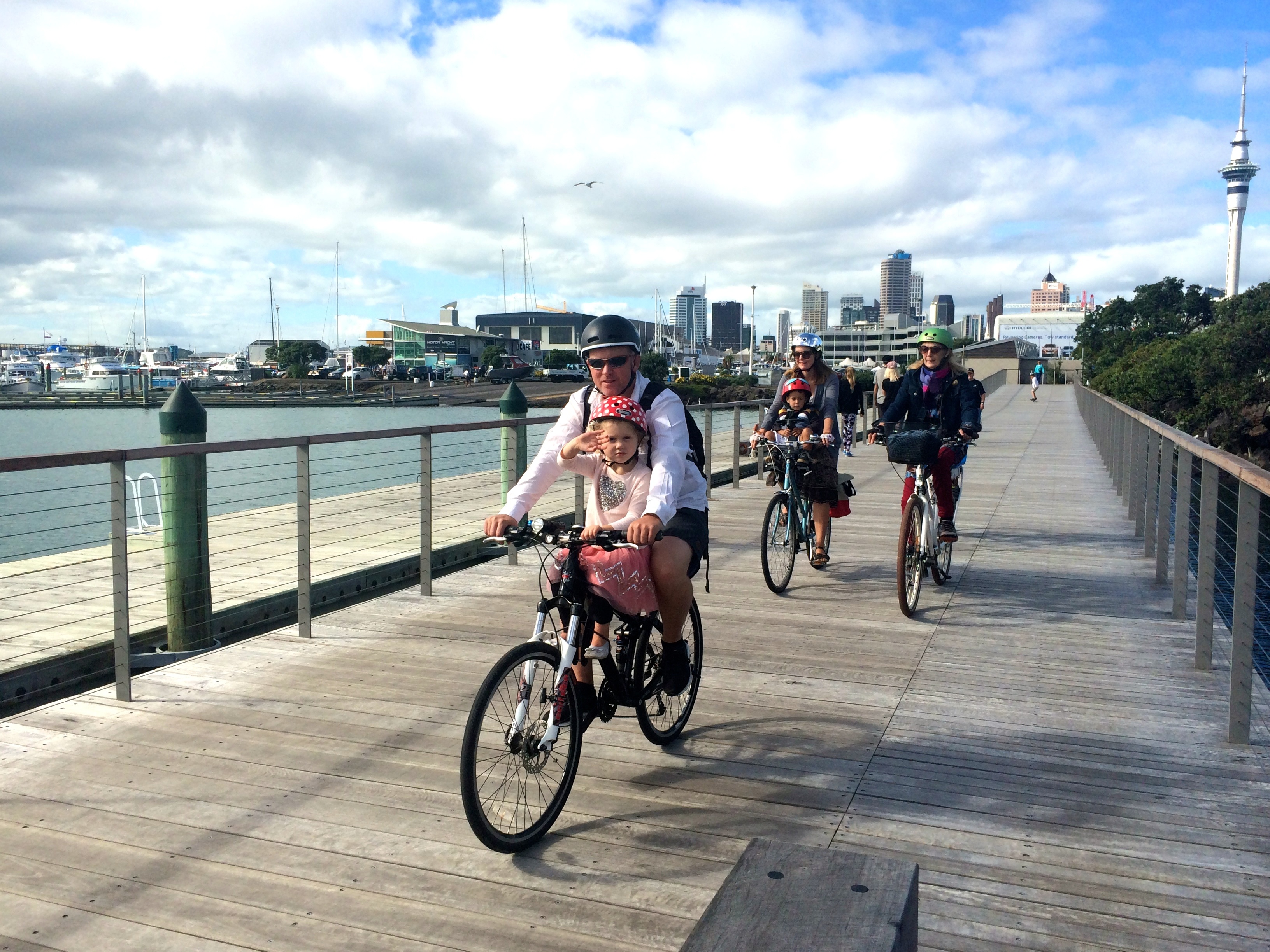
More people than ever are hearing about this bonanza of bikeways, because they make good stories shared widely on all sorts of media. Stir this up with the hip and cool fashion, food and lifestyle publications and social media, all featuring bikes, and we have a heady brew of bike mania.
Here's the trick: build bike paths so beautiful that magazines race to use them for fashion shoots. #LightpathAKL pic.twitter.com/SgPn3O5s22
— Bike Auckland (@BikeAKL) January 1, 2016
The explosion of people on bikes in the Central City and inner suburbs this summer has Bike Auckland beaming even more than usual – but we say it’s a mere blip compared with the increase we’ll see once the new cycleways are joined up to connect networks . Imagine how huge the riding stats will be once we have SkyPath, SeaPath and break into the cycling deserts of East and Southern Auckland! We know this growth will happen, because we’re following well-established international trends, supported by local research on the latent demand for safe cycling.
But new cycling facilities need to be future-proofed to accommodate this growth.
This brings me to our recent work, asking AT and NZTA to allow for separated cycle and walking facilities on the new Orakei Bay Boardwalk and Hobson Bay stages of the Glen Innes to Tamaki Cycleway.
Let’s step back for a moment to recall our involvement with this 7.5km cycleway.
GI to Tamaki was first mooted in 2013 by Bike Auckland, the Orakei Local Board and the NZTA. Our blog post at the time praised “the new cycling culture in Auckland, where the NZTA and AT are working closely with community representatives to deliver projects faster, smarter and in tune with community needs.” I know this reads like a bit of a lovefest. But it reflects the novelty of the new era that began in 2012 with collaboration and cycling leadership flowing from the Auckland office of the NZTA. This was the real genesis of the biking renaissance now underway in Auckland.
Construction on the GI to Tamaki project, which began in October last year, is planned in 4 stages to be completed by late 2018.
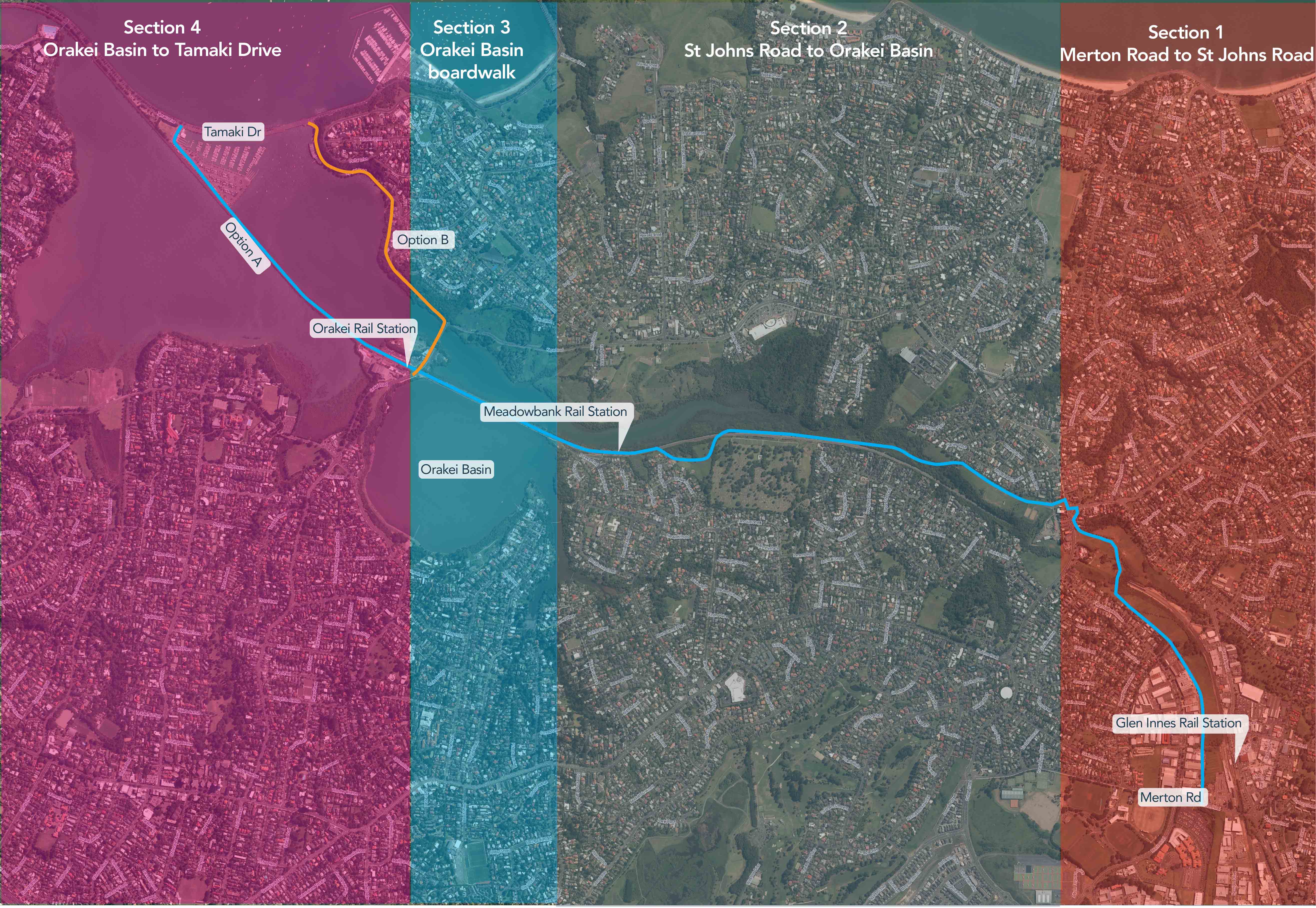
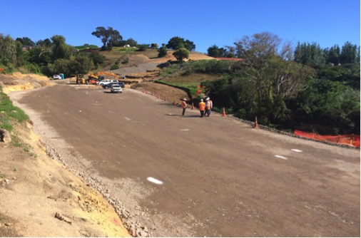
Stage 1, from Merton Rd to St John’s Rd, has made impressive progress. If you’re travelling by train from the City to GI, look out on the righthand side and you’ll see the snaking skeleton of the cycleway climbing through the former horse paddocks to St John’s Rd. (There’s talk of an open day for Stage 1 later next week. We’ll tell you more when we get the details.)
Stage 2 takes the cycleway from the northern side of St John’s Rd into the Purewa Valley, passing the Meadowbank Train Station to connect with the Orakei Boardwalk. This section includes steep, bush-clad and stream-side territory, with all sorts of earthworks, heritage and other environmental issues to be sorted. (And then there’s the question of local side-links, which will make all the difference). We’re hoping to get more details on the route soon, before documentation is lodged in early April for a Notice of Requirement (NoR) to designate the cycleway corridor route.
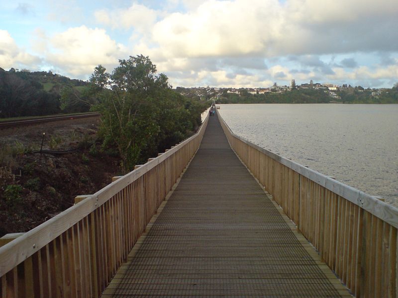
Stage 3 of the project will rebuild and widen the Orakei Basin Boardwalk through to Orakei Rd. This needs resource consent; and the consent plans and application information for this will define the location, width, materials, appearance and construction methodology of the cycleway.
We’re told the RMA documents for Stages 2 and 3 will be lodged together. This will help locals and other people keen to use the cycleway from the Glen Innes or the City end to see how they link in to the whole route. Combining the processing will save consent costs as well. Great!
Lastly, Stage 4 completes the cycleway by connecting from Orakei Rd to Tamaki Drive. There are officially two options for this; crossing Hobson Bay beside the rail line, or following the water’s edge to Ngapipi Rd. Design, resource consent and construction on this stretch are a year or so away.
This brings us back to the Orakei Boardwalk, in Stage 3. We were initially consulted about the plans for this over Christmas, and replied to the project team on 3rd February. This was our major concern, expressed here in Max’s words:
“My key concern is that we are missing a great opportunity here. It is proposed to widen the boardwalk to 4.5m. Sounds great – but it is at least 0.5m too narrow to properly separate walking and cycling.
Having a split path (with a slight mountable kerb between) would make it much easier to use the path for both transport AND leisure.
This path is heavily used by pedestrians, and may well be one of the busiest pedestrian sections of the whole GI-Tamaki Path overall. Yet it will also see cyclists who want to go fast, because they are riding long distance. And with the long straight here, they will be fast.
Even if AT is not keen to do a physical split now, it should futureproof it by adding 0.5m. If we don’t do that now, it will be a massive extra cost later. With 5m, instead of 4.5m, at least the option would be there.”
We asked for a meeting to discuss our feedback with the AT/NZTA joint Project Team. I asked if the meeting could include Ngati Whatua and the Orakei Local Board, because of their close involvement with the project alongside us from the outset. We’re also aware we’ll all be working with AT to manage the spectacular use we know the cycleway will receive. (Who would have predicted the Lightpath would attract 1,000 bikers a day, not to mention even more walkers!)
The Project Team offered to meet us on 18th February. Before the meeting, we asked for your thoughts on the width issue, to make sure we were in tune.
We arrived at the meeting to find Ngati Whatua and Orakei Local Board had not been invited. The Project Team said they had been consulted, but admitted they hadn’t been told of our request for a slightly wider, future-proofed path. Apparently the timetable didn’t allow for this. I commented that my planning experience has taught me that shared dialogue on critical issues is a good investment of time, and vital for effective consultation.
It’s true we didn’t niggle about the cycleway width when concept designs were shared with us over 2 years ago in 2014. Remember this was pre-UCP days – our main goal then was to fuel the momentum to get the project underway.
But in 2016 we can’t close our eyes to changing factors which will impact on Stages 3 and 4. Hence, we asked the Project Team for data from the project’s business case, including estimates for future population growth across each of the cycleway’s 4 different catchments and variations in future increases of walkers and bikers for the project. We noted the dramatic biking uptake evident from Central City UCP investment and asked if it could be factored into previous estimates for the city end of the GI to Tamaki project.
Three weeks later, the Project Team replied to our data request. They simply restated there would be no change to the project, and again failed to respond to our request for data. Bike Auckland was compelled to try a third time. (How could we not – didn’t we all love and learn from the Auckland Conversation from Janette Sadik-Kahn, the queen of cycling data! Remember her highly effective boss Mayor Bloomberg’s catchphrase when it comes to transforming a city: ‘In God we trust… everybody else bring data.’)
So I wrote again asking for –
- Estimated use levels used for the Project’s business case for UCP funding, including that for the various stages of the route (as clearly they will be different) and expected changes of use levels over time;
- Extra demand likely to be generated from the Orakei Point apartment development as per the approved resource consent application;
- Estimates of population growth in the catchment from developments such as the Tamaki Regeneration project and others stemming from the higher densities promoted by the Unitary Plan;
- Estimates of how demand will change due to increasing levels of cycling across Auckland in the next decade and how the local links that we all want to see will further boost this.
- Results of your investigations of the heavy demand we observe on the existing pathway by people walking dogs, children scooting and travelling in push chairs, wheelchair use and that of more frail pedestrians, families etc. It is well known the width of the existing boardwalk is too narrow for current demand levels and that at these times cycling for recreation and transport is compromised. I expressed an interest in predictions on how the balance of use will change over time, and whether the shared design will constrain commuting by bike. This is important, given the UCP goals to enable walking and cycling that widens transport choice and uptake of these modes.
The Project Team’s reply was a litany of ‘trust us, trust us, we know what’s best’. It featured comments such as –
- “We think a shared path is appropriate due to the changing mix of user types and volumes at different times of the day and day of the week. Projected usage shows that 4.5m is a generous width for this shared environment and that an extra half metre would deliver little extra capacity to an unmarked shared path.”
- “The varied usage patterns would make it a challenge to effectively divide bikes and pedestrians without physical separation of the type on Nelson Street or Beach Road.”
- “We are confident that a shared environment delivers the best outcomes for all users, within the available budget. It is consistent with the rest of the route and with other shared paths in Auckland.”
- “Without physical separation, if the path is busy in only one direction (as is likely at certain times), people are likely to disregard their assigned side of the path.The project does not have budget for physical separation.”
We were stunned! Bland reassurances, but absolutely no data.
Surely the Project Team has counts of the different types of users on the existing Orakei Boardwalk? Our riding experience shows us they are very different from users of other cycleways. For example, the Kingsland section of the NW Cycleway is barely 3m wide at parts, but it copes with this because it has tidal peaks of use by commuting bikers. Sure, local children also use it to get to school, but elderly people and dog walkers (with and without leads) tend to be less common.
It’s another planet on the Orakei boardwalk, where slower and relaxed walkers and dog people tend to be the norm. What worries us is that the GI to Tamaki project is specifically designed and funded to turn on the tap full bore with floods of people on bikes needing to get from A to B.
Our concern is: how will the new Orakei and Hobson Bay boardwalks work 5 years from opening day? How will the current users – elderly walkers, baby-strollers, and dog-exercisers – cope when these new boardwalks are not just convenient and beautiful places to get fresh air at a leisurely pace, but also integral parts of Auckland’s fast and frequent biking network?
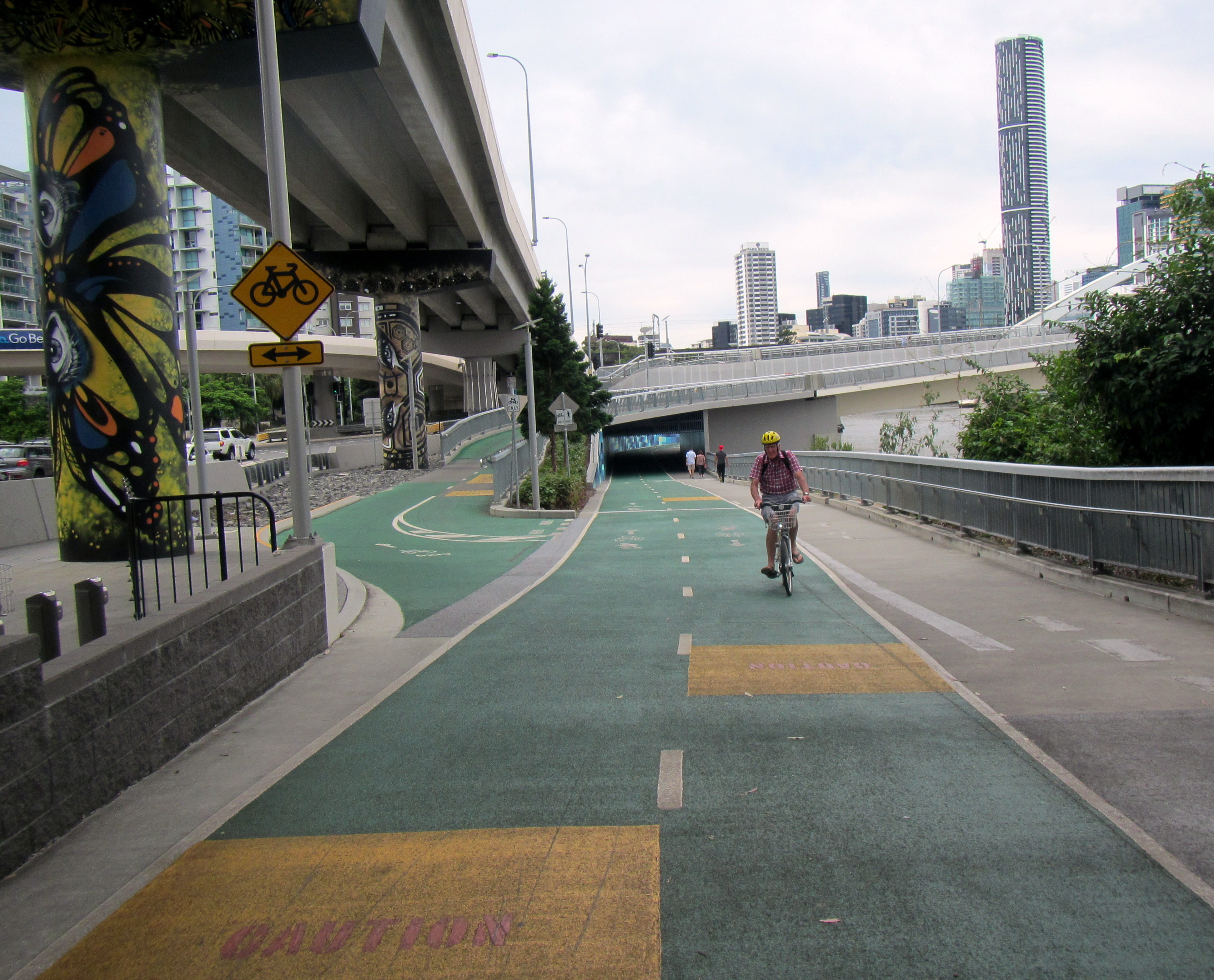
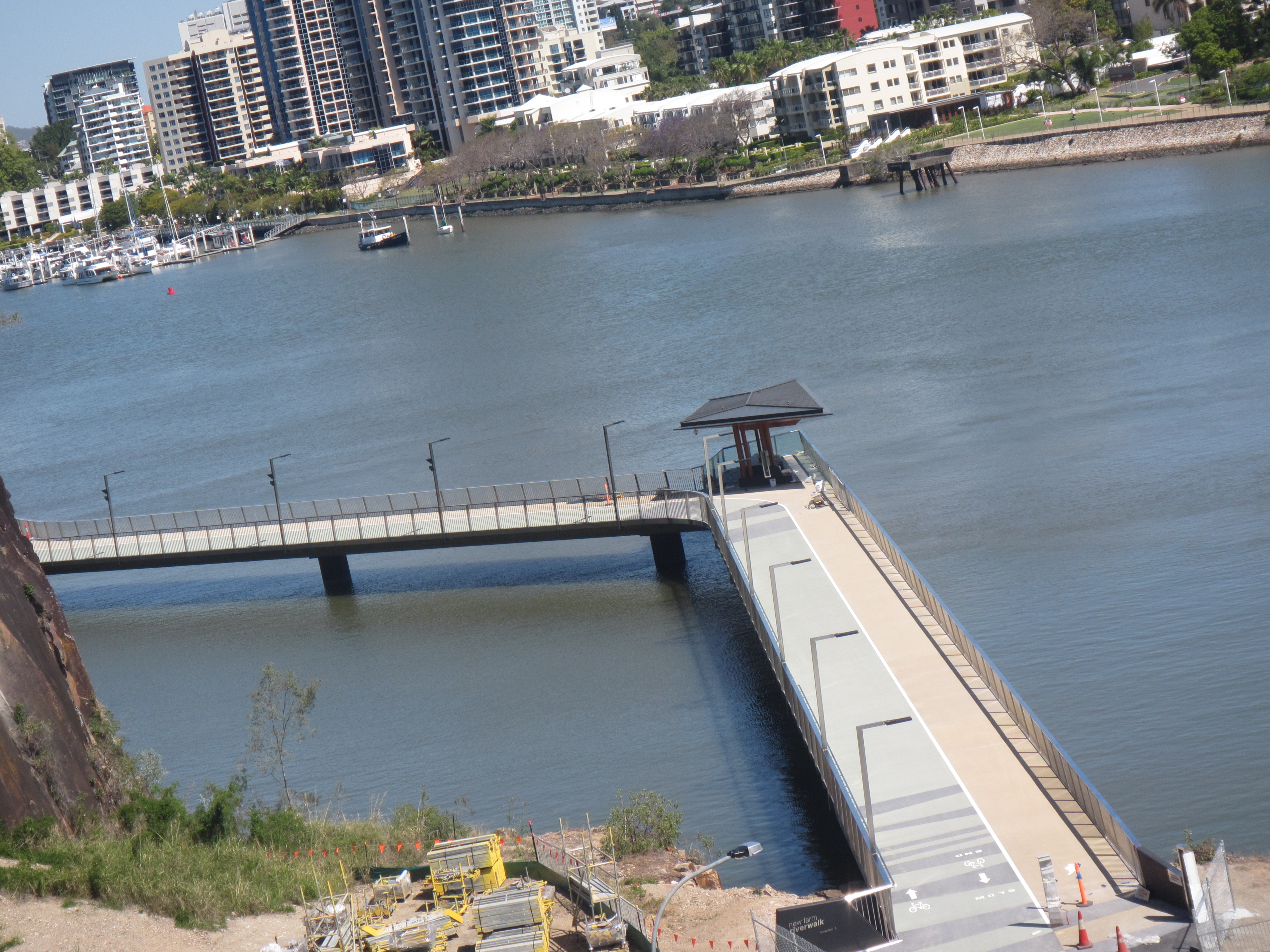
We’re also bewildered by the Project Team’s reference to Nelson St and Beach Rd, which are central city arterial roads. Surely the team is aware of other separation techniques for cycleways in open space/ foreshore/harbour environments? What about copying this gorgeous recent rebuild from Brisbane?
As well, we question the Project Team’s rigid adherence to one width across the whole the GI to Tamaki route, and their statement that Auckland’s cycleways are consistent in width. Grafton Gully is a recent build, but only 3.0 – 3.5m wide, reflecting its tricky topography and ground conditions. Lightpath is 6m width (i.e. the pre-existing width of the Nelson St off-ramp). The Canada St Bridge is 4.5m wide and has a winding pathway that helps manage the tidal flow and commuting speeds. And the Westhaven shared path is between 4m and 5m wide, with the greater width on the longer straights.
These examples tell us that Auckland’s cycleways are variable in width, and the most recent and successful of them feature high quality, future-proofed design, reflecting the specific site circumstances and reasoned understanding of future users.
We understand the UCP project teams are under extreme pressure because of budgets and tight delivery deadlines. We respect and value their work, and value the chance to be around the table throughout the planning and delivery stages. We know the GI to Tamaki Project Team will do as they see fit. We will continue to encourage and applaud – as well as question what is ‘fit for purpose’. Asking for data is part of this questioning. It’s unfortunate when a project team stonewalls and fails to even acknowledge our request for data.
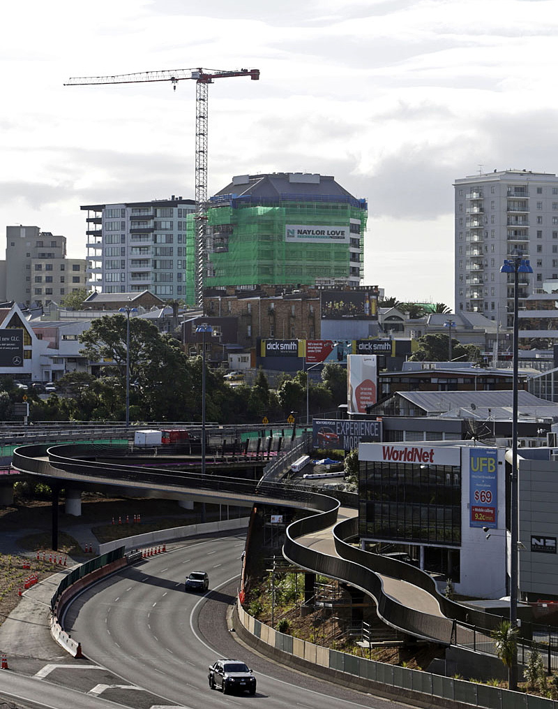
Auckland is not just charging ahead. The Council’s wildly popular Auckland Conversations programme shows us that the city is also keen to review, compare, adapt and apply what we are seeing in successful international cities. Our neighbours across the ditch, such as Brisbane, are doing this – constantly updating and improving paths built 5 years previously – but it’s a costly business.
Sadly, our bet is we’ll be paying to rebuild the Orakei Boardwalk for the third time, well within our lifetimes.