Lately, it’s all about the bridges, big and small – and every single one is a valuable connection.
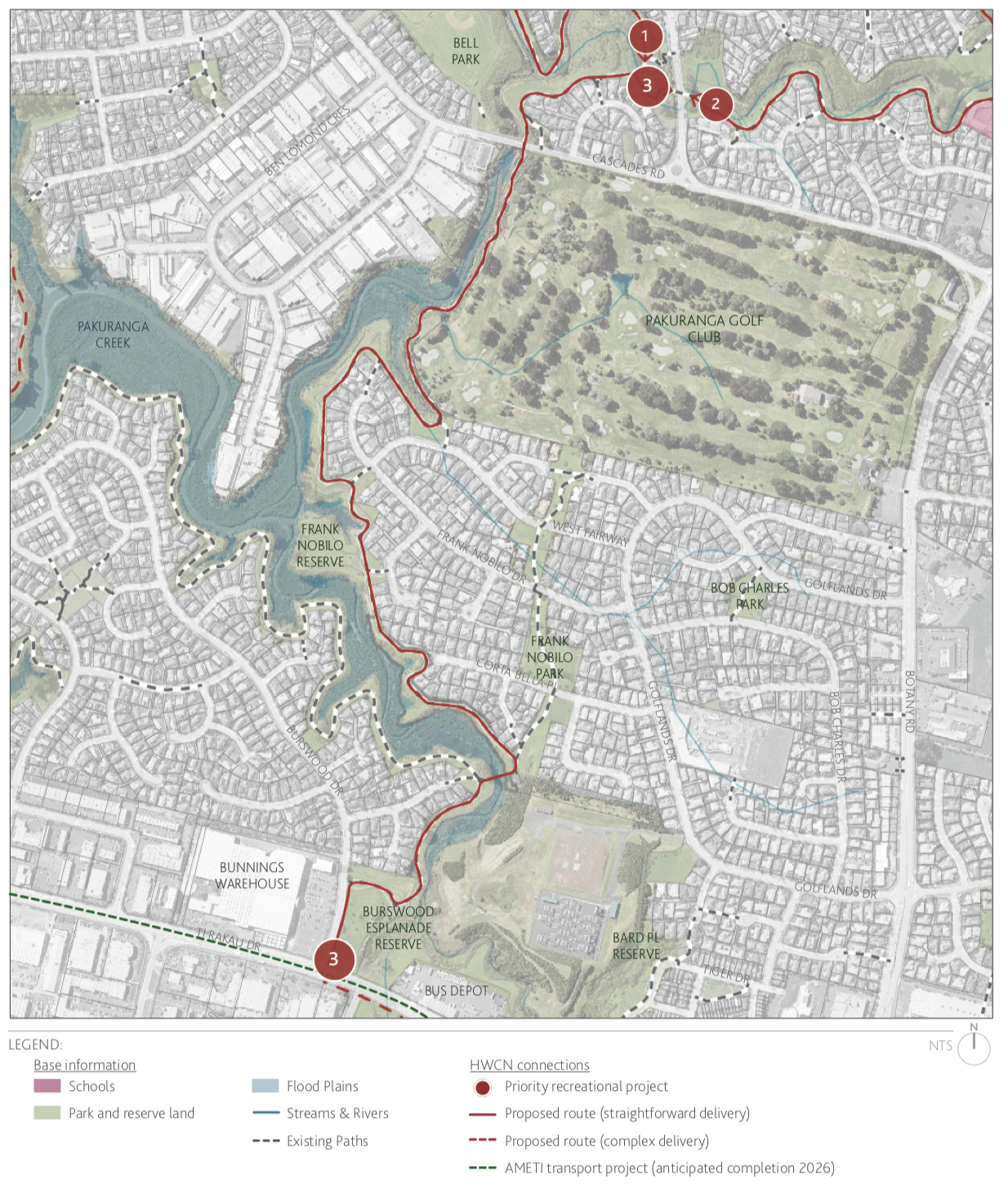
Since mid-February, the crew from Bike East Auckland have been keeping tabs on a bridge upgrade project in a local park, recently completed as part of an ongoing upgrade of the wider Cascades Shared Path network.
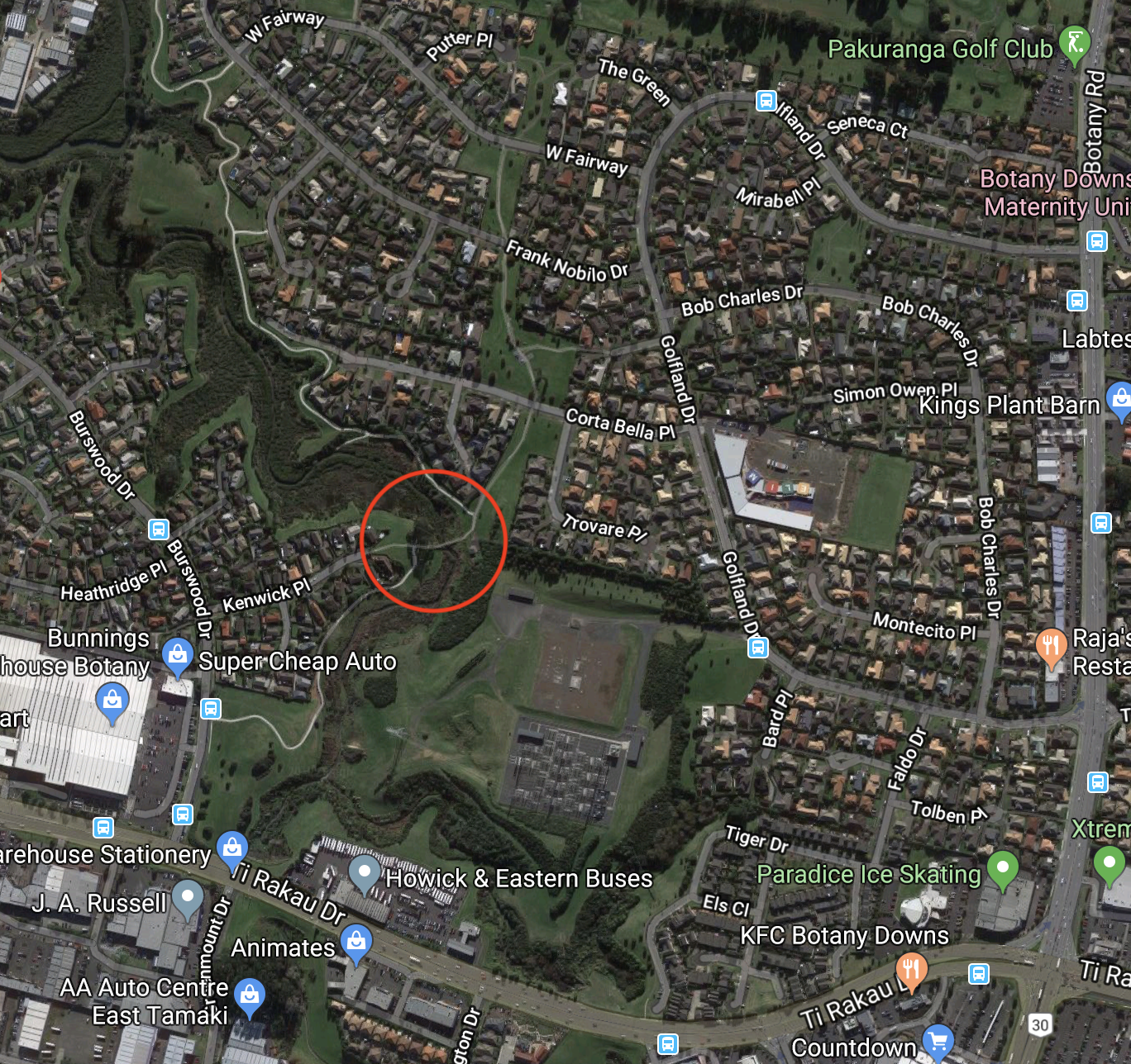
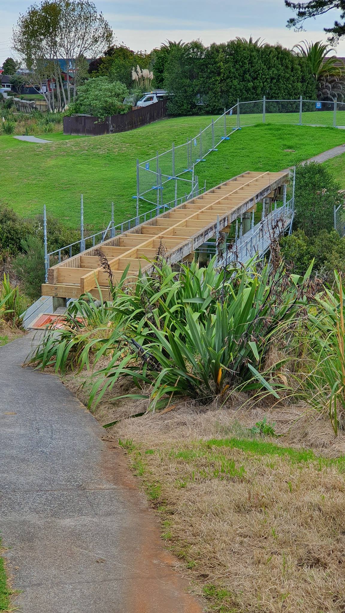
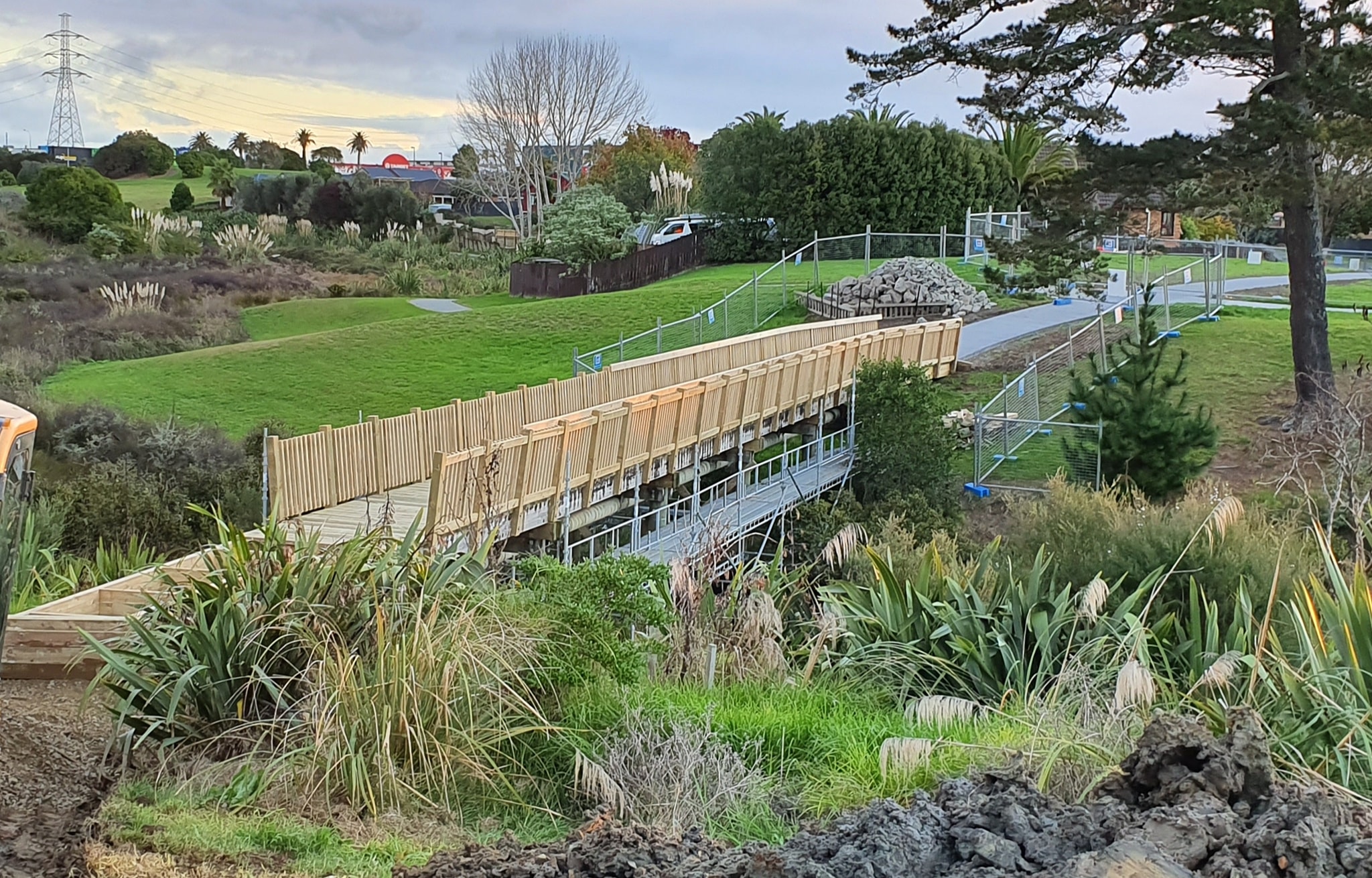
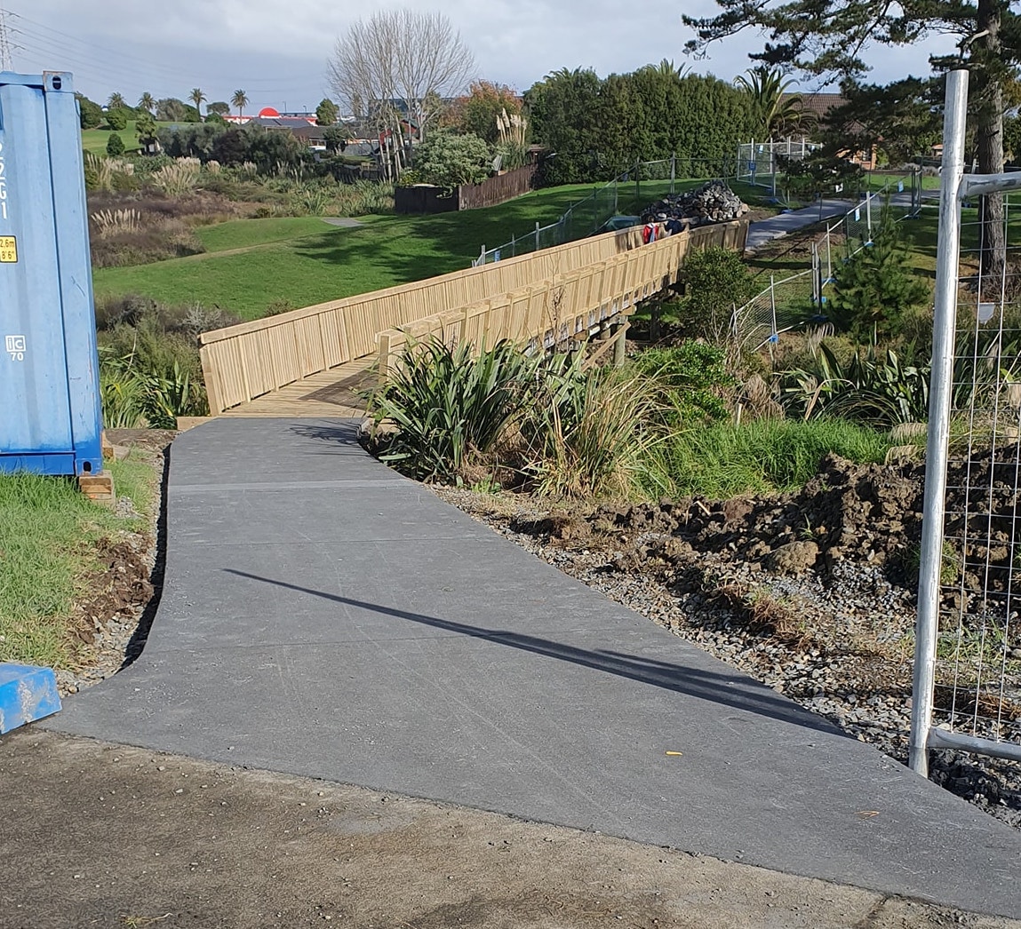
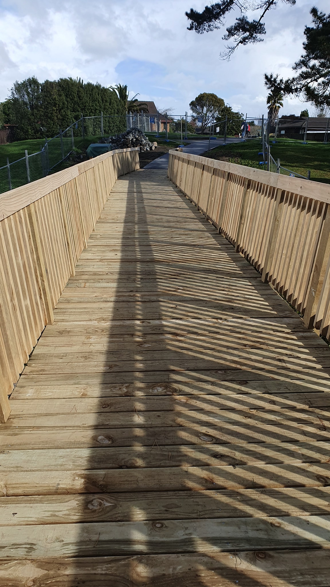
The bridge over a stream, linking Burswood to Golflands, was widened to 2.2m with new up-to-code balustrades and smoother access at both ends. It reopened over Queens Birthday Weekend after ten weeks of work, to general jubilation.
With the alternative being a long and tricky detour onto a busy highway (Ti Rakau Drive), the closure for nearly three months of reconstruction had left a real gap – and powerfully revealed the value of safe, direct and quiet links.
Three reasons locals were especially glad to see this project completed:
- This is a vital link in the local walking and cycling network around Golflands and Burswood, connecting to local back-streets and pathways and used by walkers, school kids, commuter cyclists and recreational riders.
- In particular, this route offers a safe alternative to cycling on the hostile arterials of Ti Rakau Drive and Botany Road. Commuter cyclists also use it to connect to the Highbrook area from most of Pakuranga, Botany, and beyond.
- Looking ahead, this will also be one of many feeder routes to the Eastern Bikeway aka AMETI. We’ve written before about how crucial it is to get those connections up and running now, so everyone can reap the value of the major cycleway investment from Day One – and of course this will improve local trips as well. Auckland Transport and Auckland Council must prioritise sorting out these local links as soon as possible, taking any and every opportunity to create safe connections for people on bikes.
All in all, this is one small bridge with a huge real and potential impact! Below, enjoy some before, during, and after photos, plus some maps that help show it in context.